

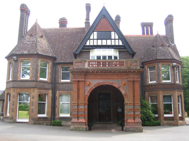


Caddington, United Kingdom
Caddington is a town of 3,112 people in England, United Kingdom.
Why visit Caddington
Townapedia lists 5 museums and landmarks, 16 parks and trails, 24 places to eat, 1 place to stay and 1 attraction in and around town.
Highlights include Stockwood Discovery Centre, Wardown Park Museum, Stockwood Park and Landpark Wood.
Weather in Caddington
Forecast from MET Norway (CC BY 4.0). Full forecast
About Caddington
Caddington is a village and civil parish in the Central Bedfordshire district of Bedfordshire, England.
From the Wikipedia article Caddington (this version), under CC BY-SA 4.0.
Things to do1

Woodside Animal Farm & Leisure PArk
Zoo and aquarium · 1.3 mi
Mancroft Road, Luton
Museums and landmarks5

Stockwood Discovery Centre
Museum · 1.4 mi
Museum in Luton, Bedfordshire, United Kingdom
London Road, Luton
We-Su 11:00-16:00; SH 11:00-16:00

Wardown Park Museum
Museum · 2.6 mi
Local museum in Luton, Bedfordshire, England, UK

Waulud's Bank
Monument and historic site · 3.0 mi
Archaeological site in Luton, Bedfordshire, England, UK


Luton Castle
Monument and historic site · 1.8 mi
UK archaeological site
Parks, trails and playgrounds16

Stockwood Park
Park · 1.4 mi
Large park with museum and gardens in Luton, England


Wardown Park
Park · 2.5 mi
Large park with museum and river in Luton, Bedfordshire, England, UK


Stockwood Park Golf Centre
Golf course · 1.4 mi
18 hole Par 69 & 9 hole Par 27 Academy Cours
London Road, Luton
Woodside Farm and Wildfowl Park
Park · 1.3 mi
Zoo in Slip End near Luton, Central Bedfordshire

4 more on the map.
Restaurants and cafes24

The Plough
Bar and pub · 0.9 mi
189 Woodside Road, Luton
Mo,Su 12:00-22:00; Tu-Sa 12:00-23:00



12 more on the map.
History
The place-name 'Caddington' is first attested in a list from circa 1000 AD of the manors of St Paul's Cathedral in the Parker Library of Corpus Christi College, Cambridge, where it appears as Caddandun. It appears as Cadandune in the Codex diplomaticus ævi Saxonici of circa 1053, and as Cadendone in the Domesday Book of 1086. The name means 'Cada's down or hill'. Until 1897 the parish of Caddington was partly in Hertfordshire and partly in Bedfordshire.
Caddington was once the centre of a thriving brick industry built around the rich source of clay. In 1908 there were two major brick fields. A "Caddington Blue" was a well-known engineering brick. Caddington Blue could simply be a Luton Grey produced in a high temperature, low oxygen kiln similar to the production method of a Staffordshire Blue for use in foundations etc. Yet the assertion relating to the Caddington Blue is regarded by some as suspect: During the 1970s Bedfordshire County Council in conjunction with the Royal Commission On Historical Monuments (England), published the book Brickmaking: A History and Gazetteer. The book identifies 17 specific sites within the Caddington locale which are credited with producing "Greys". The common name for the plum-coloured brick produced from the flinty brick earths excavated from an area from Kensworth through Caddington to Stopsley is "Luton Grey".
Read more of the history
Much of Caddington is now urban, and there has been much residential development in recent years with the provision of local facilities such as shops, schools and a public hall. Caddington still retains its village green and nearby is the medieval parish church, restored in Victorian times. Manshead CE Academy (formerly Dunstable Grammar School and then Manshead School) relocated to Caddington in 1971.
Markyate Priory, which was founded in 1145 and disestablished in 1537, was situated in what was then the parish of Caddington, although that part of the parish was subsequently transferred to Markyate in 1897.
Caddington has had various schools such as Willowfield and Heathfield Lower Schools and Five Oaks Middle School, but these have since been combined into Caddington Village School.
From the History section of Caddington on Wikipedia, under CC BY-SA 4.0.
Where to stay1
Churches and places of worship16
Saint John the Baptist, Farley Hill
Church · Anglican · 0.9 mi
Rotheram Avenue, Luton
St Thomas the Apostle Catholic Church
Church · Catholic · 0.5 mi
Manor Road, Luton
Shopping7
Gas and EV charging4
Schools, colleges and libraries12
St Margaret of Scotland Catholic Primary School
School · Roman Catholic · 0.8 mi
Rotheram Avenue, Luton
Healthcare3
Map of Caddington
89 places. The map loads OpenStreetMap tiles when you open it.
Getting there and nearby towns
London Luton Airport (LTN) is the nearest airport with scheduled flights listed in OpenStreetMap, 4 miles away.
- Luton 2 mi northeast, about 3 min by car
- Markyate 2 mi south, about 3 min by car
- Kensworth 2 mi southwest, about 4 min by car
- Dunstable 3 mi northwest, about 5 min by car
- Harpenden 5 mi southeast, about 9 min by car
- Harlington 7 mi north, about 11 min by car
- Kimpton 7 mi east, about 11 min by car
- Stanbridge 7 mi northwest, about 11 min by car
- Hemel Hempstead 8 mi south, about 13 min by car
- Berkhamsted 9 mi southwest, about 14 min by car
Drive times are estimates from straight-line distance, not routes.
Towns near Caddington


Keep exploring
Local news
Headlines from INDB.
Reviews, tips and questions
Loading what members have shared...
Sources and licences
- GeoNames (CC BY 4.0): population, coordinates, regions and time zone
- Mapillary (see each image): photos
- OpenStreetMap contributors (ODbL 1.0): places, airports, map data
- Wikidata (CC0 1.0): elevation, founding date, time zone, website, landmarks and historic places
- Wikimedia Commons (see each image): photos
- Wikipedia (CC BY-SA 4.0): overview and history text
Photo credits
- Stockwood Discovery Centre, Luton 04, GualdimG, CC BY-SA 4.0
- Wardownmuseum, Nigel Cox, CC BY-SA 2.0
- GOC Leagrave to Harpenden 010 Waulud's Bank (8548556990), Peter O'Connor aka anemoneprojectors from Stevenage, United Kingdom, CC BY-SA 2.0
- Stockwoodpark, Richard Thomas, CC BY-SA 2.0
- Landpark Wood 1, Dudley Miles, CC BY-SA 4.0
- WardownLake, Nigel Cox, CC BY-SA 2.0
- Church of St Mary, Kensworth, AnemoneProjectors ( talk ) ( Flickr ), CC BY-SA 2.0
- Our Lady Help of Christians Church - Luton from Matalan, Mugford6120, CC BY-SA 4.0
- St Mary's Church, Luton, AnemoneProjectors ( talk ) ( Flickr ), CC BY-SA 2.0
- St Andrews Church Slip End, Alex, CC BY-SA 4.0
- St Peter's Church Luton, Alex, CC BY-SA 4.0
- Street-level photo, southglos, CC BY-SA 4.0
- Street-level photo, sk53_quint, CC BY-SA 4.0
- Street-level photo, southglos, CC BY-SA 4.0
- Street-level photo, a-sav, CC BY-SA 4.0
- Street-level photo, a-sav, CC BY-SA 4.0
- Street-level photo, southglos, CC BY-SA 4.0
- Street-level photo, a-sav, CC BY-SA 4.0
- Street-level photo, southglos, CC BY-SA 4.0


Page built November 10, 2026. Spotted a mistake? Tell us or suggest a place.