


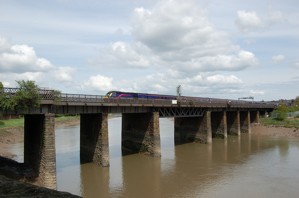
Why visit Caerleon
Townapedia lists 43 museums and landmarks, 48 parks and trails, 281 places to eat, 15 places to stay and 14 attractions in and around town.
Highlights include Caerleon Bridge, Dolman Theatre, Caerleon Roman Fortress Baths and Riverfront Theatre and Arts Centre.
Weather in Caerleon
Forecast from MET Norway (CC BY 4.0). Full forecast
About Caerleon
Caerleon ( kər-LEE-ən; Welsh: Caerllion) is a town and community in Newport, Wales. Situated on the River Usk, it lies 5 miles (8 km) northeast of Newport city centre, and 5.5 miles (9 km) southeast of Cwmbran. Caerleon is of archaeological importance, being the site of a notable Roman legionary fortress, Isca Augusta, and an Iron Age hillfort. Close to the remains of Isca Augusta are the National Roman Legion Museum and the Roman Baths Museum.
From the Wikipedia article Caerleon (this version), under CC BY-SA 4.0.
Photos of Caerleon


Things to do14


George Street Bridge
Bridge · 2.2 mi
Bridge in Newport, Wales, United Kingdom

Great Western Railway Usk bridge
Bridge · 2.2 mi
Bridge in United Kingdom


Newport City footbridge
Bridge · 2.2 mi
Bridge over the River Usk in South Wales

St Julians railway bridge
Bridge · 1.2 mi
Railway bridge in Newport, Wales

The Riverfront
Cinema and theater · 2.3 mi
Arts center and theatre in Newport, United Kingdom

City Bridge
Bridge · 2.4 mi
Bridge in Newport, south Wales, United Kingdom
New Bridge
Bridge · 3.8 mi
Bridge in Newbridge-on-Usk, Monmouthshire, Wales

2 more on the map.
Museums and landmarks43

Caerleon Roman Fortress Baths
Museum
Purpose-built building around part of the Roman baths
High Street, Newport
Apr-Oct 10:30-17:00; Nov-Mar Mo-Sa 10:00-17:00; Nov-Mar Su...
Riverfront Theatre and Arts Centre
Museum · 2.2 mi
Kingsway, Newport
Mo-Th 09:00-16:00; Fr 09:00-22:30; Sa 09:00-16:00; Su off


Caerleon Roman Amphitheatre
Monument and historic site
Roman Ampitheatre managed by Cadw. Hours are restricted to daylight.
09:30-17:00
Caerleon Roman Fortress and Baths
Museum
Archaeological museum in Newport, Wales

Isca Augusta
Monument and historic site
Architectural structure in Caerleon, Newport, Wales, UK
National Roman Legion Museum
Museum
Museum in Caerleon, Newport, Wales, United Kingdom

Newport Medieval Ship
Monument and historic site · 2.3 mi
1449 Welsh sailing ship

Newport Museum and Art Gallery
Museum · 2.4 mi
Museum in Newport, Wales, United Kingdom

The Mynde
Monument and historic site
Six properties which previously served as a fortified estate, built by a local industrialist during the Chartist Risings to protect...
Castle Lane, Newport


Arthur Machen's House
Museum
Marked by a blue plaque and often open to visitors
33 High Street, Newport
31 more on the map.
Parks, trails and playgrounds48





36 more on the map.
Restaurants and cafes281
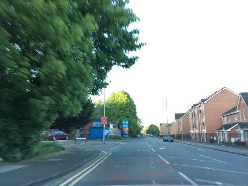
Man of Gwent
Bar and pub · Meat, Bar And Grill, Grill · 1.1 mi
Chepstow Road, Newport
Mo-Su 12:00-21:30
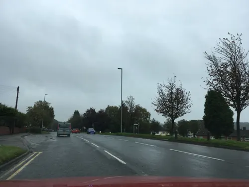
Toby Carvery
Restaurant · British · 1.1 mi
665 Chepstow Road, Newport
Mo-Th 11:30-18:00; Fr 09:00-18:00; Sa-Su 08:00-18:00

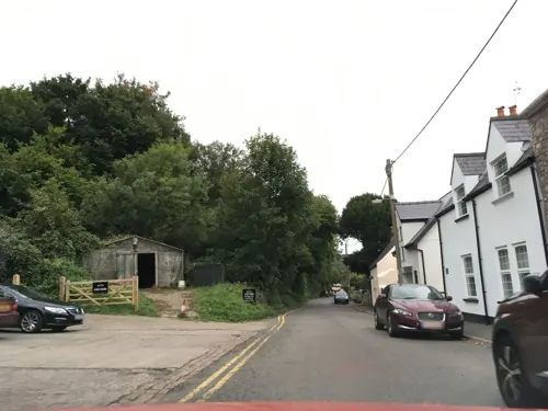
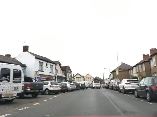
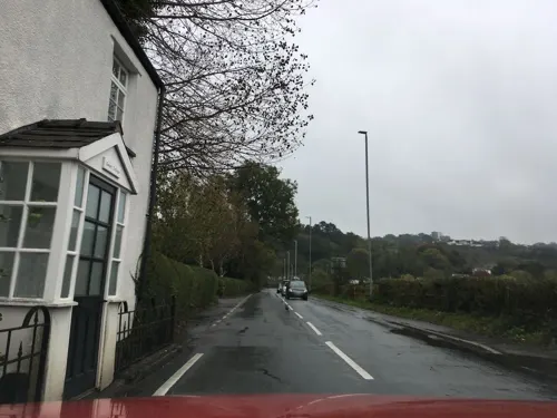
The Ship Inn
Bar and pub
New Road, Newport
Mo off; Tu-Th 12:00-23:00; Fr-Sa 12:00-23:30; Su 12:00-18:00
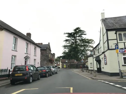
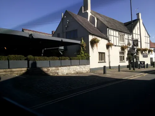
Ye Olde Bull Inn
Bar and pub
High Street, Newport
Mo-Tu 16:00-22:00; We 10:00-23:00; Th-Sa 10:00-00:00; Su 10:00-23:00
The Star Inn
Bar and pub · British · 1.8 mi
Caerleon Road, Newport
Mo-Th 15:30-21:00; Fr 15:30-22:00; Sa 12:00-22:00; Su 12:00-20:00

Parc-y-Prior Inn
Bar and pub · Bar And Grill, Grill · 2.3 mi
Almond Drive, Newport
Mo-Sa 11:00-22:20; Su 12:00-22:00

Le Pub
Bar and pub · Burger · 2.3 mi
14 High Street, Newport
Mo-Th 14:00-26:00; Fr 14:00-27:00; Sa 12:00-27:00; Su 14:00-26:00
269 more on the map.
History
The area around Caerleon is of considerable archaeological interest, with a number of important Neolithic sites. By the Iron Age, the area was home to the powerful Silures tribe and appears to have been the centre of a wealthy trading network, both manufacturing and importing La Tène style goods. From the 5th century BC, the town was the location of a great Iron Age hillfort crowning a hill overlooking the River Usk and what would become the Roman port. The hillfort at Lodge Wood Camp is defended by three lines of massive ramparts and ditches, and is the largest fortified enclosure in South Wales.
The excavation in 2000 found that the hillfort had been continuously occupied from its founding in the 5th century BC until the construction and occupation of Isca Augusta (also called Isca Silurum) around 78 AD. There is no evidence that the fort was taken militarily, and the abandonment of the fort may have been part of the terms of peace. The fort was reoccupied during the Roman period and remained in use following the end of Roman rule in Britain, suggesting that some version of the Pre-Roman society survived the occupation.
Read more of the history
Caerleon is the location of a Roman legionary fortress or castra. It was the headquarters for Legio II Augusta from about 75 to 300 AD, and on the hill above was the site of an Iron Age hillfort. The Romans called the site Isca after the River Usk (Welsh Wysg). The name Caerleon may derive from the Welsh for "fortress of the legion"; around 800 AD it was referred to as Cair Legeion guar Uisc.
Substantial excavated Roman remains can be seen, including the military amphitheatre, thermae (baths) and barracks occupied by the Roman legion. In August 2011 the remains of a Roman harbour were discovered in Caerleon. According to Gildas, followed by Bede, Roman Caerleon was the site of two early Christian martyrdoms, those of Julius and Aaron. Recent finds suggest Roman occupation of some kind as late as AD 380. Roman remains have also been discovered at The Mynde, itself a distinctive historical site.
Caerleon features extensively in Medieval Welsh literature and Welsh Mythology, often as a model city against which other settlements are compared. When discussing the disastrous flooding of Cantre'r Gwaelod in the time of Ambrosius Aurelianus, the author of the Triads of the Island of Britain notes that Medieval Caerleon is an exceptional city, "superior to all the towns and fortifications in Cambria".
Medieval Caerleon would remain an important administrative and religious centre for the Kingdom of Gwent, and was an early Metropolitan See associated with Saint Dubricius (who is commonly depicted with two crosiers, signifying the Bishoprics of Caerleon and Llandaff). At the Synod of Brefi in 545 AD, Dubricius is said to have given the See of Caerleon to Saint David, who would later move the seat to Mynyw. Caerleon was also the location of the Synod of Victory, officiated by Saint David around 569 AD.
Another medieval saint, Cadoc, is associated with the church built over the principia (legionary headquarters). Saint Cadoc's Church, is one of many churches associated with Cadoc's travels, and may have been the location of a monastic cell in the 6th century.
A Norman-style motte and bailey castle was built outside the eastern corner of the old Roman fort, possibly by the Welsh Lord of Caerleon, Caradog ap Gruffydd. The Domesday Book of 1086 recorded that a small colony of eight carucates of land (about 1.5 square miles) in the jurisdiction of Caerleon, seemingly just within the Welsh Lordship of Gwynllwg, was held by Turstin FitzRolf, standard bearer to William the Conqueror at Hastings, subject to William d'Ecouis, a magnate of unknown antecedents with lands in Hereford, Norfolk and other counties. Also listed on the manor were three Welshmen with as many ploughs and carucates, who continued their Welsh customs (leges Walensi viventes). Caerleon itself may have remained in Welsh hands, or may have changed hands frequently.
From the apparent banishment of Turstin by William II, Turstin's lands were transferred in 1088 by Wynebald de Ballon, brother of Hamelin de Ballon who held Abergavenny further up the River Usk. At about the same time, Wynebald's lands may have passed via his daughter to Henry Newmarch, possible illegitimate son of Bernard de Newmarch, In c. 1155 the Welsh Lord of Caerleon, Morgan ab Owain, grandson of King Caradog ap Gruffudd, was recognized by Henry II. Subsequently, Caerleon remained in Welsh hands, subject to occasional battles with the Normans. Caerleon was an important market and port and possibly became a borough by 1171, although no independent charters exist. In 1171 Iorwerth ab Owain and his two sons destroyed the town of Caerleon and burned the castle. Both castle and borough were seized by William Marshal from Morgan ap Hywel in 1217 and Caerleon castle was rebuilt in stone. The remains of many of the old Roman buildings stood to some height until this time and were probably demolished for their building materials.
During the Glyndŵr Rising in 1402 Rhys Gethin, general for Owain Glyndŵr, took Caerleon castle by force, together with those of Newport, Cardiff, Llandaff, Abergavenny, Caerphilly and Usk. This was probably the last time Caerleon castle was ruined, though the walls were still standing in 1537 and the castle ruins only finally collapsed in 1739: their most obvious remnant is the Round Tower at the Hanbury Arms public house. The Tower is a Grade II* listed building.
Across the Afon Lwyd from Caerleon, in the region of Penrhos Farm, are two Civil War forts. In 1648 Oliver Cromwell's troops camped overnight on Christchurch Hill, overlooking Newport, before their attack on Newport Castle the next day.
From the History section of Caerleon on Wikipedia, under CC BY-SA 4.0.
Notable people from Caerleon
 Anthony Barnes AtkinsonBritish economist (1944–2017)Photo: Niccolò Caranti, CC BY-SA 4.0
 Gary HockingRhodesian motorcycle racer and racing driver (1937–1962)Photo: Joop van Bilsen for Anefo, CC0
 Banita SandhuWelsh actressPhoto: Bizzlebear, CC BY-SA 4.0
 Caroline SheenWelsh actressPhoto: MJibson, CC0
 Roger JenkinsBritish powerboat racerPhoto: Spurzem - Lothar Spurzem, CC BY-SA 2.0 de
 Lewis Roblingrugby playerPhoto: Amy Martin Photography, CC BY-SA 4.0
- Arthur MachenWelsh author and mystic (1863–1947)
- Roger FreestoneWelsh footballer and manager (born 1968)
- Albert YoungWelsh footballer (1917-2013)
- Joyce BlandBritish actress (1906-1963)
- Len HillWelsh footballer and cricketer (1941-2007)
- Carl SargentBritish parapsychologist and fantasy game designer (1952–2018)
Born in Caerleon, according to Wikidata (CC0). Each name links to its Wikipedia article.
Where to stay15
Churches and places of worship47
Dawat E Islami Shaftesbury
Place of worship · Sunni · 2.1 mi
Shaftesbury Street, Newport
Shopping31
Gas and EV charging15
Schools, colleges and libraries36
Healthcare29
Map of Caerleon
250 places. The map loads OpenStreetMap tiles when you open it.
Getting there and nearby towns
Bristol Airport (BRS) is the nearest airport with scheduled flights listed in OpenStreetMap, 19 miles away.
- Newport 2 mi southwest, about 4 min by car
- Cwmbran 4 mi northwest, about 7 min by car
- Magor 6 mi east, about 9 min by car
- Risca 6 mi west, about 10 min by car
- Undy 6 mi east, about 10 min by car
- Pontypool 7 mi northwest, about 12 min by car
- Usk 7 mi north, about 11 min by car
- Marshfield 7 mi southwest, about 12 min by car
- Abercarn 8 mi west, about 13 min by car
- Caldicot 9 mi east, about 14 min by car
Drive times are estimates from straight-line distance, not routes.
Towns near Caerleon


Keep exploring
Local news
Headlines from INDB.
Reviews, tips and questions
Loading what members have shared...
Sources and licences
- GeoNames (CC BY 4.0): population, coordinates, regions and time zone
- Mapillary (see each image): photos
- OpenStreetMap contributors (ODbL 1.0): places, airports, map data
- Wikidata (CC0 1.0): elevation, founding date, time zone, website, landmarks and historic places
- Wikimedia Commons (see each image): photos
- Wikipedia (CC BY-SA 4.0): overview and history text
Photo credits
- Aerial view of Caerleon Roman amphitheatre, CADW, CC BY-SA 3.0
- Caerleon High Street and Ye Olde Bull Inn, Llemiles, CC0
- Caerleon-Arthur Machen's birthplace, Pwimageglow ( talk ), Public domain
- Caerleon Bridge, Pwimageglow ( talk ), Public domain
- Dolman Theatre, Pwimageglow, CC BY-SA 3.0
- Great Western Railway Usk bridge, The original uploader was Owain at English Wikipedia ., CC BY-SA 3.0
- Newport Town Bridge, Pwimageglow ( talk ), CC0
- UskBridge image1, Richard Scott-Smith at English Wikipedia, CC BY-SA 3.0
- St Julians railway bridge, The original uploader was Owain at English Wikipedia ., CC BY-SA 2.5
- Caerleon-Roman Prysg Field Barracks, Pwimageglow ( talk ), Public domain
- Newport ship, Owain at English Wikipedia, CC BY-SA 3.0
- Newport Museum, Pwimageglow, CC BY-SA 3.0
- Beechwood Park, Newport, Unknown author, Public domain
- Autumn in Belle Vue Park, WelshDave, CC BY-SA 4.0
- Riverfront, Gif absarnt at English Wikipedia, CC BY-SA 3.0
- Caerleon Roman Baths, Pwimageglow ( talk ), Public domain
- Amgueddfa'r Lleng Rhufeinig, Ham, CC BY-SA 3.0
- The Resort Hotel, Celtic Manor Resort, Ian Capper, CC BY-SA 2.0
- Caerleon - johnelamper - X, Unknown author, CC BY 2.0
- The priory hotel, Caerleon, Andy Perkins, CC BY-SA 4.0
- Caerleon Hanbury Arms Tower-19-Oct-2013, Robevans123, CC BY-SA 3.0
- Caerleon eglise, Chatsam, CC BY-SA 3.0
- Caerleon Town Hall, Pwimageglow ( talk ), Public domain
- Caerleon Cricket Pavillion, Llemiles, CC BY-SA 4.0
- Riverfront Arts Centre, Llemiles, CC BY-SA 4.0
- Caerleon Roman Amphitheatre, Llemiles, CC BY-SA 4.0
- Caerleon Endowed School, Pwimageglow ( talk ), Public domain
- The Mynde Wall in Caerleon, Roger Davies, CC BY-SA 2.0
- Hanbury Arms, Caerleon, Andy Perkins, CC BY-SA 4.0
- Under the George Street Bridge, WelshDave, CC BY-SA 4.0
- Street-level photo, southglos, CC BY-SA 4.0
- Street-level photo, southglos, CC BY-SA 4.0
- Street-level photo, southglos, CC BY-SA 4.0
- Street-level photo, southglos, CC BY-SA 4.0
- Street-level photo, southglos, CC BY-SA 4.0
- Street-level photo, southglos, CC BY-SA 4.0
- Street-level photo, southglos, CC BY-SA 4.0
- Street-level photo, southglos, CC BY-SA 4.0
- Street-level photo, southglos, CC BY-SA 4.0
- Street-level photo, southglos, CC BY-SA 4.0
- Street-level photo, southglos, CC BY-SA 4.0
- Street-level photo, southglos, CC BY-SA 4.0
- Street-level photo, southglos, CC BY-SA 4.0
- Street-level photo, southglos, CC BY-SA 4.0
- Street-level photo, southglos, CC BY-SA 4.0
- Street-level photo, southglos, CC BY-SA 4.0
- Street-level photo, southglos, CC BY-SA 4.0
- Street-level photo, southglos, CC BY-SA 4.0
- Street-level photo, southglos, CC BY-SA 4.0
- Street-level photo, southglos, CC BY-SA 4.0
- Street-level photo, southglos, CC BY-SA 4.0
- Street-level photo, southglos, CC BY-SA 4.0
- Street-level photo, southglos, CC BY-SA 4.0
- Street-level photo, southglos, CC BY-SA 4.0
- Street-level photo, southglos, CC BY-SA 4.0
- Street-level photo, southglos, CC BY-SA 4.0
- Street-level photo, southglos, CC BY-SA 4.0
- Street-level photo, southglos, CC BY-SA 4.0
- Street-level photo, southglos, CC BY-SA 4.0
- Street-level photo, southglos, CC BY-SA 4.0


Page built November 10, 2026. Spotted a mistake? Tell us or suggest a place.