
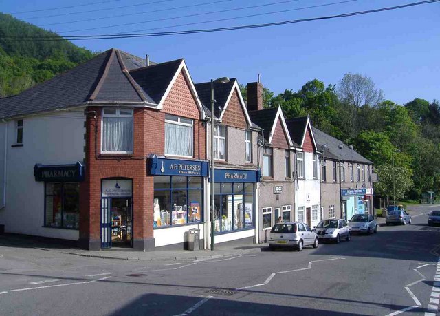


Why visit Abercarn
Townapedia lists 5 museums and landmarks, 7 parks and trails, 30 places to eat, 7 places to stay and 7 attractions in and around town.
Highlights include Blackwood Miners Welfare Institute, Crumlin Viaduct, Navigation Colliery and Cwmcarn Forest Drive Visitor Centre.
Weather in Abercarn
Forecast from MET Norway (CC BY 4.0). Full forecast
About Abercarn
Abercarn (archaic: Abercarne, Aber-carn, Aber Carn) is a town and community in Caerphilly County borough, South East Wales which until 1972 existed in the historic county of Monmouthshire. It is ten miles (16 km) northwest of Newport on the A467 between Duffryn in Newport and Brynmawr. The town lies in the middle portion of the valley of the Ebbw River, which runs on the western side of it. And it is situated in the south-eastern flank of the once great coal mining region of the South Wales Valleys.
From the Wikipedia article Abercarn (this version), under CC BY-SA 4.0.
Photos of Abercarn

Things to do7
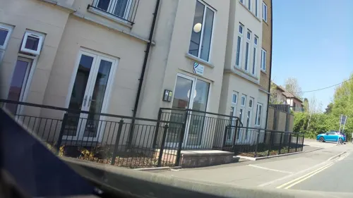
Blackwood Miners Welfare Institute
Cinema and theater · 3.0 mi
Entertainment venue in Blackwood, Caerphilly, Wales

Crumlin Viaduct
Bridge · 2.3 mi
Former viaduct crossing the Ebbw Valley
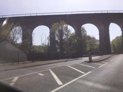
Hengoed Viaduct
Bridge · 3.8 mi
Railway viaduct in Caerphilly county borough, South Wales


Museums and landmarks5


Parks, trails and playgrounds7


Restaurants and cafes30
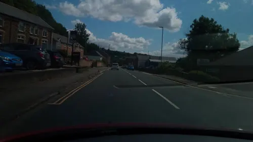
Darran
Bar and pub · 2.5 mi
2 St Mary Street, Risca
Mo-Th 11:30-23:00; Fr-Sa 11:30-00:00; Su 11:30-22:30

Marmaris Grill
Restaurant · Kebab, Grill · 1.3 mi
9 High Street, Caerphilly
Mo-Fr 16:00-23:00; Sa 15:00-23:00; Su 16:00-23:00
Masala Indian Takeaway
Restaurant · Indian · 1.3 mi
16 Victoria Terrace, Caerphilly
Mo 17:30-23:00; Tu Off; We-Th 17:30-23:00; Fr-Sa 17:30-23:30; Su...

Philanthropic Inn
Bar and pub · 1.3 mi
22 Twyncarn Road, Caerphilly
Mo-Fr 15:00-24:00; Sa-Su 12:00-24:00
Three Horseshoes
Bar and pub · 1.5 mi
High Street, Caerphilly
Mo-Su 12:00-23:00

The Patriot
Bar and pub · 2.1 mi
Main Street, Crumlin
Mo Off, Tu Off; We Off, Th 20:00-23:00; Fr 19:00-00:00; Sa...
Terrace Cafe
Cafe · Breakfast, Sandwich, Cake · 1.3 mi
10 Victoria Terrace, Caerphilly
Mo-Fr 09:00-15:00; Sa 09:00-14:00; Su Off
The Fork and Tune
Bar and pub · 0.8 mi
Newport Road, Newport
Mo Off; Tu Off; We Off; Th-Sa 16:00-23:30; Su 16:00-21:00
At A.M
Cafe · Coffee Shop, Bakery, Doughnut, Sandwich · 0.4 mi
Darren Drive, Abercarn
Mo-We 08:00-15:00; Th-Fr 08:00-18:00; Sa 09:00-16:00; Su 10:00-16:00
18 more on the map.
History
The 1535 Valor Ecclesiasticus identified Habercarne has having £23 2s 3d, an income associated with the estate of Llantarnam Abbey. According to the 1535/36 ministers accounts, Abercarne had six mills and a hundred and nineteen tenements. Out of the six mills, four were corn mills, one was a fulling mill and the other one was unspecified. One of the corn mills was located in the Gwyddon and another at Maestir (Plain Land). Jenkin ap Morgan who recorded the accounts was the bailiff for Mynyddislwyn. Henry VIII retained the estate:'until 1539, when he leased it to John Parker, one of the squires of his stables, for an annual rent of 21/-. The accounts of his bailiff show that from the lands within the Lordship of Abercarn he derived a rental of £18/11/10/½.'Clark 1962, p. 147 By the 1570s, there were also a small charcoal furnace in the Gwyddon Valley above Abercarn, which was associated with the Earl of Pembroke.
Read more of the history
Newman (2000) observed: 'Ironworking began here early, before the end of the c16; coalmining started c.1836. Welsh historian John Lloyd (1906) documented that in 1783 Joshua Glover and Samuel Glover (his son) of Birmingham, Warwick were operating 'on, or immediately adjacent to, the Ebbw main stream at Abercarne ... an important business'. The 'important business' was iron production. Newman (2000) observed that 'at Abercarn ... a tall, charcoal-fuelled blast furnace with charging-house survives. It is datable to the mid c18, and is thus the earliest well-preserved furnace in South Wales.' Newman documented, under the heading Blast Furnace: '½m. E, on the N slope of the Nant Gwyddon. The remains of a mid-c18 ironworking furnace, the earliest to survive fairly intact in the South Wales Coalfield.' Newman continued: 'Visible features are: one of the cast-iron beams supporting the top of the casting-arch; a low wall round the top of the furnace, from which an infilled arch spans to what remains of the charging-house, with a truncated masonry bridge-house. To the S is a feature which may be the top of either a broad charging-bank arch or a vaulted water-powered bellows chamber. Upstream 100 yards (100 metres) to the E is a fairly large pool impounded by a low masonry dam with stepped discharge weir. The original dam presumably powered a water wheel at the furnace, driving large bellows to provide the necessary draught.'
In 1783 Glover and his son also signed a contract with Anthony Bacon, Senior, of Cyfarthfa Ironworks to supply Abercarne Iron Works with 800 tons of pig iron a year. By 1808 only one of the Glovers survived, who Lloyd (1906) described as 'presumably the last surviving mamber of the firm'. Also, ironmaster Richard Crawshay, who had taken over the Cyfarthfa Ironworks after the death of Bacon in 1786, bought the freehold of the Abercarn estate from him. When the sale was completed, Crawshay immediately gave it to his son-in-law, Benjamin Hall, where he and his wife, Charlotte, Crawshay's second daughter, and their eldest son, five-year-old Benjamin came to live. The estate included two properties which were close to the river, a manor-house beside it and a small Georgian house on the wooded hill above it.
See Abercarn colliery disaster. Newman (2000) observed that coalmining started at Abercarn: 'c.1836.' Further, 'Industry flourished from 1845, when Ebenezer Rogers opened the Abercarn and Gwyddon Collieries' and in 1862, when 'Abercarn's major colliery, the Prince of Wales was sunk in the valley bottom.'
On 11 September 1878, an underground explosion in Abercarn Colliery killed 268 coal miners.
From the History section of Abercarn on Wikipedia, under CC BY-SA 4.0.
Notable people from Abercarn
 John DawesWelsh rugby union footballer and coach (1940-2021)Photo: Stefano Delfrate, CC BY-SA 2.0
- Clement Price ThomasWelsh surgeon
- Mike WatkinsWelsh rugby union player
- Clifford WilliamsWelsh rugby union and rugby league footballer
- Lonza BowdlerWelsh rugby union player
- Norman HarrisWelsh rugby union and rugby league footballer
- Dai ReesWelsh rugby union footballer and coach
- Dicky RalphWelsh rugby union and rugby league footballer (1908-1989)
Born in Abercarn, according to Wikidata (CC0). Each name links to its Wikipedia article.
Where to stay7
Churches and places of worship12
Shopping4
Gas and EV charging3
Schools, colleges and libraries12
Healthcare1
Map of Abercarn
88 places. The map loads OpenStreetMap tiles when you open it.
Getting there and nearby towns
Cardiff Airport (CWL) is the nearest airport with scheduled flights listed in OpenStreetMap, 19 miles away.
- Risca 3 mi southeast, about 5 min by car
- Cwmbran 5 mi east, about 8 min by car
- Bargoed 5 mi northwest, about 8 min by car
- Pontypool 5 mi northeast, about 9 min by car
- Gelligaer 5 mi west, about 9 min by car
- Abertillery 6 mi north, about 9 min by car
- Caerphilly 6 mi southwest, about 10 min by car
- Nelson 6 mi west, about 10 min by car
- Newport 7 mi southeast, about 12 min by car
- Treharris 7 mi west, about 12 min by car
Drive times are estimates from straight-line distance, not routes.
Towns near Abercarn


Keep exploring
Local news
Headlines from INDB.
Reviews, tips and questions
Loading what members have shared...
Sources and licences
- GeoNames (CC BY 4.0): population, coordinates, regions and time zone
- Mapillary (see each image): photos
- OpenStreetMap contributors (ODbL 1.0): places, airports, map data
- Wikidata (CC0 1.0): elevation, founding date, time zone, website, landmarks and historic places
- Wikimedia Commons (see each image): photos
- Wikipedia (CC BY-SA 4.0): overview and history text
Photo credits
- Abercarn, High Street, Roger Cornfoot, CC BY-SA 2.0
- Crumlin Viaduct. [graphic] / On the Taff Vale extension of the West Midland Railway - constructed exclusively of iron - length 1658 feet - height 200 feet - designed and erected by T. W. Kenard Esqr., Unknown author, Public domain
- St Luke's Church, Abercarn 062, Lewis Hulbert, CC BY-SA 3.0
- Robert Stephenson & Hawthorns 7800, hugh llewelyn, CC BY-SA 2.0
- Robert Stephenson & Hawthorns 7800 - 8462097422, hugh llewelyn, CC BY-SA 2.0
- Peckett 1009, hugh llewelyn, CC BY-SA 2.0
- Barclay 1608, hugh llewelyn, CC BY-SA 2.0
- Twmbarlwm to England - panoramio, dwtheprof, CC BY 3.0
- Crumlin Navigation Colliery - Chimney, Powerhouse and North Winding House, Lauratrefor, CC BY-SA 4.0
- Street-level photo, laye, CC BY-SA 4.0
- Street-level photo, victuallers, CC BY-SA 4.0
- Street-level photo, laye, CC BY-SA 4.0
- Street-level photo, southglos, CC BY-SA 4.0
- Street-level photo, southglos, CC BY-SA 4.0
- Street-level photo, southglos, CC BY-SA 4.0
- Street-level photo, southglos, CC BY-SA 4.0
- Street-level photo, laye, CC BY-SA 4.0
Page built November 10, 2026. Spotted a mistake? Tell us or suggest a place.