


Why visit Gaerwen
Townapedia lists 6 museums and landmarks, 1 park or trail, 3 places to eat and 2 places to stay in and around town.
Highlights include Bodowyr Burial Chamber, Bryn Gwyn stones and The Dingle.
Weather in Gaerwen
Forecast from MET Norway (CC BY 4.0). Full forecast
About Gaerwen
Gaerwen () is a village on the island of Anglesey in the community of Llanfihangel Ysgeifiog in Wales. It is located in the south of the island 4 miles (6.4 km) west of Llanfairpwllgwyngyll and 4 miles (6.4 km) southeast of Llangefni . The A5 runs through the village, and the A55 runs just a few hundred metres north. According to the 2011 Census Gaerwen is now listed by the Office for National Statistics as Llanfihangel Ysgeifiog.
From the Wikipedia article Gaerwen (this version), under CC BY-SA 4.0.
Photos of Gaerwen

Museums and landmarks6

Bodowyr Burial Chamber
Monument and historic site · 2.6 mi
Neolithic burial chamber in Llanidan, Anglesey, Wales, UK

Bryn Gwyn stones
Monument and historic site · 3.3 mi
Two remaining stones of an original circle of eight stones

Marquess of Anglesey's Column
Monument and historic site · 3.2 mi
Monument in Anglesey, Wales

HMS Conway
Monument and historic site · 2.6 mi
Royal Navy training school

Oriel Môn
Museum · 3.3 mi
Local museum in Llangefni, Wales, United Kingdom
Rayner Memorial Clock Tower
Monument and historic site · 2.8 mi
Grade II listed building in Anglesey
Parks, trails and playgrounds1

Restaurants and cafes3
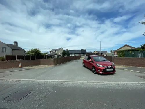
Gaerwen Fish & Chips
Fast food · Fish And Chips
Ffordd Caergybi, Gaerwen

Where to stay2

More about Gaerwen
Arts and culture
Facilities in Gaerwen include two public houses, and four churches. There are two disused windmills in the north of the village and a modern industrial estate making up the south west portion.
There is a primary school and a football pitch in the middle of the village. There is also a fish and chip shop with a barber shop next door. A science park on the south of the A55 Junction was opened in 2018.
There is a war memorial at the heart of the village paying tribute to those who fell in both World Wars.
From the Wikipedia article Gaerwen, under CC BY-SA 4.0.
Notable people from Gaerwen
- Derek BooteWelsh singer and actor
Born in Gaerwen, according to Wikidata (CC0). Each name links to its Wikipedia article.
Churches and places of worship15
Shopping1
Gas and EV charging2
Schools, colleges and libraries2
Map of Gaerwen
32 places. The map loads OpenStreetMap tiles when you open it.
Getting there and nearby towns
RAF Valley - Anglesey Airport (VLY) is the nearest airport with scheduled flights listed in OpenStreetMap, 11 miles away.
- Llangefni 3 mi northwest, about 5 min by car
- Llanfairpwllgwyngyll 3 mi east, about 5 min by car
- Menai Bridge 4 mi east, about 7 min by car
- Bangor 6 mi east, about 10 min by car
- Tregarth 8 mi east, about 13 min by car
- Llanerchymedd 9 mi northwest, about 14 min by car
- Llanberis 9 mi southeast, about 15 min by car
- Rhosneigr 10 mi west, about 16 min by car
- Penygroes 11 mi south, about 18 min by car
- Llanfairfechan 13 mi east, about 20 min by car
Drive times are estimates from straight-line distance, not routes.
Towns near Gaerwen


Keep exploring
Local news
Headlines from INDB.
Reviews, tips and questions
Loading what members have shared...
Sources and licences
- GeoNames (CC BY 4.0): population, coordinates, regions and time zone
- Mapillary (see each image): photos
- OpenStreetMap contributors (ODbL 1.0): places, airports, map data
- Wikidata (CC0 1.0): elevation, founding date, time zone, website, landmarks and historic places
- Wikimedia Commons (see each image): photos
- Wikipedia (CC BY-SA 4.0): overview and history text
Photo credits
- Gaerwen windmill as seen from Church of St Michael, Gaerwen, Anglesey, Ynys Mon, Wales. 12, Monsyn, CC BY-SA 4.0
- Melin Maengwyn (a alwyd ar un adeg yn 'Felin Gaerwen') NPRN 40338 - Gaerwen, Ynys Môn, Wales 02, Llywelyn2000, CC BY-SA 4.0
- Melin Maengwyn (a alwyd ar un adeg yn 'Felin Gaerwen') NPRN 40338 - Gaerwen, Ynys Môn, Wales 05, Llywelyn2000, CC BY-SA 4.0
- Melin Maengwyn (a alwyd ar un adeg yn 'Felin Gaerwen') NPRN 40338 - Gaerwen, Ynys Môn, Wales 03, Llywelyn2000, CC BY-SA 4.0
- Melin Maengwyn (a alwyd ar un adeg yn 'Felin Gaerwen') NPRN 40338 - Gaerwen, Ynys Môn, Wales 13, Llywelyn2000, CC BY-SA 4.0
- Melin Maengwyn (a alwyd ar un adeg yn 'Felin Gaerwen') NPRN 40338 - Gaerwen, Ynys Môn, Wales 07, Llywelyn2000, CC BY-SA 4.0
- Melin Maengwyn (a alwyd ar un adeg yn 'Felin Gaerwen') NPRN 40338 - Gaerwen, Ynys Môn, Wales 11, Llywelyn2000, CC BY-SA 4.0
- Melin Maengwyn (a alwyd ar un adeg yn 'Felin Gaerwen') NPRN 40338 - Gaerwen, Ynys Môn, Wales 06, Llywelyn2000, CC BY-SA 4.0
- Melin Maengwyn (a alwyd ar un adeg yn 'Felin Gaerwen') NPRN 40338 - Gaerwen, Ynys Môn, Wales 17, Llywelyn2000, CC BY-SA 4.0
- Melin Maengwyn (a alwyd ar un adeg yn 'Felin Gaerwen') NPRN 40338 - Gaerwen, Ynys Môn, Wales 12, Llywelyn2000, CC BY-SA 4.0
- Melin Maengwyn (a alwyd ar un adeg yn 'Felin Gaerwen') NPRN 40338 - Gaerwen, Ynys Môn, Wales 21, Llywelyn2000, CC BY-SA 4.0
- Melin Maengwyn (a alwyd ar un adeg yn 'Felin Gaerwen') NPRN 40338 - Gaerwen, Ynys Môn, Wales 19, Llywelyn2000, CC BY-SA 4.0
- Melin Maengwyn (a alwyd ar un adeg yn 'Felin Gaerwen') NPRN 40338 - Gaerwen, Ynys Môn, Wales 23, Llywelyn2000, CC BY-SA 4.0
- Melin Maengwyn (a alwyd ar un adeg yn 'Felin Gaerwen') NPRN 40338 - Gaerwen, Ynys Môn, Wales 20, Llywelyn2000, CC BY-SA 4.0
- Melin Maengwyn (a alwyd ar un adeg yn 'Felin Gaerwen') NPRN 40338 - Gaerwen, Ynys Môn, Wales 09, Llywelyn2000, CC BY-SA 4.0
- Melin Maengwyn (a alwyd ar un adeg yn 'Felin Gaerwen') NPRN 40338 - Gaerwen, Ynys Môn, Wales 22, Llywelyn2000, CC BY-SA 4.0
- Melin Maengwyn (a alwyd ar un adeg yn 'Felin Gaerwen') NPRN 40338 - Gaerwen, Ynys Môn, Wales 14, Llywelyn2000, CC BY-SA 4.0
- Bodowyr Burial Chamber 20171019 from northwest, Otter, CC BY-SA 4.0
- Bryn Gwyn slab stone with small adult 11102009, Richard Keatinge, CC BY-SA 3.0
- Llanidan Old Church, Bencherlite, CC BY-SA 3.0
- EglwysLlangaffo, Porius1, CC BY-SA 3.0
- South side of St Cristiolus, Llangristiolus, Bencherlite, CC BY-SA 3.0
- Sant Cyngar, Llangefni, Ynys Mon, Cymru 04, Monsyn, CC BY-SA 4.0
- The former St Deiniol's Church, Llanddaniel Fab, Eric Jones, CC BY-SA 2.0
- St Edwen's Church from Plas Newydd estate, J Scott, CC BY-SA 2.0
- Eglwys Credifael, Penmynydd, 2007, GeraintTudur2, CC BY-SA 3.0
- St Mary's Church and surrounding area, Llanfairpwllgwyngyll - y Santes Fair; Ynys Môn, Cymru Wales 01, Llywelyn2000, CC BY-SA 4.0
- Colofn Ardalydd Môn, Llanfair Pwllgwyngyll, Ynys Môn - Marquess of Anglesey's Column monument in Anglesey, Wales 07, Llywelyn2000, CC BY-SA 4.0
- Anglesey - St Nidan's Church, Llanidan, Angelsey, Wales - Eglwys Sant Nidan, Llanidan, Ynys Môn 11, Llywelyn2000, CC BY-SA 4.0
- Street-level photo, trigpoint, CC BY-SA 4.0
- Street-level photo, debigc, CC BY-SA 4.0
- Street-level photo, trigpoint, CC BY-SA 4.0
- Street-level photo, debigc, CC BY-SA 4.0
- Street-level photo, debigc, CC BY-SA 4.0


Page built November 10, 2026. Spotted a mistake? Tell us or suggest a place.