




Why visit Caerwent
Townapedia lists 12 museums and landmarks, 4 parks and trails, 7 places to eat, 2 places to stay and 1 attraction in and around town.
Highlights include Caer-went Roman Town, Venta Silurum and Caldicot Soft Play.
Weather in Caerwent
Forecast from MET Norway (CC BY 4.0). Full forecast
About Caerwent
Caerwent (Welsh: Caer-went) is a village and community in Monmouthshire, Wales. It is located about 5 mi (8.0 km) west of Chepstow and 11 mi (18 km) east of Newport. It was founded by the Romans as the market town of Venta Silurum, an important settlement of the Brythonic tribe of Silures. The modern village is built around the Roman ruins, which are some of the best-preserved in Europe.
From the Wikipedia article Caerwent (this version), under CC BY-SA 4.0.
Photos of Caerwent


Things to do1
Museums and landmarks12

Venta Silurum
Monument and historic site
Town in the Roman province of Britannia or Britain


Llanthony Secunda Manor
Monument and historic site · 1.4 mi
Grade 2 listed ancient building, previous monestary once owned by Henry VIII
Parks, trails and playgrounds4

Restaurants and cafes7


Aroma
Cafe · 1.5 mi
15 Newport Road, Caldicot
Mo 09:00-18:00; Tu off; We-Sa 09:00-18:00; Su 10:00-17:00; PH 10:00-17:00

History
Caerwent was founded by the Romans in AD 75 as a market town for the defeated Silures tribe. This is confirmed by inscriptions on the "Civitas Silurum" stone, now on display in the parish church. Large sections of the Roman town walls are still in place, rising up to 5 metres (16 ft) high in places. Historian John Newman has described the walls as: "easily the most impressive town defence to survive from Roman Britain, and in its freedom from later rebuilding one of the most perfectly preserved in Northern Europe." In 1881, a portion of a highly intricate coloured floor mosaic or tessellated pavement, depicting different types of fish, was unearthed during excavations in the garden of a cottage.
Excavations in 1971 dated the north-west polygonal angle-tower to the mid-300s. Further excavations were carried out in 2008 by Wessex Archaeology and was featured in the Channel 4 TV programme Time Team.
Modern houses are built on top of half the site of the old Roman market place. The ruins of several Roman buildings are still visible, including the foundations of a 4th-century Roman temple with a Temenos area. The rudimentary quality of most of the houses, few of which had mosaic or hypocaust-heated floors, indicates that, although a large settlement, Caerwent did not attain the importance or sophistication of other Romano-British tribal capitals.
Read more of the history
Caerwent was sometimes postulated a centre for the Kingdom of Gwent after the Roman occupation. The name Caerwent translates from Welsh as "fort of Venta", and the name Gwent derives from the Roman name Venta (Silurum). The English town name of Winchester has a parallel derivation, ultimately from the combination of the Latin words Venta, in that case, Venta Belgarum, and castra.
Caerwent remained an important centre, where the road between Gloucester and Caerleon met the north–south road from Shrewsbury, via Monmouth and Trellech, to the sea at Portskewett. Excavations at Caerwent have revealed remains and everyday objects from the post-Roman period. Metalwork, including elaborate penannular brooches and fastening pins, have been dated to the 5th–7th centuries. A large number of Christian burials, some stone-lined, dating from between the 4th and 9th centuries have also been discovered, both around the town's East Gate and close to the parish church. It has been suggested that it may have been the birthplace of Saint Patrick.
A monastery was established at Caerwent some time before the 10th century, and a pre-Norman cross head was discovered at the site in 1992. The Church of St Stephen and St Tathan is dedicated to Saints Stephen and Tathan, the latter name possibly having arisen through confusion with Saint Tathyw. The oldest existing part of the church dates to the 13th century.
The village appears as "Venta Siluru" and "Caer went" on the Cambriae Typus map of 1573.
From the History section of Caerwent on Wikipedia, under CC BY-SA 4.0.
Where to stay2
Churches and places of worship12
St Michael and All Angels Church, Llanfihangel Rogiet
Church · 2.0 mi
Shopping2
Gas and EV charging1
Schools, colleges and libraries3
Healthcare1
Map of Caerwent
45 places. The map loads OpenStreetMap tiles when you open it.
Getting there and nearby towns
Bristol Airport (BRS) is the nearest airport with scheduled flights listed in OpenStreetMap, 16 miles away.
- Caldicot 2 mi south, about 3 min by car
- Undy 3 mi southwest, about 5 min by car
- Magor 3 mi southwest, about 6 min by car
- Chepstow 4 mi northeast, about 7 min by car
- Severn Beach 6 mi southeast, about 9 min by car
- Pilning 6 mi southeast, about 10 min by car
- Portishead 9 mi south, about 14 min by car
- Usk 9 mi northwest, about 14 min by car
- Newport 10 mi west, about 16 min by car
- Easton-in-Gordano 10 mi south, about 16 min by car
Drive times are estimates from straight-line distance, not routes.
Towns near Caerwent


Keep exploring
Local news
Headlines from INDB.
Reviews, tips and questions
Loading what members have shared...
Sources and licences
- GeoNames (CC BY 4.0): population, coordinates, regions and time zone
- Mapillary (see each image): photos
- OpenStreetMap contributors (ODbL 1.0): places, airports, map data
- Wikidata (CC0 1.0): elevation, founding date, time zone, website, landmarks and historic places
- Wikimedia Commons (see each image): photos
- Wikipedia (CC BY-SA 4.0): overview and history text
Photo credits
- Turnstile lychgate at St Stephen's church, Caerwent, Andy Dingley, CC BY-SA 3.0
- Portskewett, Chris Downer, CC BY-SA 2.0
- Shirenewton Church, Colin Bates, CC BY-SA 2.0
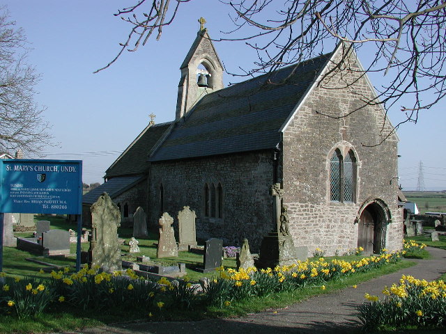
- Undy Church, ChurchCrawler, CC BY-SA 2.0
- CaerwentWall, MortimerCat, CC BY-SA 3.0
- Castle Inn pub, Caldicot, Dominic Nelson, CC BY-SA 4.0
- Roman Pillar - 52033875445, Capt' Gorgeous, CC BY 2.0
- Roman mosaic, Capt' Gorgeous, CC BY 2.0
- Roman Pillar, Capt' Gorgeous, CC BY 2.0
- Cross Inn, Caldicot, Oct 2023, Dominic Nelson, CC BY-SA 4.0
- Street-level photo, southglos, CC BY-SA 4.0
- Street-level photo, southglos, CC BY-SA 4.0
- Street-level photo, southglos, CC BY-SA 4.0
- Street-level photo, southglos, CC BY-SA 4.0
- Street-level photo, southglos, CC BY-SA 4.0
- Street-level photo, southglos, CC BY-SA 4.0
- Street-level photo, southglos, CC BY-SA 4.0
- Street-level photo, southglos, CC BY-SA 4.0
- Street-level photo, southglos, CC BY-SA 4.0
- Street-level photo, southglos, CC BY-SA 4.0
- Street-level photo, southglos, CC BY-SA 4.0
- Street-level photo, southglos, CC BY-SA 4.0
- Street-level photo, southglos, CC BY-SA 4.0
- Street-level photo, southglos, CC BY-SA 4.0
- Street-level photo, southglos, CC BY-SA 4.0
Page built November 10, 2026. Spotted a mistake? Tell us or suggest a place.