
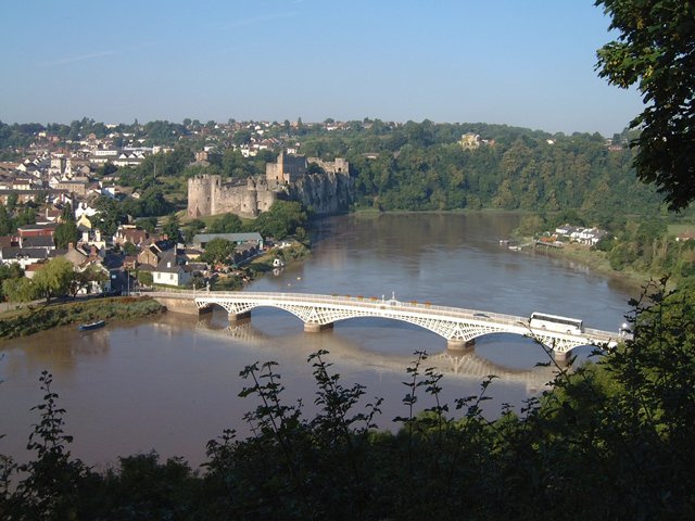


Why visit Chepstow
Townapedia lists 11 museums and landmarks, 6 parks and trails, 52 places to eat, 4 places to stay and 5 attractions in and around town.
Highlights include Fossil Beach, Chepstow Railway Bridge, Chepstow Museum and Chepstow Castle.
Weather in Chepstow
Forecast from MET Norway (CC BY 4.0). Full forecast
About Chepstow
Chepstow (Welsh: Cas-gwent) is a town and community in Monmouthshire, Wales, adjoining the border with Gloucestershire, England. It is located on the tidal River Wye, about 2 miles (3 km) above its confluence with the River Severn, and adjoining the western end of the Severn Bridge. It is the easternmost settlement in Wales, situated 16 miles (26 km) east of Newport, 28 miles (45 km) east-northeast of Cardiff, 18 miles (29 km) northwest of Bristol and 110 miles (180 km) west of London.
From the Wikipedia article Chepstow (this version), under CC BY-SA 4.0.
Travel tips from other travellers: Chepstow on Wikivoyage (CC BY-SA 4.0).
Photos of Chepstow


Things to do5

Fossil Beach
Beach · 1.6 mi
Fossil beach in Tidenham, Forest of Dean, Gloucestershire, England

Chepstow Railway Bridge
Bridge · 0.5 mi
Grade II listed railway bridge in Chepstow, United Kingdom
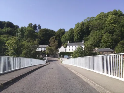

Severn Bridge
Bridge · 2.7 mi
Suspension bridge in Gloucestershire, England

Wye Bridge (M48 Viaduct)
Bridge · 1.7 mi
Grade II listed building in Chepstow. Carries the M48 motorway over the Wye estuary and Beachley peninsula, as the western continuation...
Museums and landmarks11

Chepstow Museum
Museum
Local museum in Chepstow
Bridge Street, Chepstow
Mo-Tu 11:00-16:00; We off; Th-Su 11:00-16:00

Chepstow Castle
Monument and historic site
Castle in Chepstow, Monmouthshire, Wales
Bridge Street, Chepstow
Mar 01-Jun 30,Sep 01-Oct 31 09:30-17:00; Jul 01-Aug 31...

Chepstow War Memorial
Monument and historic site
War memorial in Chepstow, Monmouthshire, Wales



Buttington Stone
Monument and historic site · 1.0 mi
"Standing stone at Offa's Dyke. Re-erected 1977, age unknown. A lump of natural sandstone c 1.5 m high set on roughly circular base of...
Parks, trails and playgrounds6

Restaurants and cafes52

Boat Inn
Bar and pub · 0.4 mi
The Back, Chepstow
Mo-Fr 12:00-14:30,17:30-21:00; Sa 12:00-21:00; Su 12:00-18:00
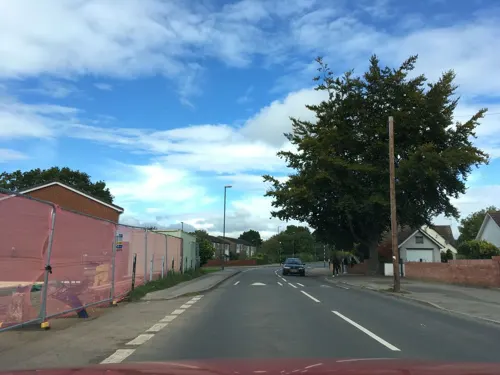
The Village Inn
Bar and pub · 0.7 mi
54 Beachley Road, Sedbury
Mo 14:00-23:00; Tu-Th 12:00-23:00; Fr 12:00-00:00; Sa-Su 11:00-23:00
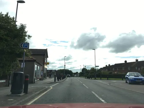
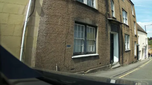
Five Alls
Bar and pub
Hocker Hill Street, Chepstow
Mo-Th 14:00-22:00; Fr 14:00-00:00; Sa 12:00-00:00; Su 14:00-22:00
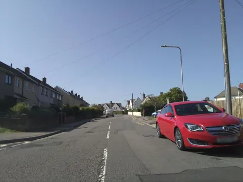
Two Brewers
Bar and pub · 1.0 mi
Thornwell Road, Chepstow
Mo-Th 11:00-23:30; Fr-Sa 11:00-00:00; Su 12:00-23:00

Hikari
Restaurant · Asian
17 St Mary Street, Chepstow
Tu-Sa 12:00-15:00 Tu-Th 17:00-21:00 Fr-Sa 17:00-22:00 Su 12:00-21:00
40 more on the map.
History
The earliest recorded evidence of human activity in the Chepstow area are charcoal deposits, found in St Peter's Cave, at the base of Hardwick Cliff, Bulwark, dating from the Upper Paleolithic.
The oldest site of known habitation at Chepstow is at Thornwell, overlooking the estuaries of the Wye and Severn close to the modern M48 motorway junction, where archaeological investigations in advance of recent housing development revealed continuous human occupation from the Mesolithic period of around 5000 BC until the end of the Roman period, about 400 AD. There are also Iron Age fortified camps in the area, dating from the time of the Silures, at Bulwark, 1 mile (1.6 km) south of the town centre, and at Piercefield and Lancaut, some 1.5 miles (2.4 km) to the north. During the Roman occupation, there was a bridge or causeway across the Wye, about 0.6 miles (0.97 km) upstream of the later town bridge. Chepstow is located at a crossing point directly between the Roman towns at Gloucester (Glevum) and Caerwent (Venta Silurum). Although historians think it likely that there was a small Roman fort in the area, the only evidence found so far has been of Roman material and burials, rather than buildings.
Read more of the history
After the Romans left, Chepstow was within the southern part of the Welsh kingdom of Gwent, known as Gwent Is-coed (i.e. Gwent this side of the woods). To the north of the modern town centre, a small church was established dedicated to St. Cynfarch (alternatively Cynmarch, Kynemark or Kingsmark), a disciple of St. Dyfrig. This later became the St Kynemark Priory on what is now Kingsmark Lane, but no traces of it remain. The town is close to the southern point of Offa's Dyke, which begins on the east bank of the Wye at Sedbury and runs all the way to the Irish Sea in north Wales. This was built in the late 8th century as a boundary between Mercia and the Welsh kingdoms, although some recent research has questioned whether the stretch near Chepstow formed part of the original Dyke. It is possible, though not clearly substantiated, that Chepstow may have superseded Caerwent as a trading centre, and been used by both Saxons and the Welsh. The Lancaut and Beachley peninsulas, opposite Chepstow, were in Welsh rather than Mercian control at that time, although by the time of the Domesday Book Striguil was assessed as part of Gloucestershire.
After the Norman conquest of England, Chepstow was a key location. It was at the lowest bridging point of the River Wye, provided a base from which to advance Norman control into south Wales, and controlled river access to Hereford and the Marches. Chepstow Castle was founded by William fitzOsbern, 1st Earl of Hereford, in 1067, and its Great Tower, often cited as the oldest surviving stone fortification in Britain, dates from that time or shortly afterwards. Its site, with sheer cliffs on one side and a natural valley on the other, afforded an excellent defensive location. A Benedictine priory, now St Mary's Church, was also established nearby. This was the centre of a small religious community, the remains of which are buried under the adjoining car park. Monks, originally from Cormeilles Abbey in Normandy, were there until the Dissolution of the Monasteries.
The castle was expanded by William Marshal in the late twelfth century and, a century later, by Roger Bigod, 5th Earl of Norfolk. Bigod was also responsible for establishing a weekly market and annual fair, in the town which had grown up on the slopes between the castle and priory, and for building the Port Wall around it shortly after 1274. A toll gate controlled entry to the market area; this Town Gate was rebuilt in the 16th century. The town faced some hostile attacks from the Welsh to the west, but after the 14th century the castle's importance diminished. The port of Chepstow developed during the medieval period, one reason being that its control by a Marcher Lord, rather than by the King, meant that it was exempt from English taxation. It mainly traded in timber and bark from the Wye Valley, and with Bristol. From medieval times, Chepstow was the largest port in Wales; its ships sailed as far as Iceland and Turkey, as well as to France and Portugal, and the town was known for its imports of wine.
Chepstow was given its first charter in 1524, by Charles Somerset, 1st Earl of Worcester, and became part of Monmouthshire when the county was formed. The town appears as "Strigulia", "Chepstowe" and "Castelh Gwent" on the Cambriae Typus map of 1573. The castle and town changed hands several times during the English Civil War, and the regicide Henry Marten was later imprisoned and died in the castle. The port continued to flourish; during the period 1790 to 1795, records show a greater tonnage of goods handled than Swansea, Cardiff and Newport combined. Chepstow reached the peak of its importance during the Napoleonic Wars, when its exports of timber, for ships, and bark, for leather tanning, were especially vital. There were also exports of wire and paper, made in the many mills on the tributaries of the Wye.
An important aspect of Chepstow's trade was entrepôt trade: bringing larger cargoes into the manageable deep water of the Wye on high tide and breaking down the load for on-shipment in the many trows up the Wye to Hereford past the coin stamping mill at Redbrook, or up the Severn to Gloucester and beyond. Chepstow also traded across the estuary to Bristol on suitable tides to work vessels up and down the Avon to that city's centre. Many buildings in the town remain from the late 18th and early 19th centuries; the elegant cast iron bridge across the Wye was opened in 1816 to replace an earlier wooden structure.
From the History section of Chepstow on Wikipedia, under CC BY-SA 4.0.
More about Chepstow
Geography
Chepstow is located on the west bank of the River Wye, some 3 miles (4.8 km) north of its confluence with the Severn estuary. To the north of the town, the Wye passes through a limestone gorge, and there are limestone cliffs at Chepstow both north and south of the town centre and on the opposite (east) side of the river. The town is overlooked by the inland cliffs at Wyndcliff near St Arvans, about 2 miles (3.2 km) north of the town, and, from parts of the town, the Severn estuary and its bridges can be seen. The historic centre of Chepstow occupies part of a bend in the River Wye, and slopes up from the river to the town centre and beyond. As well as cliffs used for rock climbing, percolation of acidic groundwater has dissolved limestone to produce caves in the area, including Otter Hole, one of the most decorated cave systems in Britain, which runs under the racecourse. The climate of the town is affected by its position close to the Severn estuary.
Economy
Chepstow developed from medieval times as a port and trading centre. Its port functions, together with its shipbuilding industry, have now virtually ceased. The industries which developed on the shipyard sites, particularly the fabrication of major engineering structures by the Mabey Group, continued close to the town centre as well as on the Newhouse Farm industrial estate beside the M48 motorway, where wind turbine towers were assembled. In July 2015, the company announced that the site was to close with the loss of 125 jobs, following the decision by the UK government to end subsidies for onshore wind generation.
Other local industries have included the material for artificial ski slopes, developed at the "Dendix" brush factory, which in its time was a producer of all sizes of industrial brushes. The works, now operated by Osborn-Unipol, relocated out of the town centre to a new site beside the motorway in 2011. There are smaller industrial estates in Bulwark, and close to the town's railway station, and the Newhouse Farm industrial estate is also a major distribution centre. Other notable locally based businesses have included Architen Landrell, a manufacturer of tensile architectural structures, whose closure was announced in December 2015; and MVM Films, a distributor of Japanese animated films.
Arts and culture
The town holds a biennial community festival, as well as an annual agricultural show and the annual Wassail and Mari Lwyd in January. There is a local Welsh society for the area, Cymdeithas Cymraeg Cas-gwent, Cil-y-coed a'r cyffiniau, holding numerous Welsh language events throughout the year that are open to all. In the early 2000s the community organised major son et lumière pageants covering aspects of local history, using local residents under professional direction. Since 2012, an annual series of "Castell Roc" music events has been held inside Chepstow Castle each August, featuring performances by artists such as Leo Sayer, Dr Hook, Bad Manners, and Jools Holland.
The Chepstow Museum, first established by the Chepstow Society, is housed in an elegant 1796 town house opposite the Castle entrance. Chepstow has no dedicated cinema or theatre, although film showings, theatrical and other events regularly take place in the Drill Hall, close to the Castle and riverside area. Chepstow is also home to the Electric Picture Hall, which organises regular 'pop-up' cinema events and a Welsh themed short film festival each year, with the long-term goal of establishing a dedicated cinema and performing arts space for the town. Group community activities also take place in the Palmer Community Centre and Bulwark Community Centre.
Education
The town is served by Chepstow School, located on Welsh Street, with over 1,300 pupils. There are four primary schools in the town: The Dell, Pembroke, Thornwell, and St Mary's Roman Catholic. Tutshill and Sedbury, on the English side of the Wye but within walking distance of Chepstow and attracting some pupils from the town, have their own schools, including Wyedean School, and the private preparatory Dean Close St John's in Tutshill.
Chepstow Community Hospital was opened in 2000, having been developed under the United Kingdom Government's Private Finance Initiative. It was built and is operated by Kintra Ltd, at an annual charge of £1.2m to Gwent Healthcare NHS Trust. The hospital building incorporates mementoes from the past, including the old Admiralty portico moulding from the front facade of the former Mount Pleasant Hospital, which was located on an adjacent site now developed as a housing estate.
From the Wikipedia article Chepstow, under CC BY-SA 4.0.
Notable people from Chepstow
 James WilsonWelsh association football playerPhoto: CLEMENATOR, CC BY-SA 4.0
 Isambard OwenBritish University Vice-ChancellorPhoto: Unknown author, CC BY 4.0
- Owain YeomanBritish actor (born 1978)
- Richard MeadeWelsh Olympic equestrian (1938–2015)
- Paul ParryWelsh footballer (born 1980)
- Mary Katherine HerbertBritish Special Operations Executive agent (1903–1983)
- Ted PooleyCricket player of England. (1842-1907)
- Ollie Burtonformer professional footballer (born 1941)
- Eric Francisarchitect (1887-1976)
- Harry RidleyNew Zealand cricketer
- William BedloeEnglish spy (1650-1680)
- Archie RidleyNew Zealand cricketer (1869-1950)
Born in Chepstow, according to Wikidata (CC0). Each name links to its Wikipedia article.
Where to stay4
Churches and places of worship11
Shopping9
Gas and EV charging4
Schools, colleges and libraries11
Healthcare5
Map of Chepstow
118 places. The map loads OpenStreetMap tiles when you open it.
Getting there and nearby towns
Bristol Airport (BRS) is the nearest airport with scheduled flights listed in OpenStreetMap, 18 miles away.
- Thornbury 7 mi east, about 11 min by car
- Stoke Gifford 10 mi southeast, about 17 min by car
- Portishead 12 mi south, about 19 min by car
- Monmouth 12 mi north, about 19 min by car
- Bristol 13 mi south, about 21 min by car
- Mangotsfield 13 mi southeast, about 21 min by car
- Yate 13 mi southeast, about 21 min by car
- Newport 14 mi west, about 23 min by car
- Cwmbran 15 mi west, about 24 min by car
- Kingswood 15 mi southeast, about 24 min by car
Drive times are estimates from straight-line distance, not routes.
Towns near Chepstow


Keep exploring
Local news
Headlines from INDB.
Reviews, tips and questions
Loading what members have shared...
Sources and licences
- GeoNames (CC BY 4.0): population, coordinates, regions and time zone
- Mapillary (see each image): photos
- OpenStreetMap contributors (ODbL 1.0): places, airports, map data
- Wikidata (CC0 1.0): elevation, founding date, time zone, website, landmarks and historic places
- Wikimedia Commons (see each image): photos
- Wikipedia (CC BY-SA 4.0): overview and history text
Photo credits
- Chepstow Castle and Bridge from Tutshill, Roy Parkhouse, CC BY-SA 2.0
- N501RVK Chepstow Classic (8888553857), KK70088, CC BY-SA 2.0
- Original pillars, Chepstow Railway Bridge, Andy Dingley, CC BY-SA 3.0
- River Wye estuary and M48 Wye road bridge, Nicholas Mutton, CC BY-SA 2.0
- Chepstow Museum (4230), Nilfanion, CC BY-SA 4.0
- Chepstow castle - panoramio, eszgé, CC BY-SA 3.0
- Chepstow War Memorial, Reading Tom, CC BY 2.0
- St Mary's Church, Chepstow, Roy Parkhouse, CC BY-SA 2.0
- Shirenewton Church, Colin Bates, CC BY-SA 2.0
- Chepstow Port Wall, Pasicles, CC0
- Chepstow School, Chepstow, Mx. Granger, CC0
- Town Gate, Chepstow, Colin Park, CC BY-SA 2.0
- Beaufort Hotel, Chepstow, Dave.Dunford, CC BY-SA 4.0
- The Boat Inn, Chepstow, Dave.Dunford, CC BY-SA 4.0
- Bridge Inn, Chepstow (4231), Nilfanion, CC BY-SA 4.0
- Chepstow Port Wall oct 2011, Ghmyrtle, CC BY-SA 3.0
- FossilBeach1 DMarshall2017, dm4244, CC BY-SA 4.0
- YX61DVT Newport Transport (8888553731), KK70088, CC BY-SA 2.0
- Under Severn Bridge, Krooczek, CC BY-SA 3.0
- The Tangent headline Winter's End 2023 at the Drill Hall, Chepstow, UK - 52895671835, kitmasterbloke, CC BY 2.0
- Street-level photo, southglos, CC BY-SA 4.0
- Street-level photo, southglos, CC BY-SA 4.0
- Street-level photo, southglos, CC BY-SA 4.0
- Street-level photo, southglos, CC BY-SA 4.0
- Street-level photo, southglos, CC BY-SA 4.0
- Street-level photo, southglos, CC BY-SA 4.0
- Street-level photo, southglos, CC BY-SA 4.0
- Street-level photo, southglos, CC BY-SA 4.0
- Street-level photo, southglos, CC BY-SA 4.0
- Street-level photo, southglos, CC BY-SA 4.0
- Street-level photo, southglos, CC BY-SA 4.0
- Street-level photo, southglos, CC BY-SA 4.0
- Street-level photo, southglos, CC BY-SA 4.0
- Street-level photo, southglos, CC BY-SA 4.0
- Street-level photo, southglos, CC BY-SA 4.0
- Street-level photo, southglos, CC BY-SA 4.0
- Street-level photo, southglos, CC BY-SA 4.0
- Street-level photo, southglos, CC BY-SA 4.0
- Street-level photo, southglos, CC BY-SA 4.0
- Street-level photo, southglos, CC BY-SA 4.0
- Street-level photo, southglos, CC BY-SA 4.0
- Street-level photo, southglos, CC BY-SA 4.0
- Street-level photo, southglos, CC BY-SA 4.0


Page built November 10, 2026. Spotted a mistake? Tell us or suggest a place.