


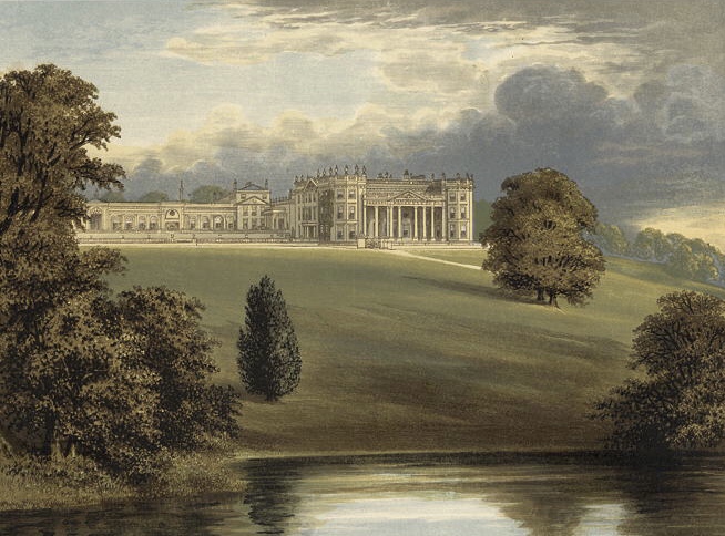
Why visit Calne
Townapedia lists 16 museums and landmarks, 24 parks and trails, 30 places to eat and 2 places to stay in and around town.
Highlights include Calne Heritage Centre and Lansdowne Monument.
Weather in Calne
Forecast from MET Norway (CC BY 4.0). Full forecast
About Calne
Calne (, locally ) is a town and civil parish in Wiltshire, southwestern England, at the northwestern extremity of the North Wessex Downs hill range, a designated Area of Outstanding Natural Beauty.
From the Wikipedia article Calne (this version), under CC BY-SA 4.0.
Travel tips from other travellers: Calne on Wikivoyage (CC BY-SA 4.0).
Museums and landmarks16

Lansdowne Monument
Monument and historic site · 3.3 mi
Monument on Cherhill Down, in Calne Without, Wiltshire, England, UK


Atwell-Wilson Motor Museum
Museum · 1.1 mi
Stockley Lane, Calne
Feb 01-Nov 30: Tu-Su,PH 10:00-16:00; Dec 01-Jan 31 closed

4 more on the map.
Parks, trails and playgrounds24


12 more on the map.
Restaurants and cafes30
King's Flavour
Restaurant · Chicken
The Square, Calne
Mo 11:00-21:00, Tu 11:00-23:30, We-Su 11:00-22:30
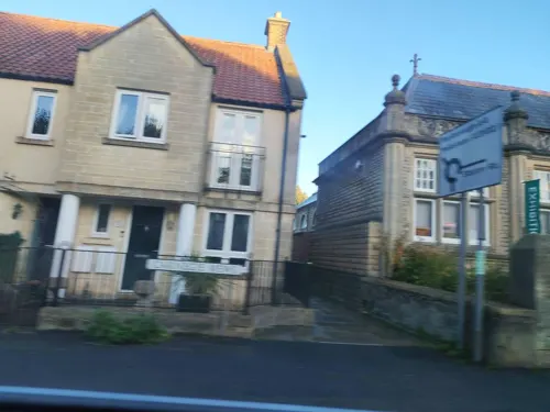
Vanessa's Treasure
Cafe · British
4 St Mary's Courtyard, Swindon
Tu-Su 10:00-15:00
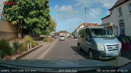


Divine On The Green
Cafe
Cafe and evening Wine bar Wine bar open 18:00 - 23:00 Friday & Saturday
35 New road, Calne
Tu-Sa 09:00-18:00
Fay's Bistro
Cafe · Sandwich, Breakfast, Ice Cream, Tea, Sausage, Cake, Local, Coffee Shop, Pancake, Chicken, Diner
3 Beach Terrace, Calne
Mo-Sa 09:00-17:00; Su 09:30-15:30

The Piggy Bank Micropub
Bar and pub
The Strand, Calne
We 17:00-21:00, Th 16:00-21:00, Fr 14:00-21:30, Sa 12:00-21:30, Su...
Antica Roma Ristorante
Restaurant · Italian
2 High Street, Swindon
Mo-Sa 12:00-14:30,17:00-22:30; Su 12:00-21:30
London Road Inn
Bar and pub · 0.4 mi
85 London Road, Swindon
Mo-Th 16:00-23:00; Fr 15:00-01:00; Sa 14:00-01:00; Su 14:00-23:00
The Wheatsheaf
Bar and pub
3 Curzon Street, Swindon
Su-Th 12:00-22:30, Fr-Sa 12:00-00:30
18 more on the map.
Where to stay2

History
In 978, Anglo-Saxon Calne was the site of a large two-storey building with a hall on the first floor. It was here that St Dunstan, Archbishop of Canterbury met the Witenagemot to justify his controversial organisation of the national church, which involved the secular priests being replaced by Benedictine monks and the influence of landowners over churches on their lands being taken away. According to an account written about 1000, at one point in this meeting Dunstan called upon God to support his cause, at which point the floor collapsed killing most of his opponents, whilst Dunstan and his supporters were in the part that remained standing. This was claimed as a miracle by Dunstan's supporters.
In 1086 Calne may already have been, as it was later, a market town on the main Bristol-London road, with 114 households and a church. 74 or more households were held almost outright by burghal tenure (as citizens of a borough), and the lordship of its large outlying land was divided between the king (of whom 45 burgesses were tenants) and the church.
Read more of the history
In the Middle Ages the king's successor as the lord of Calne manor and, as owner of the church's revenues, the treasurer of Salisbury Cathedral, each had the right to hold a market and a fair in the town, with two triangular market places or fair grounds. A modest hospital was provided on a modest endowment from 1248 until it provided no accommodation in 1546 and was sold two years later by the Crown.
Reflecting the large area of the king's estate, until the late 19th century Calne had tithings at Eastmead Street, Quemerford, Whetham, Whitley, and part of Beversbrook, all now within Calne parish; and furthermore Blackland, Calstone, Stock, Stockley and Studley, all now in the surrounding parishes.
Calne suffered an epidemic between 1880 and 1890 and Chaverywell (now in Castle Park) was the only clean water source available to residents.
Calne had a significant woollen broadcloth industry in the 18th century, and evidence of this can be seen set around the triangular green by the parish church, where 24 listed buildings remain, five at Grade II* including the Tounson almshouses for the neediest poor and Georgian era clothiers' houses. Nearby are some of the 14 original mills along the Marden. St Mary's church was extended by the generous donations of rich clothiers and wool merchants in the 15th century.
Houses of the 17th and 18th centuries have external walls of stone and timber-framed walls inside. Most of the stone is limestone rubble, laid with ashlar dressings in houses of higher quality; the walls of many houses were rendered smooth. Until the 19th century, quarries beside the London road northwest and southeast of the town were sources of stone for building.
A relic of 19th century lime extraction, a kiln, exists in the grounds of St Mary's School. This solid marine deposition is chiefly one chemical, calcium carbonate, and is dug in nearby pits for its main use in cement and as fertiliser on acid ground.
The Wilts & Berks Canal linked the Kennet and Avon Canal at Semington, near Melksham, to the River Thames at Abingdon. Much of the traffic on the canal was coal from the Somerset Coalfield. As the canal passed through open country near Stanley, east of Chippenham, a short branch led through three locks to a wharf in Calne. The canal was completed in 1810 and abandoned in 1914.
Calne railway station opened in 1863, the terminus of its own branch line of the Great Western Railway running east from Chippenham, with one intermediate stop: Stanley Bridge Halt. The opening of Black Dog Halt in the early 20th century provided insufficient demand to slow a progressive decline. The branch closed as a result of the Beeching Axe in September 1965, having made the biggest loss per mile of any line in the country.
Subsequently, Calne's main industry other than being a small market town was the imposing C&T Harris pork processing factory. It is said that the pork-curing industry developed because pigs reared in Ireland were landed at Bristol and then herded across England on drovers' roads to Smithfield, London. One resting place for the pigs was at Black Dog Hill, just west of the town, and the Harris family of butchers took the pigs that were not expected to survive the onward journey.
The Harris business began in the second half of the 18th century, when widow Sarah Harris and her son John relocated from Devizes and began trading as pork butchers in Church Street (Butchers Row). Brothers John and Henry Harris, sons of John Harris, continued separately in business, at High Street and the original Church Street shop respectively. Their products included bacon and hams preserved using the Wiltshire cure method, which the family had developed.
John Harris and his wife Mary Perkins had eleven children, and three of them, Thomas, George, and Charles, expanded the family business. The businesses of Charles and Thomas merged in 1888 as C. & T. Harris & Co. C&T Harris documented their work in a company magazine between 1927 and 1939, each issue containing an article by their managing director, Sir John Bodinnar.
C&T Harris built a five-storey factory in the centre of the town in the 1930s, which at its height employed 2,000 people to process 5,000 pigs each week into bacon, pies, sausages and cooked meats. The business declined in the 1970s, due in part to competition from Danish bacon. The company (by now Farmers Meat Company Ltd) closed in 1982, and the factory was demolished over the next two years. Its site was later redeveloped as housing and the town's public library. The departed industry is celebrated by a bronze sculpture of two pigs, installed in 1979 by Calne Civic Society on Phelps Parade in the town centre.
From the History section of Calne on Wikipedia, under CC BY-SA 4.0.
More about Calne
Economy
During the late 1990s and early 2000s, Calne saw rapid expansion compared to most other towns in the South West region, with a population which the district council projected to peak at around 19,000 by 2015 but which has since been surpassed. The Lansdowne Park housing development (completed in early 2007) has substantially increased the size of the town, creating a new northwestern suburb, including a new primary school, a medical centre and a small shopping area. This area has attracted professional workers from traditionally more expensive areas such as Bath, Bristol, Marlborough and as far afield as the 'silicon valley' towns of central Berkshire. The development's name reflects its proximity to the seat of the Marquess of Lansdowne, whose family have owned the nearby Bowood House country estate since 1784.
The Porte Marsh Industrial Estate on the north side of the town provides the bulk of the town's internal employment, and is home to around 100 companies in predominantly light industries and information technology. The Belgian company Deceuninck has invested considerably in this area and operates two large facilities for production and distribution. In 2006, plans to build a cement production plant on the Porte Marsh site were vigorously opposed by local residents and planning permission was refused by the council.
Education
Bentley's School opened in the town in 1664 using an endowment left by John Bentley in 1662. In 1901 this was amalgamated with Calne Technical School as a school of science for boys aged 9–17, which became known as Calne County School and later Calne County Secondary School. Girls were admitted from 1903 and in 1908–09 new buildings were added to the nucleus of buildings dating from 1842. The school was later called the Bentley Grammar School. In 1957 it moved to a new building in the angle of the London and Melksham roads. In 1974, Wiltshire County Council closed the grammar school and the Fynemore Secondary Modern School in Silver Street and created a new school, the John Bentley Comprehensive School, on both sites. This was later called the John Bentley School, and in 2019 was renamed as the Kingsbury Green Academy. Until 1998 both sites were used. After the buildings in Silver Street were given up, new buildings were erected on the site of Bentley Grammar, and existing ones improved.
St Mary's School, Curzon Street, is an independent school for girls established in 1873.
From the Wikipedia article Calne, under CC BY-SA 4.0.
Notable people from Calne
 Andy SandellBritish footballer (born 1983)Photo: Mattythewhite, CC BY-SA 3.0
 William WayteEnglish chess masterPhoto: Unknown author, Public domain
 John Clarke FooteAustralian politicianPhoto: Unknown author Unknown author, Public domain
- Everard of CalneBishop of Norwich
- Ralph Cobboldcricketer (1906-1987)
- Tober WestonEnglish footballer
- James AtwellDean of Winchester; Dean/Provost of St Edmundsbury; British Anglican priest
- Isaac Nicholsfarmer, shipowner and public servant in New South Wales, Australia (1770-1819)
- Henry MajendieEnglish cricketer (1840-1923)
- Charles AthertonBritish scientific engineer (1905–1875)
Born in Calne, according to Wikidata (CC0). Each name links to its Wikipedia article.
Churches and places of worship11
Shopping11
Gas and EV charging2
Schools, colleges and libraries9
Healthcare2
Map of Calne
107 places. The map loads OpenStreetMap tiles when you open it.
Getting there and nearby towns
Upavon Airfield (UPV) is the nearest airport with scheduled flights listed in OpenStreetMap, 14 miles away.
- Devizes 6 mi south, about 10 min by car
- Melksham 7 mi southwest, about 12 min by car
- Corsham 8 mi west, about 12 min by car
- Royal Wootton Bassett 8 mi northeast, about 13 min by car
- Swindon 13 mi northeast, about 20 min by car
- Westbury 15 mi southwest, about 24 min by car
- Bath 16 mi west, about 26 min by car
- Warminster 18 mi southwest, about 29 min by car
- Yate 19 mi west, about 31 min by car
- Cirencester 19 mi north, about 31 min by car
Drive times are estimates from straight-line distance, not routes.
Towns near Calne


Keep exploring
Local news
Headlines from INDB.
Reviews, tips and questions
Loading what members have shared...
Sources and licences
- GeoNames (CC BY 4.0): population, coordinates, regions and time zone
- Mapillary (see each image): photos
- OpenStreetMap contributors (ODbL 1.0): places, airports, map data
- Wikidata (CC0 1.0): elevation, founding date, time zone, website, landmarks and historic places
- Wikimedia Commons (see each image): photos
- Wikipedia (CC BY-SA 4.0): overview and history text
Photo credits
- Lansdowne Monument, Oldbury Camp, Cherhill 02, Simon Burchell, CC BY-SA 4.0
- Bowood House 3, Unknown author, Public domain
- Calne Free Church, Church Street, Calne (NHLE Code 1247331) (October 2023) (6), User:Hassocks5489, CC0
- Bowood from Morris's County Seats 1880, Benjamin Fawcett, Public domain
- Street-level photo, RyanBush, CC BY-SA 4.0
- Street-level photo, chris_debian, CC BY-SA 4.0
- Street-level photo, RyanBush, CC BY-SA 4.0
- Street-level photo, noid, CC BY-SA 4.0
- Street-level photo, jarosor0, CC BY-SA 4.0
- Street-level photo, noid, CC BY-SA 4.0
- Street-level photo, RyanBush, CC BY-SA 4.0
- Street-level photo, chris_debian, CC BY-SA 4.0
- Street-level photo, RyanBush, CC BY-SA 4.0
- Street-level photo, noid, CC BY-SA 4.0
- Street-level photo, noid, CC BY-SA 4.0
- Street-level photo, RyanBush, CC BY-SA 4.0
- Street-level photo, RyanBush, CC BY-SA 4.0
Page built November 10, 2026. Spotted a mistake? Tell us or suggest a place.