


Why visit Camber
Townapedia lists 8 museums and landmarks, 4 parks and trails, 15 places to eat, 4 places to stay and 3 attractions in and around town.
Highlights include Camber Sands, Monk Bretton Bridge, Lamb House and Winchelsea Court Hall Museum.
Weather in Camber
Forecast from MET Norway (CC BY 4.0). Full forecast
About Camber
Camber is a village and civil parish in the Rother district of East Sussex, England, 3 miles (4.8 km) south-east of Rye. The village is located behind the sand dunes that occupy the estuary of the River Rother, where the seaside settlement of Camber Sands is situated. In 2011 the parish had a population of 1265.
From the Wikipedia article Camber, East Sussex (this version), under CC BY-SA 4.0.
Photos of Camber

Things to do3

Camber Sands
Beach
Beach at the village of Camber, Kent near Rye, East Sussex, England


Museums and landmarks8

Lamb House
Museum · 3.0 mi
Historic house in Rye, East Sussex, England, UK
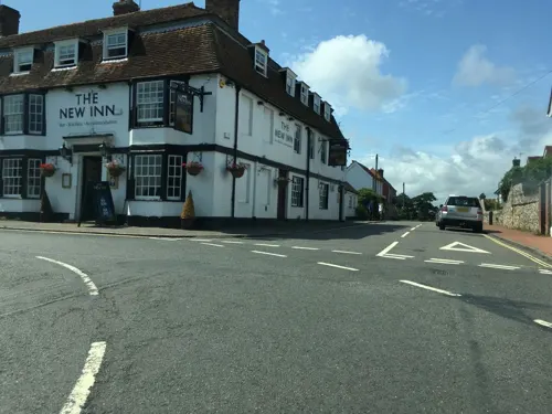
Winchelsea Court Hall Museum
Museum · 4.0 mi
Museum in Winchelsea, England, United Kingdom


Parks, trails and playgrounds4




Restaurants and cafes15
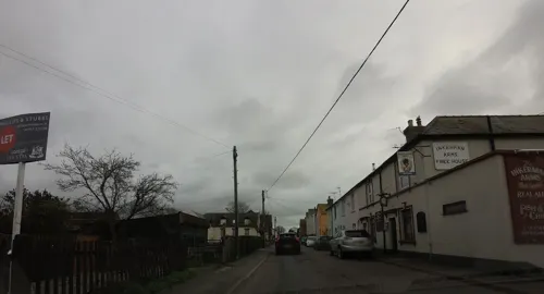
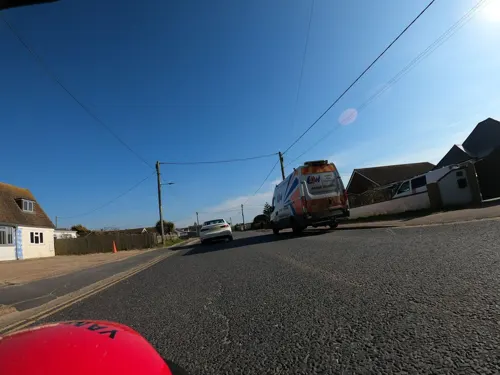


3 more on the map.
History
Camber came into its own with the game of golf: it was originally a collection of fishermen's dwellings. By the early 1890s, the number of visitors to Rye increased as tourism became more prevalent. One result of this was the building, in 1894, of Rye Golf Links in the area of sand dunes which occupy the shores of Rye Bay. The Royal William Hotel opened that year, and gradually the new village expanded. The Rye and Camber Tramway, a tourist railway originally opened for the members of the golf links to carry their gear, was opened in 1895; it closed to the public at the outbreak of World War II and never reopened.
Camber Castle, otherwise known as Winchelsea Castle, was built by Henry VIII to guard the western entrance to "the Camber" in the 16th Century and is located halfway between Rye and Winchelsea on the other side of the river.
Camber parish was formed on 1 April 1956 from the merger of the parishes of Broomhill and St Thomas the Apostle, Winchelsea.
From the History section of Camber, East Sussex on Wikipedia, under CC BY-SA 4.0.
Where to stay4
Churches and places of worship5
Map of Camber
39 places. The map loads OpenStreetMap tiles when you open it.
Getting there and nearby towns
Lydd Airport (LYX) is the nearest airport with scheduled flights listed in OpenStreetMap, 6 miles away.
- Fairlight 7 mi southwest, about 12 min by car
- Northiam 10 mi northwest, about 15 min by car
- Woodchurch 10 mi north, about 16 min by car
- Hastings 11 mi southwest, about 18 min by car
- Saint Leonards-on-Sea 12 mi southwest, about 20 min by car
- Shadoxhurst 12 mi north, about 19 min by car
- High Halden 12 mi north, about 20 min by car
- Ashford 15 mi north, about 24 min by car
- Bexhill-on-Sea 15 mi west, about 25 min by car
- Hythe 16 mi northeast, about 25 min by car
Drive times are estimates from straight-line distance, not routes.
Towns near Camber


Keep exploring
Local news
Headlines from INDB.
Reviews, tips and questions
Loading what members have shared...
Sources and licences
- GeoNames (CC BY 4.0): population, coordinates, regions and time zone
- Mapillary (see each image): photos
- OpenStreetMap contributors (ODbL 1.0): places, airports, map data
- Wikidata (CC0 1.0): elevation, founding date, time zone, website, landmarks and historic places
- Wikimedia Commons (see each image): photos
- Wikipedia (CC BY-SA 4.0): overview and history text
Photo credits
- Camber, East Sussex, and Little Cheyne Court Wind Farm, My another account ( talk ), CC0
- Camber Sands at Low Tide, Segaboyno2010, Public domain
- Rye, East Sussex, UK - panoramio (1), Jean Marc Gfp, CC BY 3.0
- Rye, St Mary's Church from the river, Michael Coppins, CC BY-SA 4.0
- Former Particular Baptist Chapel, Rye (NHLE Code 1251942), The Voice of Hassocks, CC0
- St Anthony of Padua's Church, Rye (NHLE Code 1393687), The Voice of Hassocks, CC0
- Icklesham - Martello tower no 28 at Rye Harbour - 20180422115711, Andrew Gray, CC BY-SA 4.0
- Prince of Wales Tower - 2017 (35781219381), Dennis G. Jarvis, CC BY-SA 2.0
- Lamb House Rye (4910233302), Tony Hisgett from Birmingham, UK, CC BY 2.0
- Rye Harbour Nature Reserve (16757437778), Leonard Bentley from Iden, East Sussex, UK, CC BY-SA 2.0
- Street-level photo, southglos, CC BY-SA 4.0
- Street-level photo, tallguy, CC BY-SA 4.0
- Street-level photo, wasd42, CC BY-SA 4.0
- Street-level photo, tallguy, CC BY-SA 4.0
- Street-level photo, nigeorwell, CC BY-SA 4.0
- Street-level photo, wasd42, CC BY-SA 4.0
- Street-level photo, tallguy, CC BY-SA 4.0
- Street-level photo, wasd42, CC BY-SA 4.0
- Street-level photo, tallguy, CC BY-SA 4.0
- Street-level photo, wasd42, CC BY-SA 4.0
Page built November 10, 2026. Spotted a mistake? Tell us or suggest a place.