


Shadoxhurst, United Kingdom
Shadoxhurst is a town of 1,287 people in England, United Kingdom.
Why visit Shadoxhurst
Townapedia lists 1 museum or landmark, 8 parks and trails and 2 places to eat in and around town.
Highlights include Godinton House, Ashford Community Woodland and Ashford Green Corridors.
Weather in Shadoxhurst
Forecast from MET Norway (CC BY 4.0). Full forecast
About Shadoxhurst
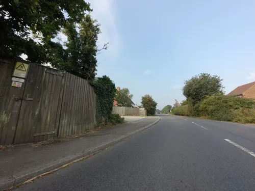
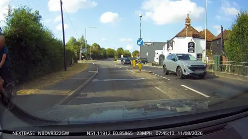
Shadoxhurst () is a civil parish and a village on the remnant forest the Kent Weald, near Ashford in Kent, England between the Greensand Ridge and Romney Marsh.
From the Wikipedia article Shadoxhurst (this version), under CC BY-SA 4.0.
Museums and landmarks1

Godinton House
Museum · 3.6 mi
Grade I listed country house in Great Chart with Singleton, Kent, England, UK
Parks, trails and playgrounds8


Ashford Green Corridors
Park · 3.3 mi
Nature reserve in Kent, England





Restaurants and cafes2
Churches and places of worship5

St Mary's Parish Church, Ashford
Church · 3.6 mi
Grade I listed church in Ashford, Kent, England, UK

Christ Church, Ashford
Church · 3.1 mi
Grade II listed church in Ashford, Kent, England, UK
History
A fairly comprehensive historical overview in Edward Hasted's History and Topography of Kent covers, for instance, the church and the village as well as the recorded history up to the end of the 18th century.
Reverend Charles Rolfe (1800–1877), who worked as the rector of Shadoxhurst's St Peter and Paul Church for thirty-nine years was directly descended from John Rolfe of Heacham who married Chief Powhatan's daughter, Pocahontas on 5 April 1614 in Jamestown, Virginia.
From the History section of Shadoxhurst on Wikipedia, under CC BY-SA 4.0.
More about Shadoxhurst
Geography
Part of the vestige of county-sized woodland known as The Weald, Shadoxhurst is mostly wooded countryside and farmland. with the Whitewater Dyke (a tributary of the River Stour) rising in the area.
The village is known as 'the woodland gateway to the countryside' and is surrounded by ancient woodlands.
The area ranges between approximately 40 and 50 metres above sea level.
From the Wikipedia article Shadoxhurst, under CC BY-SA 4.0.
Schools, colleges and libraries2
Map of Shadoxhurst
18 places. The map loads OpenStreetMap tiles when you open it.
Getting there and nearby towns
Lydd Airport (LYX) is the nearest airport with scheduled flights listed in OpenStreetMap, 12 miles away.
- Woodchurch 3 mi southwest, about 5 min by car
- Ashford 4 mi northeast, about 6 min by car
- Sissinghurst 11 mi west, about 18 min by car
- Hythe 12 mi east, about 19 min by car
- Folkestone 15 mi east, about 24 min by car
- Faversham 15 mi north, about 24 min by car
- Canterbury 16 mi northeast, about 26 min by car
- Maidstone 17 mi northwest, about 27 min by car
- Sittingbourne 17 mi north, about 27 min by car
- Hastings 20 mi southwest, about 33 min by car
Drive times are estimates from straight-line distance, not routes.
Towns near Shadoxhurst


Keep exploring
Local news
Headlines from INDB.
Reviews, tips and questions
Loading what members have shared...
Sources and licences
- GeoNames (CC BY 4.0): population, coordinates, regions and time zone
- Mapillary (see each image): photos
- OpenStreetMap contributors (ODbL 1.0): places, airports, map data
- Wikidata (CC0 1.0): elevation, founding date, time zone, website, landmarks and historic places
- Wikimedia Commons (see each image): photos
- Wikipedia (CC BY-SA 4.0): overview and history text
Photo credits
- Ashford Community Woodland 2, Dudley Miles, CC BY-SA 4.0
- Ashford Green Corridor - panoramio, Immanuel Giel, CC BY 3.0
- Stone Wood 2, Dudley Miles, CC BY-SA 4.0
- St mary's parish church - Ashford - panoramio (1), Jean Marc Gfp, CC BY 3.0
- Street-level photo, tallguy, CC BY-SA 4.0
- Street-level photo, tallguy, CC BY-SA 4.0
Page built November 10, 2026. Spotted a mistake? Tell us or suggest a place.