


Why visit Rugeley
Townapedia lists 5 museums and landmarks, 5 parks and trails, 52 places to eat, 3 places to stay and 2 attractions in and around town.
Highlights include High Bridge, Wolseley Centre and George's Hayes.
Weather in Rugeley
Forecast from MET Norway (CC BY 4.0). Full forecast
About Rugeley
Rugeley is a market town and civil parish in the Cannock Chase District, in Staffordshire, England. It lies on the north-eastern edge of Cannock Chase next to the River Trent; it is eight miles (13 kilometres) north of Lichfield, 10 miles (16 km) southeast of Stafford, five miles (8 km) northeast of Hednesford and 11 miles (18 km) southwest of Uttoxeter. At the 2021 Census, the population was 26,156.
From the Wikipedia article Rugeley (this version), under CC BY-SA 4.0.
Photos of Rugeley


Things to do2


Museums and landmarks5



Tomb of Elizabeth Cuting and Emma Hollinhurst
Monument and historic site · 0.4 mi
Parks, trails and playgrounds5



Restaurants and cafes52
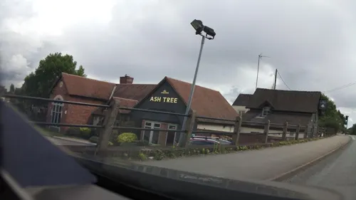
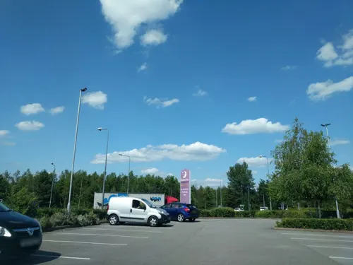
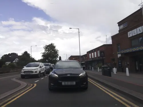
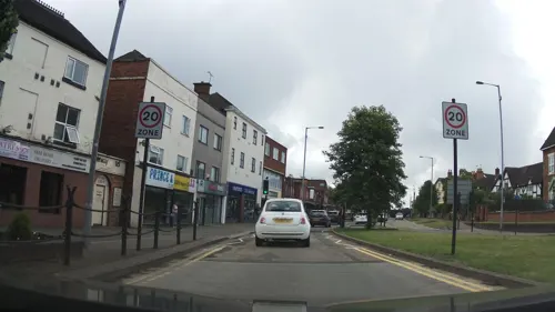



40 more on the map.
History
The town, historically known as Rudgeley or Ridgeley, is listed in the Domesday Book of 1086. This name is thought to be derived from 'Ridge lee', or 'the hill over the field'. In the mediaeval period, it thrived on iron workings and was also a site of glass manufacturing. During the Industrial Revolution the economy of Rugeley benefited from the construction of the Trent and Mersey Canal and then from it becoming a junction on the railway network.
Rugeley was considered royal land and Cannock Chase was considered a royal forest. In 1189, Rugeley was sold to the Bishop of Lichfield and Coventry by King Richard I the Lionheart. Rugeley was still relatively small at this point.
By 1259, Rugeley had grown significantly enough to be granted the right to hold a weekly market. To this day there is a weekly outdoor market held in the town.
In 1532, the manor of Rugeley was inherited by the Chetwynd family who held it until 1764. In 1768, the manor passed to Thomas Anson, later Viscount Anson.
In 1709 Rugeley was hit with two disasters. One was a fire that ravaged the town (the town had been hit by a fire sixty years prior to this too, making this the second such disaster) and the other was when the Rising Brook which runs through the town broke its banks and flooded the town.
Read more of the history
Rugeley was an agricultural community for hundreds of years and held regular sheep, cattle and horse fairs. This reached its peak in the mid 19th century and lasting until the 1930s. The Rugeley annual horse fair was known internationally and attracted trade from far and away. To this day there is a main road in Rugeley town centre called Horsefair honouring this, as well as another street honouring the sheep fair.
St. Augustine's Church in Rugeley has memorials to the Levett family, who live at nearby Milford Hall and who established the Rugeley Home and Cottage Hospital on Church Street in 1866.
From 1894 to 1974 the town was administered by Rugeley Urban District Council which was based at Rugeley Town Hall; the town hall was largely demolished in 1978 and all that remains of the building now is the clock tower.
Between 1793 and 1967 Rugeley Grammar School provided selective secondary education for the town and also for Hednesford. Historical characters who were educated at RGS include the banker and railway promoter Edward Charles Blount and the Australian pioneer and politician Charles Bonney.
Although smaller pits had existed beforehand, the town became a centre of industrial scale deep-shaft coal mining from the 1950s, to access similar coal seams to those under Cannock Chase. The Lea Hall Colliery that opened in July 1960 was the first modern coal mine opened by the National Coal Board, which managed the United Kingdom's nationalized coal industry. Nearby the Central Electricity Generating Board built the two Rugeley power stations. With the construction of Rugeley A and B power stations Rugeley became a major centre for electricity generation. These developments led to the town growing very quickly in the 1960s. The Rugeley A power station was designed to take its fuel directly from Lea Hall by conveyor belt (although the coal was of poor quality not suitable for Rugeley B). This was the first such arrangement in Britain. Rugeley power station was shut in 2016 and demolished in stages in 2021. Rugeley was once home to an Amazon fulfilment centre, which was built at the Tower Business Park. The centre closed permanently on 3 March 2024.
From the History section of Rugeley on Wikipedia, under CC BY-SA 4.0.
Notable people from Rugeley
 Nicholas WintertonBritish politician (born 1938)Photo: Me, User:Mholland, CC BY-SA 3.0
 John PorterBritish horse trainer (1838–1922)Photo: Liborio Prosperi, Public domain
 Frederic BonneyBritish photographer (1842–1921)Photo: Frederic Bonney, Public domain
- William PalmerEnglish doctor found guilty of murder (1824–1856)
- Thomas George BonneyEnglish geologist (1833-1923)
- Craig JenningsEnglish cricketer (born 1984)
- Maurice BuckmasterSOE officer (1902-1992)
- George Pilkingtonfootballer (born 1981)
- Arden MaddisonFootballer (1900-1987)
- Reg Edwardsfootballer, goalkeeper (born 1953)
- Herbert GardnerEnglish cricketer and solicitor
- Charles McVittieBritish cricketer (1908-1973)
Born in Rugeley, according to Wikidata (CC0). Each name links to its Wikipedia article.
Where to stay3
Churches and places of worship15
Shopping18
Gas and EV charging3
Schools, colleges and libraries11
Hob Hill CE/Methodist (VC) Primary School
School · Anglican, Methodist · 1.4 mi
Armitage Lane, Rugeley
Map of Rugeley
114 places. The map loads OpenStreetMap tiles when you open it.
Getting there and nearby towns
Birmingham Airport (BHX) is the nearest airport with scheduled flights listed in OpenStreetMap, 22 miles away.
- Uttoxeter 10 mi north, about 16 min by car
- Walsall 12 mi south, about 20 min by car
- Streetly 12 mi south, about 20 min by car
- Burton upon Trent 13 mi east, about 20 min by car
- Wolverhampton 14 mi southwest, about 23 min by car
- Sutton Coldfield 14 mi south, about 23 min by car
- Stone 14 mi northwest, about 22 min by car
- Wednesbury 15 mi south, about 24 min by car
- West Bromwich 17 mi south, about 27 min by car
- Birmingham 19 mi south, about 31 min by car
Drive times are estimates from straight-line distance, not routes.
Towns near Rugeley


Keep exploring
Local news
Headlines from INDB.
Reviews, tips and questions
Loading what members have shared...
Sources and licences
- GeoNames (CC BY 4.0): population, coordinates, regions and time zone
- Mapillary (see each image): photos
- OpenStreetMap contributors (ODbL 1.0): places, airports, map data
- Wikidata (CC0 1.0): elevation, founding date, time zone, website, landmarks and historic places
- Wikimedia Commons (see each image): photos
- Wikipedia (CC BY-SA 4.0): overview and history text
Photo credits
- Rugeley Market Hall and Rugeley Bus Station - Elmore Lane, Rugeley - painted shop shutter (34530204776), Elliott Brown from Birmingham, United Kingdom, CC BY-SA 2.0
- Rugeley Market Hall and Rugeley Bus Station - Elmore Lane, Rugeley (33761130873), Elliott Brown from Birmingham, United Kingdom, CC BY-SA 2.0
- Elmore Park - Rugeley (34409487542), Elliott Brown from Birmingham, United Kingdom, CC BY-SA 2.0
- Elmore Park - Rugeley - Hall Pool and bluebells (34441001031), Elliott Brown from Birmingham, United Kingdom, CC BY-SA 2.0
- Commemorative Railings at Upper Brook Street, Rugeley - Globe House (34451391251), Elliott Brown from Birmingham, United Kingdom, CC BY-SA 2.0
- Commemorative Railings at Upper Brook Street, Rugeley (33771826613), Elliott Brown from Birmingham, United Kingdom, CC BY-SA 2.0
- Commemorative Railings at Upper Brook Street, Rugeley (33739011634), Elliott Brown from Birmingham, United Kingdom, CC BY-SA 2.0
- Commemorative Railings at Upper Brook Street, Rugeley (33771811633), Elliott Brown from Birmingham, United Kingdom, CC BY-SA 2.0
- Commemorative Railings at Upper Brook Street, Rugeley (34582031715), Elliott Brown from Birmingham, United Kingdom, CC BY-SA 2.0
- Globe Island, Rugeley - Memorial to the Miners (34547917746), Elliott Brown from Birmingham, United Kingdom, CC BY-SA 2.0
- Globe Island, Rugeley - Memorial to the Miners (34589321805), Elliott Brown from Birmingham, United Kingdom, CC BY-SA 2.0
- Globe Island, Rugeley - Memorial to the Miners (34589339045), Elliott Brown from Birmingham, United Kingdom, CC BY-SA 2.0
- Globe Island, Rugeley - Memorial to the Miners (33779149323), Elliott Brown from Birmingham, United Kingdom, CC BY-SA 2.0
- Rugeley (33266782403), Alex Liivet from Chester, United Kingdom, CC0
- St. Augustine's Church Rugeley, Geoff Pick, CC BY-SA 2.0
- Close-up of the inscription (OpenBenches 8583), Anonymous Unknown author, CC BY-SA 4.0
- Close-up of the inscription (OpenBenches 8587), Anonymous Unknown author, CC BY-SA 4.0
- Long shot of the bench (OpenBenches 8583-1), Anonymous Unknown author, CC BY-SA 4.0
- View from the bench (OpenBenches 8583-2), Anonymous Unknown author, CC BY-SA 4.0
- Close-up of the inscription (OpenBenches 8586), Anonymous Unknown author, CC BY-SA 4.0
- View from the bench (OpenBenches 8587-2), Anonymous Unknown author, CC BY-SA 4.0
- Long shot of the bench (OpenBenches 8587-1), Anonymous Unknown author, CC BY-SA 4.0
- View from the bench (OpenBenches 8586-2), Anonymous Unknown author, CC BY-SA 4.0
- Long shot of the bench (OpenBenches 8586-1), Anonymous Unknown author, CC BY-SA 4.0
- Globe Island, Rugeley - Memorial to the Miners (33779224193), Elliott Brown from Birmingham, United Kingdom, CC BY-SA 2.0
- Elmore Park - Rugeley (34571298575), Elliott Brown from Birmingham, United Kingdom, CC BY-SA 2.0
- Street-level photo, adam2, CC BY-SA 4.0
- Street-level photo, southglos, CC BY-SA 4.0
- Street-level photo, southglos, CC BY-SA 4.0
- Street-level photo, adam2, CC BY-SA 4.0
- Street-level photo, southglos, CC BY-SA 4.0
- Street-level photo, southglos, CC BY-SA 4.0
- Street-level photo, southglos, CC BY-SA 4.0
- Street-level photo, adam2, CC BY-SA 4.0


Page built November 10, 2026. Spotted a mistake? Tell us or suggest a place.