


Why visit Capel
Townapedia lists 13 museums and landmarks, 15 parks and trails, 17 places to eat, 4 places to stay and 2 attractions in and around town.
Highlights include Leith Hill, Leith Hill Place (National Trust), Anstiebury (Hill Fort) and Newdigate Brickworks.
Weather in Capel
Forecast from MET Norway (CC BY 4.0). Full forecast
About Capel
Capel () is a village and civil parish in southern Surrey, England. It is equidistant between Dorking and Horsham – about 5 miles (8.0 km) away. Around Capel, to the west, skirts the A24 road. Capel is approximately 2.5 miles (4.0 km) north of the West Sussex border, 26 miles (42 km) south of London and 12 miles (19 km) southeast of Guildford and is in the Mole Valley district.
From the Wikipedia article Capel, Surrey (this version), under CC BY-SA 4.0.
Photos of Capel


Things to do2

Museums and landmarks13
Leith Hill Place (National Trust)
Monument and historic site · 2.8 mi
Closed until 2024 for renovation work see https://www.nationaltrust.org.uk/visit/surrey/leith-hill/visiting-the-house-at-leith-hill-place
11-16hrs Sat, Sun and BH June-Sept only

1 more on the map.
Parks, trails and playgrounds15



3 more on the map.
Restaurants and cafes17

Leith Hill Tower
Cafe · Coffee Shop · 2.8 mi
Leith Hill Road to Leith Hill (BW 142), Dorking
Mo-Su 10:00-15:00
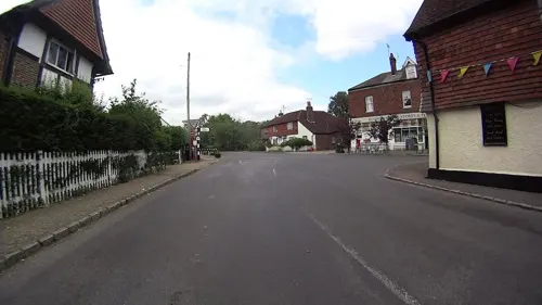
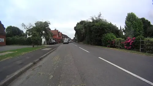
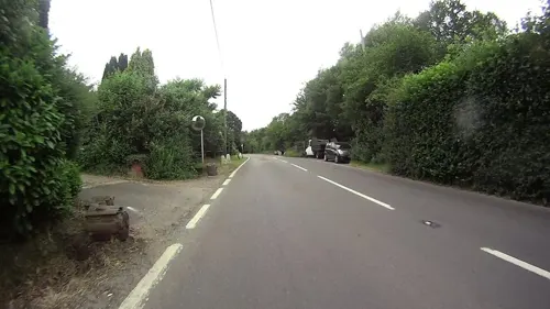
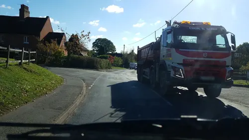



5 more on the map.
History
Within the parish in Coldharbour there is one Scheduled Ancient Monument, a large Iron Age hillfort named Anstiebury Camp evidencing early occupation. Multivallate, defined by boundaries consisting of two or more lines of closely set earthworks, this relatively late hill fort constructed in the second and first centuries BC covers approximately 5 hectares (12 acres).
Read more of the history
There is a triple rampart wall to the north and south-east where the ground is fairly level, a double terrace on the west and south where the ground is much steeper, and a single line of defences to the north-east. The entrance is mid-way along the eastern side, defined by a wide break in the main rampart. Trenches dug in the southeast, the entrance, and a few other investigations in 1972-3 revealed that the front of the main rampart had been set against and into the edge of the associated ditch and revetted with massive, irregular blocks of sandstone. The conclusion was that the purpose was to resist sling warfare due to the form and width, with rounded pebbles, foreign to the Greensand Ridge, being frequently found in the areas excavated. The archaeologist also considered that the entrance and the defences to the north of it were never completed, possibly linked with the deliberate demolition of the main rampart revetment, and possibly coinciding with Caesar's invasions of Britain. The site was re-occupied in the Roman period, probably at least a century after it was originally abandoned.
Capel in the Middle Ages developed only enough to have a chapel of ease, as a chapelry within the parish of Dorking. The chapel, which gives its name to the village, was first mentioned in a confirmation (1129–71) of a grant to the Priory of Lewes by the Earls of Warenne, consisting of 'Ecclesiam de Dorking cum Capella de la Wachna.'
The original settlement of Capel consisted of approximately thirty farms, most of which still exist today bearing the names of their tenants in the early 14th century. Timbers in some of the farmhouses have also been dated to 14th century.
By 1848 there were 989 inhabitants over 5,522 acres (2,235 ha), of which 105 acres (42 ha) were common or waste. Lewis summarised Capel in that year as:
The lands are principally arable, producing good crops of wheat and oats, and the soil is also well adapted to the growth of timber. Broom Hall [sic] here is an elegant edifice, on the south-eastern confines of Leith Hill. The living is a donative [not a rectory], in the patronage of Charles Webb, with a net income of £84: the tithes have been commuted for £610.
The 13th century church, pictured, was enlarged in 1836, paid by James Shudi Broadwood of the piano-making family from nearby Lyne House and was restored in 1858 by architect Henry Woodyer, who installed a spiral staircase and bell cage in the same style as Buckland's church.
In the 17th and 18th centuries, Capel was the centre of a Quaker community which met at the houses of the local Bax family. The Quaker Sussex Quarterly Meeting recorded the fact that Thomas Patching "who then lived at Bonwick's Place in Ifield" met with George Fox, and then later "there was settled the first Monthly Meeting that was set up in this county .... and has since been removed to the house of Richard Bax at Capel in Surrey by reason of Thomas Patching's removing from that place". It is known that George Fox visited Surrey in 1668 and held a Meeting at Pleystowe Farm, Capel, the home of Richard Bax. The Friends Meeting House, built 1724, is in the main conservation area of the village; it is also a listed building.
The clay soil of the Upper Weald on which Capel lies has a rich history of brick-making. A small brickyard owned by the Lee - Steere family existed next to Ockley and Capel station until the early 1920s. The manager's house named Arundel Cottage still stands. To the south and also adjacent to the railway is the derelict Auclaye Brickworks. The yard which ceased working sometime in the late 1980s was subject to a proposal in 2017 to reopen and extract minerals. This was rejected and the site is subject to a Geological Conservation Review
The largest brickyard in the area was The Clock House Brick Company Ltd., opened to the south of Capel in 1933 to exploit a rich seam of clay. It was for seventy years a major source of employment for local inhabitants. In 1941 the majority of shares were acquired by The London Brick Company who expanded quarrying of the clay to accommodate improved production methods. The yard specialised in the production of the dense Phorpres brick. The London Brick Company was acquired by Hanson plc in 1984. They opted to refit the works producing bricks under the Butterley and Capel names. By 2000, the Clock House brickyard was making around 42 million bricks per year.
The Great Recession temporarily decimated the building materials industry. A sudden slump in housing prices meant that house-building ground almost to a halt and demand for bricks plummeted. In March 2009, Hanson announced a 'phased closure programme' which began later that month and led to the loss of 61 jobs. The works closed in 2009 after which the site was allowed to deteriorate.
From the History section of Capel, Surrey on Wikipedia, under CC BY-SA 4.0.
Where to stay4
Churches and places of worship9
Gas and EV charging3
Schools, colleges and libraries4
Map of Capel
67 places. The map loads OpenStreetMap tiles when you open it.
Getting there and nearby towns
London Gatwick Airport (LGW) is the nearest airport with scheduled flights listed in OpenStreetMap, 6 miles away.
- Warnham 4 mi south, about 7 min by car
- Ewhurst 5 mi west, about 8 min by car
- Horsham 6 mi south, about 10 min by car
- Dorking 6 mi north, about 9 min by car
- Broadfield 6 mi southeast, about 10 min by car
- Slinfold 6 mi southwest, about 10 min by car
- Crawley 7 mi east, about 11 min by car
- Cranleigh 7 mi west, about 11 min by car
- Horley 7 mi east, about 12 min by car
- Reigate 8 mi northeast, about 13 min by car
Drive times are estimates from straight-line distance, not routes.
Towns near Capel


Keep exploring
Local news
Headlines from INDB.
Reviews, tips and questions
Loading what members have shared...
Sources and licences
- GeoNames (CC BY 4.0): population, coordinates, regions and time zone
- Mapillary (see each image): photos
- OpenStreetMap contributors (ODbL 1.0): places, airports, map data
- Wikidata (CC0 1.0): elevation, founding date, time zone, website, landmarks and historic places
- Wikimedia Commons (see each image): photos
- Wikipedia (CC BY-SA 4.0): overview and history text
Photo credits
- Former Providence Chapel, Chapel Road, Charlwood (NHLE Code 1277978), The Voice of Hassocks, CC0
- Capel Church Surrey, Speach, CC BY-SA 3.0
- Leith Hill Place 2, Rob enwiki, CC BY-SA 4.0
- St Mary Magdalene's Church, Rusper - from the southeast, Colin Smith, CC BY-SA 2.0
- St Margaret's Church, Coles Lane, Ockley (NHLE Code 1028694) (July 2013) (8), Hassocks5489, CC0
- Cycling up Leith Hill, Colin, CC BY-SA 4.0
- St Mary Magdalene's Church, Horsham Road, South Holmwood (NHLE Code 1378100), The Voice of Hassocks, CC0
- St Mark's Church, North Heath Lane, North Heath, Horsham (April 2018) (10), User:Hassocks5489, CC0
- Glechoma hederacea 120812649, stuartfraser, CC BY 4.0
- Glechoma hederacea 120812626, stuartfraser, CC BY 4.0
- Glechoma hederacea 120812670, stuartfraser, CC BY 4.0
- Didymium spongiosum 342394215, Stuart Fraser, CC BY 4.0
- Mesembrina meridiana 163769636, Stuart Fraser, CC BY 4.0
- Street-level photo, daveemtb, CC BY-SA 4.0
- Street-level photo, richardc, CC BY-SA 4.0
- Street-level photo, daveemtb, CC BY-SA 4.0
- Street-level photo, daveemtb, CC BY-SA 4.0
- Street-level photo, richardc, CC BY-SA 4.0
- Street-level photo, daveemtb, CC BY-SA 4.0
- Street-level photo, daveemtb, CC BY-SA 4.0
- Street-level photo, daveemtb, CC BY-SA 4.0
- Street-level photo, richardc, CC BY-SA 4.0
- Street-level photo, daveemtb, CC BY-SA 4.0
- Street-level photo, richardc, CC BY-SA 4.0


Page built November 10, 2026. Spotted a mistake? Tell us or suggest a place.