


Slinfold, United Kingdom
Slinfold is a town of 1,147 people in England, United Kingdom, founded in 1150.
Why visit Slinfold
Townapedia lists 9 museums and landmarks, 9 parks and trails, 8 places to eat, 5 places to stay and 3 attractions in and around town.
Highlights include Capitol Horsham, Westons Farm Shop, Horsham Museum and Art Gallery and Alfoldean Roman site.
Weather in Slinfold
Forecast from MET Norway (CC BY 4.0). Full forecast
About Slinfold
Slinfold is a village and civil parish in the Horsham District of West Sussex, England.
From the Wikipedia article Slinfold (this version), under CC BY-SA 4.0.
Things to do3

Capitol Horsham
Cinema and theater · 3.7 mi
Arts centre in Horsham, England

Westons Farm Shop
Farm and orchard · 2.0 mi
Westons Hill, Itchingfield
Mo-Fr 09:00-17:30; Sa 10:00-16:00

Museums and landmarks9

Horsham Museum and Art Gallery
Museum · 3.5 mi
Museum in Horsham, West Sussex, England, UK
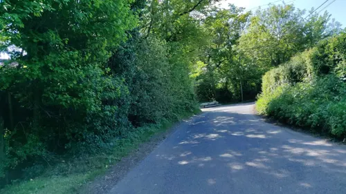

Alfoldean Roman site
Monument and historic site · 0.9 mi
Archaeological site in Slinfold, Horsham, England, UK
Parks, trails and playgrounds9



Restaurants and cafes8


History
Alfodean was excavated by archaeological television programme Time Team in 2006, the site of one of a probable four mansiones on the route of Stane Street between London and Chichester.
There has been a house at Dedisham, 1 mile (1.6 km) northeast of the village, since at least 1271, when Henry III granted the then occupier a licence to crenellate the manor house then on the site. The present house on the site appears to date from the 16th or 17th century. During the English Civil War the Parliamentarian commander Sir William Waller sacked a house on this site in 1643.
Slinfold Manor, 1.5 miles (2.4 km) south of the village, is a Georgian house built late in the 18th century.
From the History section of Slinfold on Wikipedia, under CC BY-SA 4.0.
More about Slinfold
Geography
The village is almost 4 miles (6.4 km) west of Horsham, just off the A29 road.
The parish covers 4,186 acres (1,694 ha). The 2001 Census recorded a population of 1,647 people living in 627 households of whom 780 were economically active.
Slinfold is the source of the western River Adur, which flows to the English Channel at Shoreham-by-Sea
From the Wikipedia article Slinfold, under CC BY-SA 4.0.
Notable people from Slinfold
 Anton DolinEnglish ballet dancer and choreographer (1904-1983)Photo: Allan warren, CC BY-SA 3.0
 Alfred ShrubbEnglish middle and long distance runnerPhoto: Unknown author Unknown author, Public domain
- John CopnallBritish artist (1928-2007)
- David BlundyBritish journalist
- John RichardsonAustralian convict and botanist (1797-1882)
Born in Slinfold, according to Wikidata (CC0). Each name links to its Wikipedia article.
Where to stay5
Churches and places of worship12
Shopping2
Gas and EV charging3
Schools, colleges and libraries10
Healthcare2
Map of Slinfold
63 places. The map loads OpenStreetMap tiles when you open it.
Getting there and nearby towns
London Gatwick Airport (LGW) is the nearest airport with scheduled flights listed in OpenStreetMap, 11 miles away.
- Horsham 3 mi east, about 6 min by car
- Warnham 3 mi northeast, about 5 min by car
- Cranleigh 6 mi northwest, about 9 min by car
- Broadfield 9 mi east, about 14 min by car
- Handcross 9 mi east, about 15 min by car
- Crawley 10 mi east, about 16 min by car
- Dorking 12 mi north, about 19 min by car
- Godalming 12 mi northwest, about 19 min by car
- Guildford 13 mi northwest, about 22 min by car
- Horley 13 mi northeast, about 21 min by car
Drive times are estimates from straight-line distance, not routes.
Towns near Slinfold


Keep exploring
Local news
Headlines from INDB.
Reviews, tips and questions
Loading what members have shared...
Sources and licences
- GeoNames (CC BY 4.0): population, coordinates, regions and time zone
- Mapillary (see each image): photos
- OpenStreetMap contributors (ODbL 1.0): places, airports, map data
- Wikidata (CC0 1.0): elevation, founding date, time zone, website, landmarks and historic places
- Wikimedia Commons (see each image): photos
- Wikipedia (CC BY-SA 4.0): overview and history text
Photo credits
- Horsham - museum 01, Whn64, CC BY-SA 3.0
- Billingshurst Unitarian Chapel, Charlesdrakew, Public domain
- Church of the Holy Innocents, Southwater (NHLE Code 1259780), The Voice of Hassocks, CC0
- Hope Strict Baptist Chapel, Oakhill Road, Horsham, The Voice of Hassocks, CC0
- Horsham Unitarian Church, Worthing Road, Horsham (IoE Code 298204), The Voice of Hassocks, CC0
- St Mary's Church, Billingshurst, Antiquary, CC BY 4.0
- Holy Trinity Rudgwick - from the north west, Martinking73, CC BY-SA 3.0
- Farlington school, Thestationmaster, CC BY-SA 4.0
- St Peter's Church, Slinfold (IoE Code 299579), The Voice of Hassocks, CC0
- Church of St John, Andy Potter, CC BY-SA 2.0
- St Mark's Church, North Heath Lane, North Heath, Horsham (April 2018) (10), User:Hassocks5489, CC0
- Street-level photo, matt_ellery, CC BY-SA 4.0
- Street-level photo, matt_ellery, CC BY-SA 4.0
- Street-level photo, matt_ellery, CC BY-SA 4.0
- Street-level photo, matt_ellery, CC BY-SA 4.0
- Street-level photo, matt_ellery, CC BY-SA 4.0
- Street-level photo, matt_ellery, CC BY-SA 4.0
- Street-level photo, matt_ellery, CC BY-SA 4.0
- Street-level photo, southglos, CC BY-SA 4.0
- Street-level photo, tallguy, CC BY-SA 4.0
- Street-level photo, matt_ellery, CC BY-SA 4.0
- Street-level photo, matt_ellery, CC BY-SA 4.0


Page built November 10, 2026. Spotted a mistake? Tell us or suggest a place.