


Why visit Cholsey
Townapedia lists 9 museums and landmarks, 15 parks and trails, 37 places to eat, 4 places to stay and 13 attractions in and around town.
Highlights include Benson Lock, Goring and Streatley Bridge, Wallingford Museum and Blewburton Hill.
Weather in Cholsey
Forecast from MET Norway (CC BY 4.0). Full forecast
About Cholsey
Cholsey is a village and civil parish immediately south of Wallingford in South Oxfordshire. Its population in 2011 was 3,457. 2011 Census. Its parish boundary, some 17 miles (27 km) long, reaches from the edge of Wallingford into the Berkshire Downs.
From the Wikipedia article Cholsey (this version), under CC BY-SA 4.0.
Travel tips from other travellers: Cholsey on Wikivoyage (CC BY-SA 4.0).
Things to do13

Benson Lock
Bridge · 3.4 mi
Lock on the River Thames in Oxfordshire, England


Moulsford Railway Bridge
Bridge · 1.1 mi
Railway bridge in Oxfordshire, England, UK

Shillingford Bridge
Bridge · 3.6 mi
Bridge in Warborough, South Oxfordshire, England, UK

Wallingford Bridge
Bridge · 2.4 mi
Bridge in Oxfordshire, England, UK


Corn Exchange Theatre
Cinema and theater · 2.3 mi
Meeting hall, concert hall and theatre in Wallingford, Oxfordshire, England, UK

1 more on the map.
Museums and landmarks9

Wallingford Museum
Museum · 2.2 mi
Local museum in Wallingford, England, United Kingdom
52 High Street, Wallingford
Mar 01-Nov 30 Tu-Fr 14:00-17:00; Mar 01-Nov 30 Sa 10:30-17:00;...

Blewburton Hill
Monument and historic site · 2.5 mi
Hillfort in Oxfordshire, England, UK

Wallingford Castle
Monument and historic site · 2.5 mi
Castle in Wallingford, Oxfordshire, England, UK




Parks, trails and playgrounds15

The Bull Croft
Park · 2.3 mi
Park in Wallingford, Oxfordshire, England, UK


Kinecroft
Park · 2.1 mi
Park in Wallingford, Oxfordshire, England, UK



3 more on the map.
Restaurants and cafes37
Ox Shed Cafe
Cafe · Brunch · 0.6 mi
5 Ratcliffe Court, Cholsey Meadows
Mo-Fr 08:30-16:00; Sa-Su 09:30-17:30
The Perch & Pike
Bar and pub · 1.9 mi
The Street, South Stoke
Mo-Fr 11:30-15:00,17:00-23:00; Sa 11:00-23:00; Su 11:30-21:00
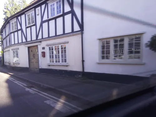

The Chequers
Bar and pub · 2.1 mi
We 18:00-23:00; Th 18:00-23:00; Fr 17:00-24:00; Sa 12:00-24:00; Su...
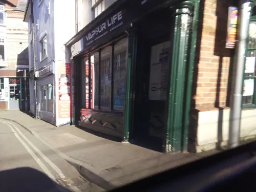


The Old Post Office
Cafe · 2.2 mi
St Martin's Street, Wallingford
Mo-Th 08:00-24:00; Fr-Sa 08:00-01:00; Su 08:00-23:00
The Bear at Home
Bar and pub · 2.4 mi
High Street, North Moreton
25 more on the map.
History
A late Bronze Age site has been found beside the River Thames at Whitecross Farm in the northeast of the parish. A pre-Roman road, the Icknield Way, crosses the River Thames at Cholsey. A find announced in 2017 was of a substantial Roman site in Celsea Place. Archaeologists discovered the best examples of corn dryers they have seen, with precision suggesting they were built by an engineer. Sites of burials and cremation pots have also been found. There is also part of a Roman villa, the majority of which appeared to have extended out under the existing road and houses and will have suffered significant unrecorded damage. The section of villa remaining within the archaeologically excavated area has been preserved in situ.
The village itself was founded on an island ("Ceol's Isle") in marshy ground close to the Thames. There is evidence that the House of Wessex royal family owned land in Cholsey in the sixth and seventh centuries. At this time the town was home to a Saint Wilgyth who was venerated locally in the Middle Ages. A royal nunnery, Cholsey Abbey, was founded in the village in 986 by Queen Dowager Ælfthryth on land given by her son, King Æthelred the Unready. The nunnery is thought to have been destroyed by invading Vikings in 1006 when they camped in Cholsey after setting nearby Wallingford ablaze.
Read more of the history
However, Saxon masonry still survives in the Church of England parish church of St Mary. Most of this flint and stone church was built in the twelfth century. The church is cruciform. Additions were made to it in the thirteenth and fourteenth centuries. In the thirteenth-century a tithe barn was built in the village. It was, at the time, the largest aisled building in the world, being 51 feet (16 m) high, 54 feet (16 m) wide and over 300 feet (91 m) long. It was demolished in 1815. Fair Mile Hospital, a former psychiatric hospital, opened near Cholsey in 1870 and closed in 2003. In 2011–14 its Victorian buildings were converted to homes and new housing was built in its grounds.
From the History section of Cholsey on Wikipedia, under CC BY-SA 4.0.
Where to stay4
Churches and places of worship21
Shopping12
Gas and EV charging2
Schools, colleges and libraries12
St Nicholas Church of England Infants' School
School · Anglican · 2.4 mi
St Nicholas Road, Wallingford
Healthcare3
Map of Cholsey
128 places. The map loads OpenStreetMap tiles when you open it.
Getting there and nearby towns
RAF Benson (BEX) is the nearest airport with scheduled flights listed in OpenStreetMap, 4 miles away.
- Wallingford 2 mi northeast, about 4 min by car
- Blewbury 3 mi west, about 5 min by car
- Streatley 3 mi south, about 6 min by car
- Didcot 5 mi northwest, about 7 min by car
- Compton 6 mi southwest, about 9 min by car
- Harwell 6 mi west, about 10 min by car
- Upper Basildon 6 mi south, about 10 min by car
- Sutton Courtenay 7 mi northwest, about 11 min by car
- Watlington 8 mi northeast, about 13 min by car
- Abingdon 9 mi northwest, about 14 min by car
Drive times are estimates from straight-line distance, not routes.
Towns near Cholsey


Keep exploring
Local news
Headlines from INDB.
Reviews, tips and questions
Loading what members have shared...
Sources and licences
- GeoNames (CC BY 4.0): population, coordinates, regions and time zone
- Mapillary (see each image): photos
- OpenStreetMap contributors (ODbL 1.0): places, airports, map data
- Wikidata (CC0 1.0): elevation, founding date, time zone, website, landmarks and historic places
- Wikimedia Commons (see each image): photos
- Wikipedia (CC BY-SA 4.0): overview and history text
Photo credits
- Cholsey Train Station 05, Simon Burchell, CC BY-SA 4.0
- GoringBridge01, Motmit, CC BY-SA 3.0
- Moulsford Viaduct 09, Simon Burchell, CC BY-SA 4.0
- Shillingford Bridge, Nancy, CC BY-SA 3.0
- UK-Wallingford Bridge, Sciencebloke at English Wikipedia, Public domain
- ByPass Bridge, Sciencebloke at English Wikipedia, Public domain
- UK-Wallingford Museum, Photograph by David Hemming, Public domain
- Wallingford castle ruins, Pitou250, Public domain
- Wallingford, Sciencebloke at English Wikipedia, Public domain
- 2347 QS Cranford House 284 low res, Cranford House, CC BY 4.0
- Motte, South Moreton, Oxfordshire 02, Simon Burchell, CC BY-SA 4.0
- St Nicholas Wallingford Castle, Sciencebloke ( talk ), CC BY-SA 3.0
- St. Andrews Church, South Stoke, Oxfordshire, UKgeofan, CC BY-SA 3.0
- All Saints Church, Aston Upthorpe 15, Simon Burchell, CC BY-SA 4.0
- South Moreton church 09, Simon Burchell, CC BY-SA 4.0
- Moulsford01, Motmit, CC BY-SA 3.0
- Aston Tirrold, Oxfordshire 13, Simon Burchell, CC BY-SA 4.0
- Wallingford St Peters Bridge, Sciencebloke at English Wikipedia, CC BY-SA 3.0
- Benson Lock, Dennis Jackson, CC BY-SA 2.0
- Blewburton Hill 12, Simon Burchell, CC BY-SA 4.0
- Jethro Tull blue plaque at Crowmarsh Gifford, Oxfordshire, Bill Nicholls, CC BY-SA 2.0
- Street-level photo, swinetown, CC BY-SA 4.0
- Street-level photo, swinetown, CC BY-SA 4.0
- Street-level photo, southglos, CC BY-SA 4.0
- Street-level photo, southglos, CC BY-SA 4.0
- Street-level photo, southglos, CC BY-SA 4.0
- Street-level photo, southglos, CC BY-SA 4.0
- Street-level photo, swinetown, CC BY-SA 4.0
- Street-level photo, southglos, CC BY-SA 4.0
- Street-level photo, southglos, CC BY-SA 4.0
- Street-level photo, southglos, CC BY-SA 4.0


Page built November 10, 2026. Spotted a mistake? Tell us or suggest a place.