


Christchurch, United Kingdom
Christchurch is a town of 31,372 people in England, United Kingdom, founded in 700.
Why visit Christchurch
Townapedia lists 35 museums and landmarks, 59 parks and trails, 192 places to eat, 47 places to stay and 13 attractions in and around town.
Highlights include Pavilion Theatre, St Catherine's Hill, Red House Museum and Highcliffe Castle.
Weather in Christchurch
Forecast from MET Norway (CC BY 4.0). Full forecast
About Christchurch
Christchurch () is a town and civil parish on the south coast of Dorset, England. The parish had a population of 31,372 in 2021. It adjoins Bournemouth to the west, with the New Forest to the east. Part of the historic county of Hampshire, Christchurch was a borough within the administrative county of Dorset from 1974 until 2019, when it became part of the new Bournemouth, Christchurch and Poole unitary authority.
From the Wikipedia article Christchurch, Dorset (this version), under CC BY-SA 4.0.
Travel tips from other travellers: Christchurch on Wikivoyage (CC BY-SA 4.0).
Photos of Christchurch


Things to do13

Pavilion Theatre
Cinema and theater · 4.3 mi
Theatre in Bournemouth, Dorset, England, UK


Adventure Wonderland
Monument and historic site · 3.9 mi
Theme park in Hurn, Dorset, England

Bournemouth Little Theatre club
Cinema and theater · 4.3 mi
Community theatre in Bournemouth,England
Bournemouth Winter Gardens
Cinema and theater · 4.5 mi
Former theatre in Bournemouth, England
Lapland New Forest
Monument and historic site · 5.3 mi
Former theme park in Hampshire, England
O2 Academy Bournemouth
Cinema and theater · 2.6 mi
Live entertainment venue in Bournemouth, Dorset, England, UK

Sopley Farm shop and bakery
Farm and orchard · 2.9 mi
Apr-May,Nov-Dec Mo-Su 10:00-16:00; Jun-Aug Mo-Su 10:00-18:00

1 more on the map.
Museums and landmarks35


Highcliffe Castle
Monument and historic site · 3.0 mi
Grade I listed historic house museum in Highcliffe and Walkford, Bournemouth, Christchurch and Poole, Dorset, England, UK
Rothesay Drive, Highcliffe


Warren Hill
Monument and historic site · 1.9 mi
Archaeological site by Christchurch

Bournemouth War Memorial
Monument and historic site · 4.5 mi
War memorial in Bournemouth, Dorset, England, UK
Red House Museum and Gardens
Museum
Museum in Christchurch, United Kingdom

Russell-Cotes Art Gallery & Museum
Museum · 4.1 mi
Art museum in Bournemouth, United Kingdom

Ducking Stool
Monument and historic site
The first recorded use of the ducking stool in Christchurch was in 1350 and the last in 1809. This replica was placed by the Mill Stream...

Bournemouth Natural Science Museum
Museum · 3.4 mi
39 Christchurch Road, Bournemouth
Tu 10:00-16:00
Bournemouth North Cemetery and Bournemouth Crematorium
Monument and historic site · 3.3 mi
Historic cemetery in Dorset, England
Sammy Miller Motorcycle Museum
Museum · 5.1 mi
Motorcycle museum in New Milton, Hampshire
23 more on the map.
Parks, trails and playgrounds59

Vitality Stadium
Sports field and stadium · 2.5 mi
Kings Park, Bournemouth

Christchurch Golf Club - Bridge Course
Golf course · 1.7 mi
18 hole, par 72 course. Name changed from "PlayGolf Bournemouth" in May 2022.
Riverside Avenue, Christchurch
Christchurch Golf Club - Stour Course
Golf course · 1.7 mi
9 hole, par 27 course. Name changed from "PlayGolf Bournemouth" in May 2022.
Riverside Avenue, Christchurch

47 more on the map.
Restaurants and cafes192
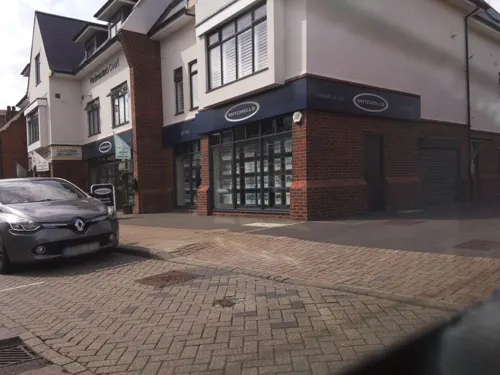
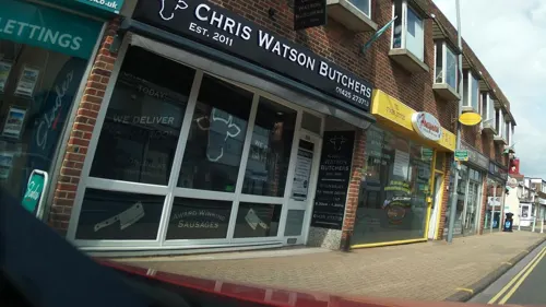
Honeymoon Chinese Takeaway
Restaurant · Chinese · 3.6 mi
360 Lymington Road, Highcliffe
Mo-Su 16:30-23:00
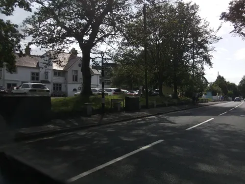
The Oaks
Restaurant · French, British, Brasserie · 3.2 mi
189 Lymington Road, Highcliffe-on-Sea
Mo-Sa 11:00-23:00; Su 12:00-22:00
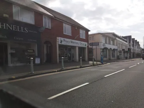
Tides
Cafe · Coffee Shop · 3.6 mi
330-332 Lymington Road, Highcliffe
We-Fr 09:00-14:00; Sa 09:00-14:30; Su 09:30-14:00



Chaplins & The Cellar Bar
Bar and pub · 2.8 mi
529 Christchurch Road, Boscombe
Mo-Fr 11:30-01:00; Fr,Sa 11:30-03:00; Su 12:00-01:00
Costa Drive Thru
Cafe · Coffee Shop · 1.6 mi
143-147 Somerford Road, Christchurch
Mo-Fr 05:30-20:00; Sa 06:00-20:00; Su 07:00-19:00
180 more on the map.
History
Christchurch was founded in approximately AD 650 by missionaries sent to Wessex by St Birinus, the first Bishop of Dorchester (Oxfordshire). They settled on a stretch of raised land between the rivers Avon and Stour which carried people and their wares to and from market settlements such as Blandford and Old Sarum (near modern Salisbury). The harbour became one of the most important in Saxon England as it was easily reached from the continent and boats could travel up the river Avon to Salisbury. The town appears in the Anglo-Saxon Chronicle entry of 901 as Tweoxneam (Twynham) from Old English betweoxn (between) and ēam (rivers). In around 890 AD, Alfred the Great considered Twynham to be of such strategic importance that, with the threat of invasion by the Danes, he made it a burh and defensive walls were erected around the town. In 1094 a chief minister of King William II, Ranulf Flambard, then Dean of Twynham, began the building of a priory on the site of the original mission church. Soon after the construction of the priory the town became known as Christchurch.
Read more of the history
Some time in the early 12th century, Christchurch Castle was built within the town. Originally a wooden fort built by Richard de Redvers, first cousin to King Henry I, it was rebuilt in stone by Baldwin de Redvers to resist King Stephen during the Anarchy. The castle again saw action during the Civil War of 1642–1651 when occupied by the Parliamentarians. Christchurch changed hands a number of times: originally under Royalist control, it was captured by Sir William Waller's Parliamentary army in 1644. Lord Goring briefly retook the town in 1645 but was obliged to withdraw and returned with a larger force days later and laid siege to the castle. However, the Parliamentarians withstood the siege and maintained their hold on the town. Fearing such a powerful stronghold might once again fall into Royalist hands, Cromwell ordered the castle to be destroyed in 1652.
Although the fishing industry thrived in Christchurch, the importance of the harbour declined as it became inaccessible to vessels of a large draught. The harbour entrance was particularly troublesome with constantly shifting sandbars. In 1665 Edward Hyde, Earl of Clarendon, bought the Lordship of the Manor of Christchurch. As part of his plans to improve trade in the town, he attempted to resolve the problems with the harbour entrance by cutting a new one through the sandspit at the foot of Hengistbury Head. However, upon completion the new entrance repeatedly silted up and in 1703 a large storm damaged a groyne which blocked the entrance entirely. Over the following 150 years alternative schemes were proposed but none were ever taken up.
Smuggling was one of Christchurch's most lucrative industries during the 18th and 19th centuries due to easy access to neighbouring towns and the difficult harbour entrance which acted as a barrier to customs cutters. Many townspeople were involved in this illegal trade and large quantities of wealth were accumulated. In 1784 a confrontation between a gang of local smugglers and Customs and Excise officers led to the Battle of Mudeford in which a Royal Navy officer was killed and a smuggler subsequently executed. Another important industry during this period was the manufacture of fusee chains for watches and clocks. In 1790, Robert Cox began to manufacture fusee chains in workshops in the High Street. By 1793 Cox gained a monopoly on chain production in Britain, supplying watch, clock and chronometer makers throughout the country. In 1845 William Hart opened a similar factory in Bargates. However, by 1875 the chains were no longer required due to changes in watch designs and the factories were closed.
The railway came to Christchurch in 1847 although the nearest station, Christchurch Road, was at Holmsley and passengers were taken the rest of the way by omnibus. In 1862 a new station was built in the town close to where it stands today and was served by a branch line from Ringwood. Christchurch joined the mainline in 1883, and a third station had to be built. Christchurch, and in particular Mudeford, had been enjoying a modest tourist trade since King George III had patronised the town in the 1790s but the arrival of the railways made Christchurch accessible to more potential visitors. A power station was built in Christchurch in 1903 to power the public trams. The excess generated was sufficient to light the town, and it was added to the national grid in 1940.
The Fisher Aviation Company began to provide flights from fields at the eastern end of Somerford Road in 1930, and by 1933 the company had flown over 19,000 passengers. In 1934, they obtained permission to establish an aerodrome on the site which became known as Christchurch Airfield. During the Second World War an Airspeed factory was built on the airfield, and began manufacturing aircraft for the RAF; the USAAF Ninth Air Force established a base there in 1944. A second aerodrome opened at Hurn in 1944 and later became Bournemouth Airport. In 1940, with the German 6th Army at Cherbourg, Christchurch was fortified against an expected invasion: the construction of pillboxes, gun emplacements and tank traps in and around the town, made Christchurch an "anti-tank island". Between 1941 and 1942 Donald Bailey developed the Bailey bridge at the Military Engineering Experimental Establishment at Christchurch Barracks.
From the History section of Christchurch, Dorset on Wikipedia, under CC BY-SA 4.0.
More about Christchurch
Geography
Christchurch is the most easterly coastal town of the administrative county of Dorset, and it lies within the historic boundaries of Hampshire. The town abuts Bournemouth to the west and is approximately 9 miles (14 km) east of Poole, 20 miles (32 km) west of Southampton, 23 miles (37 km) south of Salisbury. The town centre lies between the rivers Avon and Stour which flow directly into Christchurch Harbour. The borough boundaries stretched to Hurn Forest in the north encompassing Bournemouth Airport and eastwards along the coast as far as Walkford. The River Stour forms a natural boundary to the west; the estuary and harbour form the southern boundary.
Economy
Between 2000 and 2007 the total gross value added (GVA) of the borough grew by 37% from £552 million to £757 million. The biggest contributor to the local economy through the period 2000–2007 was the transport and communication sector which in 2007 brought in £145 million GVA; £64 million more than in 2000. The sector which saw the largest growth during that period however, was metals and engineering which increased by 140%. The food, textiles and wood industries experienced the largest negative change at −42% whereas the electronics industry experienced the biggest fall with £16.2 million less than seven years previous.
Arts and culture
A weekly market was granted to the town by Baldwin de Redvers and the first market took place in 1149 at the junction of Castle Street and High Street. These weekly markets stopped in 1872 but resumed a century later in a car park next to the town hall, now the site of Saxon Square. When construction of the square began in 1983, the market was moved to a car park in Bank Close. Today it is held every Monday in High Street which is then closed to traffic. Periodically there are food fairs and a French market in the town.
Every year since 2000 the town has held a food and wine festival during May. It includes an international food market with over 100 stalls selling food and drink, and a large marquee with a kitchen area erected in Saxon Square. Here cooking demonstrations are given, sometimes by a celebrity chef: past guests have included Gary Rhodes and Jean-Christophe Novelli. The week-long festival is a community event which aims to educate people in healthy eating as well as the availability of foods. During the festival local chefs are invited into schools to demonstrate recipes; and throughout the weekend the marquee hosts a cookery workshop for 7- to 10-year-olds.
Education
Christchurch has two infant schools, two junior schools, five primary schools (combined infant and junior) and three secondary schools. The secondary schools are, in order of size: Twynham School (1,515 pupils), Highcliffe School (1,347 pupils) and the Grange School (637 pupils). The secondary schools share a sixth form, with the three sites providing different courses.
From the Wikipedia article Christchurch, Dorset, under CC BY-SA 4.0.
Notable people from Christchurch
 Daniel LloydEnglish racing cyclistPhoto: Matthieu Riegler English : This..., CC BY 3.0
 Peter AllamsailorPhoto: NED33, CC BY-SA 4.0
 Darryl HuntBritish musician (1950–2022)Photo: Dawkin01, CC BY-SA 4.0
 Gleeson WhiteEnglish writer and editor (1851–1898)Photo: Frederick Hollyer, Public domain
 Roger EvansBritish Army general (1886-1968)Photo: Lieutenant S.A. Gladstone, Public domain
 Rhino Boy ChrisMarathon runner and conservationistPhoto: Stephen and Helen Jones from England, CC BY-SA 2.0
- Don FinlayBritish athlete and RAF officer
- Gilbert de Clare, 7th Earl of GloucesterEnglish nobleman
- Edmund Lyons, 1st Baron LyonsBritish Royal Navy admiral (1790-1858)
- Alan Lennox-Boyd, 1st Viscount Boyd of MertonBritish politician (1904-1983)
- Shaun WallaceBritish cyclist
- Will AimsonEnglish association football player (born 1995)
Born in Christchurch, according to Wikidata (CC0). Each name links to its Wikipedia article.
Where to stay47
Churches and places of worship76
Shopping95
Gas and EV charging10
Schools, colleges and libraries50
Corpus Christi Catholic Primary School
School · Roman Catholic · 2.2 mi
St James's Square, Bournemouth
Healthcare32
Map of Christchurch
250 places. The map loads OpenStreetMap tiles when you open it.
Getting there and nearby towns
Bournemouth Airport (BOH) is the nearest airport with scheduled flights listed in OpenStreetMap, 4 miles away.
- Bournemouth 4 mi west, about 7 min by car
- New Milton 5 mi east, about 8 min by car
- Ringwood 8 mi north, about 12 min by car
- Poole 9 mi west, about 15 min by car
- Wimborne Minster 9 mi west, about 15 min by car
- Verwood 10 mi north, about 17 min by car
- Lymington 11 mi east, about 17 min by car
- Swanage 12 mi southwest, about 19 min by car
- Hythe 19 mi northeast, about 30 min by car
- Southampton 20 mi northeast, about 32 min by car
Drive times are estimates from straight-line distance, not routes.
Towns near Christchurch


Keep exploring
Local news
Headlines from INDB.
Reviews, tips and questions
Loading what members have shared...
Sources and licences
- GeoNames (CC BY 4.0): population, coordinates, regions and time zone
- Mapillary (see each image): photos
- OpenStreetMap contributors (ODbL 1.0): places, airports, map data
- Wikidata (CC0 1.0): elevation, founding date, time zone, website, landmarks and historic places
- Wikimedia Commons (see each image): photos
- Wikipedia (CC BY-SA 4.0): overview and history text
Photo credits
- Christchurch Priory, Bellminsterboy /JackPeasePhotography, CC BY-SA 4.0
- Bemister's Fountain Christchurch Dorset, Chris Talbot, CC BY-SA 2.0
- Christchurch Castle (30533889408), oatsy40 from London, CC BY 2.0
- Bournemouth - Pavilion, Tiia Monto, CC BY-SA 3.0
- Highcliffe Castle 1, Dave Pape, Public domain
- Christchurch Dorset 02, R J Higginson, CC BY 3.0
- Bournemouth War Memorial, Ethan Doyle White, CC BY-SA 4.0
- RussellCotesExterior1, User:LordHarris, CC BY 2.5
- Red House Museum Christchurch Dorset, Ykraps, Public domain
- Deancourt 14092013 vblackpool, Matthew Jackson, CC BY-SA 3.0
- Bournemouth Aviation Museum 2010, Nimbus227, Public domain
- ChristchurchCastle, Ulli1105, CC BY 3.0
- St Peter's School, view over playground (2002), AndyScott, CC BY-SA 4.0
- Saint Andrew's Church in Boscombe, Ethan Doyle White, CC BY-SA 4.0
- Christchurch - The King's Arms Hotel - 20360306000828, Geni, CC BY-SA 4.0
- Ducking-Stool 1 (PSF), Pearson Scott Foresman, Public domain
- Bournemouth School from the sky, CultivatedJeeves, CC BY-SA 4.0
- St Catherine's Hill, Dorset, seen from the Avon Valley., Ykraps, CC BY-SA 3.0
- Priory (5916314988), Rafaela Ely, CC BY 2.0
- Shamrock Buses 213 P262 NRH rear, Arriva436, CC BY-SA 3.0
- Transdev Yellow Buses 417 Y417 CFX, Arriva436, CC BY-SA 3.0
- Transdev Yellow Buses 111 HF04 JWK, Arriva436, CC BY-SA 3.0
- Transdev Yellow Buses 183 HF04 JWD 3, Arriva436, CC BY-SA 3.0
- Wilts & Dorset 413 HF05 GGY and Transdev Yellow Buses 113 HF05 HNA and 411 Y411 CFX, Arriva436, CC BY-SA 3.0
- Transdev Yellow Buses 411 Y411 CFX, Arriva436, CC BY-SA 3.0
- Shamrock Buses 212 JFR 13W, Arriva436, CC BY-SA 3.0
- Shamrock Buses 212 JFR 13W rear badges, Arriva436, CC BY-SA 3.0
- Shamrock Buses 212 JFR 13W rear, Arriva436, CC BY-SA 3.0
- Shamrock Buses 212 JFR 13W 2, Arriva436, CC BY-SA 3.0
- Thompson's Tours 024 WFX 257S 2, Arriva436, CC BY-SA 3.0
- Thompson's Tours 024 WFX 257S 3, Arriva436, CC BY-SA 3.0
- Thompson's Tours 020 PIL 7013 rear, Arriva436, CC BY-SA 3.0
- Thompson's Tours YT09 BJZ, Arriva436, CC BY-SA 3.0
- Transdev Yellow Buses 483 P989 AFV, Arriva436, CC BY-SA 3.0
- Transdev Yellow Buses 17 R17 TYB, Arriva436, CC BY-SA 3.0
- Wilts & Dorset 407 HF05 GGK, Arriva436, CC BY-SA 3.0
- Transdev Yellow Buses 113 HF05 HNA front dash, Arriva436, CC BY-SA 3.0
- Transdev Yellow Buses 113 HF05 HNA award sticker, Arriva436, CC BY-SA 3.0
- Wilts & Dorset 407 HF05 GGK 2, Arriva436, CC BY-SA 3.0
- Transdev Yellow Buses 483 P989 AFV 2, Arriva436, CC BY-SA 3.0
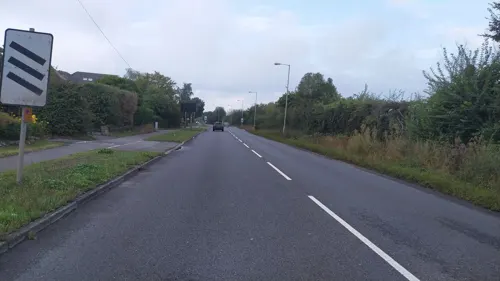
- Street-level photo, southglos, CC BY-SA 4.0
- Street-level photo, noid, CC BY-SA 4.0
- Street-level photo, noid, CC BY-SA 4.0
- Street-level photo, noid, CC BY-SA 4.0
- Street-level photo, southglos, CC BY-SA 4.0
- Street-level photo, southglos, CC BY-SA 4.0
- Street-level photo, southglos, CC BY-SA 4.0
- Street-level photo, southglos, CC BY-SA 4.0
- Street-level photo, southglos, CC BY-SA 4.0
- Street-level photo, southglos, CC BY-SA 4.0
- Street-level photo, southglos, CC BY-SA 4.0
- Street-level photo, southglos, CC BY-SA 4.0
- Street-level photo, southglos, CC BY-SA 4.0
- Street-level photo, southglos, CC BY-SA 4.0
- Street-level photo, southglos, CC BY-SA 4.0


Page built November 10, 2026. Spotted a mistake? Tell us or suggest a place.