

Why visit Cogenhoe
Townapedia lists 2 museums and landmarks, 4 parks and trails, 14 places to eat and 2 places to stay in and around town.
Highlights include Abington Meadows and Billing Aquadrome.
Weather in Cogenhoe
Forecast from MET Norway (CC BY 4.0). Full forecast
About Cogenhoe
Cogenhoe (locally KUUK-noh, ) is a village and former civil parish, now in the parish of Cogenhoe and Whiston, in the West Northamptonshire district, in the ceremonial county of Northamptonshire, England. The civil parish of Cogenhoe and Whiston had a population at the 2011 census of 1,436.
From the Wikipedia article Cogenhoe (this version), under CC BY-SA 4.0.
Museums and landmarks2

Parks, trails and playgrounds4


Billing Aquadrome
Park · 1.3 mi
Leisure park in Great Billing, Northamptonshire
Lings Wood Nature Reserve
Park · 2.7 mi
Nature reserve in the United Kingdom
Sywell Country Park
Park · 3.0 mi
Country park in Northamptonshire, England, UK
Restaurants and cafes14
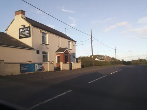


The Royal Oak
Bar and pub
Whiston Road, Northampton
Tu-Sa 12:00-15:00,18:00-23:00; Su 12:00-19:30


Greggs
Fast food · Sandwich, Bakery · 1.2 mi
The Causeway, Northampton
Mo-Sa 06:00-17:30; Su 07:30-17:00
2 more on the map.
Where to stay2


History
In prehistory, the Nene valley was a system of braided channels with Neolithic and later, Bronze Age humans living in and around the area. The main evidence from these periods is the many flint tools which have been found including arrow heads, scrapers, boring tools and an axe-head. On top of the hill towards Cogenhoe Firs, and almost halfway between Cogenhoe and Whiston (the nearest hamlet), one group of people were actively engaged in making these tools and possibly trading them.
Their little settlement looked north and down into the river valley where, over many years, they constructed a barrow cemetery of at least six large mounds, each presumably containing at least one grave of an important member of the community. Only one of these mounds has survived the plough and is now a Scheduled Ancient Monument and can be seen from the footpath to Earls Barton.
Read more of the history
There were a number of Iron Age settlements in the Parish including one in Short Lane. A later settlement took root on the south side of Cogenhoe Firs and developed into an important Romano-British settlement which lasted for several hundred years. Apart from a villa with mosaic floors, there were many other buildings with a variety of uses. Iron slag suggests that they had learned to use the local ores for smelting and other materials included copper alloy and glass were also used. A large number of bronze coins were found over the years and a grave with a small child was discovered in 1959. The body had been buried with two small pewter dishes beside it.
Another Romano-British villa was built on the southern rim of the valley and east of Whiston. Still to be excavated, this villa had glass windows and other high status building materials. In Cogenhoe village, north of Station Road, a number of skeletons from the Romano-British period have been found. One group of three included two children and an adult with a snake's head bracelet on their wrist. Another, decapitated skeleton was found with its head lying between its legs. Yet another skeleton, also decapitated was left to lie in peace in one of the gardens off Station Road and is still there to this day. One of the front gardens in Corn Kiln Close is home to the Roman corn drying kiln that lies preserved there and which gives the Close its name. When the E-shaped kiln was excavated in the early 1960s, a variety of finds included animal bones, antlers, quern stones (for grinding corn), a bronze brooch, a buckle and numerous coins were found. There were even carbonised grains of corn left by the Roman farmer.
Later pottery from the Dark Ages has been found west of Cogenhoe Church (St Peters). This may have belonged to the first Christians to worship there. Later Saxon pottery was also found further to the west and it was probably these people who gave Cogenhoe its name. The name, Cogenhoe, has two elements to it. The second, ...hoe, is easy to interpret – having a topographical origin. A hoe was a spur of land, usually overlooking a valley. Other Northamptonshire examples include Farthinghoe and Wadenhoe. The first part of the name is problematic. It could refer to a personal name – Cucga's Hoe. A 19th century cleric believed that it was a corruption of the Latin word, gucken; if so it became Gucken Hoe or Spy Hill. Latin place names though are rare and it is more likely that it is a corruption of a Germanic word which may have the same or similar meaning – a lookout place (modern German gucken means "to watch").
At Cogenhoe, a medieval settlement north of the church which included narrow closes and a fishpond also became empty – probably by the early modern period. At Domesday, there was a third settlement or manor that was centred on the present Cotton Farm where a number of houses were shown on the later Cogenhoe map of 1630. These were in the field to the south of Cotton Farm but then seem to have disappeared soon after – possibly by fire. A large quantity of pottery and other finds have been discovered on this site, and a crudely made stone cross base was found in a wall on Cotton Hill in the 1960s.
Apart from agriculture the village has, over time, supported other industries. Until the 19th century, this was a woollen and textiles area, but from the mid 19th century until shortly after the Second World War, Cogenhoe became a boot and shoe village, with the Mann family first working from a converted cottage in Church Street, then to a purpose-built factory in Whiston Road. When that burnt down in 1909, a replacement factory was built in Short Lane which was used until the late 1940s, when production ceased and it became a bus garage. That too was destroyed by fire in the early 1970s.
Alongside the boot and shoe industry was the remains of the hand lace trade. It was a cottage-based industry with a lace school in Church Street where children might have been taught the basic 3Rs and the Catechism but also and more importantly, how to make bone lace. By the late 19th century, this ancient craft was gradually being driven into decline by the Nottinghamshire machine lace industry, but it still exists today as a hobby or past-time practised by very skilled craftspeople.
One of the most important factors in encouraging industrial growth in the area was the opening of the Blisworth to Peterborough Railway (the Northampton and Peterborough Railway) in 1845. Operated by the London and North Western Railway Company (LNWR), it became a very busy line with stations at Billing Road, west of Cogenhoe, and Castle Ashby (Castle Ashby & Earls Barton railway station), east of Whiston. Many local men worked on the line as plate-layers, signalmen and porters, and the busy goods yard at Billing dispatched agricultural produce and boots and shoes out to the larger centres and accepted coal, fertiliser and many other goods for local customers.
From the History section of Cogenhoe on Wikipedia, under CC BY-SA 4.0.
Notable people from Cogenhoe
- George ThompsonEnglish cricketer for Northamptonshire (1877-1943)
Born in Cogenhoe, according to Wikidata (CC0). Each name links to its Wikipedia article.
Churches and places of worship5
Shopping2
Gas and EV charging4
Ramco Filling Station And Convenience Store
Gas station · 1.4 mi
3 Bedford Road, Northampton
Schools, colleges and libraries2
Healthcare1
Map of Cogenhoe
36 places. The map loads OpenStreetMap tiles when you open it.
Getting there and nearby towns
Sywell Aerodrome (ORM) is the nearest airport with scheduled flights listed in OpenStreetMap, 5 miles away.
- Northampton 4 mi west, about 7 min by car
- Hackleton 4 mi southwest, about 6 min by car
- Wellingborough 6 mi northeast, about 9 min by car
- Hartwell 7 mi southwest, about 11 min by car
- Lavendon 7 mi southeast, about 11 min by car
- Rushden 8 mi northeast, about 14 min by car
- Harrold 8 mi east, about 12 min by car
- Kislingbury 8 mi west, about 13 min by car
- Harpole 9 mi west, about 14 min by car
- Kettering 11 mi north, about 18 min by car
Drive times are estimates from straight-line distance, not routes.
Towns near Cogenhoe


Keep exploring
Local news
Headlines from INDB.
Reviews, tips and questions
Loading what members have shared...
Sources and licences
- GeoNames (CC BY 4.0): population, coordinates, regions and time zone
- Mapillary (see each image): photos
- OpenStreetMap contributors (ODbL 1.0): places, airports, map data
- Wikidata (CC0 1.0): elevation, founding date, time zone, website, landmarks and historic places
- Wikimedia Commons (see each image): photos
- Wikipedia (CC BY-SA 4.0): overview and history text
Photo credits
- Abington Meadows 3, Dudley Miles, CC BY-SA 4.0
- Street-level photo, rac_uk, CC BY-SA 4.0
- Street-level photo, rac_uk2, CC BY-SA 4.0
- Street-level photo, lamaar639, CC BY-SA 4.0
- Street-level photo, southglos, CC BY-SA 4.0
- Street-level photo, southglos, CC BY-SA 4.0
Page built November 10, 2026. Spotted a mistake? Tell us or suggest a place.