


Congresbury, United Kingdom
Congresbury is a town of 3,078 people in England, United Kingdom.
Why visit Congresbury
Townapedia lists 26 museums and landmarks, 8 parks and trails, 23 places to eat, 2 places to stay and 3 attractions in and around town.
Highlights include Cadbury Hill, Bow Bridge, Cadbury Hill Fort and Cleeve Toot Camp.
Weather in Congresbury
Forecast from MET Norway (CC BY 4.0). Full forecast
About Congresbury
Congresbury (CONGSbry) is a village and civil parish on the northwestern slopes of the Mendip Hills in North Somerset, England, which in 2011 had a population of 3,497. It lies on the A370 between Junction 21 of the M5 and Bristol Airport, 13 miles (21 km) south of Bristol city centre, and 7 miles (11 km) east of Weston-super-Mare. The Congresbury Yeo river flows through the village. The parish includes the hamlet of Brinsea.
From the Wikipedia article Congresbury (this version), under CC BY-SA 4.0.
Things to do3


Bow Bridge
Bridge · 1.0 mi
Bridge in Iwood, Congresbury, Somerset, England, UK

Museums and landmarks26

Cleeve Toot Camp
Monument and historic site · 1.9 mi
Hillfort in North Somerset, England, UK
Boundary Stone CP next to Boundary Stone No 9 Manor of Congresbury
Monument and historic site · 1.0 mi
Boundary Stone No 15 Manor of Congresbury adjacent to Boundary Stone TW
Monument and historic site · 1.4 mi
Boundary Stone No 26 Parish of Congresbury Centenary 1895-1995
Monument and historic site · 1.4 mi
14 more on the map.
Parks, trails and playgrounds8

Mendip Spring Golf Club - Brinsea Championship Course
Golf course · 1.4 mi
18 hole Par 71 Brinsea Championship Course
Honeyhall Lane, Congresbury
Mendip Spring Golf Club - Lakeside Course
Golf course · 1.5 mi
9 hole Par 34 Lakeside Course
Honeyhall Lane, Congresbury

Hangstones
Park · 1.1 mi
Hangstones recreation park, featuring two full sized and two junior football pitches, a cricket green in the summer months, and a skate park.

Rock Road Park
Park · 0.8 mi
Home of the Yatton Junior football club. This recreation park features two full sized football pitches, an AstroTurf training ground,...
Restaurants and cafes23
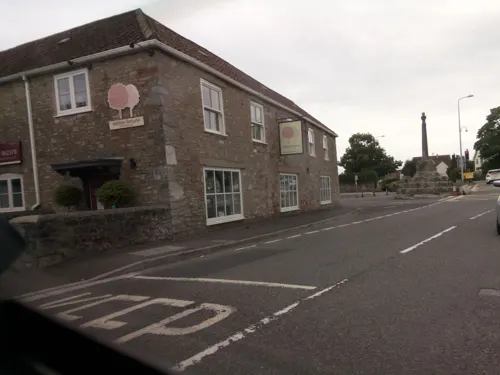
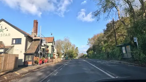
The Cottage Tea Rooms
Cafe · Coffee Shop · 1.3 mi
102 High Street, Bristol

Strawberry Line Cafe
Cafe · Coffee Shop · 1.5 mi
Station Approach, Bristol
Mo-Fr 08:00-16:00; Sa,Su 09:00-16:00


11 more on the map.
History
Congresbury is named after St Congar, who is said to have performed three miracles in the area. The second part of the name is thought to come from burh meaning fortified place.
The remains of an Iron Age hill fort at Cadbury Hill have been discovered,
as well as a Roman villa, temple and hoard of coins. Christian burial grounds have also been discovered on Cadbury Hill.
The archaeologist Mick Aston identified an Anglo-Saxon sculpture of St Congar which is believed to have come from St Andrew's Church, and which is now in the Museum of Somerset in Taunton.
The village cross dates from the 15th century and is a Grade II* listed building and Scheduled monument. A 2.5 metres (8 ft 2 in) high 15th century cross on an octagonal plinth. The head of the cross was replaced in the early 19th century.
Urchinwood Manor is a Grade II* listed building, part of which was built around 1620 with additions being made in the 17th century. The house and surrounding estate has been bought and sold many times over the centuries with the estate now being used as an equestrian centre.
The Vicarage includes an early 19th-century vicarage and former Priest's House from around 1446. It has been designated as a Grade I listed building.
Read more of the history
The village had a school founded in the 1870s that was split into separate infant and junior schools in the early 1970s. In September 2009, the two schools were re-joined as one primary school.
From the History section of Congresbury on Wikipedia, under CC BY-SA 4.0.
More about Congresbury
Education
The local council responsible for education is North Somerset Council. Congresbury has a pre-school and St Andrews Primary School. Secondary education is not available in the village and so many of Congresbury's children commute daily to the nearby village of Churchill to attend Churchill Academy and Sixth Form.
From the Wikipedia article Congresbury, under CC BY-SA 4.0.
Where to stay2
Churches and places of worship19
Shopping5
Gas and EV charging2
Schools, colleges and libraries6
Healthcare1
Map of Congresbury
95 places. The map loads OpenStreetMap tiles when you open it.
Getting there and nearby towns
Bristol Airport (BRS) is the nearest airport with scheduled flights listed in OpenStreetMap, 4 miles away.
- Yatton 1 mi northwest, about 2 min by car
- Wrington 2 mi east, about 3 min by car
- Churchill 2 mi southeast, about 4 min by car
- Sandford 3 mi south, about 5 min by car
- Banwell 4 mi southwest, about 6 min by car
- Shipham 4 mi south, about 6 min by car
- Nailsea 5 mi northeast, about 8 min by car
- Clevedon 5 mi northwest, about 9 min by car
- Locking 5 mi southwest, about 8 min by car
- Blagdon 5 mi southeast, about 8 min by car
Drive times are estimates from straight-line distance, not routes.
Towns near Congresbury


Keep exploring
Local news
Headlines from INDB.
Reviews, tips and questions
Loading what members have shared...
Sources and licences
- GeoNames (CC BY 4.0): population, coordinates, regions and time zone
- Mapillary (see each image): photos
- OpenStreetMap contributors (ODbL 1.0): places, airports, map data
- Wikidata (CC0 1.0): elevation, founding date, time zone, website, landmarks and historic places
- Wikimedia Commons (see each image): photos
- Wikipedia (CC BY-SA 4.0): overview and history text
Photo credits
- Congresbury, Alan Hawkes, CC BY-SA 2.0
- Kingston Seymour All Saints church, NotFromUtrecht, CC BY-SA 3.0
- Wringtonchurch, Dbown100, CC BY 3.0
- Holy Trinity Church Cleeve, John Lord, CC BY-SA 2.0
- CongresburyChurch, AlanFord at English Wikipedia, Public domain
- Church of St Bridget, Chelvey, from south-west, NotFromUtrecht, CC BY-SA 3.0
- Church of St. John the Baptist, Churchill, Andrew Riley, CC BY-SA 2.0
- Kenn church, Adrian and Janet Quantock, CC BY-SA 2.0
- St Marys Yatton winter panorama, NotFromUtrecht, CC BY-SA 3.0
- Puxton church, Brian Robert Marshall, CC BY-SA 2.0
- Churchill Methodist Church, Gricharduk, CC BY-SA 4.0
- View from Cadbury Hill, NotFromUtrecht, CC BY-SA 3.0
- Street-level photo, southglos, CC BY-SA 4.0
- Street-level photo, southglos, CC BY-SA 4.0
- Street-level photo, southglos, CC BY-SA 4.0
- Street-level photo, editid, CC BY-SA 4.0
- Street-level photo, southglos, CC BY-SA 4.0
- Street-level photo, southglos, CC BY-SA 4.0
- Street-level photo, editid, CC BY-SA 4.0
- Street-level photo, editid, CC BY-SA 4.0
- Street-level photo, southglos, CC BY-SA 4.0
- Street-level photo, southglos, CC BY-SA 4.0
- Street-level photo, southglos, CC BY-SA 4.0
- Street-level photo, southglos, CC BY-SA 4.0
- Street-level photo, southglos, CC BY-SA 4.0
- Street-level photo, southglos, CC BY-SA 4.0
- Street-level photo, southglos, CC BY-SA 4.0
- Street-level photo, southglos, CC BY-SA 4.0
- Street-level photo, southglos, CC BY-SA 4.0
- Street-level photo, southglos, CC BY-SA 4.0
- Street-level photo, southglos, CC BY-SA 4.0
- Street-level photo, southglos, CC BY-SA 4.0


Page built November 10, 2026. Spotted a mistake? Tell us or suggest a place.