


Cricklewood, United Kingdom
Cricklewood is a town of 65,000 people in England, United Kingdom.
Why visit Cricklewood
Townapedia lists 64 museums and landmarks, 60 parks and trails, 225 places to eat, 25 places to stay and 19 attractions in and around town.
Highlights include Kiln Theatre, Bishop's Bridge, Cricklewood Broadway and Shoot-up Hill.
Weather in Cricklewood
Forecast from MET Norway (CC BY 4.0). Full forecast
About Cricklewood
Cricklewood is a town in North West London, England, in the London Boroughs of Barnet and Brent. The Crown pub, now the Clayton Crown Hotel, is a local landmark and lies 5 miles (8 km) north-west of Charing Cross.
From the Wikipedia article Cricklewood (this version), under CC BY-SA 4.0.
Photos of Cricklewood

Things to do19

Kiln Theatre
Cinema and theater · 1.1 mi
Theatre and cinema in Kilburn, Brent, London, England
269 Kilburn High Road, London

Bishop's Bridge
Bridge · 3.1 mi
Road bridge in the Paddington district of London


Everyman Cinema
Cinema and theater · 1.6 mi
Cinema and former theatre in Hampstead, London, England

Golders Green Hippodrome
Cinema and theater · 1.4 mi
Theatre in London, England, UK

Mercury Theatre, Notting Hill Gate
Cinema and theater · 3.3 mi
Former theatre in London, England

Pentameters Theatre
Cinema and theater · 1.6 mi
Pub theatre in Hampstead, Camden, London, England

Canal Cafe Theatre
Cinema and theater · 2.8 mi
Theatre in City of Westminster, London, England, UK


Merchant Square Footbridge
Bridge · 3.2 mi
Movable pedestrian bridge spanning a canal in Paddington, London
Metropolitan Theatre
Cinema and theater · 3.1 mi
Former theatre, music hall and cinema in Edgware Road, Paddington, London, now demolished
7 more on the map.
Museums and landmarks64


Camden Arts Centre
Museum · 1.4 mi
52 Arkwright Road, London
Mo off; Tu-We,Fr-Su 11:00-18:00; Th 11:00-21:00

Fenton House
Museum · 1.5 mi
Handsome 17th-century house with unusual collections and picturesque walled gardens
Hampstead Grove, London


2 Willow Road
Museum · 2.0 mi
Heritage Museum in London, United Kingdom


Freud Museum London
Museum · 1.7 mi
Historic house museum in London, England, United Kingdom

Great Western Railway War Memorial
Monument and historic site · 3.2 mi
Railway company war memorial in London, England

Burgh House and Hampstead Museum
Museum · 1.7 mi
Local museum in Camden, London, England, United Kingdom

Hendon War Memorial
Monument and historic site · 2.1 mi
War memorial in London
52 more on the map.
Parks, trails and playgrounds60


Brent Park
Park · 2.0 mi
Park in London Borough of Barnet, United Kingdom

Emslie Horniman's Pleasance
Park · 2.2 mi
Park in Royal Borough of Kensington and Chelsea, London, UK


Hammersmith Park
Park · 3.3 mi
Park in London Borough of Hammersmith and Fulham, United Kingdom

Hampstead Heath
Park · 2.4 mi
Park in Camden and Barnet in London, England


Little Wormwood Scrubs
Park · 2.4 mi
Park in London Borough of Hammersmith and Fulham, United Kingdom

London Zoo
Park · 3.0 mi
World's oldest scientific zoo, in London, England

Meanwhile Gardens
Park · 2.3 mi
4-acre public park in North Kensington
48 more on the map.
Restaurants and cafes225

The Black Lion
Bar and pub · Indian · 1.1 mi
274 Kilburn High Road, London
Mo-Fr 16:00-00:00; Sa 12:00-00:00; Su 12:00-23:00

Beer + Burger
Bar and pub · Burger · 0.6 mi
Beer bar that sells burgers
88 Walm Lane, London
Mo-Th 16:00-23:00; Fr-Sa 12:00-23:00; Su 12:00-22:30
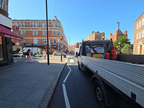
Bobby Fitzpatrick
Bar and pub · Snack, Pizza · 1.1 mi
273 West End Lane, London
Mo-We 17:00-23:00; Th-Fr 16:00-01:00; Sa 12:00-01:00; Su 16:00-11:00
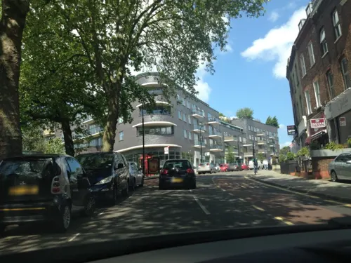
Bombay Nights
Restaurant · Indian · 0.8 mi
90 Fortune Green Road, London
Mo 16:45-23:30; Tu-Th 17:00-23:30; Fr-Sa 17:00-23:45; Su 17:00-23:30
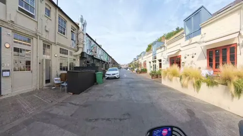
Carmel
Restaurant · Mediterranean · 1.4 mi
21-25 Lonsdale Road, London
Tu-Sa 12:00-23:00; Su 12:00-22:00
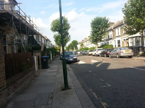
Casa Felicia
Restaurant · Italian · 1.5 mi
79 Salusbury Road, London
Tu-We 18:00-22:00; Th-Sa 12:00-15:00,18:00-22:00; Su 12:00-17:00
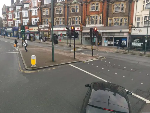
Eat Tokyo G2 Shabu-Shabu
Restaurant · Japanese · 1.3 mi
628 Finchley Road, London
Mo-Fr 11:30-15:00, 17:30-23:00; Sa 11:30-16:00, 17:30-23:00; Su 10:00-22:00
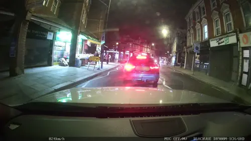
Kadiri's
Restaurant · Indian · 0.8 mi
High Road, London
Tu-Th 17:00-22:00; Fr 12:00-22:00; Sa,Su 12:00-22:00
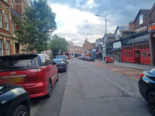
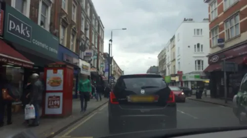
Mama's Kubo
Restaurant · Filipino · 1.2 mi
250 Finchley Road, London
Th-Fr 17:00-22:00; Sa 12:00-22:00; Su 12:00-20:00
Pizaza Golders Green
Restaurant · Pizza · 1.3 mi
100 Golders Green Road, London
Su-Th 12:00-23:00; Sa 21:00-03:00
213 more on the map.
History
The small settlement at the junction of Cricklewood Lane and the Edgware Road was established by 1294, which by 1321 was called Cricklewood. The settlement took its name from a nearby wood, perhaps on Cricklewood Lane, in Hendon. The name of the wood may be a tautology meaning "hill hill wood", with the Common Brittonic word cruc (meaning hill) forming the first element, and the Old English hyll (also meaning hill) the second element.
The area of the hamlet east of Watling street was in the Ancient Parish of Hendon (now part of Barnet), and the area to the west was in the Ancient Parish of Willesden (now part of Brent).
By the 1750s the Crown (rebuilt in 1889) was providing for coach travellers, and by the 1800s it had a handful of cottages and Cricklewood House as neighbours, and was known for its pleasure gardens. By the 1860s there were a number of substantial villas along the Edgware Road starting with Rockhall Lodge.
Read more of the history
Childs Hill and Cricklewood station, later renamed Cricklewood, opened in 1868. In the summer of 1881, the Midland Railway Company relocated its locomotive works from Kentish Town to the new Brent sidings. That October, the company announced it would build worker housing, which later became the now-listed Railway Cottages. Mr H. Finch laid out a handful of streets directly behind the Crown Inn, (including Yew, Ash and Elm Groves) in 1880. The station had become the terminus for the Midland Railway suburban services by 1884. The census of 1881 showed that the population had grown enough for a new church, and St. Peter's replaced a tin chapel in 1891. A daughter church called Little St. Peter's was opened in 1958 on Claremont Way but closed in 1983. The parish church on Cricklewood Lane was demolished and rebuilt in the 1970s. This church building was closed in 2004. Services for Anglicans were then held in the Carey Hall on Claremont Road (which is the church hall of Claremont Free Church) but were discontinued there in December 2015. The London General Omnibus Company commenced services to Regent Street from the Crown in 1883, and in 1899 opened a bus garage (Garage code W), which is still in use and was completely rebuilt in 2010.
By the 1890s, houses and shops had been built along part of Cricklewood Lane. Cricklewood Broadway had become a retail area by 1900 replacing the Victorian villas. The Queens Hall Cinema, later the Gaumont, replaced Rock Hall House, and was itself demolished in 1960. Thorverton, Caddington and Dersingham Roads were laid out in 1907, the year of the opening of Golders Green Underground station.
Cowhouse Farm, latterly Dicker's Farm and finally Avenue Farm, was closed in 1932. From 1908 to 1935, Westcroft Farm was owned by the Home of Rest for Horses; at its peak it could house 250 horses. The Metropolitan Borough of Hampstead opened the Westcroft Estate in 1935.
Much of the land to the west of Edgware Road was part of the estate of All Souls College, Oxford. Much of the land was wooded and in 1662 there were 79 oaks in Cricklewood. The transformation of the area came with the opening of the underground station in Willesden Green in 1879, which was known as Willesden Green and Cricklewood station from 1894 to 1938.
A number of developers acquired land in the area and built houses in the 1890s and 1900s. George Furness laid out what he called Cricklewood Park between 1893 and 1900 on Clock Farm. Roads in the area are named after trees (Pine, Larch, Cedar, Ivy, Olive). The name Cricklewood Park is no longer used. To the south of this, Henry Corsellis built Rockhall, Oaklands and Howard Roads from 1894; at the time he was also building in the Lavender Hill and Clapham Common area in Wandsworth. All Souls' College built a group of roads named after fellows of the college; for example, Chichele Road is named after Henry Chichele, founder of All Souls' College. Further expansion westward was blocked by the Dollis Hill estate, which became a public park, Gladstone Park, in 1901. To the north of Furness's Cricklewood Park Estate, Earl Temple built Temple Road by 1906 and surrounding roads. To the south, the Mapesbury Estate was built mainly between 1895 and 1905 and is a Conservation Area of largely semi-detached and detached houses.
With the introduction of the tram system in 1904, and the motorisation of bus services by 1911, numerous important industries were established. The first of these was the Phoenix Telephone Company in 1911 (later moved to the Hyde). The Handley Page Aircraft Company soon followed, from 1912 until 1917, at 110 Cricklewood Lane and subsequently occupying a large part of Claremont Road. The Cricklewood Aerodrome adjacent to their factory was used for the first London-Paris air service in the 1920s.
The former aircraft factory was converted into Cricklewood Studios in 1920, the largest film studio in the country at the time. It became the production base for Stoll Pictures during the silent era. After later turning out a number of quota quickies, it closed down in 1938. Some years later, the property was redeveloped and currently hosts a Wickes DIY store.
A number of plans were drawn up around the turn of the 20th century to extend the developing London Underground network to Cricklewood. Several proposals were put forward to construct an underground railway tunnel under the length of the Edgware Road, including an unusual scheme to build a type of subterranean monorail roller-coaster, but these proposals were abandoned.
From the History section of Cricklewood on Wikipedia, under CC BY-SA 4.0.
More about Cricklewood
Arts and culture
The Mapesbury Dell on Hoveden Road is a small park and garden administered by local residents. It started in 2000 when local residents in conjunction with the Mapesbury Residents Association decided that their local green space was too valuable to leave to fortune. The dell is open to the public during daylight hours and is used throughout the year, for example hosting carol services in mid-December.
Gladstone Park marks the north-western edge, covering approximately 35 hectares (86 acres). In 2003–04, Gladstone Park features and facilities were improved/restored with the aid of Heritage Lottery funding. The park contains a well maintained formal garden, children's playground, art gallery, café and pond, as well as good sport facilities (football/rugby/cricket pitches and tennis and netball courts). Barring fog and rain its peak gives good views of Wembley Stadium, the London Eye and the Shard. The park was frequented by Mark Twain around the turn of the 20th century whilst staying in accompanying Dollis Hill House, about which altogether he said he had "never seen any place that was so satisfactorily situated, with its noble trees and stretch of country, and everything that went to make life delightful, and all within a biscuit's throw of the metropolis of the world".
From the Wikipedia article Cricklewood, under CC BY-SA 4.0.
Notable people from Cricklewood
 Kayvan NovakBritish actorPhoto: John Manard for Super Festivals from..., CC BY 2.0
 KnoxBritish punk artistPhoto: Liftarn, Public domain
 Marjorie Constance CaserioAmerican chemistPhoto: Los Angeles Times, CC BY 4.0
 Michael MacklinAustralian politicianPhoto: Bjenks, CC BY 3.0
- Vince McNeiceBritish football player (1938-2022)
- John Fairbrotherassociation football player (1941-1999)
- Elkan AllanTelevision producer, journalist
- Agnes DillonDillon, Agnes Joseph Madeline [Una] (1903–1993), bookseller
- Aphra WilsonBritish plant pathologist and mycologist (1895-1976)
- Nick LeslauBritish businessman
Born in Cricklewood, according to Wikidata (CC0). Each name links to its Wikipedia article.
Where to stay25
Churches and places of worship85
Neasden - St Catherine w St Paul
Church · Anglican · 1.4 mi
Tanfield Avenue, London
Shopping56
Gas and EV charging9
Schools, colleges and libraries58
St Eugene de Mazenod Roman Catholic Primary School
School · Roman Catholic · 1.4 mi
Mazenod Avenue, London
Healthcare27
Map of Cricklewood
250 places. The map loads OpenStreetMap tiles when you open it.
Getting there and nearby towns
RAF Northolt (NHT) is the nearest airport with scheduled flights listed in OpenStreetMap, 9 miles away.
- Golders Green 2 mi northeast, about 2 min by car
- Willesden 2 mi southwest, about 3 min by car
- Harlesden 2 mi southwest, about 3 min by car
- Belsize Park 2 mi east, about 3 min by car
- Highgate 3 mi east, about 4 min by car
- Chalk Farm 3 mi east, about 5 min by car
- Finchley 3 mi north, about 5 min by car
- Camden Town 3 mi east, about 5 min by car
- Archway 4 mi east, about 6 min by car
- Wembley 4 mi west, about 6 min by car
Drive times are estimates from straight-line distance, not routes.
Towns near Cricklewood


Keep exploring
Local news
Headlines from INDB.
Reviews, tips and questions
Loading what members have shared...
Sources and licences
- GeoNames (CC BY 4.0): population, coordinates, regions and time zone
- Mapillary (see each image): photos
- OpenStreetMap contributors (ODbL 1.0): places, airports, map data
- Wikidata (CC0 1.0): elevation, founding date, time zone, website, landmarks and historic places
- Wikimedia Commons (see each image): photos
- Wikipedia (CC BY-SA 4.0): overview and history text
Photo credits
- Cricklewood is ready (49546754076), Steve Bowbrick from Radlett, United Kingdom, CC BY 2.0
- IMG 1934 Costa Coffee ..173 Cricklewood Broadway London NW2 3HT, Tadie88 from Wallington Surrey, CC BY-SA 2.0
- Crown, Cricklewood, NW2 (5695370397), Ewan Munro from London, UK, CC BY-SA 2.0
- The Crown, Cricklewood 2026-05-20, Matt Brown, CC BY 4.0
- Lucky 7, Cricklewood, NW2 (5695373643), Ewan Munro from London, UK, CC BY-SA 2.0
- Kiln Theatre, QueensOfTheHighRoad, CC BY-SA 4.0
- Paddington Bridge1, Chris McKenna ( Thryduulf ), CC BY-SA 4.0
- Lock 17 Market Bar, Camden Town, NW1 (6800612358), Ewan Munro from London, UK, CC BY-SA 2.0
- Mercury Theatre - Ladbroke Road Notting Hill Gate London W11 3BY, Spudgun67, CC BY-SA 4.0
- Fenton House Hampstead front February 2006, Unknown author, CC BY-SA 2.0
- 1-3 Willow Road, Steve Cadman from London, U.K., CC BY-SA 2.0
- BU Gallery Exterior 2015 (1), Benuricw, CC BY-SA 4.0
- Freud Museum London 2, Rup11, CC BY-SA 3.0
- Jagger GWR memorial1, Cnbrb at English Wikipedia, CC BY-SA 3.0
- Adelaide Nature Reserve 1, Dudley Miles, CC BY-SA 3.0
- River Brent in Brent Park, Dudley Miles, CC BY-SA 3.0
- Fryent Country Park view north, Dudley Miles, Public domain
- Hammersmith Park, Alexander Williams, CC BY-SA 4.0
- Hampstead Heath entrance south, Sunil060902, CC BY-SA 3.0
- Hendon Park, Dudley Miles, Public domain
- Little Wormwood Scrubs in London, spring 2013 (9), Chmee2, CC BY-SA 3.0
- Snowdon Aviary at London Zoo, England-16Aug2009, heena_mistry, CC BY 2.0
- Meanwhile Gardens from the east, summer 2024, Dann Chinn, CC BY 4.0
- EH1356972 Christ Church, City of Westminster 05, Katie Chan, CC BY-SA 3.0
- Camden Arts Centre, London, UK, Camden Arts Centre, CC BY-SA 3.0
- Gladstone Park Horses, Unknown author, Public domain
- Hampstead cemetery, Ultrahorse at English Wikipedia, Public domain
- Facade of St. Mary's Church, Hampstead, London, Rachel Clarke, CC BY-SA 2.0
- Hampstead Synagogue in 2012, Jim Linwood, CC BY 2.0
- Church of St Andrew, Willesden, Bernard Burns, CC BY-SA 3.0
- Side view of Emmanuel Church, West Hampstead, Zigzig20s, CC BY-SA 4.0
- St Albans, Golders Green-1, This image was produced by me, David Castor ( user:dcastor ). The pictures I submit to the Wikipedia Project are released to the public domain. This gives you the right to use them in any way you..., Public domain
- Inside Brent Cross, Billy Hicks, CC BY-SA 3.0
- Pentameters Theatre front, July 2021 (02), Isochrone, CC BY-SA 4.0
- St. Mary's Church Interior, Tony Singleton, Public domain
- The Emslie Horniman Pleasance (2945072572), Steve Cadman from London, U.K., CC BY-SA 2.0
- The Black Lion, Kilburn 2023-09-16, Matt Brown, CC BY 2.0
- Tapestry lawn at Avondale Park Summer, Solstice2015, CC BY-SA 4.0
- IMG 1922 Costa Coffee address..173 Cricklewood Broadway London NW2 3HT, Tadie88 from Wallington Surrey, CC BY-SA 2.0
- Everyman Cinema Club, Hampstead, NW3 (2487183245), Ewan Munro from London, UK, CC BY-SA 2.0
- Golders Green Hippodrome North End Road London NW11 7RP, Spudgun67, CC BY-SA 4.0
- Learie Constantine - Kendal Court Shoot Up Hill London NW2 3PD London Borough of Brent, Spudgun67, CC BY-SA 4.0
- Beer + Burger, Willesden, NW2, Ewan-M, CC BY-SA 2.0
- Street-level photo, domdomegg, CC BY-SA 4.0
- Street-level photo, Roufster, CC BY-SA 4.0
- Street-level photo, Roufster, CC BY-SA 4.0
- Street-level photo, Semir_Mapillary, CC BY-SA 4.0
- Street-level photo, domdomegg, CC BY-SA 4.0
- Street-level photo, domdomegg, CC BY-SA 4.0
- Street-level photo, sk53, CC BY-SA 4.0
- Street-level photo, laye, CC BY-SA 4.0
- Street-level photo, Roufster, CC BY-SA 4.0
- Street-level photo, rsandu, CC BY-SA 4.0
- Street-level photo, potaro67v, CC BY-SA 4.0
- Street-level photo, domdomegg, CC BY-SA 4.0
- Street-level photo, domdomegg, CC BY-SA 4.0
- Street-level photo, harry_wood, CC BY-SA 4.0
- Street-level photo, tcoppel, CC BY-SA 4.0
- Street-level photo, tcoppel, CC BY-SA 4.0
- Street-level photo, domdomegg, CC BY-SA 4.0
- Street-level photo, tcoppel, CC BY-SA 4.0
- Street-level photo, harry_wood, CC BY-SA 4.0
- Street-level photo, athuler, CC BY-SA 4.0
- Street-level photo, athuler, CC BY-SA 4.0
- Street-level photo, domdomegg, CC BY-SA 4.0
- Street-level photo, smsm1, CC BY-SA 4.0
- Street-level photo, laye, CC BY-SA 4.0
- Street-level photo, laye, CC BY-SA 4.0
- Street-level photo, laye, CC BY-SA 4.0
- Street-level photo, laye, CC BY-SA 4.0
- Street-level photo, domdomegg, CC BY-SA 4.0
- Street-level photo, domdomegg, CC BY-SA 4.0
- Street-level photo, laye, CC BY-SA 4.0
- Street-level photo, laye, CC BY-SA 4.0
- Street-level photo, domdomegg, CC BY-SA 4.0
- Street-level photo, domdomegg, CC BY-SA 4.0
- Street-level photo, domdomegg, CC BY-SA 4.0
- Street-level photo, athuler, CC BY-SA 4.0


Page built November 10, 2026. Spotted a mistake? Tell us or suggest a place.