


Camden Town, United Kingdom
Camden Town is a town of 26,122 people in England, United Kingdom.
Why visit Camden Town
Townapedia lists 164 museums and landmarks, 68 parks and trails, 132 places to eat, 32 places to stay and 38 attractions in and around town.
Highlights include Bloomsbury Theatre, Hampstead Theatre, Anaesthesia Heritage Centre and Camden Market.
Weather in Camden Town
Forecast from MET Norway (CC BY 4.0). Full forecast
About Camden Town
Camden Town is an area in the London Borough of Camden, around 2.5 miles (4 km) north-northwest of Charing Cross. Historically in Middlesex, it is identified in the London Plan as one of 34 major centres in Greater London.
From the Wikipedia article Camden Town (this version), under CC BY-SA 4.0.
Travel tips from other travellers: Camden Town on Wikivoyage (CC BY-SA 4.0).
Photos of Camden Town


Things to do38



26 more on the map.
Museums and landmarks164
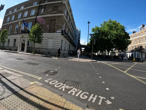


London Canal Museum
Museum · 1.1 mi
12-13 New Wharf Road, London
Tu-Su 10:00-16:30; PH Mo 10:00-16:30; Dec 23-Jan 01 Off


Grant Museum of Zoology
Museum · 1.2 mi
21 University Street, London
Tu-Fr 13:00-17:00; Sa 11:00-17:00; Su,Mo,PH off

London King's Cross Railway Station
Monument and historic site · 1.0 mi
Euston Road, London
Mo-Fr 05:00-25:40; Sa 05:00-25:11; Su 05:30-01:36



The Museum of Philatelic History
Museum · 1.4 mi
The Museum of Philatelic History at the Royal Philatelic Society London holds a collection of internationally significant objects. The...
41 Devonshire Place, London
Mo-Fr 09:30-16:30
152 more on the map.
Parks, trails and playgrounds68



Emslie Horniman's Pleasance
Park · 3.0 mi
Park in Royal Borough of Kensington and Chelsea, London, UK

Gorilla Circus Regents Park Flying Trapeze School
Park · 1.1 mi
Flying circu trapeze school.
Outer Circle, London
Mo-Su 08:30-20:30
Lonsdale Square Garden
Park · 1.5 mi
Lonsdale Square, London
Mo-Su 08:00-sunset
56 more on the map.
Restaurants and cafes132

Indian YMCA
Restaurant · Indian · 1.2 mi
41 Fitzroy Street, London
Mo-Fr 07:30-09:15, 12:00-15:00; Sa-Su 07:30-09:15, 12:00-14:00
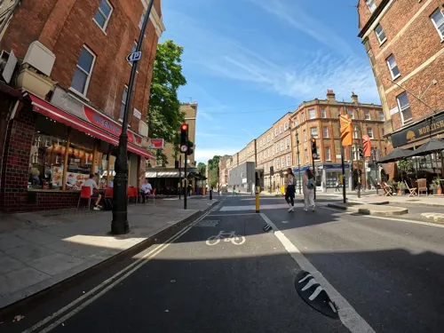
North Sea Fish
Restaurant · Seafood · 1.2 mi
7-8 Leigh Street, London
Mo 05:00-09:30; Tu-Su 12:00-21:00

The Barrel Vault
Bar and pub · Burger, Italian Pizza, Curry, Pasta, Salad, Breakfast · 0.9 mi
Unit 23 The Circle, Saint Pancras Station, London
Mo-Th 06:30-00:00; Fr, Sa 06:30-01:00; Su 07:30-23:00

The Metropolitan Bar
Bar and pub · Burger, Local · 1.4 mi
7 Station Approach, Marylebone Road, London
Mo-Sa 08:00-23:30; Su 09:00-22:30

The Pineapple
Bar and pub · Thai · 0.9 mi
51 Leverton Street, London
Mo-Th 12:00-23:00; Fr-Sa 12:00-00:00; Su 12:00-22:30


Crown & Anchor
Bar and pub · 1.0 mi
137 Drummond Street, London
Mo-We 12:00-23:00; Th-Fr 12:00-00:00; Sa 10:00-00:00; Su 10:00-22:30


Scandinavian Kitchen
Restaurant · Coffee Shop, Danish · 1.5 mi
61 Great Titchfield Street, London
Mo-Fr 08:00-19:00; Sa 09:00-18:00; Su 09:00-17:00

The Big Chill House
Bar and pub · 1.2 mi
257-259 Pentonville Road, London
Mo-Th 12:00+, Fr,Sa 12:00-03:00, Su 12:00-21:00

Home Marylebone
Restaurant · 1.4 mi
79 Marylebone High Street, London
Mo-Sa 10:00-24:00, Su 10:00-23:00
120 more on the map.
History
Camden Town is named after Charles Pratt, 1st Earl Camden. His earldom was styled after his estate, Camden Place near Chislehurst in Kent (now in the London Borough of Bromley), formerly owned by historian William Camden. The name, which appears on the Ordnance Survey map of 1822, was later applied to the early-20th-century Camden Town Group of artists and the London Borough of Camden, created in 1965.
The emergence of the industrial revolution in the 19th century meant Camden was the North Western Railway's terminal stop in 1837. It was where goods were transported off the tracks and onto the roads by some of London's 250,000 workhorses. The whole area was adapted to a transportation function: the Roundhouse (1846), Camden Lock and the Stables were examples of this.
Read more of the history
Camden Town stands on land that was once the manor of Kentish Town. Sir Charles Pratt, a radical 18th-century lawyer and politician, acquired the manor through marriage. In 1791, he started granting leases for houses to be built in the manor. In 1816, the Regent's Canal was built through the area. Up to at least the mid-20th century, Camden Town was considered an "unfashionable" locality. The Camden Markets, which started in 1973 and have grown since then, attract many visitors. A 1993 bomb blast injured 18 people on Camden High Street. On 9 February 2008, Camden Canal market suffered a major fire, but there were no injuries. It later reopened as Camden Lock Village, until closed in 2015 for redevelopment.
From the History section of Camden Town on Wikipedia, under CC BY-SA 4.0.
More about Camden Town
Geography
Camden Town is on relatively flat ground at 100 feet (30 m) above sea level, 2.5 miles (4.0 km) north-northwest of Charing Cross. The area of Camden Town Ward proper (ward code E05013655) is 60.30ha. To the north are the hills of Hampstead and Highgate; to the west is Primrose Hill. The culverted, subterranean River Fleet flows from its source on Hampstead Heath through Camden Town south to the River Thames. The Regent's Canal runs through the north of Camden Town.
Economy
At the end of the 20th century, entertainment-related businesses began moving into the area, and a Holiday Inn was built abutting the canal. A number of retail and food chain outlets replaced independent shops, driven out by high rents and redevelopment. Restaurants with a variety of culinary traditions thrived, many of them near the markets, on Camden High Street and its side streets, Parkway, Chalk Farm Road, and Bayham Street. The plan to redevelop the historic Stables Market led to a steel and glass extension, built on the edges of the site in 2006, and increased the market's capacity. The Dr. Martens footwear company global head office, including the design team, moved to Camden Town in 2017.
From the Wikipedia article Camden Town, under CC BY-SA 4.0.
Notable people from Camden Town
 Oliver Heavisideelectrical engineer, mathematician and physicist (1850–1925)Photo: Unknown author Unknown author, Public domain
 Daniel KaluuyaBritish actor (born 1989)Photo: Marlene Landu, CC BY-SA 4.0
 Freddie HighmoreEnglish actor (born 1992)Photo: MingleMediaTVNetwork, CC BY-SA 2.0
 Olivia WilliamsBritish actress (born 1968)Photo: Mingle Media TV, CC BY 2.0
 Keir GilchristCanadian actorPhoto: Ned_Vizzini_and_Keir_Gilchrist.jpg :..., CC BY 2.0
 Eugene Aynsley GoossensEnglish conductor and composer (1893-1962)Photo: Bain News Service, publisher, Public domain
 Just JackBritish singerPhoto: Bertrand from Paris, France, CC BY 2.0
 DappyBritish rapper and singerPhoto: Johnvedwards, CC BY-SA 3.0
 John Henry DearleBritish textile and stained-glass designer with Morris & Co. (1859-1932)Photo: William Morris and John Henry Dearle, Public domain
 Tobi Adebayo-RowlingBritish association football playerPhoto: Seaninryan, CC BY-SA 4.0
- Anthony HeadEnglish actor (1954–2026)
- Philibert Jacques MelotteBritish astronomer (1880-1961)
Born in Camden Town, according to Wikidata (CC0). Each name links to its Wikipedia article.
Where to stay32
Churches and places of worship59
Shopping64
Gas and EV charging21
Schools, colleges and libraries34
Healthcare31
MSI Reproductive Choices Local Treatment Centre
Clinic and pharmacy · 1.2 mi
108 Whitfield Street, London
Map of Camden Town
250 places. The map loads OpenStreetMap tiles when you open it.
Getting there and nearby towns
London City Airport (LCY) is the nearest airport with scheduled flights listed in OpenStreetMap, 9 miles away.
- Islington 2 mi east, about 3 min by car
- Archway 2 mi north, about 3 min by car
- London 2 mi south, about 4 min by car
- Holborn 2 mi southeast, about 3 min by car
- Highgate 2 mi north, about 3 min by car
- Highbury 2 mi east, about 3 min by car
- City of Westminster 3 mi south, about 5 min by car
- Hornsey 3 mi north, about 5 min by car
- Wood Green 4 mi north, about 7 min by car
- Harlesden 5 mi west, about 7 min by car
Drive times are estimates from straight-line distance, not routes.
Towns near Camden Town


Keep exploring
Local news
Headlines from INDB.
Reviews, tips and questions
Loading what members have shared...
Sources and licences
- GeoNames (CC BY 4.0): population, coordinates, regions and time zone
- Mapillary (see each image): photos
- OpenStreetMap contributors (ODbL 1.0): places, airports, map data
- Wikidata (CC0 1.0): elevation, founding date, time zone, website, landmarks and historic places
- Wikimedia Commons (see each image): photos
- Wikipedia (CC BY-SA 4.0): overview and history text
Photo credits
- Camden Town 9, Georgia Pinaud, Lille, France., Public domain
- CAMDEN TOWN-1 230612 CPS (7567933300), Chris Sampson, CC BY 2.0
- London - Camden Town (3), Fred Romero from Paris, France, CC BY 2.0
- Bucks Head - 202 Camden High Street, Camden Town, ell brown, CC BY-SA 2.0
- Camden Town - panoramio (10), TomasEE, CC BY 3.0
- Camden Town deep level shelter 5 June 2023, Matt Brown, CC BY 2.0
- Buck's Head, Camden Town, NW1, Ewan-M, CC BY-SA 4.0
- Bucks Head, Camden Town, NW1 (6795129246), Ewan Munro from London, UK, CC BY-SA 2.0
- Quarter Shoes, 241 Camden High Street, Camden Town, ell brown, CC BY-SA 2.0
- 4 Feet - 249 Camden High Street, Camden Town, ell brown, CC BY-SA 2.0
- New Rock - 220 Camden High Street, Camden Town - 30681891273, ell brown, CC BY-SA 2.0
- British Library + St Pancras 7527-31hug, Patche99z, CC BY-SA 3.0
- MadameTussaudMuseumLondon, Citizen59, CC BY-SA 3.0
- St Marylebone church, Charles Miller, CC BY 2.0
- King's Cross station, August 2014, George Rex from London, England, CC BY-SA 2.0
- Snowdon Aviary at London Zoo, England-16Aug2009, heena_mistry, CC BY 2.0
- Lords-Cricket-Ground-Pavilion-06-08-2017, Yorkspotter, CC BY-SA 4.0
- Regent's Park London, Tom Page from London, UK, CC BY-SA 2.0
- London - Camden Town by Horst Michael Lechner, Horst Michael Lechner, CC BY-SA 3.0
- Coram's 7274, ClemRutter, CC BY-SA 4.0
- Royal Academy of Music, London W1, Philafrenzy, CC BY 2.0
- Regent's Park Open Air Theatre Auditorium, TomJAnderson ( talk ), CC BY-SA 3.0
- 221B Baker Street, London - Sherlock Holmes Museum, Jordan 1972 ( talk ), Public domain
- University College Hospital - New Building - London - 020504, Tagishsimon ( talk ) ( Uploads ), CC BY-SA 3.0
- All Souls Church in London, Tedd Santana, CC BY 2.0
- UCL Bloomsbury Theatre, Frankieroberto at English Wikipedia, Public domain
- Camley Street Natural Park, Unknown author, CC BY-SA 2.5
- Cyberdog shop 2009, Fenvoe, CC BY 3.0
- Gays the Word, Ross Burgess, CC BY-SA 3.0
- Horse Hospital, Colonnade, Bloomsbury, London WC1N 1JD 01, Edwardx, CC BY-SA 4.0
- London Canal Museum TQ3083, Oxyman, CC BY-SA 2.0
- Scandinavian Kitchen, Fitzrovia, W1 (3334294559), Ewan Munro from London, UK, CC BY-SA 2.0
- St Pancras Railway Station 2012-06-23, Colin, CC BY-SA 3.0
- SwissCottageCentral Library20070217, No machine-readable author provided. Andytuna assumed (based on copyright claims)., CC BY-SA 3.0
- The Wellcome Building, David Samuel, User:Hellodavey1902, CC BY-SA 3.0
- St John's Wood Chapel, Steve Cadman, CC BY-SA 2.0
- DanishChLondon, Matthew Ross, Public domain
- Crown and Anchor, Somers Town, NW1 (2630808524), Ewan Munro from London, UK, CC BY-SA 2.0
- Weymouth Street Hospital 09, Edward, CC BY-SA 4.0
- Saint Charles Borromeo church, London 03, Philafrenzy, CC BY-SA 4.0
- Great Northern Hotel (16247872463), Richard Ash, CC BY-SA 2.0
- The former Bell public house, Kings Cross, June 2024, No Swan So Fine, CC BY-SA 4.0
- Cafe Med, St Johns Wood, NW8 (6934376468), Ewan Munro from London, UK, CC BY-SA 2.0
- 1 Colville Place, Fitzrovia, August 2023, No Swan So Fine, CC BY-SA 4.0
- Waterstones Bookshop - Facade, Stefan Wolmarans, CC BY-SA 4.0
- Hilton London Euston, APK, CC BY 4.0
- 40 College Crescent, Belsize Park, July 2023 01, No Swan So Fine, CC BY-SA 4.0
- Keats Community Library dome, JRennocks, CC BY 4.0
- Renoir Cinema, The Brunswick Centre - panoramio, N19±, CC BY-SA 3.0
- Everyman, Belsize Park, NW3 (3379581497), Ewan Munro from London, UK, CC BY-SA 2.0
- Odeon, Swiss Cottage, NW3 (8671401551), Ewan Munro from London, UK, CC BY-SA 2.0
- J. Sainsbury's supermarket Camden Road, London, Philafrenzy, CC BY-SA 4.0
- Barrel Vault, St Pancras International Station, N1, Ewan-M, CC BY-SA 2.0
- Metropolitan Bar, Marylebone, NW1 (2882826659), Ewan Munro from London, UK, CC BY-SA 2.0
- Camden Gardens 2020 front, TheFrog001, CC0
- At London 2025 975, Photograph by Mike Peel ( www.mikepeel.net )., CC BY-SA 4.0
- Collinge & Clark storefront, CJJ2501, CC0
- West Lodge in Euston Square (Southwest View - 02), Doyle of London, CC BY-SA 4.0
- People’s Museum Somers Town, Frombowen, CC BY-SA 4.0
- Norfolk Arms, St Pancras, WC1, Ewan Munro from London, UK, CC BY-SA 2.0
- Royal-free-5-July-2025, CapabilityTrent, CC0
- Grant Museum of Zoology (9201048849), DAVID HOLT from London, England, CC BY-SA 2.0
- The Emslie Horniman Pleasance (2945072572), Steve Cadman from London, U.K., CC BY-SA 2.0
- Barnsbury Wood 6, Dudley Miles, CC BY-SA 3.0
- London MMB A0 Royal National Hotel, mattbuck ( category ), CC BY-SA 3.0
- Barnsbury Square - gardens, User:Masato.harada, CC BY-SA 4.0
- Swiss Cottage Openspace onto Hampstead Theatre, Isochrone, CC BY-SA 2.0
- Paul Mccartney Roundhouse, Richard from Peterborough, United Kingdom, CC BY 2.0
- St Joan, Shaw Theatre, Euston Road, Keith Grant (sculpture) / Stu's Images (photo), CC BY-SA 3.0
- Indian YMCA London (2), Philafrenzy, CC BY-SA 4.0
- Keystone with pineapple (15626069846), Images George Rex from London, England, CC BY-SA 2.0
- Street-level photo, erias, CC BY-SA 4.0
- Street-level photo, matth81, CC BY-SA 4.0
- Street-level photo, erias, CC BY-SA 4.0
- Street-level photo, erias, CC BY-SA 4.0
- Street-level photo, gness, CC BY-SA 4.0
- Street-level photo, tcoppel, CC BY-SA 4.0
- Street-level photo, erias, CC BY-SA 4.0
- Street-level photo, NatchaponJ, CC BY-SA 4.0
- Street-level photo, gness, CC BY-SA 4.0
- Street-level photo, rsandu, CC BY-SA 4.0
- Street-level photo, laye, CC BY-SA 4.0
- Street-level photo, gness, CC BY-SA 4.0
- Street-level photo, marikocco, CC BY-SA 4.0
- Street-level photo, smsm1, CC BY-SA 4.0
- Street-level photo, erias, CC BY-SA 4.0
- Street-level photo, erias, CC BY-SA 4.0
- Street-level photo, gness, CC BY-SA 4.0
- Street-level photo, tcoppel, CC BY-SA 4.0
- Street-level photo, Semir_Mapillary, CC BY-SA 4.0
- Street-level photo, erias, CC BY-SA 4.0
- Street-level photo, erias, CC BY-SA 4.0
- Street-level photo, cheese_melon, CC BY-SA 4.0


Page built November 10, 2026. Spotted a mistake? Tell us or suggest a place.