
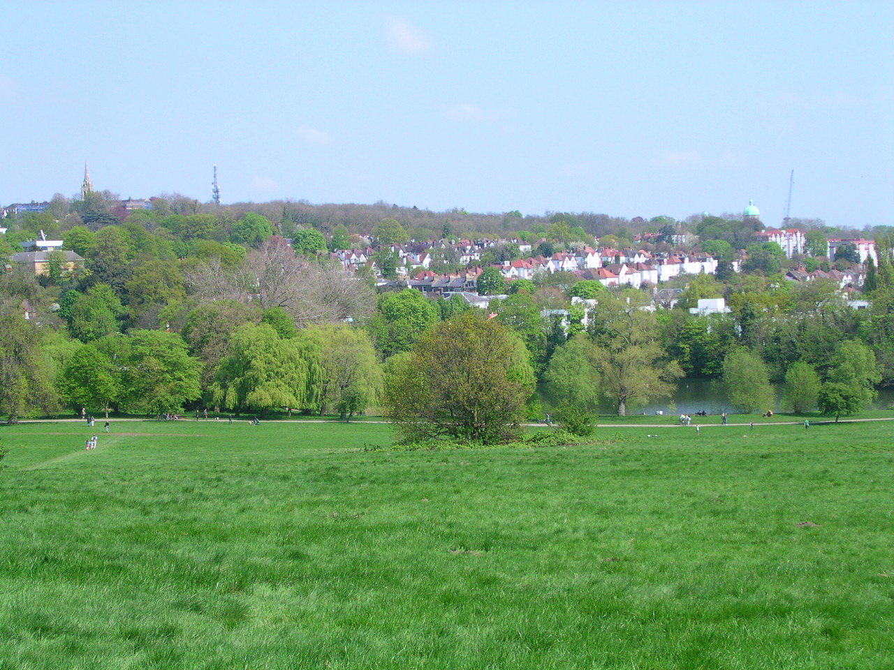


Highgate, United Kingdom
Highgate is a town of 10,955 people in England, United Kingdom.
Why visit Highgate
Townapedia lists 118 museums and landmarks, 86 parks and trails, 175 places to eat, 10 places to stay and 34 attractions in and around town.
Highlights include Everyman, Pentameters Theatre, Camden Arts Centre and Freud Museum London.
Weather in Highgate
Forecast from MET Norway (CC BY 4.0). Full forecast
About Highgate
Highgate is an area of north London, which is divided among three London boroughs: Haringey in the north and east, Camden in the south and west, and Islington in the south and east. It lies at the north-eastern corner of Hampstead Heath, 4.5 mi (7 km) north-north-west of Charing Cross.
From the Wikipedia article Highgate (this version), under CC BY-SA 4.0.
Photos of Highgate


Things to do34


Pentameters Theatre
Cinema and theater · 1.1 mi
Pub theatre in Hampstead, Camden, London, England

Almeida Theatre
Cinema and theater · 3.0 mi
Theatre in Islington, London

BBC Radio Theatre
Cinema and theater · 3.3 mi
Theatre at BBC Broadcasting House in London

Bishop's Bridge
Bridge · 3.4 mi
Road bridge in the Paddington district of London

Bloomsbury Theatre
Cinema and theater · 3.0 mi
Theatre in London, England

BT Tower
Monument and historic site · 3.2 mi
Communications tower located in Fitzrovia, London, England, UK

Canal Cafe Theatre
Cinema and theater · 3.3 mi
Theatre in City of Westminster, London, England, UK
Cock Tavern Theatre
Cinema and theater · 2.4 mi
Former pub theatre in Kilburn, London (2009-2011)
22 more on the map.
Museums and landmarks118

Camden Arts Centre
Museum · 1.4 mi
52 Arkwright Road, London
Mo off; Tu-We,Fr-Su 11:00-18:00; Th 11:00-21:00

Freud Museum London
Museum · 1.4 mi
Historic house museum in London, England, United Kingdom
20 Maresfield Gardens, London
We-Su 10:30-17:00

Highgate Cemetery
Cemetery · 0.5 mi
Swain's Lane, London
Mar-Oct 10:00-17:00; Nov-Feb 10:00-16:00; Dec 25,Dec 26 off

Fenton House
Museum · 1.0 mi
Handsome 17th-century house with unusual collections and picturesque walled gardens
Hampstead Grove, London



The Chalybeate Well
Monument and historic site · 0.8 mi
The name ‘Chalybeate’ means that the water contains iron. Because of the iron contents the medicinal value (health benefits) of the...


Burma Railway Memorial
Monument and historic site · 2.3 mi
Memorial in Camden Town, London

106 more on the map.
Parks, trails and playgrounds86

Brent Park
Park · 2.6 mi
Park in London Borough of Barnet, United Kingdom


Clitterhouse Recreation Ground
Park · 2.4 mi
Park in Brent Cross, London, England

Gladstone Park
Park · 3.4 mi
Park in the Dollis Hill area of north-west London, England


London Zoo
Park · 2.1 mi
World's oldest scientific zoo, in London, England

Primrose Hill
Park · 1.8 mi
Hill and park in the London Borough of Camden, England, UK

Princes Park
Park · 2.3 mi
Park in Temple Fortune, in the London Borough of Barnet, North London, England


74 more on the map.
Restaurants and cafes175

The Bull
Bar and pub · British · 0.8 mi
13 North Hill, London
Mo-Th 12:00-23:00; Fr-Sa 12:00-24:00; Su 12:00-22:30

The Pineapple
Bar and pub · Thai · 1.2 mi
51 Leverton Street, London
Mo-Th 12:00-23:00; Fr-Sa 12:00-00:00; Su 12:00-22:30
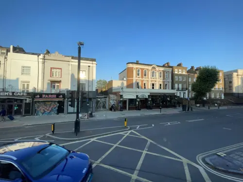
The Bull & Gate
Bar and pub · 1.2 mi
389 Kentish Town Road, London
Mo-We 11:00-23:00; Th-Sa 11:00-24:00; Su 11:00-22:30


The Gatehouse
Bar and pub · 0.6 mi
1 North Road, London
Mo-Th 11:00-23:30; Fr 11:00-00:00; Sa 10:00-00:00; Su 11:00-22:30

The Washington
Bar and pub · 1.4 mi
50 England's Lane, London
Mo-Th 12:00-23:00; Fr 12:00-24:00; Sa 10:00-24:00; Su 12:00-22:30

The Wells Tavern
Bar and pub · 0.8 mi
30 Well Walk, London
Mo-Fr 12:00-23:00; Sa 12:00-23:00; Su 12:00-22:30
Berberè
Restaurant · Pizza · 1.3 mi
Pizzeria
300 Kentish Town Road, London
Mo-Th,Su 12:00-22:00; Fr-Sa 12:00-22:30

Duke of St. Albans
Bar and pub · 0.5 mi
15 Highgate Road, London
Mo-Th 12:00-23:00; Fr,Sa 10:00-00:00; Su 12:00-22:00


The Old White Bear
Bar and pub · 0.9 mi
1 Well Road, London
Mo-Th 12:00-23:00; Fr-Sa 11:00-23:00; Su 12:00-22:30
163 more on the map.
History
Historically, Highgate adjoined the Bishop of London's hunting estate. Highgate gets its name from these hunting grounds, as there was a high, deer-proof hedge surrounding the estate: 'the gate in the hedge'.
The bishop kept a toll-house where one of the main northward roads out of London entered his land. A number of pubs sprang up along the route, one of which, the Gatehouse, commemorates the toll-house.
Hampstead Lane and Highgate Hill contain the red brick Victorian buildings of Highgate School and its adjacent Chapel of St Michael. The school has played a role in the life of the village and has existed on its site since its founding was permitted by letters patent from Queen Elizabeth I in 1565.
From 1853 to 1940, the London Diocesan Penitentiary was sited on North Hill in Highgate. The area north of Hampstead Lane and east of the High Street was part of Hornsey parish and also later the Municipal Borough of Hornsey, and the seat of that borough's governing body for many years.
Until late Victorian times, it was a distinct village outside London, sitting astride the main road to the north. The area retains many green expanses, including the eastern part of Hampstead Heath, three ancient woods, Waterlow Park and the eastern-facing slopes, known as Highgate bowl.
Read more of the history
Highgate Hill, a steep road linking Archway (traditionally called part of Upper Holloway) and Highgate village, was the route of the Highgate Hill Cable Tramway, the first cable car to be built in Europe. It operated between 1884 and 1909.
Like much of London, Highgate suffered damage during World War II by German air raids; Highgate tube station was used as a bomb shelter.
Highgate New Town is a post-war estate adjacent to the cemetery, designed by Camden Council with similarities to the Alexandra Road estate.
From the History section of Highgate on Wikipedia, under CC BY-SA 4.0.
More about Highgate
Geography
The village lies at the top of Highgate Hill, which provides views across central London. Highgate is 136 m (446 ft) above sea level at its highest point.
From the Wikipedia article Highgate, under CC BY-SA 4.0.
Notable people from Highgate
 Edward LearBritish artist, illustrator, author and poet (1812-1888)Photo: Unknown author Unknown author, Public domain
 Rupert GooldBritish theatre directorPhoto: PhilipRomanoPhoto, CC BY-SA 4.0
 Lynne FeatherstoneBritish politician (born 1951)Photo: ©House of Lords / photography by Roger Harris, CC BY 3.0
 Beryl GreyBritish ballet dancer (1927–2022)Photo: Unknown author, CC BY-SA 2.0
 E. S. DrowerBritish cultural anthropologist and philologistPhoto: Unknown photographer, Public domain
 William SargantBritish psychiatrist (1907–1988)Photo: US Dep. of Justics, CC BY 4.0
 Anthony SharpBritish actor (1915-1984)Photo: Stanley Kubrick, Public domain
- Walter Frank Raphael WeldonBritish evolutionary biologist (1860-1906)
- Oswald TurnbullBritish tennis player (1890–1970)
- Tabitha StoeckerBritish skeleton racer (born 2000)
- Roland Culveractor (1900-1984)
- Donald CogganArchbishop of Canterbury; and of York; Bishop of Bradford (1909-2000)
Born in Highgate, according to Wikidata (CC0). Each name links to its Wikipedia article.
Where to stay10
Holiday Inn Express Swiss Cottage
Motel and hotel · 1.5 mi
152-156 Finchley Road, London
Churches and places of worship67
Shopping68
Gas and EV charging10
Schools, colleges and libraries49
Healthcare37
Map of Highgate
250 places. The map loads OpenStreetMap tiles when you open it.
Getting there and nearby towns
London City Airport (LCY) is the nearest airport with scheduled flights listed in OpenStreetMap, 10 miles away.
- Archway 1 mi east, about 2 min by car
- Hornsey 2 mi northeast, about 4 min by car
- Islington 3 mi southeast, about 5 min by car
- Wood Green 3 mi northeast, about 5 min by car
- London 4 mi south, about 7 min by car
- Holborn 4 mi southeast, about 6 min by car
- Palmers Green 4 mi northeast, about 7 min by car
- Southgate 4 mi northeast, about 7 min by car
- City of Westminster 5 mi south, about 8 min by car
- Tottenham 5 mi northeast, about 8 min by car
Drive times are estimates from straight-line distance, not routes.
Towns near Highgate


Keep exploring
Local news
Headlines from INDB.
Reviews, tips and questions
Loading what members have shared...
Sources and licences
- GeoNames (CC BY 4.0): population, coordinates, regions and time zone
- Mapillary (see each image): photos
- OpenStreetMap contributors (ODbL 1.0): places, airports, map data
- Wikidata (CC0 1.0): elevation, founding date, time zone, website, landmarks and historic places
- Wikimedia Commons (see each image): photos
- Wikipedia (CC BY-SA 4.0): overview and history text
Photo credits
- Hampstead Heath 7, Charlesdrakew, Public domain
- Almeida Theatre 05 (2023), GilPe, CC BY-SA 4.0
- Paddington Bridge1, Chris McKenna ( Thryduulf ), CC BY-SA 4.0
- UCL Bloomsbury Theatre, Frankieroberto at English Wikipedia, Public domain
- BT Tower-1, David Castor ( dcastor ), Public domain
- Freud Museum London 2, Rup11, CC BY-SA 3.0
- BU Gallery Exterior 2015 (1), Benuricw, CC BY-SA 4.0
- Burma Railway memorial Camden High Street 04, Philafrenzy, CC BY-SA 4.0
- River Brent in Brent Park, Dudley Miles, CC BY-SA 3.0
- Clarefield Park, Dudley Miles, CC0
- Gladstone Park Horses, Unknown author, Public domain
- Snowdon Aviary at London Zoo, England-16Aug2009, heena_mistry, CC BY 2.0
- Primrose Hill, London -16Sept2010, Louise Ireland, CC BY-SA 2.0
- Princes Park tree, Dudley Miles, CC0
- Regent's Park London, Tom Page from London, UK, CC BY-SA 2.0
- Egyptian Avenue Highgate Cemetery, JohnArmagh, Public domain
- Hampstead Heath entrance south, Sunil060902, CC BY-SA 3.0
- Camden Arts Centre, London, UK, Camden Arts Centre, CC BY-SA 3.0
- Fenton House Hampstead front February 2006, Unknown author, CC BY-SA 2.0
- St Aloysius' College, Highgate, London, Mx. Granger, CC0
- Facade of St. Mary's Church, Hampstead, London, Rachel Clarke, CC BY-SA 2.0
- Flask, Highgate, N6 (2883805442), Ewan Munro from London, UK, CC BY-SA 2.0
- Wells Tavern, Hampstead, NW3 (2629997899), Ewan Munro from London, UK, CC BY-SA 2.0
- Washington, Belsize Park, NW3 (3905278876), Ewan Munro from London, UK, CC BY-SA 2.0
- St Martin's church, Gospel Oak, London (22780697665), The National Churches Trust, CC BY 2.0
- Old White Bear, Hampstead, NW3 (4760777235), Ewan Munro from London, UK, CC BY-SA 2.0
- Boston Arms Tufnell Park 2005, Unknown author, CC BY-SA 2.0
- Bull, Highgate, N6 (7285705742), Ewan Munro from London, UK, CC BY-SA 2.0
- Fiddlers Elbow, Kentish Town, NW5 (3904408191), Ewan Munro from London, UK, CC BY-SA 2.0
- Keats Community Library dome, JRennocks, CC BY 4.0
- Everyman, Belsize Park, NW3 (3379581497), Ewan Munro from London, UK, CC BY-SA 2.0
- The Bomb Factory Art Foundation, Bethsface, CC BY-SA 4.0
- Duke of St Alban's, Dartmouth Park, NW5, Ewan-M, CC BY-SA 4.0
- Highgate Cemetery East, Panyd The muffin is not subtle, CC BY-SA 3.0
- 01DVG HAMPSTEAD HEATH EXTENSION, Dudley Miles, CC BY-SA 3.0
- Royal-free-5-July-2025, CapabilityTrent, CC0
- Kenwood House 2, MrsEllacott, CC BY-SA 4.0
- Pentameters Theatre front, July 2021 (02), Isochrone, CC BY-SA 4.0
- St. Mary's Church Interior, Tony Singleton, Public domain
- Clitterhouse Recreation Ground, Dudley Miles, CC0
- Greville Place 4, Dudley Miles, CC BY-SA 4.0
- BBC Radio Theatre, Michal Bělka, CC BY-SA 4.0
- Jacksons Lane Arts Centre 2026-09-19, Matt Brown, CC BY 4.0
- Chalybeate Well, Hampstead (9501589606), Peter O'Connor aka anemoneprojectors, CC BY-SA 2.0
- Keystone with pineapple (15626069846), Images George Rex from London, England, CC BY-SA 2.0
- The Gatehouse (49445195628), Reading Tom from Reading, UK, CC BY 2.0
- Street-level photo, gness, CC BY-SA 4.0
- Street-level photo, gness, CC BY-SA 4.0
- Street-level photo, Semir_Mapillary, CC BY-SA 4.0
- Street-level photo, tcoppel, CC BY-SA 4.0
- Street-level photo, tcoppel, CC BY-SA 4.0
- Street-level photo, Semir_Mapillary, CC BY-SA 4.0
- Street-level photo, Semir_Mapillary, CC BY-SA 4.0
- Street-level photo, gness, CC BY-SA 4.0
- Street-level photo, gness, CC BY-SA 4.0
- Street-level photo, gness, CC BY-SA 4.0
- Street-level photo, matth81, CC BY-SA 4.0
- Street-level photo, matth81, CC BY-SA 4.0
- Street-level photo, gness, CC BY-SA 4.0
- Street-level photo, erias, CC BY-SA 4.0
- Street-level photo, erias, CC BY-SA 4.0
- Street-level photo, gness, CC BY-SA 4.0
- Street-level photo, laye, CC BY-SA 4.0
- Street-level photo, gness, CC BY-SA 4.0
- Street-level photo, matth81, CC BY-SA 4.0
- Street-level photo, gness, CC BY-SA 4.0
- Street-level photo, gness, CC BY-SA 4.0
- Street-level photo, rsandu, CC BY-SA 4.0
- Street-level photo, gness, CC BY-SA 4.0
- Street-level photo, harry_wood, CC BY-SA 4.0


Page built November 10, 2026. Spotted a mistake? Tell us or suggest a place.