


Belsize Park, United Kingdom
Belsize Park is a town of 11,600 people in England, United Kingdom.
Why visit Belsize Park
Townapedia lists 142 museums and landmarks, 85 parks and trails, 159 places to eat, 20 places to stay and 23 attractions in and around town.
Highlights include Hampstead Theatre, Roundhouse, Camden Arts Centre and Camden Market.
Weather in Belsize Park
Forecast from MET Norway (CC BY 4.0). Full forecast
About Belsize Park
Belsize Park is a residential area of Hampstead in the London Borough of Camden, in the inner north-west of London, England.
From the Wikipedia article Belsize Park (this version), under CC BY-SA 4.0.
Things to do23


Bishop's Bridge
Bridge · 2.0 mi
Road bridge in the Paddington district of London

Mercury Theatre, Notting Hill Gate
Cinema and theater · 2.8 mi
Former theatre in London, England

Canal Cafe Theatre
Cinema and theater · 1.9 mi
Theatre in City of Westminster, London, England, UK

11 more on the map.
Museums and landmarks142

Camden Arts Centre
Museum · 0.5 mi
52 Arkwright Road, London
Mo off; Tu-We,Fr-Su 11:00-18:00; Th 11:00-21:00


Abbey Road Studios
Monument and historic site · 1.1 mi
EMI Recording Studios, St. John's Wood, were established in November 1931 by The Gramophone Company, a predecessor of British music...
3 Abbey Road, London


Fenton House
Museum · 0.8 mi
Handsome 17th-century house with unusual collections and picturesque walled gardens
Hampstead Grove, London


Nuffield Lodge
Monument and historic site · 1.2 mi
Prince Albert Road, London


Goatherd's Daughter
Monument and historic site · 1.5 mi
The young girl is tenderly holding a kid goat under one arm. he inscription on the pedestal reads: to all the protectors of the...
130 more on the map.
Parks, trails and playgrounds85


Emslie Horniman's Pleasance
Park · 2.2 mi
Park in Royal Borough of Kensington and Chelsea, London, UK


Grosvenor Square
Park · 2.7 mi
Square in the Mayfair district of London, England, UK



Gorilla Circus Regents Park Flying Trapeze School
Park · 1.1 mi
Flying circu trapeze school.
Outer Circle, London
Mo-Su 08:30-20:30
73 more on the map.
Restaurants and cafes159


The Black Lion
Bar and pub · Indian · 1.2 mi
274 Kilburn High Road, London
Mo-Fr 16:00-00:00; Sa 12:00-00:00; Su 12:00-23:00

The Pineapple
Bar and pub · Thai · 1.4 mi
51 Leverton Street, London
Mo-Th 12:00-23:00; Fr-Sa 12:00-00:00; Su 12:00-22:30

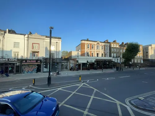
The Bull & Gate
Bar and pub · 1.3 mi
389 Kentish Town Road, London
Mo-We 11:00-23:00; Th-Sa 11:00-24:00; Su 11:00-22:30

The Ice Wharf
Bar and pub · 1.2 mi
Jamestown Road, London
Mo,Tu,We,Su 08:00-23:30; Th 08:00-24:30; Fr,Sa 08:00-25:30

The Oxford Arms
Bar and pub · 1.3 mi
265 Camden High Street, London
Fr-Sa 12:00-02:00; Su-Th 12:00-01:00

The Princess of Wales
Bar and pub · 0.9 mi
22 Chalcot Road, London
Mo-Fr 12:00-00:00; Sa 10:00-00:00; Su 10:00-23:00

The Washington
Bar and pub · 0.4 mi
50 England's Lane, London
Mo-Th 12:00-23:00; Fr 12:00-24:00; Sa 10:00-24:00; Su 12:00-22:30

The Wells Tavern
Bar and pub · 0.8 mi
30 Well Walk, London
Mo-Fr 12:00-23:00; Sa 12:00-23:00; Su 12:00-22:30

Warrington
Bar and pub · 1.5 mi
93 Warrington Crescent, London
Mo-Th 15:00-23:00; Fr 15:00-00:00; Sa 12:00-00:00; Su 12:00-22:30
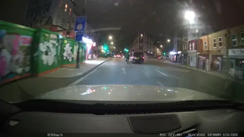
Berberè
Restaurant · Pizza · 1.4 mi
Pizzeria
300 Kentish Town Road, London
Mo-Th,Su 12:00-22:00; Fr-Sa 12:00-22:30
147 more on the map.
History
The name is derived from French bel assis meaning "well situated". The area has many thoroughfares bearing its name: Belsize Avenue, Belsize Court, Belsize Crescent, Belsize Gardens, Belsize Grove, Belsize Lane, Belsize Mews, Belsize Park (the road), Belsize Park Gardens, Belsize Place, Belsize Square, and Belsize Terrace.
The Manor of Belsize dates back to 1317, when as a subdivision to the Manor of Hampstead it was left to the Roman Catholic monks of Westminster Abbey. The original manor consisted of a number of subdivided farms, which were rented out for income. After the Reformation, King Henry VIII returned the estate to the Anglican Dean of Westminster Abbey. By 1600, including the manor house of Belsize House there were at least three other properties on the estate, with diplomat and courtier Sir Isaac Wake (1581 – 1632) having a substantial property built on the west side of the main London to Hampstead road. Inherited by his daughter and her husband, Charles West (1626–1687), the fifth Baron de la Warr, by 1714 it had passed through various hands into the ownership of William Paget, the 6th Baron Paget, who had a substantial formal garden constructed.
Read more of the history
The name Belsize Park comes from the 17th-century manor house and parkland (built by Daniel O'Neill for his wife, the Countess of Chesterfield) which once stood on the site. Rebuilt in 1663, it was sublet by 1721, when the parklands opened as pleasure gardens for those looking to escape the dirt and grime of the City of London, with concerts, singing, dancing and country sports such as fishing and racing. In 1722 magistrates were instructed to act to stop riotous behaviour, although the parkland remained open until 1745. Belsize House was rebuilt in 1746, after which additional large country houses were built on the surrounding farmlands for wealthy lawyers and merchants.
Between 1679 and 1714, the number of houses on the estate had increased from 8 to 14, and by 1808 there were still only 22 recorded. However, the formal division of the estate in 1808 into eight separate parcels of land, based on the structure of the underleases of the estate's formal houses, allowed the church to maximise its income, by allowing additional substantial houses to be built on the lands. This income allowed the church to have Belsize House rebuilt in 1812 for additional letting income. The wealthy leaseholders soon enabled themselves to purchase the freehold from the church, allowing the accelerated development of Belsize as a Victorian country urban suburb of London. One of the new landowners, George Todd, redeveloped what was known as the White House in 1815 as a substantial Georgian stucco villa with portico and two lodges. Known as Belsize House. It was later sold to Matthew Forster (1786–1869), the Whig MP for Berwick-upon-Tweed, as Belsize Lodge; it was demolished in 1937.
Victorian development started along the main London to Hampstead road from 1815 through the works of Edward Bliss, a self-made man who had leased and then bought the Newman's House land, on the west side of Haverstock Hill north of England's Lane. Bliss not only built properties to lease out, but also allowed construction subleases. In 1829 Eton College advertised villa-sized plots on Haverstock Hill. The college then started developing an axis road to Finchley Road, naming it after Queen Adelaide. Development halted in the 1830s due to the proposal for the lines of the London and Birmingham Railway (L&BR) to be built through Belsize Park, but Eton College successfully lobbied for the railway to be tunnelled underground via Primrose Hill, which was then designed and engineered by Robert Stephenson. All the 38 houses on the Newman's House land had been built by 1830.
The passing of the Ecclesiastical Leases Act 1842 allowed all church lands to be let on long term construction leases, which unlocked the accelerated urban development of Belsize Park. The opening in 1851 of Hampstead Road railway station on the L&BR prompted William Lund in 1852 to agree a 99-year construction sublease on the former Forsyth estate. He proposed developments to the west of Haverstock Hill, although his plans were curtailed by construction issues associated with building over both the Pond Street sewer and the L&BR tunnel. In 1852 Charles James Palmer, a Bloomsbury-based solicitor bought the lease of Belsize House. In 1853 he proposed demolition of the main house, with Daniel Tiley taking the lead role in constructing Belsize Square and associated properties. Palmer commissioned architect James Piers St Aubyn to design St Peter's Church. In 1864 the church bought back the lease on the undeveloped backlot of the Bliss lands. Tiley gained agreement from Palmer and Eton College to buy the construction lease from the church, and hence extend development south of Belsize Square to connect with the college's estate. Mimicking the then fashionable styles of Kensington and Bayswater, between 1851 and the late 1860s he built over 250 8-10 bedroom semi-detached stucco houses with large porticos, aimed at the middle classes. The church undertook a similar agreement in 1857, reacquiring full control over the portion of Todd's lease north of Belsize Lane in 1865, and again selling it to Tiley. With construction almost complete, fashion changed and Tiley went bankrupt in 1870.
From the History section of Belsize Park on Wikipedia, under CC BY-SA 4.0.
Where to stay20
Holiday Inn Express Swiss Cottage
Motel and hotel · 0.4 mi
152-156 Finchley Road, London
Churches and places of worship61
Shopping78
Gas and EV charging8
Schools, colleges and libraries42
Healthcare40
Map of Belsize Park
250 places. The map loads OpenStreetMap tiles when you open it.
Getting there and nearby towns
London City Airport (LCY) is the nearest airport with scheduled flights listed in OpenStreetMap, 10 miles away.
- Chalk Farm 1 mi east, about 2 min by car
- Camden Town 1 mi east, about 2 min by car
- Highgate 1 mi northeast, about 2 min by car
- Archway 2 mi northeast, about 3 min by car
- King's Cross 2 mi southeast, about 4 min by car
- London 3 mi southeast, about 5 min by car
- Islington 3 mi east, about 5 min by car
- Highbury 3 mi east, about 5 min by car
- Holborn 3 mi southeast, about 5 min by car
- City of Westminster 4 mi southeast, about 6 min by car
Drive times are estimates from straight-line distance, not routes.
Towns near Belsize Park


Keep exploring
Local news
Headlines from INDB.
Reviews, tips and questions
Loading what members have shared...
Sources and licences
- GeoNames (CC BY 4.0): population, coordinates, regions and time zone
- Mapillary (see each image): photos
- OpenStreetMap contributors (ODbL 1.0): places, airports, map data
- Wikidata (CC0 1.0): elevation, founding date, time zone, website, landmarks and historic places
- Wikimedia Commons (see each image): photos
- Wikipedia (CC BY-SA 4.0): overview and history text
Photo credits
- Baynes Mews, Belsize Park (51586506957), Simon from London, United Kingdom, CC BY 2.0
- Belsize Park Mews (51583922648), Simon from London, United Kingdom, CC BY 2.0
- Colourful Leaves against a White Wall, Belsize Park (51588245005), Simon from London, United Kingdom, CC BY 2.0
- Paddington Bridge1, Chris McKenna ( Thryduulf ), CC BY-SA 4.0
- Mercury Theatre - Ladbroke Road Notting Hill Gate London W11 3BY, Spudgun67, CC BY-SA 4.0
- Grosvenor Square nord, CVB, CC BY-SA 4.0
- Hyde Park Albert Memorial Jan 2006, Diliff, CC BY-SA 3.0
- Jewish Museum London, Graham Hale, CC BY-SA 2.0
- Abbey road studios, portum, CC BY-SA 3.0
- Snowdon Aviary at London Zoo, England-16Aug2009, heena_mistry, CC BY 2.0
- Lords-Cricket-Ground-Pavilion-06-08-2017, Yorkspotter, CC BY-SA 4.0
- Regent's Park London, Tom Page from London, UK, CC BY-SA 2.0
- London - Camden Town by Horst Michael Lechner, Horst Michael Lechner, CC BY-SA 3.0
- Freud Museum London 2, Rup11, CC BY-SA 3.0
- Hampstead Heath entrance south, Sunil060902, CC BY-SA 3.0
- Regent's Park Open Air Theatre Auditorium, TomJAnderson ( talk ), CC BY-SA 3.0
- Camden Arts Centre, London, UK, Camden Arts Centre, CC BY-SA 3.0
- Cyberdog shop 2009, Fenvoe, CC BY 3.0
- Fenton House Hampstead front February 2006, Unknown author, CC BY-SA 2.0
- Hampstead cemetery, Ultrahorse at English Wikipedia, Public domain
- St Augustine's Kilburn4, Cnbrb, CC BY 3.0
- SwissCottageCentral Library20070217, No machine-readable author provided. Andytuna assumed (based on copyright claims)., CC BY-SA 3.0
- Kiln Theatre, QueensOfTheHighRoad, CC BY-SA 4.0
- Crockers Folly, St Johns Wood, NW8 (6982425962), Ewan Munro from London, UK, CC BY-SA 2.0
- Wells Tavern, Hampstead, NW3 (2629997899), Ewan Munro from London, UK, CC BY-SA 2.0
- St John's Wood Chapel, Steve Cadman, CC BY-SA 2.0
- Hampstead Synagogue in 2012, Jim Linwood, CC BY 2.0
- Washington, Belsize Park, NW3 (3905278876), Ewan Munro from London, UK, CC BY-SA 2.0
- Warrington Hotel, Maida Vale, W9 (13583485914), Ewan Munro from London, UK, CC BY-SA 2.0
- Nuffield Lodge, January 2018, No Swan So Fine, CC BY-SA 4.0
- DanishChLondon, Matthew Ross, Public domain
- Cafe Med, St Johns Wood, NW8 (6934376468), Ewan Munro from London, UK, CC BY-SA 2.0
- Church of Our Lady, St John's Wood, London, Jaggery, CC BY-SA 2.0
- 40 College Crescent, Belsize Park, July 2023 01, No Swan So Fine, CC BY-SA 4.0
- Keats Community Library dome, JRennocks, CC BY 4.0
- Everyman, Belsize Park, NW3 (3379581497), Ewan Munro from London, UK, CC BY-SA 2.0
- Odeon, Swiss Cottage, NW3 (8671401551), Ewan Munro from London, UK, CC BY-SA 2.0
- J. Sainsbury's supermarket Camden Road, London, Philafrenzy, CC BY-SA 4.0
- Camden Gardens 2020 front, TheFrog001, CC0
- Hampstead Road Locks (No 1) Regent's Canal Ice Wharf 0881, Photograph by Clem Rutter, Rochester, Kent. ( www.clemrutter.net ). See below, CC BY-SA 3.0
- Princess of Wales, Primrose Hill, NW1, Ewan-M, CC BY-SA 4.0
- The Oxford Arms (6910444734), Tony Hisgett from Birmingham, UK, CC BY 2.0
- Royal-free-5-July-2025, CapabilityTrent, CC0
- The Emslie Horniman Pleasance (2945072572), Steve Cadman from London, U.K., CC BY-SA 2.0
- The Black Lion, Kilburn 2023-09-16, Matt Brown, CC BY 2.0
- Greville Place 4, Dudley Miles, CC BY-SA 4.0
- Tapestry lawn at Avondale Park Summer, Solstice2015, CC BY-SA 4.0
- Swiss Cottage Openspace onto Hampstead Theatre, Isochrone, CC BY-SA 2.0
- Paul Mccartney Roundhouse, Richard from Peterborough, United Kingdom, CC BY 2.0
- Green park (52251426821), Daniel from Glasgow, United Kingdom, CC BY 2.0
- Keystone with pineapple (15626069846), Images George Rex from London, England, CC BY-SA 2.0
- Street-level photo, gness, CC BY-SA 4.0
- Street-level photo, gness, CC BY-SA 4.0
- Street-level photo, erias, CC BY-SA 4.0
- Street-level photo, matth81, CC BY-SA 4.0
- Street-level photo, erias, CC BY-SA 4.0
- Street-level photo, erias, CC BY-SA 4.0
- Street-level photo, erias, CC BY-SA 4.0
- Street-level photo, Semir_Mapillary, CC BY-SA 4.0
- Street-level photo, Semir_Mapillary, CC BY-SA 4.0
- Street-level photo, potaro67v, CC BY-SA 4.0
- Street-level photo, erias, CC BY-SA 4.0
- Street-level photo, domdomegg, CC BY-SA 4.0
- Street-level photo, domdomegg, CC BY-SA 4.0
- Street-level photo, tcoppel, CC BY-SA 4.0
- Street-level photo, laye, CC BY-SA 4.0
- Street-level photo, tcoppel, CC BY-SA 4.0
- Street-level photo, tcoppel, CC BY-SA 4.0
- Street-level photo, domdomegg, CC BY-SA 4.0
- Street-level photo, domdomegg, CC BY-SA 4.0
- Street-level photo, domdomegg, CC BY-SA 4.0
- Street-level photo, domdomegg, CC BY-SA 4.0
- Street-level photo, domdomegg, CC BY-SA 4.0
- Street-level photo, dsmm, CC BY-SA 4.0
- Street-level photo, gness, CC BY-SA 4.0
- Street-level photo, erias, CC BY-SA 4.0
- Street-level photo, erias, CC BY-SA 4.0


Page built November 10, 2026. Spotted a mistake? Tell us or suggest a place.