



Why visit Cwmafan
Townapedia lists 8 museums and landmarks, 6 parks and trails, 30 places to eat, 5 places to stay and 12 attractions in and around town.
Highlights include Aberavon Beach, Gwyn Hall, Craig Ty-Isaf and Neath Castle.
Weather in Cwmafan
Forecast from MET Norway (CC BY 4.0). Full forecast
About Cwmafan
Cwmafan (), also known as Cwmavon, is a large village and community in the Afan valley in Wales, lying within Neath Port Talbot County Borough. It had a population of 5,615 at the 2011 Census. Cwmafan is known for having a high percentage of Welsh speakers. In many ways it is a suburb of the nearby town of Port Talbot which is less than 2 miles (3 km) to the south.
From the Wikipedia article Cwmafan (this version), under CC BY-SA 4.0.
Photos of Cwmafan

Things to do12



Museums and landmarks8

Craig Ty-Isaf
Monument and historic site · 1.7 mi
Hillfort in Neath Port Talbot

Neath Castle
Monument and historic site · 3.8 mi
Castle in Neath, Wales, UK

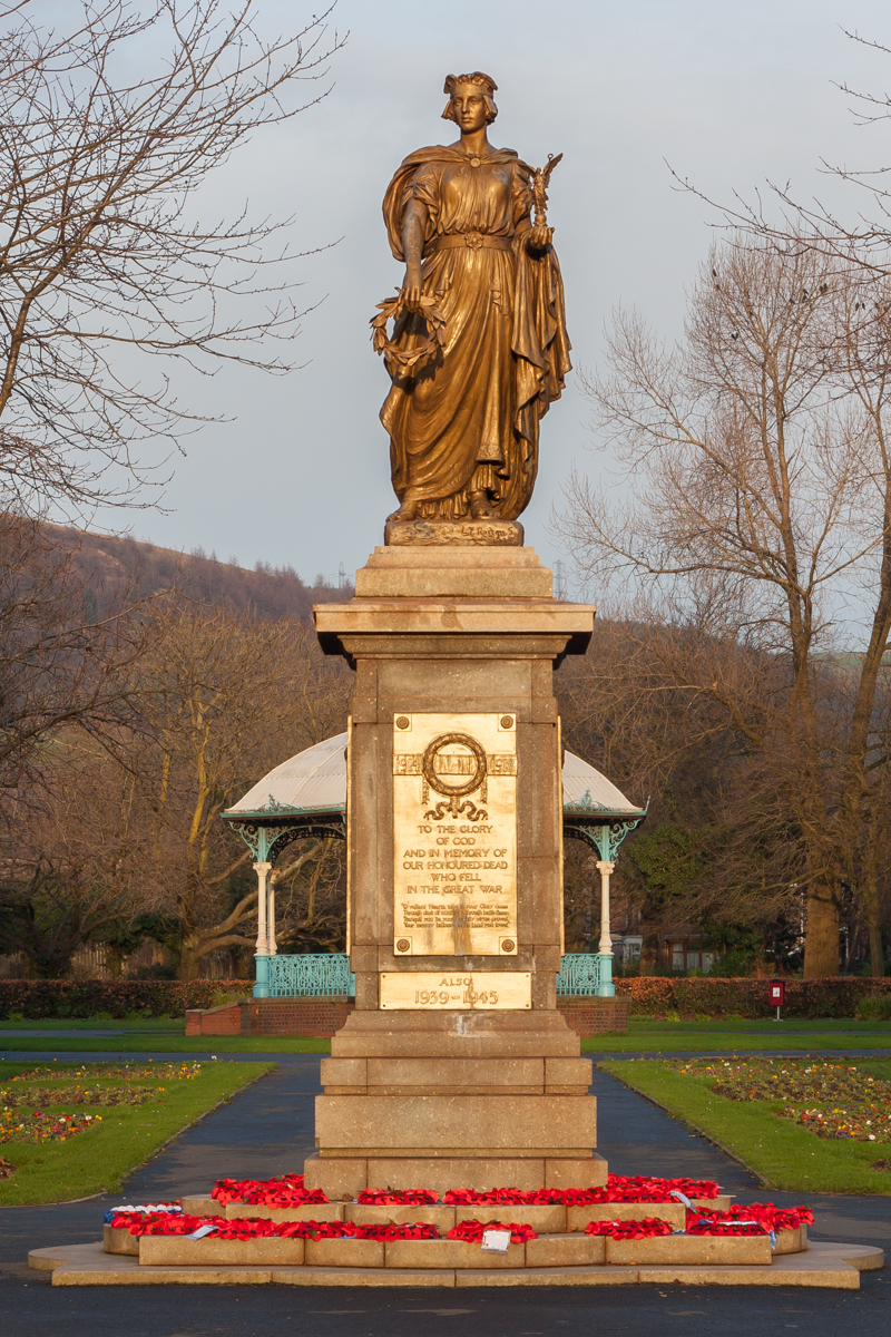
Port Talbot War Memorial
Monument and historic site · 2.1 mi
Grade II* listed building in Neath Port Talbot County Borough

South Wales Miners' Museum
Museum · 3.1 mi
Mining museum in Port Talbot, South Wales


Buarth-y-Gaer
Monument and historic site · 1.2 mi
Archaeological site in United Kingdom
Parks, trails and playgrounds6


Gnoll Estate Country Park
Park · 3.3 mi
Park in the Vale of Neath, Wales
Victoria Gardens, Neath
Park · 3.5 mi
Grade II registered park In Wales

Talbot Athletic Ground
Sports field and stadium · 1.7 mi
Manor Street, Port Talbot
Restaurants and cafes30
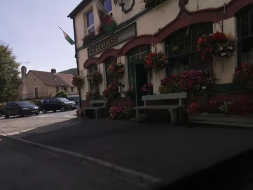
The Colliers
Bar and pub · 1.9 mi
Afan Valley Road, Pontrhydyfen
Mo-Th 11:00-23:00; Fr-Sa 11:00-23:45; Su 11:00-23:00

Pig Iron Tavern
Bar and pub · 1.8 mi
44-46 Station Road, Port Talbot
Mo-Th 11:00-23:00; Fr 10:30-25:00; Sa 11:00-26:00; Su 11:00-22:00

Red Lion
Bar and pub · 1.9 mi
1 Talbot Road, Port Talbot
Mo-Th 12:00-22:00; Fr-Su 12:00-23:00

The Brit
Bar and pub · 0.4 mi
Rhes Llundain, Cwmafan
Jan-Apr Mo off; Tu off; We-Th 12:00-22:00; Fr-Sa 12:00-23:00; Su...
The Lord Caradoc
Bar and pub · 1.8 mi
69-73 Station Road, Port Talbot
Mo-Th 08:00-00:00; Fr-Sa 08:00-25:00; Su 08:00-00:00
Afan Tavern
Bar and pub
Clos Jersey, Cwmafan
Mo-Tu 12:00-22:00; We-Sa 12:00-23:00; Su 12:00-22:00

Forge Tavern
Bar and pub · 1.7 mi
4 Forge Road, Port Talbot
Mo-Su 12:00-21:00
Rolling Mill
Bar and pub · 0.5 mi
Heol Salem, Cwmafan
Mo 18:30-21:00; Tu-We 12:00-24:00; Th 12:00-23:00; Fr 12:00-24:00;...
Afan Ales and Fine Wines
Bar and pub · 1.8 mi
24 Station Road, Port Talbot
Mo-Th 11:00-20:00; Fr-Sa 10:00-23:00; Su 12:00-20:00
Cwmafan RFC Social Club
Bar and pub
Depot Road, Cwmafan
Mo Off; Tu-Fr 19:00-23:00; Sa 14:00-24:00; Su 14:00-23:00

18 more on the map.
History
The village has an industrial history, with metalworking being particularly significant.
There were large copper, iron and tin works as well as many coal mines close by. The metal ores, from as far away as Chile, were off-loaded in Port Talbot or Swansea docks and brought by rail to Cwmafan.
In 1985 the Ynys-y-Gwas bridge suddenly collapsed, cutting off the water supply to the residents. A resident of Maesteg, Paul Barry, escaped unharmed from the incident, despite being on the bridge when it collapsed.
From the History section of Cwmafan on Wikipedia, under CC BY-SA 4.0.
More about Cwmafan
Geography
The village is surrounded by hills: the biggest is Foel Fynyddau, which stands 370 m (1200 ft) high and stands above the northern edge of the village. West of Foel Fynyddau is Mynydd-y-Gaer: at its summit the community boundaries of Cwmafan, Baglan and Briton Ferry all meet. The River Afan runs through the village from north-east to south-west; the village is on the right bank. The area of Ynysygwas lies immediately across the river, Brynbryddan adjoins Cwmafan to the west and Pwllyglaw adjoins Cwmafan to the north-east (ie up the valley). The B4286 road runs through the village along the valley, and the A4107 runs along the valley on the opposite bank.
Arts and culture
The village is also home to several sporting grounds, the most prominent of these being the Welfare Ground, home to Cwmavon RFC who are currently playing in the Welsh Rugby Union leagues. A second rugby union pitch along with a football pitch, tennis courts and bowling green are located at " Parc Siencyn Powell" (Formerly named Parc-y-Llyn), which is administered by Neath Port Talbot County Borough Council.
From the Wikipedia article Cwmafan, under CC BY-SA 4.0.
Notable people from Cwmafan
- William AbrahamWelsh trade unionist (1842–1922)
- Chris NeedsWelsh radio personality and musician
- Lyn JonesWelsh rugby union footballer and coach
- David ThomasWelsh composer, born 1881
- Marc BreezeWelsh rugby union player
- Thomas ParkerWelsh rugby league footballer
- Evan ReesWelsh rugby union and rugby league footballer
- Rees RichardsWelsh rugby union and rugby league footballer
Born in Cwmafan, according to Wikidata (CC0). Each name links to its Wikipedia article.
Where to stay5
Churches and places of worship19
Shopping7
Gas and EV charging1
Schools, colleges and libraries12
St. Joseph's Catholic Comprehensive School
School · Catholic · 1.8 mi
Newton Avenue
Healthcare1
Map of Cwmafan
101 places. The map loads OpenStreetMap tiles when you open it.
Getting there and nearby towns
Swansea Airport (SWS) is the nearest airport with scheduled flights listed in OpenStreetMap, 13 miles away.
- Taibach 2 mi south, about 4 min by car
- Briton Ferry 3 mi west, about 4 min by car
- Neath 4 mi northwest, about 6 min by car
- Maesteg 4 mi east, about 7 min by car
- Clydach 7 mi northwest, about 12 min by car
- Pyle 7 mi south, about 12 min by car
- Resolven 7 mi northeast, about 11 min by car
- Swansea 8 mi west, about 13 min by car
- Aberkenfig 9 mi southeast, about 14 min by car
- Porthcawl 10 mi south, about 16 min by car
Drive times are estimates from straight-line distance, not routes.
Towns near Cwmafan


Keep exploring
Local news
Headlines from INDB.
Reviews, tips and questions
Loading what members have shared...
Sources and licences
- GeoNames (CC BY 4.0): population, coordinates, regions and time zone
- Mapillary (see each image): photos
- OpenStreetMap contributors (ODbL 1.0): places, airports, map data
- Wikidata (CC0 1.0): elevation, founding date, time zone, website, landmarks and historic places
- Wikimedia Commons (see each image): photos
- Wikipedia (CC BY-SA 4.0): overview and history text
Photo credits
- Aberavon Beach view to Swansea Bay, Darren Wyn Rees, CC BY-SA 4.0
- Craig Ty-isaf enclosure, nr Baglan, May 2014 (1), RobinLeicester, CC BY-SA 3.0
- NeathCastleRemains, Darren Wyn Rees at Aberdare Blog, CC BY 3.0
- Port Talbot War Memorial Talbot Park, Sean Pursey, CC BY-SA 3.0
- Afan Forest Park Visitor Centre, Jeremy Bolwell, CC BY-SA 2.0
- Afan Forest Park 1, Purple128, CC BY-SA 3.0
- Ebenezer chapel, Aberavon, Jaggery, CC BY-SA 2.0
- St Joseph's Church front, Port Talbot by Jon K, Jon K., CC BY-SA 2.0 uk
- Holy Cross Church, Port Talbot, Lewis Hulbert, CC BY-SA 4.0
- St Peter's Church, Goytre, Lewis Hulbert, CC BY-SA 4.0
- Pig Iron Tavern, Port Talbot, Sionk, CC BY-SA 4.0
- The Grand Hotel, Port Talbot, Sionk, CC BY-SA 4.0
- The Red Lion, Port Talbot, Sionk, CC BY-SA 4.0
- Hudswell Clarke 1562, hugh llewelyn, CC BY-SA 2.0
- Street-level photo, southglos, CC BY-SA 4.0


Page built November 10, 2026. Spotted a mistake? Tell us or suggest a place.