


Aberkenfig, United Kingdom
Aberkenfig is a town of 10,083 people in Wales, United Kingdom.
Why visit Aberkenfig
Townapedia lists 1 museum or landmark, 4 parks and trails, 30 places to eat, 4 places to stay and 4 attractions in and around town.
Highlights include Old Bridge, Odeon, Bryngarw Country Park and Bridgend Minature Railway.
Weather in Aberkenfig
Forecast from MET Norway (CC BY 4.0). Full forecast
About Aberkenfig
Aberkenfig (Welsh: Abercynffig, meaning "mouth of the Kenfig" (stream)) is a village located in the County Borough of Bridgend, Wales to the north of Bridgend town. It is in the community of Newcastle Higher.
From the Wikipedia article Aberkenfig (this version), under CC BY-SA 4.0.
Things to do4

Old Bridge
Bridge · 2.4 mi
Grade II* listed building in Bridgend County Borough. Bridge in Bridgend, south Wales


Museums and landmarks1

Parks, trails and playgrounds4




Restaurants and cafes30



Mowgli Street Food
Restaurant · Indian · 1.0 mi
McArthur Glen Designer Outlet, Bridgend
18 more on the map.
More about Aberkenfig
Education
Aberkenfig has a Roman Catholic Primary school, St. Robert's, in Dan y Lan, which is in the south of the village. It also has a state primary school, Tondu Primary School—which was originally located in Tondu, but was knocked down and rebuilt in Meadow Street, retaining the name—which is in the north of the village, and Pandy Infant School, which is just off Heol Persondy.
Most comprehensive school children go either to Ynysawdre Comprehensive School, which is located in nearby Tondu, or to the Catholic comprehensive school, Archbishop McGrath Comprehensive School, which was also in Tondu, but is now in Brackla.
Aberkenfig also has a bowling green, and a communal space, the Aberkenfig Welfare Hall. Aberkenfig also has a telephone exchange.
From the Wikipedia article Aberkenfig, under CC BY-SA 4.0.
Notable people from Aberkenfig
- David JonesWelsh cricketer, born 1920
- Valerie MilesWelsh artist (1914–1999)
- Gwyn DaviesWelsh rugby union and rugby league footballer (1908–1992)
- Johnny ThomasWelsh rugby union and rugby league footballer
Born in Aberkenfig, according to Wikidata (CC0). Each name links to its Wikipedia article.
Where to stay4
Churches and places of worship8
Shopping20
Gas and EV charging6
Schools, colleges and libraries10
Pen Y Fai Church in Wales Primary School
School · Church In Wales · 0.9 mi
Heol Eglwys, Bridgend
Healthcare2
Map of Aberkenfig
89 places. The map loads OpenStreetMap tiles when you open it.
Getting there and nearby towns
Cardiff Airport (CWL) is the nearest airport with scheduled flights listed in OpenStreetMap, 15 miles away.
- Coity 2 mi southeast, about 3 min by car
- Bridgend 2 mi south, about 4 min by car
- Pyle 5 mi west, about 8 min by car
- Maesteg 5 mi northwest, about 9 min by car
- Porthcawl 6 mi southwest, about 10 min by car
- Rhondda 10 mi northeast, about 17 min by car
- Llantrisant 10 mi east, about 15 min by car
- Llantwit Major 10 mi southeast, about 16 min by car
- Briton Ferry 11 mi northwest, about 18 min by car
- Pontypridd 12 mi east, about 19 min by car
Drive times are estimates from straight-line distance, not routes.
Towns near Aberkenfig


Keep exploring
Local news
Headlines from INDB.
Reviews, tips and questions
Loading what members have shared...
Sources and licences
- GeoNames (CC BY 4.0): population, coordinates, regions and time zone
- Mapillary (see each image): photos
- OpenStreetMap contributors (ODbL 1.0): places, airports, map data
- Wikidata (CC0 1.0): elevation, founding date, time zone, website, landmarks and historic places
- Wikimedia Commons (see each image): photos
- Wikipedia (CC BY-SA 4.0): overview and history text
Photo credits
- Old Bridge (Yr Hen Bont) Bridgend 2948762 b59f41b8, Chris Andrews, CC BY-SA 2.0
- Bryngarw Country Park, Cafe 2011, Fillius, CC BY-SA 3.0
- Cadbury cocoa ad 1900, Cecil Aldin, Public domain
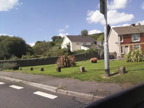
- Street-level photo, southglos, CC BY-SA 4.0
- Street-level photo, southglos, CC BY-SA 4.0
- Street-level photo, southglos, CC BY-SA 4.0
Page built November 10, 2026. Spotted a mistake? Tell us or suggest a place.