




Why visit Darton
Townapedia lists 2 museums and landmarks, 5 parks and trails and 33 places to eat in and around town.
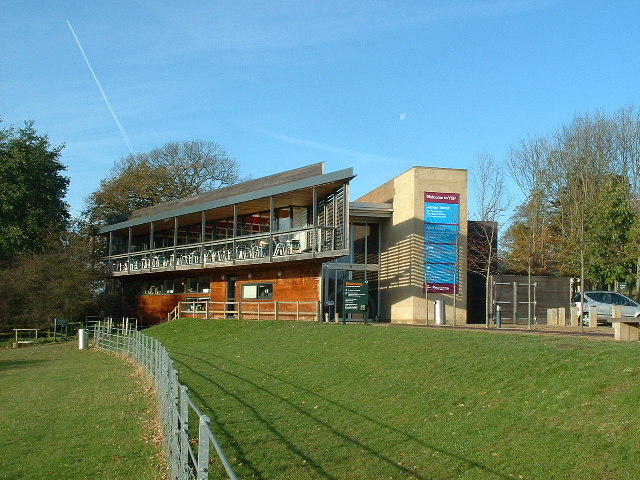
Highlights include Cannon Hall, Penny Pie Park and Yorkshire Sculpture Park.
Weather in Darton
Forecast from MET Norway (CC BY 4.0). Full forecast
About Darton
Darton is a large village in the Metropolitan Borough of Barnsley (part of South Yorkshire), on the border with West Yorkshire, England. At the time of the 2001 UK census, it had a population of 14,927, increasing to 21,345 for both Darton Wards (East & West) at the 2011 Census.
From the Wikipedia article Darton (this version), under CC BY-SA 4.0.
Museums and landmarks2

Cannon Hall
Museum · 2.8 mi
Country house museum in Cawthorne, South Yorkshire, England, United Kingdom

Parks, trails and playgrounds5

Penny Pie Park
Park · 2.5 mi
Park in Barnsley, South Yorkshire, England, United Kingdom

Yorkshire Sculpture Park
Park · 2.6 mi
Sculpture park in West Bretton, Yorkshire, United Kingdom

Restaurants and cafes33




21 more on the map.
Churches and places of worship10

Church In Bretton Park
Church · 2.3 mi
Church building in West Bretton, United Kingdom

Church of All Saints, Silkstone
Church · 3.0 mi
Anglican church in Silkstone, South Yorkshire, England, UK

Church of St John the Baptist
Church · 3.2 mi
On Church Street in Royston, South Yorkshire, England, UK


Church of All Saints
Church
Anglican church in Barnsley, South Yorkshire, England, UK
St Mary's Church
Church · 2.8 mi
Church in Barnsley, South Yorkshire, England, UK
Kexborough Methodist Church
Church · Methodist · 0.8 mi
Churchfield Lane, Barnsley
History
The name Darton is believed to be an amalgamation of "Dearne" and the Anglo-Saxon word "ton" (meaning 'town'). Hence, in ancient times it was known as 'the town on the Dearne'. However, other sources dispute this explanation and claim that the name originates from a description given to a deer enclosure or something similar. In 1086 the hamlet of Dertone was in the wapentake of Staincross.
The hamlet grew to become a village so the Parish of Darton was founded in 1150, when the first church was built. As elsewhere in England, an official register of baptisms, deaths and marriages did not begin until later, in 1539. The parish was historically within the West Riding of Yorkshire and became a part of the former county of South Yorkshire upon its creation in 1974.
From the History section of Darton on Wikipedia, under CC BY-SA 4.0.
More about Darton
Geography
Darton lies on the River Dearne, directly to the east of Kexbrough, and is situated about 1 mile (1.6 km) west of Mapplewell, 5 miles (8 km) north of Barnsley, 9 miles (14 km) south-west of Wakefield, 14 miles (23 km) south-east of Huddersfield, 19 miles (31 km) south of Leeds, and 21 miles (34 km) north of Sheffield. It is served by the A637 road and is bisected by the M1 motorway (junction 38 being a mile to the north). Its location is approximately 53°35′6″N 1°31′57″W, at an elevation of around 260 feet (79 m) above mean sea level.
Education
Darton has its own primary school and a secondary school called Darton Academy actually in Kexborough which opened in 2011. The new building (and rebranded school) replaced Darton High School -previously Darton Hall Senior School - that had been on the site since 1957.
From the Wikipedia article Darton, under CC BY-SA 4.0.
Notable people from Darton
- Dave BoothEnglish football player and manager (born 1948)
- Ian Butlerfootballer (born 1944)
- Jack Graingerfootball player (1924-1983)
- Ken KnightonEnglish footballer and manager (born 1944)
- Michael ClaphamBritish politician (born 1943)
- Alan OgleyFootballer (born 1946)
- Frank Lloydassociation football player (1928-2009)
- Thomas Richard BeaumontBritish politician (1758-1829)
Born in Darton, according to Wikidata (CC0). Each name links to its Wikipedia article.
Shopping3
Gas and EV charging2
Schools, colleges and libraries7
Healthcare5
Map of Darton
67 places. The map loads OpenStreetMap tiles when you open it.
Getting there and nearby towns
Leeds Bradford Airport (LBA) is the nearest airport with scheduled flights listed in OpenStreetMap, 20 miles away.
- Horbury 5 mi north, about 8 min by car
- Penistone 6 mi southwest, about 10 min by car
- Wakefield 7 mi north, about 11 min by car
- Ossett 7 mi north, about 11 min by car
- Hoyland Nether 7 mi southeast, about 11 min by car
- Wombwell 7 mi southeast, about 11 min by car
- Stocksbridge 8 mi south, about 12 min by car
- Mirfield 9 mi northwest, about 15 min by car
- Wath upon Dearne 9 mi southeast, about 15 min by car
- Featherstone 9 mi northeast, about 15 min by car
Drive times are estimates from straight-line distance, not routes.
Towns near Darton


Keep exploring
Local news
Headlines from INDB.
Reviews, tips and questions
Loading what members have shared...
Sources and licences
- GeoNames (CC BY 4.0): population, coordinates, regions and time zone
- OpenStreetMap contributors (ODbL 1.0): places, airports, map data
- Wikidata (CC0 1.0): elevation, founding date, time zone, website, landmarks and historic places
- Wikimedia Commons (see each image): photos
- Wikipedia (CC BY-SA 4.0): overview and history text
Photo credits
- Former Sunday School, Darton, Stephen Craven, CC BY-SA 2.0
- Cannon Hall (Barnsley), Dave Gorman, Public domain
- PennyPiePark 26042015, ChicXulub, CC BY-SA 4.0
- TheYorkshireSculpturePark(NigelHomer)Nov2005, Nigel Homer, CC BY-SA 2.0
- Bretton Chapel, J3Mrs, CC BY-SA 3.0
- All Saints Silkstone, Geoff Pick, CC BY-SA 2.0
- StJohnsRoyston, Chemical Engineer, Public domain
- Darton Church, DaveGorman at English Wikipedia, Public domain
- Darton College, Barnsley - 06062015, ChicXulub, CC BY-SA 4.0

Page built November 10, 2026. Spotted a mistake? Tell us or suggest a place.