


Why visit Deal
Townapedia lists 24 museums and landmarks, 7 parks and trails, 89 places to eat, 7 places to stay and 1 attraction in and around town.
Highlights include Regent Cinema, Deal Castle, Deal Pier and Betteshanger Park.
Weather in Deal
Forecast from MET Norway (CC BY 4.0). Full forecast
About Deal
Deal is a coastal town in Kent, England, which lies where the North Sea and the English Channel meet, 8 miles (13 km) north-east of Dover and 8 miles (13 km) south of Ramsgate. It is a former fishing, mining and garrison town whose history is closely linked to the anchorage in the Downs. Close to Deal is Walmer, a possible location for Julius Caesar's first arrival in Britain.
From the Wikipedia article Deal, Kent (this version), under CC BY-SA 4.0.
Travel tips from other travellers: Deal on Wikivoyage (CC BY-SA 4.0).
Things to do1

Regent Cinema
Cinema and theater
Seaside pavilion in Deal, Kent, England, a former cinema, later bingo hall
Museums and landmarks24


Finglesham Anglo-Saxon cemetery
Monument and historic site · 2.8 mi
Archaeological site in the United Kingdom



Goodwins & Downs 8
Monument and historic site · 1.5 mi
Shipwreck in the English Channel east of Deal, Kent, England, UK
HMS Niger
Monument and historic site · 1.6 mi
1892 Alarm-class torpedo gunboat
Kent Museum of the Moving Image
Museum
Museum in Deal, Kent, England, UK
12 more on the map.
Parks, trails and playgrounds7

Restaurants and cafes89
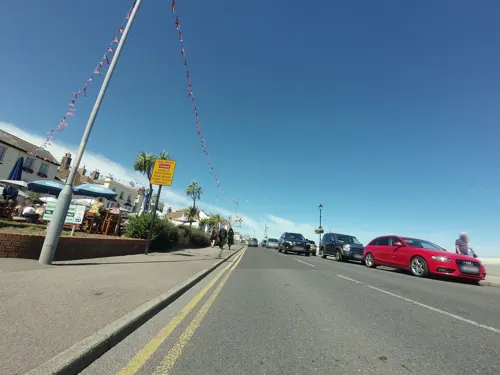
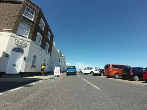
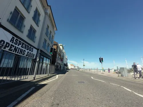

81 Beach Street
Restaurant · Modern European
81 Beach Street, Deal
Mo-Sa 12:00-15:00,18:00-22:00; Su 12:00-17:00,17:45-22:00

The Sir Norman Wisdom
Bar and pub
18-20 Queens Street, Deal
Mo,Tu,We,Th,Su 08:00-24:00; Fr,Sa 08:00-25:00
Ship Inn
Bar and pub
141 Middle Street, Deal
Mo-Sa 11:00-00:00; Su 12:00-00:00
Just Reproach
Bar and pub
14 King Street, Deal
Mo 12:00-15:00,17:00-20:00; Tu-Th 12:00-14:00,17:00-21:00; Fr...

Le Pinardier
Brewery and winery
102 High Street, Deal
We,Th 16:00-23:00; Fr 12:00-23:00; Sa 11:00-23:00; Su 12:00-19:00
77 more on the map.
History
Deal is first mentioned as a village in the Domesday Book of 1086, where it appears as Addelam. It is referred to as Dela in 1158, and Dale in 1275. The name is the Old English dael meaning 'valley', cognate with the modern English 'dale'. Deal developed into a port by the end of the 13th century. In 1495, the town was the site of an attempted landing by the pretender to the English throne Perkin Warbeck. His supporters were driven off by locals loyal to Henry VII at the Battle of Deal, fought on the beach. Sandown, Deal and Walmer castles were constructed around the town by Henry VIII to protect against foreign naval attack.
In 1699 the inhabitants petitioned for incorporation, since previously the town had been under the jurisdiction of Sandwich and governed by a deputy appointed by the mayor of that town; William III by his charter incorporated the town under the title of mayor, jurats and commonalty of Deal. Deal Town Hall, the former meeting place of Deal Borough Council, was completed in 1803.
In the Second World War, 12 people were killed by shelling, from 120 shells.
In 1861, the Royal Marine Depot was established in the town. In 1989, it was bombed by the Provisional Irish Republican Army, killing 11 bandsmen.
Read more of the history
The proximity of Deal's shoreline to the Goodwin Sands has made its coastal waters a source of both shelter and danger through the history of sea travel in British waters. The Downs, the water between the town and the sands, provides a naturally sheltered anchorage. Positioned at the eastern end of the English Channel, this is where sailing vessels would wait for a favourable wind, either to proceed into the North Sea, or, heading to the west, down the Channel. Ships going from London (the largest port in the world for much of the age of sail) to the Channel would leave under a fair wind (largely westerly), would turn south past the North Foreland and then find the same wind to be against them to go any further. (The reverse is true for ships heading for London from the Channel: a westerly wind prevents the last part of their journey.) It was common to find one or two hundred ships waiting for a slight change in wind direction that would allow them to proceed; at times, three hundred or more ships could be windbound in the Downs. When a useful wind shift occurred, those in the anchorage would be hastily weighing anchor and setting sail, whilst some ships heading in the opposite direction might now be entering the Downs to anchor, as the wind had turned against them.
When the port of Sandwich silted up, the only way to provide ships in the Downs with fresh provisions, stores and equipment was in boats launched directly from the beach. This was an extensive trade for Deal, and lasted until steam ships took over from sail. Deal also provided a convenient landing place for passengers for London, potentially saving a long wait for a fair wind to finish a voyage; it also allowed outward bound ships to be caught up with and joined.
One problem with the Downs was the quality of the holding ground of the anchorage. It consists of chalk, which is not the best material. Hence it was common for ships in the roadstead to drag their anchors in strong winds, especially those from north round to east northeast or from the southeast, as these directions were less sheltered. This provided salvage work as an additional source of income for the town, with many ships being saved by help from the boatmen.
The importance of the Downs started to reduce from the late 1860s, as competition from steamships made speed an important commercial consideration. Sailing ships began to employ tugs to overcome adverse winds. By the 1880s, the only common usage of the anchorage was by small sailing vessels.
Deal was, for example, visited by Lord Nelson and was the first English soil on which James Cook set foot in 1771 on returning from his first voyage to Australia. The anchorage is still used today by international and regional shipping, though on a scale far smaller than in former times (some historical accounts report hundreds of ships being visible from the beach).
In 1672, a small Naval Yard was established at Deal, providing stores and minor repair facilities. Just outside the gates of the yard there is now a building originally used as a semaphore tower planned to be used as a communication link to the Admiralty in London but converted to a timeball tower, in 1855 and which remains today as a museum.
The Deal Maritime and Local History Museum is housed in an historic complex of light-industrial buildings in St George's Road, dating from 1803. It contains a series of displays and artefacts, narrating the town's maritime, industrial, domestic and leisure history.
The Deal boatmen were internationally famous for their skilled seamanship and bravery in operating their locally-built craft, launching and recovering from the open beach. Only the severest weather prevented the larger of the working boats from being able to launch. A range of work was done, with provisions and supplies being taken out to ships anchored in the Downs, and the Post Office paying for mail to be taken out or landed. Ballast (in the form of shingle loaded from the beach) would be sold. Passengers were taken to and from moored ships. It was not unusual for a ship in the Downs to lose her anchor – either slipping the cable in an emergency or if a cable or anchor chain parted, thereby providing two sources of work for the boatmen.
First, the Downs had to be kept as clear as possible of the obstruction that lost gear presented, otherwise the anchors of other ships could become entangled in them and prevent weighing. In 1607, two boatmen were awarded £30 a year for sweeping for and recovering lost anchors, with substantial numbers being salvaged. In the three years from 1866, over 600 anchors were swept up from the Downs – at that time the Board of Trade paid for this to be done.
From the History section of Deal, Kent on Wikipedia, under CC BY-SA 4.0.
Notable people from Deal
 Elizabeth CarterEnglish poet and polymath (1717 – 1806)Photo: John Fayram, Public domain
 John HulkeBritish geologist and surgeon (1830–1895)Photo: Unknown author Unknown author, Public domain
 James ArbuthnotBritish politician and life peer (born 1952)Photo: ©House of Lords / photography by Roger Harris, CC BY 3.0
 Edward MillenAustralian journalist and politician (1860-1923)Photo: Alice Mills (1870-1929), Public domain
 Stephen ChidwickBritish poker playerPhoto: World Poker Tour, CC BY 3.0
 Alan PattersonBritish athlete (1886-1916)Photo: Unknown author Unknown author, Public domain
- Frank DaneBritish actor of the silent era (1885-1957)
- Neil StukeBritish actor
- David FullerBritish murderer and necrophile
- Linda Ann Martinfencer
- John Stanton Fleming MorrisonBritish golf course architect (1892-1961)
- Bruce MontagueBritish actor
Born in Deal, according to Wikidata (CC0). Each name links to its Wikipedia article.
Where to stay7
Churches and places of worship18
Shopping25
Gas and EV charging3
Schools, colleges and libraries11
Healthcare8
Map of Deal
193 places. The map loads OpenStreetMap tiles when you open it.
Getting there and nearby towns
Manston Airport (MSE) is the nearest airport with scheduled flights listed in OpenStreetMap, 9 miles away.
- Saint Peters 10 mi north, about 16 min by car
- Herne Bay 16 mi northwest, about 25 min by car
- Hythe 17 mi southwest, about 28 min by car
- Whitstable 19 mi northwest, about 30 min by car
- Faversham 23 mi west, about 37 min by car
- Sheerness 31 mi northwest, about 51 min by car
- Southend-on-Sea 37 mi northwest, about 59 min by car
- Maidstone 38 mi west, about 1 h by car
- Gillingham 39 mi west, about 1 h by car
- Rochford 39 mi northwest, about 1 h by car
Drive times are estimates from straight-line distance, not routes.
Towns near Deal


Keep exploring
Local news
Headlines from INDB.
Reviews, tips and questions
Loading what members have shared...
Sources and licences
- GeoNames (CC BY 4.0): population, coordinates, regions and time zone
- Mapillary (see each image): photos
- OpenStreetMap contributors (ODbL 1.0): places, airports, map data
- Wikidata (CC0 1.0): landmarks and historic places
- Wikimedia Commons (see each image): photos
- Wikipedia (CC BY-SA 4.0): overview and history text
Photo credits
- Deal library (50244796763), JuliaC2006 from Rochester, UK, CC BY 2.0
- The Finglesham Buckle at the Ashmolean Museum, Ethan Doyle White, CC BY-SA 4.0
- Walmer Castle aerial view, Lieven Smits, CC BY-SA 3.0
- St Mary's Walmer 1, Josh Tilley, CC BY-SA 4.0
- Deal Castle Front, JimRussell, CC BY-SA 4.0
- Deal Castle Aerial View, Lieven Smits, CC BY-SA 3.0
- Old St Mary's Church Walmer 1, Josh Tilley, CC BY-SA 4.0
- Deal Pier shore end high aerial Aug 2026, Scribwik, CC0
- Street-level photo, tallguy, CC BY-SA 4.0
- Street-level photo, tallguy, CC BY-SA 4.0
- Street-level photo, tallguy, CC BY-SA 4.0
- Street-level photo, tallguy, CC BY-SA 4.0
- Street-level photo, tallguy, CC BY-SA 4.0
- Street-level photo, tallguy, CC BY-SA 4.0
- Street-level photo, tallguy, CC BY-SA 4.0
- Street-level photo, tallguy, CC BY-SA 4.0

Page built November 10, 2026. Spotted a mistake? Tell us or suggest a place.