


Wood Street Village, United Kingdom
Wood Street Village is a town of 1,619 people in England, United Kingdom.
Why visit Wood Street Village
Townapedia lists 8 museums and landmarks, 19 parks and trails, 4 places to eat and 6 attractions in and around town.
Highlights include Electric Theatre, Yvonne Arnaud Theatre, Guildford Castle and Guildford House.
Weather in Wood Street Village
Forecast from MET Norway (CC BY 4.0). Full forecast
About Wood Street Village
Wood Street Village is a clustered and linear village in Surrey, England with a village green, buffered by Metropolitan Green Belt on all sides. It is centred 3 miles (4.8 km) west of Guildford and is part of the civil parish of Worplesdon (where the 2011 Census population was included), as well as continuing to be served semi-dependently as a chapelry of the Church of England.
From the Wikipedia article Wood Street Village (this version), under CC BY-SA 4.0.
Things to do6

Electric Theatre
Cinema and theater · 2.8 mi
Theatre in Guildford, England

Yvonne Arnaud Theatre
Cinema and theater · 2.9 mi
Theatre in Guildford, England

Museums and landmarks8

Guildford Castle
Museum · 3.0 mi
Castle in Guildford, Surrey, England, UK
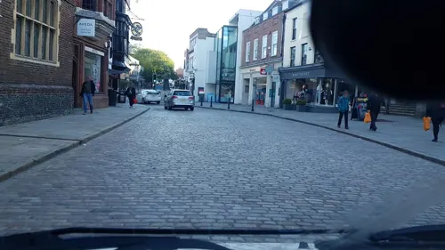
Guildford House
Museum · 3.0 mi
House in Guildford, Surrey, England, UK
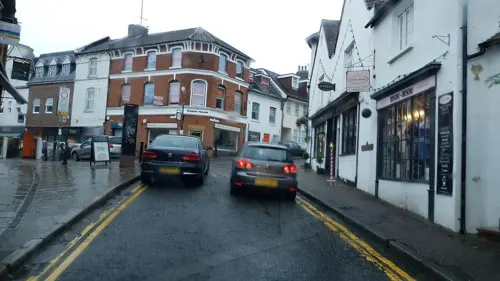
Guildford Museum
Museum · 3.0 mi
Local museum in Guildford, England, United Kingdom

Lewis Elton Gallery
Museum · 2.1 mi
Art gallery at the University of Surrey's Guildford campus

Loseley Park
Museum · 2.8 mi
Grade I listed historic house museum in Artington, United Kingdom


Parks, trails and playgrounds19

Burner's Heath and Swallows Pond
Park · 2.6 mi
Nature reserve in Pirbright in Surrey, South East England



Littlefield Common
Hiking and trails · 1.0 mi
Nature reserve south-west of Worplesdon in Surrey, England

7 more on the map.
Restaurants and cafes4
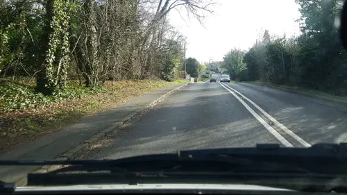
Cricketers
Bar and pub · 1.4 mi
A real ale pub that also serves meals
Aldershot Road, Guildford
12:00-23:00


History
The earliest known settlement in the area was a Roman villa, dating to the third century, on the extreme eastern edge of the village, discovered in 1824. The find was unexpected as it is a long way from the nearest Roman settlement and on poor land for arable farming. In the medieval period the area was part of the Windsor Forest. Known as Guildford Park, it was hunting grounds for the King when he was in residence at Windsor Castle. From around the 14th Century, sheep farming became the main occupation in the area.
There are a large minority of pre-20th century houses in the village; Wood Street Village has farmhouses which date from the 15th and 16th centuries. Littlefield Manor, in the mid-category of architectural listing Grade II* joins with neighbouring Whipley Manor as one of two similarly sized farms, but which were once larger manors, the history of which is well documented by its many returns such as the Feet of Fines kept by the central government. Historically these records were kept at the Palace of Westminster but today are held at the National Archives (UK) and their contents are summarised in such works as the Victoria County History.
Wood Street School opened in 1878 and the Victorian part still stands.
From the History section of Wood Street Village on Wikipedia, under CC BY-SA 4.0.
More about Wood Street Village
Geography
The village is nucleated in layout but with a linear part to the north-west and east and more than half of its land consists of cultivated fields or woodland, in the south and along the banks of its two main brooks, which flow north to eventually join the River Wey. The centre of Guildford is 3 miles (4.8 km) to the east.
Elevations range from 67 metres (220 ft) in the north and west to 38 metres (125 ft) Above Ordnance Datum (sea level) in the far north. The soil is rich in humus with a mixed subsoil of clay and loamy soil interspersed with small amounts of sandier soil in the uninhabited highest patches.
From the Wikipedia article Wood Street Village, under CC BY-SA 4.0.
Churches and places of worship11
Shopping2
Schools, colleges and libraries7
Healthcare5
Map of Wood Street Village
62 places. The map loads OpenStreetMap tiles when you open it.
Getting there and nearby towns
Farnborough Airport (FAB) is the nearest airport with scheduled flights listed in OpenStreetMap, 6 miles away.
- Normandy 2 mi west, about 3 min by car
- Guildford 3 mi east, about 5 min by car
- Mayford 4 mi northeast, about 7 min by car
- Godalming 5 mi south, about 7 min by car
- Aldershot 5 mi west, about 9 min by car
- Chilworth 5 mi southeast, about 8 min by car
- Woking 6 mi northeast, about 9 min by car
- Farnborough 6 mi northwest, about 10 min by car
- Frimley 7 mi northwest, about 11 min by car
- Farnham 8 mi west, about 12 min by car
Drive times are estimates from straight-line distance, not routes.
Towns near Wood Street Village


Keep exploring
Local news
Headlines from INDB.
Reviews, tips and questions
Loading what members have shared...
Sources and licences
- GeoNames (CC BY 4.0): population, coordinates, regions and time zone
- Mapillary (see each image): photos
- OpenStreetMap contributors (ODbL 1.0): places, airports, map data
- Wikidata (CC0 1.0): elevation, founding date, time zone, website, landmarks and historic places
- Wikimedia Commons (see each image): photos
- Wikipedia (CC BY-SA 4.0): overview and history text
Photo credits
- Electric Theatre, Guildford, Weydonian ( talk ), CC BY 3.0
- Yvonne Arnaud Theatre View 2016, Jack1956, CC0
- Guildford castle 1, SuzanneKn at English Wikipedia, Public domain
- Lewis Elton Gallery, Murgatroyd49, CC BY-SA 4.0
- Loseley Park 03, Andrew Wilkinson from London, CC BY-SA 2.0
- Watts Gallery (Restored), ©Watts Gallery, CC BY-SA 3.0
- Burner's Heath and Swallows Pond 4, Dudley Miles, CC BY-SA 4.0
- Middlebriars Wood (5), Dudley Miles, CC BY-SA 4.0
- Riverside Park, Guildford, view of the lake, AndyScott, CC BY-SA 4.0
- Surrey county show 20040531, SGBailey, CC BY-SA 3.0
- St Edward the Martyr Orthodox Church, Brookwood Cemetery, Brookwood (June 2015) (2), Hassocks5489, CC0
- Compton, Surrey. Church of St. Nicholas DSC 2785 edited-1, Ainslie, CC BY-SA 3.0
- St Peter's Church, Ash Church Road, Ash (May 2014) (2), Hassocks5489, CC0
- Guildford Holy Trinity fr NE GeoUK 2639999, Paul Gillett, CC BY-SA 2.0
- St Mary's Church, Quarry Street, Guildford (April 2014) (1), Hassocks5489, CC0
- St Nicholas' Church, Bury Street, Guildford (April 2014, from Northwest) (1), Hassocks5489, CC0
- UniSSoM, Mark Boyce, CC BY-SA 3.0
- St Alban's Church, Wood Street Village, Guildford (April 2014, from South-Southeast) (2), Hassocks5489, CC0
- Street-level photo, richardc, CC BY-SA 4.0
- Street-level photo, richardc, CC BY-SA 4.0
- Street-level photo, richardc, CC BY-SA 4.0
- Street-level photo, richardc, CC BY-SA 4.0
- Street-level photo, richardc, CC BY-SA 4.0
- Street-level photo, richardc, CC BY-SA 4.0
- Street-level photo, swinetown, CC BY-SA 4.0
- Street-level photo, richardc, CC BY-SA 4.0
- Street-level photo, swinetown, CC BY-SA 4.0


Page built November 10, 2026. Spotted a mistake? Tell us or suggest a place.