


Denby Dale, United Kingdom
Denby Dale is a town of 3,043 people in England, United Kingdom.
Why visit Denby Dale
Townapedia lists 4 museums and landmarks, 4 parks and trails, 34 places to eat, 1 place to stay and 3 attractions in and around town.
Highlights include Penistone Railway Viaduct on Penistone and Denby Dale Line, Parkhouse Fresh Produce and Cannon Hall.
Weather in Denby Dale
Forecast from MET Norway (CC BY 4.0). Full forecast
About Denby Dale
Denby Dale is a village and civil parish in the metropolitan borough of Kirklees in West Yorkshire, England. It is 8 miles north-west of Barnsley and 10 miles south-east of Huddersfield.
From the Wikipedia article Denby Dale (this version), under CC BY-SA 4.0.
Things to do3

Penistone Railway Viaduct on Penistone and Denby Dale Line
Bridge · 3.3 mi
Railway viaduct in Penistone, Barnsley, South Yorkshire, England, UK
Parkhouse Fresh Produce
Farm and orchard · 1.5 mi
29 Huddersfield Road, Sheffield
sunrise-sunset

Museums and landmarks4

Cannon Hall
Museum · 2.8 mi
Country house museum in Cawthorne, South Yorkshire, England, United Kingdom

Skelmanthorpe Textile Heritage Centre
Museum · 1.4 mi
6 Queen Street, Huddersfield

Parks, trails and playgrounds4



Restaurants and cafes34
Hide & Hoof
Restaurant · Regional · 1.3 mi
Delph House Farm, Huddersfield
Mo-Fr 09:00-16:00; Sa,Su 09:00-17:00
Yummy Yorkshire Ice Cream Company
Ice cream · 1.3 mi
Delph House Farm, Huddersfield
Mo-Fr 09:00-16:00; Sa,Su 09:00-17:00
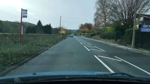

The George
Bar and pub · 0.7 mi
114 Denby Lane, Huddersfield
Mo 15:30-20:00; Tu,Th 15:30-21:00; We 15:30-21:30; Fr 12:00-22:30;...
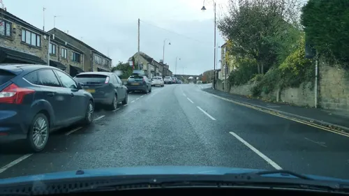
Jo's Kitchen
Cafe
378 Wakefield Road, Huddersfield
Mo-Fr 09:00-16:00; Sa 09:00-14:00; Su 10:00-14:00
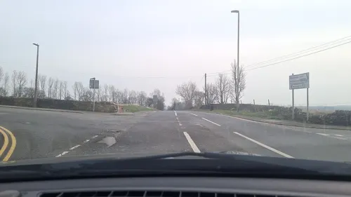

The Fountain Village Pub & Kitchen
Bar and pub · 1.5 mi
Wellthorne Lane, Sheffield
Tu 17:00-23:00; We-Su 12:00-23:00

Chi Chini
Restaurant · Pizza · 1.4 mi
49 Commercial Road, Huddersfield

22 more on the map.
History
Historically Denby Dale is part of the West Riding of Yorkshire in the Wapentake of Staincross. The Wapentake almost corresponds with the current Barnsley Metropolitan Area, although a few settlements and townships within the Staincross Wapentake such as Denby Dale were put outside the Metropolitan Borough of Barnsley and now lie within the current West Yorkshire Metropolitan Area since April 1974.
First recorded as Denby Dyke, before the Industrial Revolution the village was sparsely populated with a small textile industry at the crossroads of the Barnsley to Shepley Lane Head and the Wakefield to Denby Dale roads. Within 25 years, factories and mills had been built and had a railway station on the Penistone Line. Denby Dale provided the textile industry with raw materials, coal, and transportation. Silk for the Queen Mother's wedding dress was made at Springfield Mill. With the economy flourishing, the population increased and the village grew.
In 1674, the Denby Petition, created by Nathan Staniforth, then headteacher of Penistone Grammar School, was signed by over 50 residents of Denby, in defence of Susanna Hinchcliffe and Anne Shillitoe against charges of witchcraft.
From the History section of Denby Dale on Wikipedia, under CC BY-SA 4.0.
More about Denby Dale
Education
Denby Dale First and Nursery school (formerly known as Gilthwaites First School and Denby Dale Nursery) provides education from aged 2 to aged 10.
Denby Church of England Voluntary Aided First School is a voluntary aided primary school associated with the Church of England in Upper Denby. The school has two classes, infants and juniors, with the infants running through years reception to year 2 and the juniors running through the years 3 to 5. At the turn of the millennium, there were around 40 to 50 pupils in the school.
From the Wikipedia article Denby Dale, under CC BY-SA 4.0.
Notable people from Denby Dale
 Daniel KitsonEnglish stand-up comedian and writer (born 1977)Photo: Lighthouselady, CC BY-SA 4.0
- Paul CopleyBritish actor
- Tommy AllottBritish speedway rider
Born in Denby Dale, according to Wikidata (CC0). Each name links to its Wikipedia article.
Where to stay1
Churches and places of worship10
Parish Church of Saint Aidan
Church · Anglican · 1.2 mi
Radcliffe Street, Huddersfield
Shopping5
Schools, colleges and libraries7
Denby Church of England Voluntary Aided First School
School · Anglican · 0.8 mi
Denby Lane, Huddersfield
Healthcare2
Map of Denby Dale
70 places. The map loads OpenStreetMap tiles when you open it.
Getting there and nearby towns
Leeds Bradford Airport (LBA) is the nearest airport with scheduled flights listed in OpenStreetMap, 21 miles away.
- Upper Cumberworth 1 mi west, about 2 min by car
- Scissett 2 mi northeast, about 3 min by car
- Penistone 3 mi south, about 6 min by car
- Emley 3 mi north, about 5 min by car
- Millhouse Green 3 mi south, about 5 min by car
- Flockton 4 mi north, about 7 min by car
- Silkstone 4 mi southeast, about 7 min by car
- Holmfirth 5 mi west, about 9 min by car
- Darton 6 mi east, about 9 min by car
- Huddersfield 7 mi northwest, about 12 min by car
Drive times are estimates from straight-line distance, not routes.
Towns near Denby Dale


Keep exploring
Local news
Headlines from INDB.
Reviews, tips and questions
Loading what members have shared...
Sources and licences
- GeoNames (CC BY 4.0): population, coordinates, regions and time zone
- Mapillary (see each image): photos
- OpenStreetMap contributors (ODbL 1.0): places, airports, map data
- Wikidata (CC0 1.0): elevation, founding date, time zone, website, landmarks and historic places
- Wikimedia Commons (see each image): photos
- Wikipedia (CC BY-SA 4.0): overview and history text
Photo credits
- Penistone - Viaduct, Dave Bevis, CC BY-SA 2.0
- Cannon Hall (Barnsley), Dave Gorman, Public domain
- St Aiden's Church, Skelmanthorpe, Betty Longbottom, CC BY-SA 2.0
- St Nicholas' Church, Upper Cumberworth, Gordon Hatton, CC BY-SA 2.0
- St John's Church, Upper Denby, Peter Moore, CC BY-SA 2.0
- The George, Upper Denby (3950766333), Tim Green from Bradford, UK, CC BY 2.0
- Street-level photo, cuttlebug, CC BY-SA 4.0
- Street-level photo, mappo2, CC BY-SA 4.0
- Street-level photo, mappo2, CC BY-SA 4.0
- Street-level photo, cuttlebug, CC BY-SA 4.0
- Street-level photo, cuttlebug, CC BY-SA 4.0
- Street-level photo, mappo2, CC BY-SA 4.0
- Street-level photo, mappo2, CC BY-SA 4.0
- Street-level photo, cuttlebug, CC BY-SA 4.0
- Street-level photo, cuttlebug, CC BY-SA 4.0
- Street-level photo, cuttlebug, CC BY-SA 4.0
- Street-level photo, mappo2, CC BY-SA 4.0
- Street-level photo, mappo2, CC BY-SA 4.0
- Street-level photo, cuttlebug, CC BY-SA 4.0
- Street-level photo, cuttlebug, CC BY-SA 4.0
- Street-level photo, cuttlebug, CC BY-SA 4.0
Page built November 10, 2026. Spotted a mistake? Tell us or suggest a place.