


Dewsbury, United Kingdom
Dewsbury is a town of 61,035 people in England, United Kingdom.
Why visit Dewsbury
Townapedia lists 4 museums and landmarks, 16 parks and trails, 80 places to eat, 2 places to stay and 2 attractions in and around town.
Highlights include Ledgard Bridge, Bagshaw Museum, Dewsbury Bus Museum and Crow Nest Park.
Weather in Dewsbury
Forecast from MET Norway (CC BY 4.0). Full forecast
About Dewsbury
Dewsbury is a market town in the Metropolitan Borough of Kirklees, West Yorkshire, England. It is sited on the River Calder and on an arm of the Calder and Hebble Navigation waterway. It lies to the west of Wakefield, east of Huddersfield and south of Leeds. Historically a part of the West Riding of Yorkshire, after undergoing a period of major growth in the 19th century as a mill town, Dewsbury went through a period of decline.
From the Wikipedia article Dewsbury (this version), under CC BY-SA 4.0.
Photos of Dewsbury

Things to do2

Ledgard Bridge
Bridge · 3.1 mi
Grade II listed bridge in Mirfield, Kirklees, West Yorkshire, England, UK

Museums and landmarks4
Bagshaw Museum
Museum · 2.7 mi
Local museum in Batley, West Yorkshire, United Kingdom

Dewsbury Bus Museum
Museum · 1.7 mi
Bus museum in Ravensthorpe, West Yorkshire, England

National Coal Mining Museum for England
Museum · 3.3 mi
Coal mining museum in Yorkshire, England, United Kingdom

The Unknown Warrior
Monument and historic site · 0.7 mi
Crow Nest Park Boer War Memorial
Parks, trails and playgrounds16

Crow Nest Park
Park · 0.8 mi
Green Flag public park in Yorkshire, England, UK

Ponderosa Zoo
Park · 1.7 mi
Zoo in Heckmondwike, West Yorkshire, England



Wilton Park, Batley
Park · 2.6 mi
A public park in West Yorkshire, England


4 more on the map.
Restaurants and cafes80
West Riding Licensed Refreshment Rooms
Bar and pub
Wellington Road, Dewsbury
Mo-Th,Su 10:00-23:00; Fr-Sa 10:00-24:00

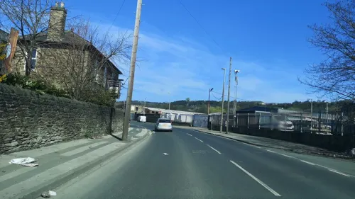
The Leggers Inn
Bar and pub · 0.5 mi
Mill Street East, Dewsbury
Mo-We 12:00-20:00; Th-Sa 12:00-22:00; Su 12:00-21:00


The Grand Banqueting Suite
Restaurant · 1.5 mi
Yorkshire's Leading provider of Premium Asian Wedding Services. Call 24/7 on 0785 22 88 540
549 Huddersfield Road, Dewsbury
24/7
Royal King Grill
Restaurant · Indian
South Street, Dewsbury
Su-Th 16:30-23:00; Fr-Sa 16:30-24:00

Cellar Bar
Bar and pub · 1.3 mi
51 Station Road, Batley
Mo-We 16:00-22:00, Th 16:00-22:30, Fr 12:00-23:00, Sa 11:00-24:00,...
68 more on the map.
History
The Domesday Book of 1086 records the name as Deusberie, Deusberia, Deusbereia, or Deubire, literally "Dewi's fort", Dewi being an old Welsh (native British) name (equivalent to David) and "bury" coming from the old English word "burh", meaning fort.
Other, less supported, theories exist as to the name's origin. For example, that it means "dew hill", from Old English dēaw (genitive dēawes), "dew", and beorg, "hill" (because Dewsbury is built on a hill). It has been suggested that dēaw refers to the town's proximity to the water of the River Calder.
In the past other origins were proposed, such as "God's fort", from Welsh Duw, "God". "Antiquarians supposed the name, Dewsbury, to be derived from the original planter of the village, Dui or Dew, who … had fixed his abode and fortified his "Bury". Another conjecture holds, that the original name is Dewsborough, or God's Town" (1837)
In Anglo-Saxon times, Dewsbury was a centre of considerable importance. The ecclesiastical parish of Dewsbury encompassed Huddersfield, Mirfield and Bradford. Ancient legend records that in 627 Paulinus, the Bishop of York, preached here on the banks of the River Calder. Numerous Anglian graves have been found in Dewsbury and Thornhill.
Read more of the history
Dewsbury Minster lies near the River Calder, traditionally on the site where Paulinus preached. Some of the visible stonework in the nave is Saxon, and parts of the church also date to the 13th century. The tower houses "Black Tom", a bell which is rung each Christmas Eve, one toll for each year since Christ's birth, known as the "Devil's Knell", a tradition dating from the 15th century. The bell was given by Sir Thomas de Soothill, in penance for murdering a servant boy in a fit of rage. The tradition was commemorated on a Royal Mail postage stamp in 1986.
In the Domesday Book of 1086, Dewsbury was in Morley wapentake, but with a recorded population of only nine households it was a relatively small settlement at that time. The Agbrigg and Morley wapentakes were administratively combined into the Agbrigg and Morley wapentake in the 13th century. When they were separated for administrative purposes in the mid-19th century, Dewsbury parish had grown to straddle the border between both wapentakes, hence being mainly in the Lower Division of the Wapentake of Agbrigg.
Dewsbury market was established in the 14th century for local clothiers. Occurrences of the plague in 1593 and 1603 closed the market and it reopened in 1741.
Throughout the Middle Ages, Dewsbury retained a measure of importance in ecclesiastical terms, collecting tithes from as far away as Halifax in the mid-14th century. John Wesley visited the area five times in the mid-18th century, and the first Methodist Society was established in 1746. Centenary Chapel on Daisy Hill commemorates the centenary of this event, and the Methodist tradition remained strong in the town.
In 1770, a short branch of the Calder and Hebble Navigation was completed, linking Dewsbury to the canal system giving access to Manchester and Hull. By the time of the Industrial Revolution, Dewsbury was a centre for the shoddy and mungo industries which recycled woollen items by mixing them with new wool and making heavy blankets and uniforms. The town benefited economically from the canal, its location at the heart of the Heavy Woollen District, and its proximity to coal mines. The railway arrived in 1848 when Dewsbury Wellington Road railway station on the London and North Western Railway opened. This is the only station which remains open.
Other stations were Dewsbury Central on the Great Northern Railway which closed in 1964 and Dewsbury Market Place on the Lancashire and Yorkshire Railway which closed in 1930. A fourth goods-only railway station was built in the early 20th century at Savile Town by the Midland Railway. In 1985 a bypass road was built on the site of Central Station and its adjacent viaduct, and nothing remains of Market Place railway station. The 19th century saw a great increase in population, rising from 4,566 in 1801 to around 30,000 by 1890.
The town's rapid expansion and commitment to industrialisation resulted in social instability. In the early 19th century, Dewsbury was a centre of Luddite opposition to mechanisation in which workers retaliated against the mill owners who installed textile machinery and smashed the machines which threatened their way of life. In the 1830s, Dewsbury was a centre of Chartist agitation. In August 1838, after a speech by Chartist leader Feargus O'Connor, a mob of between five and seven thousand people besieged the Dewsbury Poor Law Guardians in the town's Royal Hotel. The mob was dispersed by troops.
Trouble flared in 1840 when radical agitators seized control of the town, and troops were stationed to maintain order. This radical tradition left a legacy in the town's political life: its first elected Member of Parliament (MP) in 1867 was John Simon, a Jewish lawyer from Jamaica and a Liberal. The tradition of firing the "Ten o'Clock" gun dates from 1815 and was a hangover from the Luddite problems. It was fired from Wormald and Walker's Mill to reassure that all was well, and could be heard all over the area. Eventually the actual gun was replaced with a specially made firework, but the tradition was discontinued in 1983 with the closure of the mill.
The mills were family businesses and continued manufacturing after the wool crisis in 1950–51, which saw Australian sheep farmers begin to charge higher prices. The recovery of the late 1960s was reversed by the 1973 oil crisis, and the textile industry in Dewsbury declined, with only bed manufacturing remaining a large scale employer.
Significant immigration from the 1960s onwards left a huge demographic impact on the town, which continues today. Asian British and Muslims now make up roughly 45 percent of the population, and the percentage is expected to grow in the coming years.
From the History section of Dewsbury on Wikipedia, under CC BY-SA 4.0.
More about Dewsbury
Geography
Dewsbury is situated between Leeds and Bradford 8 miles (13 km) to the north, Huddersfield a similar distance to the south west, and Wakefield 6 mi (10 km) east. Its proximity to these major urban centres, the M1 and M62 motorways and its position on the Huddersfield Line, served by the TransPennine Express, have contributed to its growth.
Dewsbury is part of the West Yorkshire Urban Area, although its natural boundaries are not well-defined, with built up areas of the town running into Batley, Heckmondwike and Ossett.
Geologically, the town is situated on rocks of the Carboniferous Period, consisting of coal measures and gritstones. Quaternary Period rock, glacial deposits and gravels exist in the Calder Valley. Coal, sandstone and gravel have been exploited commercially. Average rainfall is 100 cm per annum.
The town is dominated by hills, notably Earlsheaton, Dewsbury Moor, Staincliffe and Thornhill. The town centre is between 130 and 180 feet (40 and 55 metres) above sea level, rising to 360 ft (110 m) at Earlsheaton and Batley Carr, and 755 ft (230 m) at Grange Moor. The approach from Earlsheaton through the Wakefield Road cutting, constructed in 1830 , is dramatic with the view of the town centre in the Calder Valley opening up.
Arts and culture
Dewsbury Museum was located within the mansion house in Crow Nest Park, before it closed to the public in November 2016. Nearby attractions include the National Coal Mining Museum for England, located in Overton, Wakefield.
Dewsbury Town Hall contains a 700-seater concert hall and regularly hosts concerts, exhibitions, live music, cabaret evenings and weddings.
The town also has an annual event called Spirit, a street theatre show every winter which takes place in the town centre.
The comedy film Destination: Dewsbury was filmed and partly set in the town. The production was shot in 2016 and premiered at the 2018 Beverly Hills Film Festival.
Education
Dewsbury had two grammar schools: Wheelwright Grammar School for Boys and Wheelwright Grammar School for Girls further up the hill. The 1970s education reforms converted these two establishments to high schools and they were renamed Dewsbury College and Birkdale High School. Dewsbury College was merged with Huddersfield Technical College to become part of Kirklees College in 2008, and is now known by that name.
Birkdale High School closed in July 2011. In the 2005 School League Tables, Dewsbury's Eastborough Junior, Infants and Nursery schools were reported to have the most consistently improved results over the past four years. However, the headteacher of the school, Nicola Roth, has been highly critical of School League Tables in the UK, and has been reported to have said, "It would be better if league tables did not exist".
Batley College of Art and Design, which is part of Kirklees College (Dewsbury Centre), has a strong reputation for print and textile-based art work, whilst St John Fisher Catholic Voluntary Academy is a specialist Sports College and is one of the few schools in the area with a Sixth Form.
From the Wikipedia article Dewsbury, under CC BY-SA 4.0.
Notable people from Dewsbury
 Alistair BrownleeBritish triathletePhoto: Jim Thurston, CC BY-SA 2.0
 Betty BoothroydBritish politician (1929–2023)Photo: Chris McAndrew, CC BY 3.0
 Sayeeda Warsi, Baroness WarsiBritish-Pakistani lawyer and politician (born 1971)Photo: Chris McAndrew, CC BY 3.0
 Thomas Clifford AllbuttBritish physician (1836–1925)Photo: Unknown author Unknown author, CC BY 4.0
 Jack WolfeBritish actorPhoto: PhilipRomanoPhoto, CC BY-SA 4.0
 Daniel Bennettassociation football refereePhoto: mustapha_ennaimi, CC BY 2.0
 Robert HardyBritish musicianPhoto: Selbymay, CC BY-SA 4.0
 Andrew MortonEnglish journalist and biographerPhoto: Open Media Ltd., CC BY-SA 3.0
 Sam BurgessEnglish international rugby league and union playerPhoto: https://www.flickr.com/photos/naparazzi/, CC BY-SA 2.0
 Les SmithBritish musicianPhoto: Shadowgate, CC BY 2.0
- Owen Willans RichardsonBritish physicist (1879–1959)
- Tom KilburnBritish electrical engineer (1921–2001)
Born in Dewsbury, according to Wikidata (CC0). Each name links to its Wikipedia article.
Where to stay2
Churches and places of worship70
Dewsbury Minster Church of All Saints
Church · Anglican
Vicarage Road, Dewsbury
Shopping16
Gas and EV charging8
Schools, colleges and libraries35
Bywell Church of England Voluntary Controlled Junior School
School · Anglican · 0.9 mi
Bendigo Road, Dewsbury
Hanging Heaton Church of England Voluntary Controlled Junior and Infant School
School · Anglican · 1.2 mi
High Street, Batley
Headfield Church of England Voluntary Controlled Junior School
School · Anglican · 0.9 mi
Vicarage Road, Dewsbury
Savile Town Church of England Voluntary Controlled Infant and Nursery School
School · Anglican · 0.5 mi
Warren Street, Dewsbury
Staincliffe Church of England Voluntary Controlled Junior School
School · Anglican · 1.5 mi
Staincliffe Hall Road, Batley
Healthcare4
Map of Dewsbury
237 places. The map loads OpenStreetMap tiles when you open it.
Getting there and nearby towns
Leeds Bradford Airport (LBA) is the nearest airport with scheduled flights listed in OpenStreetMap, 12 miles away.
- Ossett 2 mi east, about 3 min by car
- Heckmondwike 2 mi northwest, about 4 min by car
- Liversedge 3 mi west, about 5 min by car
- Mirfield 3 mi southwest, about 5 min by car
- Morley 4 mi north, about 6 min by car
- Horbury 4 mi southeast, about 6 min by car
- Cleckheaton 4 mi northwest, about 7 min by car
- Wakefield 5 mi east, about 9 min by car
- Lofthouse 6 mi northeast, about 10 min by car
- Huddersfield 7 mi southwest, about 11 min by car
Drive times are estimates from straight-line distance, not routes.
Towns near Dewsbury


Keep exploring
Local news
Headlines from INDB.
Reviews, tips and questions
Loading what members have shared...
Sources and licences
- GeoNames (CC BY 4.0): population, coordinates, regions and time zone
- Mapillary (see each image): photos
- OpenStreetMap contributors (ODbL 1.0): places, airports, map data
- Wikidata (CC0 1.0): elevation, founding date, time zone, website, landmarks and historic places
- Wikimedia Commons (see each image): photos
- Wikipedia (CC BY-SA 4.0): overview and history text
Photo credits
- Dewsbury Town Hall, David Ward, CC BY-SA 2.0
- Longcauseway Church, Dewsbury (25654446175), Tim Green from Bradford, CC BY 2.0
- 995 and 670 at DBM, 24 Barnsley Road, CC BY-SA 4.0
- Ponderosa Zoo Entrance and General View, TheArmchairSoldier, CC BY-SA 4.0
- Holy Trinity, Ossett, Tim Green, CC BY 2.0
- St Marys Mirfield 1, Yorks_LF, from the English Wikipedia, CC BY-SA 3.0
- Church St Peters Birstall 05-02-2018 11-44-24 (41140679685), Mark Stevenson, CC BY 2.0
- Tetley stadium, Samantha Cheverton, CC BY-SA 2.0
- Mount Pleasant Batley 7 Feb 2010, VikingJohn, CC BY-SA 3.0
- Central Methodist Church (8054722942), Tim Green from Bradford, CC BY 2.0
- Black Bull, Dewsbury (5508853743), Tim Green from Bradford, CC BY 2.0
- Holy Innocents, Thornhill Lees 1 (4177652618), Tim Green from Bradford, CC BY 2.0
- St Matthew, Westtown, Dewsbury (8048277243), Tim Green from Bradford, CC BY 2.0
- Crown Flatt, Fleets, CC0
- Dewsbury Minster in 2021, DragonofBatley, CC BY-SA 4.0
- Ledgard Bridge (3407757746), Tim Green from Bradford, CC BY 2.0
- The Eagle has Landed 1- in Crow Nest Park (8060315604), Tim Green from Bradford, CC BY 2.0
- Street-level photo, cuttlebug, CC BY-SA 4.0
- Street-level photo, cuttlebug, CC BY-SA 4.0
- Street-level photo, cuttlebug, CC BY-SA 4.0
- Street-level photo, cuttlebug, CC BY-SA 4.0
- Street-level photo, cuttlebug, CC BY-SA 4.0
- Street-level photo, cuttlebug, CC BY-SA 4.0
- Street-level photo, cuttlebug, CC BY-SA 4.0
- Street-level photo, cuttlebug, CC BY-SA 4.0
- Street-level photo, cuttlebug, CC BY-SA 4.0
- Street-level photo, lvl5, CC BY-SA 4.0
- Street-level photo, cuttlebug, CC BY-SA 4.0
- Street-level photo, cuttlebug, CC BY-SA 4.0
- Street-level photo, cuttlebug, CC BY-SA 4.0
- Street-level photo, cuttlebug, CC BY-SA 4.0
- Street-level photo, cuttlebug, CC BY-SA 4.0
- Street-level photo, cuttlebug, CC BY-SA 4.0
- Street-level photo, cuttlebug, CC BY-SA 4.0
- Street-level photo, cuttlebug, CC BY-SA 4.0


Page built November 10, 2026. Spotted a mistake? Tell us or suggest a place.