


Dunchurch, United Kingdom
Dunchurch is a town of 2,405 people in England, United Kingdom.
Why visit Dunchurch
Townapedia lists 4 museums and landmarks, 12 parks and trails, 30 places to eat, 6 places to stay and 3 attractions in and around town.
Highlights include Macready Theatre, Rugby Theatre, Rugby Art Gallery and Museum and Webb Ellis Rugby Football Museum.
Weather in Dunchurch
Forecast from MET Norway (CC BY 4.0). Full forecast
About Dunchurch
Dunchurch is a village and civil parish in the Borough of Rugby, approximately 2.5 miles (4.0 km) south-west of central Rugby in Warwickshire, England. The civil parish, which also includes the nearby hamlet of Toft, had a population of 4,123 at the 2021 Census, a significant increase from 2,938 at the 2011 Census.
From the Wikipedia article Dunchurch (this version), under CC BY-SA 4.0.
Things to do3
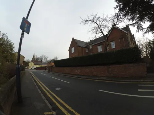
Macready Theatre
Cinema and theater · 2.6 mi
Building in Rugby, Warwickshire, England

Rugby Theatre
Cinema and theater · 2.8 mi
Amateur theatre in Warwickshire, England

Museums and landmarks4

Rugby Art Gallery and Museum
Museum · 2.6 mi
Art gallery and museum in the United Kingdom


British Thomson-Houston Company War Memorial
Monument and historic site · 3.5 mi
War memorial in Warwickshire, England, UK
Parks, trails and playgrounds12


Newbold Quarry Park
Park · 3.6 mi
Nature reserve in Warwickshire, England


Whitefields Golf Course
Golf course · 1.7 mi
London Road, Rugby
Mo-Th 07:30-22:00, Fr 07:30-23:00, Sa-Su 07:00-22:00


Restaurants and cafes30



18 more on the map.
History
The earliest historical reference to Dunchurch was in the Domesday Book of 1086, which mentioned a settlement called Don Cerce.
The core of the village has been declared a conservation area because it has many buildings of historical interest. Some of the buildings date to the 15th century are timber-framed and still have traditional thatch roofs.
As Dunchurch was located at the crossroads of the coaching roads between London and Birmingham (now the A45 road) (classified as B4429 through the village) and Oxford and Leicester (now the A426 road), it was for centuries an important staging post. At one point, there were 27 coaching inns in Dunchurch to cater for travellers. Two of these still remain; the 'Dun Cow' and 'The Green Man'
Many notable people have stayed at Dunchurch. Most notably, in 1605 the Gunpowder Plotters stayed at the 'Lion Inn' (now a private residence called 'Guy Fawkes House') in Dunchurch, convened by Sir Everard Digby, awaiting news of Guy Fawkes's attempt to blow up the Houses of Parliament. If he had been successful they planned to kidnap the King's daughter Princess Elizabeth from nearby Coombe Abbey.
Read more of the history
Other well known people who have stayed in the village include the young Queen Victoria (before she became Queen) and the Duke of Wellington. Robert Stephenson stayed in Dunchurch when supervising the construction of the Kilsby Tunnel during the building of the London and Birmingham Railway.
Dunchurch was for many centuries a more important settlement than nearby Rugby, that changed however with the coming of the railways in the 19th century; Rugby became a major railway centre and grew into a large town, this led to a dramatic decline in the coaching trade, and a decline in the importance of Dunchurch. However, from 1871 until 1964 the village was served by its own railway station about two miles from the village on the Rugby to Leamington Spa line.
The ancient parish of Dunchurch included the village itself, plus the nearby settlements of Cawston, Thurlaston, and Toft; The former two have become separate civil parishes. In the early 1930s part of the civil parish of Dunchurch was transferred to Rugby, and the part of the parish of Bilton which was not merged with Rugby was transferred to Dunchurch.
From the History section of Dunchurch on Wikipedia, under CC BY-SA 4.0.
More about Dunchurch
Arts and culture
The village has a sportsfield on Rugby Road donated to the village by Baron Waring in the 1920s. Currently Dunchurch & Bilton Cricket Club play in the summer months and Dunchurch Football Club play in the winter. Cricket has been played on the land since the 1800s. In 1999 Dunchurch Cricket Club merged with Bilton Cricket Club to form Dunchurch & Bilton Cricket Club. The changing rooms for the pitches are found adjacent to the village hall which was opened in 2003. There is a large main hall which can seat up to 160 people as well as a smaller sports room. Both have attached kitchens.
Other groups in the village include: Dunchurch Silver Band, District of Dunchurch Brass, Dunchurch Festival Group, Guides, Dunchurch Health Walks, Scouts, Mothers' Union, Photographic Club, St. Peter's Bell Ringers, Dunchurch Twinning Association, Dunchurch and Thurlaston Women's Institute, Working Men's Club.
Education
There are three schools in the area: Dunchurch Infant and Nursery School (School Street), Dunchurch Boughton C of E Junior School (Dew Close) and Bilton Grange Preparatory School (Rugby Road).
From the Wikipedia article Dunchurch, under CC BY-SA 4.0.
Notable people from Dunchurch
 Katharine MerryBritish 400m runnerPhoto: Glen Bowman from Newcastle, England, CC BY 2.0
Born in Dunchurch, according to Wikidata (CC0). Each name links to its Wikipedia article.
Where to stay6
Churches and places of worship13
Shopping7
Gas and EV charging1
Schools, colleges and libraries20
Dunchurch Boughton Church of England Infant Academy and Nursery
School · Anglican
School Street, Dunchurch
Healthcare3
Map of Dunchurch
99 places. The map loads OpenStreetMap tiles when you open it.
Getting there and nearby towns
Birmingham Airport (BHX) is the nearest airport with scheduled flights listed in OpenStreetMap, 21 miles away.
- Rugby 3 mi northeast, about 4 min by car
- Braunston 5 mi southeast, about 8 min by car
- Kilsby 5 mi east, about 8 min by car
- Stockton 5 mi southwest, about 9 min by car
- Long Itchington 6 mi southwest, about 9 min by car
- Brinklow 6 mi northwest, about 10 min by car
- Ryton on Dunsmore 6 mi west, about 10 min by car
- Crick 7 mi east, about 11 min by car
- Daventry 8 mi southeast, about 13 min by car
- Coventry 10 mi northwest, about 17 min by car
Drive times are estimates from straight-line distance, not routes.
Towns near Dunchurch


Keep exploring
Local news
Headlines from INDB.
Reviews, tips and questions
Loading what members have shared...
Sources and licences
- GeoNames (CC BY 4.0): population, coordinates, regions and time zone
- Mapillary (see each image): photos
- OpenStreetMap contributors (ODbL 1.0): places, airports, map data
- Wikidata (CC0 1.0): elevation, founding date, time zone, website, landmarks and historic places
- Wikimedia Commons (see each image): photos
- Wikipedia (CC BY-SA 4.0): overview and history text
Photo credits
- Dunchurch -Rugby Rd -statue-29Oct09, Snowmanradio, CC BY-SA 3.0
- Rugby Theatre 3.21, G-13114, CC BY-SA 4.0
- Rugby Art Gallery, Museum & Library, G-Man at English Wikipedia, Public domain
- Rugby football museum, G-Man at English Wikipedia, Public domain
- St Andrew's Church, Rugby, G-Man, Public domain
- St Michael's Church, Brownsover, Hugh Craddock, CC BY-SA 2.0
- Rugby High School 5.20 (3), G-13114, CC BY-SA 4.0
- St Mark's Church, Bilton, rear 7.20, G-13114, CC BY-SA 4.0
- St Peter's Church, Dunchurch, Jack Fitzsimons, CC BY-SA 4.0
- Newbold Quarry Park overview 10.22, G-13114, CC BY-SA 4.0
- Swift Valley Nature Reserve, old canal arm (1), G-13114, CC BY-SA 4.0
- Caldecott Park, Rugby (39852792695), Amanda Slater from Coventry, West Midlands, UK, CC BY-SA 2.0
- Street-level photo, gness, CC BY-SA 4.0
- Street-level photo, gness, CC BY-SA 4.0
- Street-level photo, laye, CC BY-SA 4.0
- Street-level photo, gness, CC BY-SA 4.0
- Street-level photo, gness, CC BY-SA 4.0
- Street-level photo, gness, CC BY-SA 4.0
- Street-level photo, gness, CC BY-SA 4.0
- Street-level photo, gness, CC BY-SA 4.0
- Street-level photo, gness, CC BY-SA 4.0
- Street-level photo, gness, CC BY-SA 4.0
- Street-level photo, gness, CC BY-SA 4.0
- Street-level photo, gness, CC BY-SA 4.0
- Street-level photo, gness, CC BY-SA 4.0
- Street-level photo, gness, CC BY-SA 4.0
- Street-level photo, gness, CC BY-SA 4.0
- Street-level photo, gness, CC BY-SA 4.0
- Street-level photo, gness, CC BY-SA 4.0
- Street-level photo, adam2, CC BY-SA 4.0
- Street-level photo, editid, CC BY-SA 4.0


Page built November 10, 2026. Spotted a mistake? Tell us or suggest a place.