


Ryton on Dunsmore, United Kingdom
Ryton on Dunsmore is a town of 1,813 people in England, United Kingdom.
Why visit Ryton on Dunsmore
Townapedia lists 7 museums and landmarks, 9 parks and trails, 7 places to eat, 2 places to stay and 1 attraction in and around town.
Highlights include 29th Division War Memorial, Brandon Castle, Ryton Pools Country Park and Brandon Marsh.
Weather in Ryton on Dunsmore
Forecast from MET Norway (CC BY 4.0). Full forecast
About Ryton on Dunsmore
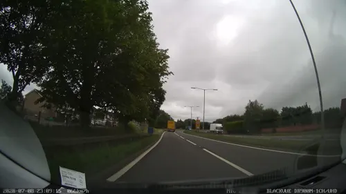
Ryton-on-Dunsmore is a village and civil parish in the Borough of Rugby, Warwickshire, England. It is situated 5.5 miles (8.9 km) south-east of Coventry and 8 miles (13 km) west of Rugby. The 2001 census recorded a population of 1,672 in the parish, increasing to 1,813 at the 2011 census. The A45 dual carriageway bissects Ryton, and nearby villages include Bubbenhall, Stretton-on-Dunsmore and Wolston.
From the Wikipedia article Ryton-on-Dunsmore (this version), under CC BY-SA 4.0.
Photos of Ryton on Dunsmore


Things to do1

Museums and landmarks7
29th Division War Memorial
Monument and historic site · 1.9 mi
War memorial in Stretton-on-Dunsmore, Rugby, Warwickshire, England, UK

Brandon Castle
Monument and historic site · 1.6 mi
Castle in Warwickshire, England, UK

Lunt Roman Fort
Museum · 2.7 mi
Roman fort in Warwickshire, England, UK

Midland Air Museum
Museum · 2.0 mi
Aviation museum in Baginton, Warwickshire, United Kingdom

Wolston Priory
Monument and historic site · 2.0 mi
Benedictine priory in Warwickshire, England, UK
Parks, trails and playgrounds9



Ryton Wood Meadows
Park · 1.2 mi
Nature reserve in Warwickshire, United Kingdom


Restaurants and cafes7


Where to stay2
Churches and places of worship2
Shopping1
Gas and EV charging1
Schools, colleges and libraries3
Ryton-On-Dunsmore Provost Williams Church of England Academy
School · Anglican
Sodens Avenue, Coventry
Map of Ryton on Dunsmore
33 places. The map loads OpenStreetMap tiles when you open it.
Getting there and nearby towns
Birmingham Airport (BHX) is the nearest airport with scheduled flights listed in OpenStreetMap, 14 miles away.
- Coventry 4 mi northwest, about 7 min by car
- Kenilworth 6 mi west, about 10 min by car
- Royal Leamington Spa 7 mi southwest, about 11 min by car
- Rugby 7 mi east, about 11 min by car
- Leek Wootton 7 mi southwest, about 11 min by car
- Stockton 7 mi southeast, about 12 min by car
- Bedworth 8 mi north, about 13 min by car
- Warwick 9 mi southwest, about 14 min by car
- Nuneaton 11 mi north, about 18 min by car
- Hinckley 12 mi north, about 20 min by car
Drive times are estimates from straight-line distance, not routes.
Towns near Ryton on Dunsmore


Keep exploring
Local news
Headlines from INDB.
Reviews, tips and questions
Loading what members have shared...
Sources and licences
- GeoNames (CC BY 4.0): population, coordinates, regions and time zone
- Mapillary (see each image): photos
- OpenStreetMap contributors (ODbL 1.0): places, airports, map data
- Wikidata (CC0 1.0): elevation, founding date, time zone, website, landmarks and historic places
- Wikimedia Commons (see each image): photos
- Wikipedia (CC BY-SA 4.0): overview and history text
Photo credits
- Remains of Brandon Castle, David Stowell, CC BY-SA 2.0
- Lunt fort baginton, Original uploader was Snowmanradio at en.wikipedia (Original text : snowmanradio ), CC BY-SA 3.0
- MAM hanger July06, Snowmanradio, CC BY-SA 3.0
- The Priory, Wolston, Fitzsimons, CC BY-SA 4.0
- Ryton pools waterfront 28a07, Snowmanradio, CC BY-SA 3.0
- Brandon Marsh East Marsh Pool, Black Kite, CC BY-SA 3.0
- WTC Dumbledore's Army StBartholemew'sChurch4, Carmen McLean-Ellmann, Oliver Ellmann (Wikipedia Takes Coventry participant), CC BY 3.0
- 2003 lake3 scenic photos (3), Coombe country park, CC BY 3.0
- Long shot of the bench (OpenBenches 7846-1), Anonymous Unknown author, CC BY-SA 4.0
- View from the bench (OpenBenches 7846-2), Anonymous Unknown author, CC BY-SA 4.0
- Close-up of the inscription (OpenBenches 7846), Anonymous Unknown author, CC BY-SA 4.0
- View from the bench (OpenBenches 7845-2), Anonymous Unknown author, CC BY-SA 4.0
- Long shot of the bench (OpenBenches 7844-1), Anonymous Unknown author, CC BY-SA 4.0
- View from the bench (OpenBenches 7844-2), Anonymous Unknown author, CC BY-SA 4.0
- Close-up of the inscription (OpenBenches 7844), Anonymous Unknown author, CC BY-SA 4.0
- Long shot of the bench (OpenBenches 7845-1), Anonymous Unknown author, CC BY-SA 4.0
- Close-up of the inscription (OpenBenches 7845), Anonymous Unknown author, CC BY-SA 4.0
- Truvelo speed camera, DeFacto, CC BY-SA 2.5
- Close-up of the inscription (OpenBenches 7842), Anonymous Unknown author, CC BY-SA 4.0
- View from the bench (OpenBenches 7843-2), Anonymous Unknown author, CC BY-SA 4.0
- Close-up of the inscription (OpenBenches 7841), Anonymous Unknown author, CC BY-SA 4.0
- Close-up of the inscription (OpenBenches 7843), Anonymous Unknown author, CC BY-SA 4.0
- Long shot of the bench (OpenBenches 7842-1), Anonymous Unknown author, CC BY-SA 4.0
- View from the bench (OpenBenches 7842-2), Anonymous Unknown author, CC BY-SA 4.0
- Long shot of the bench (OpenBenches 7841-1), Anonymous Unknown author, CC BY-SA 4.0
- View from the bench (OpenBenches 7841-2), Anonymous Unknown author, CC BY-SA 4.0
- Long shot of the bench (OpenBenches 7843-1), Anonymous Unknown author, CC BY-SA 4.0
- Street-level photo, southglos, CC BY-SA 4.0
- Street-level photo, editid, CC BY-SA 4.0
- Street-level photo, laye, CC BY-SA 4.0
- Street-level photo, adam2, CC BY-SA 4.0
- Street-level photo, editid, CC BY-SA 4.0
- Street-level photo, laye, CC BY-SA 4.0
- Street-level photo, editid, CC BY-SA 4.0
- Street-level photo, southglos, CC BY-SA 4.0


Page built November 10, 2026. Spotted a mistake? Tell us or suggest a place.