


Dundonald, United Kingdom
Dundonald is a town of 13,985 people in Northern Ireland, United Kingdom.
Why visit Dundonald
Townapedia lists 4 museums and landmarks, 6 parks and trails, 12 places to eat, 2 places to stay and 1 attraction in and around town.
Highlights include Dundonald Omniplex, Scrabo Tower, Stormont Estate and Moat Park.
Weather in Dundonald
Forecast from MET Norway (CC BY 4.0). Full forecast
About Dundonald
Dundonald (from Irish Dún Dónaill, meaning 'Donald's fort') is a large settlement and civil parish in County Down, Northern Ireland. It lies east of Belfast and is a suburb of the city. It is home to Moat Park, the Ulster Hospital, and Dundonald International Ice Bowl.
From the Wikipedia article Dundonald, County Down (this version), under CC BY-SA 4.0.
Travel tips from other travellers: Dundonald on Wikivoyage (CC BY-SA 4.0).
Things to do1

Museums and landmarks4

Scrabo Tower
Monument and historic site · 3.4 mi
Tower in County Down, Northern Ireland

Parks, trails and playgrounds6



Restaurants and cafes12
Wagamama
Restaurant · Asian · 1.0 mi
Eastpoint Entertainment Village, Dundonald
Mo-Th 12:00-21:00; Fr,Sa 12:00-22:00
The Middle Ale
Bar and pub
Dunlady Road
Mo-Th 15:00-23:00; Fr,Sa 12:00-23:00; Su 12:30-23:00




History
The name Dundonald is first recorded as Dundouenald (c. 1183) and later as Dundonnell. It comes from Irish Dún Dónaill, meaning "Donald's fort". While the ruined fort currently visible is of Norman origin, the Gaelic name suggests that it may have been the site of a pre-Norman stronghold belonging to a local chieftain named Dónall.
In 1177, the Anglo-Norman knight John de Courcy invaded eastern Ulster and created the Earldom of Ulster. To secure his new territory, he built a network of motte-and-bailey castles, including one at Dundonald. It was a strategic choice for a fort, as it sat on the main inland route linking de Courcy's headquarters at Carrickfergus Castle with his southern stronghold at Dundrum Castle. A wooden tower was built atop a man-made hill (the motte), and a church and settlement was built at the base (the bailey), marking the beginning of the Church Quarter. De Courcy signed a charter mentioning Richard de Dundoenald, who was named Lord of the Manor and is credited with establishing Dundonald as a Norman settlement.
Today, the site is known as Moat Park, with "moat" being a corruption of the word "motte". Dundonald motte is one of the largest surviving examples in Ireland.
Dundonald developed around the medieval parish church. The parish was one of the oldest ecclesiastical sites in eastern County Down.
Read more of the history
In July 1210, King John of England arrived in Ulster to rein in the de Lacys, as they had become too independent of the English Crown. The king used Dundonald fort as a Royal residence. A record from this visit remains in the Royal "Prest" (payment) accounts: while staying at Dundonald, King John reportedly lost 2 pence while playing a game of cards with the Earl of Winchester.
Dundonald acquired rail links to Belfast and Newtownards in 1850, Downpatrick in 1859 and Newcastle in 1869. The town was located on the once extensive Belfast and County Down Railway mainline. The rail link with Belfast encouraged Dundonald to expand as a commuter town, but in 1950, the railway line running through Dundonald was closed. Dundonald railway station was opened on 6 May 1850, but finally closed on 24 April 1950.
The old railway line has now been converted to the Comber Greenway, a pedestrian and cycle path running from East Belfast, through Dundonald to Comber.
In 1877, the Dundonald Purple Vine Orange Lodge was established, taking on the warrant of LOL 1056.
The Independent Orange Order, constituted in June 1903, held its first ever parade that same year. Dundonald was selected as the host town. It was attended by around 500 members.
The Robbs were tenant farmers who went on to own a vast majority of the land in Dundonald. The family originally arrived from Scotland during the Plantation of Ulster, arriving in the Dundonald area around 1700. The farmland is now Ballybeen Housing Estate, which was built in the 1960s when the Robbs sold around 220 to 250 acres of this land in Ballybeen to the Northern Ireland Housing Trust. This changed Dundonald from a rural farming village into a town. Robbs Road, a main road today, was once a private lane to the farm. The Castlereagh Council named the road after the family.
Ballybeen House was the Robbs family seat, an elegant country house located where Ballybeen Square is today. The family home was eventually used as offices by the Northern Ireland Housing Executive. It was demolished in the late 1980s. Today, only a few old trees and the layout of certain paths hint at where the grand gardens once were.
The Cleland family were also landowners in Dundonald. St. Elizabeth's Church is located beside the moat, with the Cleland Mausoleum in the adjacent graveyard. The mausoleum was built for Samuel Jackson Cleland, by his wife, Eliza Cleland.
In 1966, following a bodybuilding competition, judge Ivan Dunbar invited Arnold Schwarzenegger to Belfast for a bodybuilding exhibition at the Ulster Hall. Arnold stayed at the Dunbar family home in Wanstead, Dundonald, where he was served a traditional Ulster fry. Schwarzenegger credited Dunbar with helping him overcome a fear of public speaking. In March 2026, Schwarzenegger returned to the Belfast area to receive an honorary doctorate from Ulster University, where he publicly reminisced about his 1966 stay in Dundonald as the catalyst for his international career and reunited with local residents from his initial visit.
In the 1960s, Dundonald was deemed a small village. In the late 20th century, Dundonald saw a spike increase in housing developments, given its proximity to Belfast, Bangor, Stormont and Ballyhackamore.
From the History section of Dundonald, County Down on Wikipedia, under CC BY-SA 4.0.
More about Dundonald
Arts and culture
The Dundonald Arts Club is a well-established group that holds regular meetings, talks, and an annual exhibition for local artists.
Sir Daniel Dixon Bart Orange Hall, also known as Dundonald Orange Hall, has been used by the Dundonald Loyal Orders since 1924.
The Dundonald Purple Vine Loyal Orange Lodge 1056 is an Orange Lodge on the Comber Road. They are a part of the Holywood District No. 14. They organized the district's Twelfth of July demonstration in 2025, the first it had been held in Dundonald since 1967.
The Dundonald Purple Vine holds an annual lodge parade in January.
Dundonald True Blues Loyal Orange Lodge 1111 is another historic Orange Lodge.
Rising Sons of Dundonald JLOL 172 is a junior Orange Lodge in Dundonald under the North Down Junior District and County Down Junior LOL.
Dundonald Browning Club is a local branch of the Apprentice Boys of Derry. In June, the branch holds an annual march from Dundonald Orange Hall to the Cross of Reflection in Dundonald Cemetery. This service is held to remember those who died in the Battle of the Somme. They also partake in the Relief of Derry and Closing of the Gates parades in Derry.
Dundonald Royal Black Preceptory 482 is the local branch of the Royal Black Institution. Their meetings take place at Dundonald Orange Hall. They partake in the "Last Saturday in August" also known as the Royal Black parade.
Education
Dundonald has two primary schools, Dundonald Primary School and Brooklands Primary School. The local secondary school is Dundonald High School. Dundonald also has two schools for those with special needs and learning difficulties: Tor Bank and Longstone Special School.
From the Wikipedia article Dundonald, County Down, under CC BY-SA 4.0.
Notable people from Dundonald
 Gary WilsonIrish cricketerPhoto: Rorser at English Wikipedia, CC BY 2.5
 James LawrieNorthern Irish footballer (born 1990)Photo: Dominic Nelson, CC BY-SA 4.0
- Noel BrotherstonNorthern Irish footballer (1956-1995)
- Colin MurrayBritish-Northern Irish broadcaster (born 1977)
- Davy LarmourNorthern Irish footballer (born 1977)
- Steven AgnewNorthern Irish politician
- Ryan HaireIrish cricketer
- John LoweyBritish boxer
- Donna McNallyBowls player from Northern Ireland
- Barry McClementsIrish Paralympic swimmer
- Chloe WatsonIrish lawn and Indoor bowler
- Phil McNallyBritish animator
Born in Dundonald, according to Wikidata (CC0). Each name links to its Wikipedia article.
Where to stay2
Churches and places of worship11
Dundonald Baptist Church
Church · Baptist · 0.4 mi
Upper Newtownards Road, Dundonald
Shopping5
Gas and EV charging4
Schools, colleges and libraries7
Healthcare1
Map of Dundonald
53 places. The map loads OpenStreetMap tiles when you open it.
Getting there and nearby towns
George Best Belfast City Airport (BHD) is the nearest airport with scheduled flights listed in OpenStreetMap, 4 miles away.
- Holywood 3 mi north, about 5 min by car
- Newtownards 4 mi east, about 7 min by car
- Belfast 5 mi west, about 8 min by car
- Newtownabbey 6 mi northwest, about 10 min by car
- Lisburn 11 mi southwest, about 17 min by car
- Larne 18 mi north, about 29 min by car
- Portadown 28 mi southwest, about 46 min by car
- Newry 36 mi southwest, about 58 min by car
- Dungannon 39 mi west, about 1 h by car
- Limavady 56 mi northwest, about 1 h 30 min by car
Drive times are estimates from straight-line distance, not routes.
Towns near Dundonald


Keep exploring
Local news
Headlines from INDB.
Reviews, tips and questions
Loading what members have shared...
Sources and licences
- GeoNames (CC BY 4.0): population, coordinates, regions and time zone
- Mapillary (see each image): photos
- OpenStreetMap contributors (ODbL 1.0): places, airports, map data
- Wikidata (CC0 1.0): elevation, founding date, time zone, website, landmarks and historic places
- Wikimedia Commons (see each image): photos
- Wikipedia (CC BY-SA 4.0): overview and history text
Photo credits
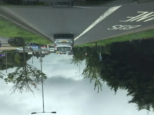
- Road junction, Dundonald, Ross, CC BY-SA 2.0
- Scrabo - Scrabo Tower (Londonderry Monument) - 20240820110149, Elkay62, CC BY-SA 4.0
- Ulster Hospital, Stubacca, CC BY-SA 3.0
- Stormont Castle Stormont Estate, Portwilliamborn, CC BY-SA 4.0
- Street-level photo, laye, CC BY-SA 4.0
- Street-level photo, laye, CC BY-SA 4.0
- Street-level photo, username23, CC BY-SA 4.0
- Street-level photo, mackerski, CC BY-SA 4.0
- Street-level photo, mackerski, CC BY-SA 4.0
- Street-level photo, mackerski, CC BY-SA 4.0
- Street-level photo, mcda, CC BY-SA 4.0
- Street-level photo, laye, CC BY-SA 4.0
- Street-level photo, laye, CC BY-SA 4.0
- Street-level photo, username23, CC BY-SA 4.0
- Street-level photo, laye, CC BY-SA 4.0
- Street-level photo, username23, CC BY-SA 4.0
- Street-level photo, mackerski, CC BY-SA 4.0
- Street-level photo, mackerski, CC BY-SA 4.0
- Street-level photo, jonnymccullagh, CC BY-SA 4.0
- Street-level photo, username23, CC BY-SA 4.0
- Street-level photo, username23, CC BY-SA 4.0
- Street-level photo, username23, CC BY-SA 4.0
- Street-level photo, username23, CC BY-SA 4.0
- Street-level photo, laye, CC BY-SA 4.0
Page built November 10, 2026. Spotted a mistake? Tell us or suggest a place.