


Dymchurch, United Kingdom
Dymchurch is a town of 3,263 people in England, United Kingdom.
Why visit Dymchurch
Townapedia lists 4 museums and landmarks, 2 parks and trails, 11 places to eat and 2 places to stay in and around town.
Highlights include Martello Tower 24, Castra Lemanis, Romney Warren Country Park and Dymchurch Amusements.
Weather in Dymchurch
Forecast from MET Norway (CC BY 4.0). Full forecast
About Dymchurch
Dymchurch is a village and civil parish in the Folkestone and Hythe district of Kent, England. The village is located on the coast five miles (8 km) south-west of Hythe, and on the Romney Marsh.
From the Wikipedia article Dymchurch (this version), under CC BY-SA 4.0.
Museums and landmarks4

Parks, trails and playgrounds2


Restaurants and cafes11




Yongs
Fast food · Chinese · 1.3 mi
26 Jefferstone Lane, St Mary's Bay
Where to stay2
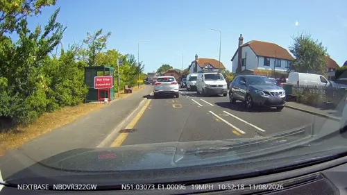
The Community Nest
Campground · 0.5 mi
26 Hythe Road, Dymchurch

History
The history of Dymchurch began with the gradual build-up of the Romney Marsh.
New Hall was rebuilt in 1575 after an earlier wooden structure was destroyed in a fire. It was used as a court room for the Romney Marsh area. The head magistrate was known as Leveller of the Marsh Scotts. It was there that the so-called Scot tax was introduced, levied on residents to fund maintenance of the sea wall. Those directly outside the boundaries and thus not eligible for the tax were said to have got away "scot free".
Residents with land were required to grow thorn bushes for building of the wall, as thorn twigs were believed impervious to sea water. Failure resulted in an ear being cut off.
During the 17th and 18th centuries, smuggling was rife all along the south-east coast of England. Due to its remote location, Romney Marsh and the surrounding areas were amongst the busiest locations for illicit trade. This inspired Russell Thorndike to set his Doctor Syn smuggling novels in Dymchurch. Every two years a celebration of the novels is held, usually on August Bank Holiday.
Read more of the history
Dymchurch played a significant role in the Anglo-French Survey (1784–1790), which linked the Royal Greenwich Observatory with the Paris Observatory using trigonometry. There were two baselines for the English part of the survey, on Hounslow Heath and on Romney Marsh. The Romney Marsh base-line extended from Ruckinge to High Nook, on the sea-wall near Dymchurch.
Several Martello towers were built in the nineteenth century as part of an Empire-wide coastal defence programme: most have since fallen into the sea or become dilapidated. Tower 23 was restored externally in the early 1970s and is currently a private residence. Tower 24 has undergone renovation and using Tower 23 used as a guide: in 1969 it became the first Martello tower to be opened to the public and remains as a museum of Martello Towers, owned by English Heritage. Tower 25 is possibly the only empty tower that is regularly maintained.
Two redoubt forts were constructed into the south coast Martello chain to act as supply depots for the local Martellos, and were originally described as "eleven-gun towers". A four-gun tower was originally proposed at Dymchurch, but this idea was revised at the Rochester conference of 1804. Dymchurch Redoubt was built between 1806 and 1809 to the same specifications as its Eastbourne counterpart, although Dymchurch does not have any caponiers. A caponier is a type of fortification structure. The word originates from the French word caponnière. It is a type of fortification structure which allows firing along the bottom of a dry moat that surrounds the main fortress.
In 1908, Walter Jerrold described the village as "a quiet scattered village and a delightful place far from the madding crowd". It is typical of this part of the coast, having originally been a very small village which became a much larger settlement during the 1930s. Many of homes from this era were converted railway carriages: very few of these remain, although a few similar ones still exist in nearby Dungeness. Dymchurch is now a popular seaside resort complete with holiday camp, caravan parks, light railway station and amusement park. Today the village is relatively large and mainly dedicated to seasonal tourism.
From the History section of Dymchurch on Wikipedia, under CC BY-SA 4.0.
More about Dymchurch
Arts and culture
Dymchurch has a blue flag awarded sandy beach and is surrounded by flat countryside that is well suited to walking and cycling. It has two nearby holiday parks, and an amusement park with "the usual offering of Ghost Train, Dodgems, Log Flume and other rides which will keep the whole family entertained".
Russell Thorndike, the creator of Doctor Syn, was born on 6 February 1885 in Rochester, Kent.
Thorndike was a British actor and novelist, best known for the Dr Syn of Romney Marsh novels, and brother of renowned actress Dame Sybil Thorndike. Thorndike's first appearance on stage was in Cambridge in 1904.
In 1914, Thorndike joined the army as a trooper in the 1st Westminster Dragoons, but due to being severely wounded at Gallipoli in 1916, he was discharged and returned to acting.
Touring the US with his sister and a theatrical company, a murder took place outside their hotel. The body was left all night on the street below their window. Unable to sleep, they passed the time by telling stories. The character of Dr Syn is said to have been created that night.
Due to his successful life as both a Shakespearean actor, a writer and playwright, in 1922 Thorndike played the leading man in his own Dr Syn play, which he adapted from his books.
During his lifetime, Thorndike created and published seven Dr Syn novels; he died on 7 November 1972.
From the Wikipedia article Dymchurch, under CC BY-SA 4.0.
Churches and places of worship4
Schools, colleges and libraries1
Map of Dymchurch
26 places. The map loads OpenStreetMap tiles when you open it.
Getting there and nearby towns
Lydd Airport (LYX) is the nearest airport with scheduled flights listed in OpenStreetMap, 6 miles away.
- Lympne 4 mi north, about 6 min by car
- Hythe 5 mi northeast, about 8 min by car
- Folkestone 8 mi northeast, about 14 min by car
- Shadoxhurst 9 mi northwest, about 15 min by car
- Ashford 10 mi northwest, about 16 min by car
- Woodchurch 10 mi west, about 16 min by car
- Camber 11 mi southwest, about 17 min by car
- Capel le Ferne 11 mi northeast, about 18 min by car
- Wye 11 mi north, about 18 min by car
- Dover 15 mi northeast, about 25 min by car
Drive times are estimates from straight-line distance, not routes.
Towns near Dymchurch


Keep exploring
Local news
Headlines from INDB.
Reviews, tips and questions
Loading what members have shared...
Sources and licences
- GeoNames (CC BY 4.0): population, coordinates, regions and time zone
- Mapillary (see each image): photos
- OpenStreetMap contributors (ODbL 1.0): places, airports, map data
- Wikidata (CC0 1.0): elevation, founding date, time zone, website, landmarks and historic places
- Wikimedia Commons (see each image): photos
- Wikipedia (CC BY-SA 4.0): overview and history text
Photo credits
- Dormer's Cottage 23 High Street Dymchurch Romney Marsh TN29 0NH, Spudgun67, CC BY-SA 4.0
- Paul Nash Artist Noel Coward ActorPlaywright Edith Nesbit Author Stayed here (Dymchurch Heritage Trail plaque), Spudgun67, CC BY-SA 4.0
- Mackett’s Cottages 10-16 Mill Road Dymchurch New Romney Kent TN29 0NY, Spudgun67, CC BY-SA 4.0
- Village Workhouse plaque 10-16 Mill Road Dymchurch TN29 0NY, Spudgun67, CC BY-SA 4.0
- Romney Warren Visitor Centre, DavidAnstiss, CC BY-SA 3.0
- Street-level photo, tallguy, CC BY-SA 4.0
- Street-level photo, tallguy, CC BY-SA 4.0
- Street-level photo, tallguy, CC BY-SA 4.0
- Street-level photo, tallguy, CC BY-SA 4.0
- Street-level photo, tallguy, CC BY-SA 4.0
- Street-level photo, tallguy, CC BY-SA 4.0
- Street-level photo, tallguy, CC BY-SA 4.0
Page built November 10, 2026. Spotted a mistake? Tell us or suggest a place.