


Why visit Wye
Townapedia lists 18 museums and landmarks, 11 parks and trails, 25 places to eat, 3 places to stay and 3 attractions in and around town.
Highlights include Church of St. Mary's Eastwell, Godmersham Park, Conningbrook Lakes Country Park and Ashford Green Corridor.
Weather in Wye
Forecast from MET Norway (CC BY 4.0). Full forecast
About Wye
Wye is a village and former civil parish, now in the parish of Wye with Hinxhill, in the Ashford district, in Kent, England, 5 miles (8.0 km) from Ashford and 12 miles (19 km) from Canterbury. The Built-up Area had a population of 2,063 at the 2021 census.
From the Wikipedia article Wye, Kent (this version), under CC BY-SA 4.0.
Photos of Wye

Things to do3


Museums and landmarks18




6 more on the map.
Parks, trails and playgrounds11
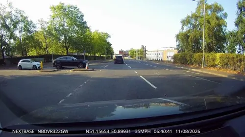


Ashford Green Corridors
Park · 3.9 mi
Nature reserve in Kent, England


Hatch Park
Park · 3.6 mi
Nature reserve near Mersham, Kent, England, UK



Restaurants and cafes25
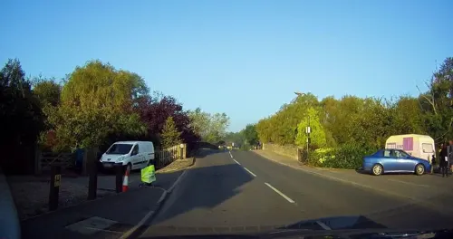
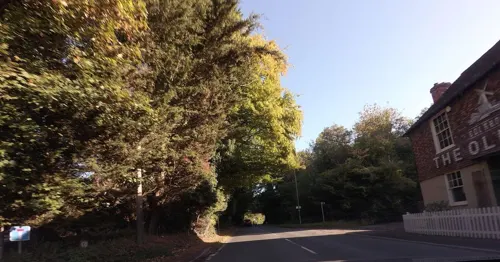
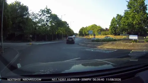


The Hub Wye
Cafe
Cycle Cafe on the Cantii Way and Pilgrims' Way - Exciting venue offering delicious coffee, cakes and cycling spares for the community,...
Churchfield Way, Ashford
Mo-Su,PH 08:30-16:30
Wye Coffee & Kitchen
Cafe
1 Church Street, Ashford
Mo 08:00-16:00; Tu-Fr 08:00-17:00; Sa 09:00-17:00; Su 09:00-16:00

Sawyers
Bar and pub
169 Bridge Street, Wye
Tu-Th 18:00-23:00; Fr 17:00-23:00; Sa 12:00-23:00; Su 12:00-17:00
Golden Wye Chinese Restaurant
Restaurant
Su-Th 12:00-14:00, 17:00-23:00; Fr-Sa 12:00-14:00, 17:00-23:30
13 more on the map.
History
The village's name comes from the Old English "Wēoh" meaning idol or shrine. Wye may have been used for worship by the pre-Christian Angles.
Wye became an important communications centre because of a ford across the River Great Stour connecting with ancient trackways across the North Downs. Romans constructed a road between Canterbury and Hastings using the gap through the North Downs and there have been suggestions the straight Olantigh Road may have been built by them as a separate route from Wye to Canterbury on the east of the River Stour. Remains of an ironworks at the west bank of the river, from that period, have been found. By medieval times, Wye had a market and hosted the local hundred court.
two cross streets, the whole unpaved. There is a large green in it, built round, on one side of which is the church and college close to it.
Later in the 18th century a turnpike had bypassed the village on the west bank of the River Stour, which the A28 road still does today. Wye railway station was built for the South Eastern Railway line from Ashford to Margate and opened on 1 December 1846.
During World War I the Royal Flying Corps established an unpaved aerodrome off Bramble Lane near Wye Railway Station. It became RAF Wye in 1918 but closed the following year. As of 2022, it is farmland.
Read more of the history
Wye Racecourse's inaugural 1849 meeting was held in Fanscombe Valley, an isolated coombe and natural amphitheatre directly north of Wye Crown, and 1 mile (1.6 km) as the crow flies from Wye village. Flat racing took place annually on Oak Leaf Day, 29 May coinciding with Wye Fair.
By 1878, Wye's racing had moved to the National Hunt course on Harville Road. Steeplechase meetings were held in September, January, March, and May until 1974, and the course closed permanently by June 1975. As of 2022, both former courses are farmland.
As early as the 6th century, Wye was a royal vill, and the royal court would have resided in the vicinity of Wye Court for part of the year. In the 13th century it was a Royal Manor whose Liberty extended as far as Hawkhurst. The Palace complex by then was at Wye Court.
Wye was important for being the first ford over the River Stour that travellers could cross on their route from the West Country to Dover.
In 1307, King Edward II spent Christmas at Wye Court between the death of his father King Edward I, and his own coronation the following February. The father had received his Seal from the Officer of State there. Young King Henry VI visited Wye Court in 1428 when Cardinal Kempe of Olantigh was his Lord Chancellor.
The Manor House at Wye Court was a large building, with a circular dungeon that was extant as late as the 19th century and known locally as the Lollard's Hole. In 1553, two Protestants were executed by burning in front of Wye Church. The disturbances and associated use of the dungeons may have led to that name.
Wye was not isolated from Wat Tyler's 1381 uprising or Jack Cade's rebellion of 1450. In the 15th century, church officials were ordered especially to address lollardy in Maidstone, Tenterden, Faverisham and Wy.
Queen Elizabeth I granted Wye Court to the Boleym related Hunsden family but by the time of King Charles I, ownership had passed to the Finches, a distant branch of the Earls of Winchilsea.
Following the 1572 lightning strike at Wye Church, yeoman farmer Roger Twysden of Wye Court provided timber for reconstruction of the tower. He became High Sheriff of Kent in 1599 but following a fire at his own home he moved from Wye Court to a family dwelling at Chelmington, and then Roydon Hall.
A 1648 Civil War skirmish involving Rich's men and cavaliers took place at the entrance to Wye Court on Olantigh Road. Accounts identify four casualties of the encounter being buried at Wye, and three others killed.
By 1732, Wye Court, along with other land near Wye at Harville, Coldharbour, Wye Downs and Naccolt had fallen into the ownership of miser, John "Vulture" Hopkins. Once his affairs had been unravelled the properties were inherited by Benjamin Bond Hopkins (1745–1794). He sold them to John Sawbridge of Olantigh whose son owned Wye Court by 1798.
Wye Court formerly extended beyond the present day farm, including land to Churchfield Way. Wye College purchased parts of Wye Court for expansion along Olantigh Road in 1925. In 1917, Wye Church agreed to purchase a parcel of Wye Court, to extend its graveyard, from Wanley Elias Sawbridge Erle-Drax, a descendant of John Sawbridge. The Long family purchased their present Wye Court farm and former racecourse on Harville Road in 1925.
Entomologist Frederick Theobald lived at Wye Court until he died in 1930. He had moved to Wye to teach at the South Eastern Agricultural College when it opened in 1894. Apart from his work at the college he spent much of his time curating economic zoology and mosquito collections at the British Museum, and ceased lecturing from 1920 in favour of agricultural extension. Theobald's research on mosquitos and tropical sanitation earned him international recognition including the Order of Osmanieh and Mary Kingsley Medal.
In September 1940, a Spitfire of No 19 Squadron from RAF Duxford crashed at Wye Court injuring the pilot and writing the aircraft off. The crash site was excavated in 1974 by the RAF Museum.
Wye College was founded in 1447 as a chantry by Cardinal Kempe. From 1627, a grammar and charity school operated from the premises. In 1894 the buildings re-opened as the South Eastern Agricultural College, offering University of London degrees from 1898, and in 1948 incorporated as Wye College. It merged with Imperial College in 2000 but the campus was progressively closed between 2005 and 2009.
From the History section of Wye, Kent on Wikipedia, under CC BY-SA 4.0.
More about Wye
Arts and culture
A farmers' market, founded by former Wye College student and environmentalist Richard Boden, is held by The Green in Wye on the first and third Saturday of every month. There are typically 15 vendors. During COVID-19 restrictions the market operated a virtual shop.
Wye Village Hall on Bridge Street was extensively refurbished between 2014 and 2019. There are three function rooms of which the largest can accommodate 180 people.
The present Anglican Church of Saint Gregory and Saint Martin at the junction of High Street, Church Street and Churchfield Way is grade I listed. Its original dedication was solely to Pope Gregory the Great. Saint Martin was added c. 1475, possibly to recognise the role of Battle Abbey which was itself dedicated to Saint Martin and owned the Manor of Wye, and to be consistent with Wye College.
A church on the present site was first constructed in 1290, and considerably more extensive than the present building. There was a longer nave and much larger chancel. The Steeple had a tall wooden spire clad with lead. Of this church, only the outer nave walls, built of whole flints, survive. The original door and window openings have all been replaced.
From the Wikipedia article Wye, Kent, under CC BY-SA 4.0.
Notable people from Wye
 Catharine MacaulayEnglish historian, philosopher, feminist (1731-1791)Photo: Robert Edge Pine, Public domain
 Bias BoshellBritish singerPhoto: Gordondfwallace, CC BY-SA 4.0
- John KempEnglish cardinal, Archbishop of Canterbury and Lord Chancellor of England (1380-1454)
Born in Wye, according to Wikidata (CC0). Each name links to its Wikipedia article.
Where to stay3
Churches and places of worship18
Shopping3
Gas and EV charging2
Schools, colleges and libraries11
Map of Wye
94 places. The map loads OpenStreetMap tiles when you open it.
Getting there and nearby towns
Lydd Airport (LYX) is the nearest airport with scheduled flights listed in OpenStreetMap, 16 miles away.
- Ashford 4 mi southwest, about 6 min by car
- Charing 6 mi west, about 10 min by car
- Shadoxhurst 7 mi southwest, about 12 min by car
- Lympne 8 mi southeast, about 13 min by car
- Canterbury 9 mi northeast, about 15 min by car
- Faversham 9 mi north, about 15 min by car
- Bridge 9 mi northeast, about 15 min by car
- Hythe 10 mi southeast, about 16 min by car
- Blean 10 mi northeast, about 16 min by car
- Folkestone 12 mi southeast, about 20 min by car
Drive times are estimates from straight-line distance, not routes.
Towns near Wye


Keep exploring
Local news
Headlines from INDB.
Reviews, tips and questions
Loading what members have shared...
Sources and licences
- GeoNames (CC BY 4.0): population, coordinates, regions and time zone
- Mapillary (see each image): photos
- OpenStreetMap contributors (ODbL 1.0): places, airports, map data
- Wikidata (CC0 1.0): elevation, founding date, time zone, website, landmarks and historic places
- Wikimedia Commons (see each image): photos
- Wikipedia (CC BY-SA 4.0): overview and history text
Photo credits
- Wye Crown, Original uploader was O1ive at en.wikipedia, CC BY-SA 3.0
- Methodist Church And Church Hall, Wye, Kent - May 2026 - 02, Mertbiol, CC0
- Methodist Church And Church Hall, Wye, Kent - May 2026 - 01, Mertbiol, CC0
- Tree carvings on Ashford Green Corridor, Deryck Chan, CC BY-SA 4.0
- Ashford Green Corridor - panoramio, Immanuel Giel, CC BY 3.0
- Spong Wood 3, Dudley Miles, CC BY-SA 4.0
- All Saints Boughton Aluph 1, Josh Tilley, CC BY-SA 4.0
- St. Christpher's Church, Boughton Lees 04, Simon Burchell, CC BY-SA 3.0
- Derelict church, Eastwell, near Ashford, Kent, England UK, jwfairley, CC BY 2.0
- Wye (Kent) Church St Gregory and St Martin, -- Rensi 19:54, 11. Okt. 2009 (CEST), Public domain
- Eastwell Towers, C.Hoyle No machine-readable author provided. O1ive assumed (based on copyright claims)., CC BY 2.5
- St Mary Brook 1, Josh Tilley, CC BY-SA 4.0
- Eastwell Park 1, Wentwort12, CC BY-SA 4.0
- Godmersham Park, Digihum, CC0
- Agricultural Museum, Brook, Kent, Tim Sheerman-Chase, CC BY 4.0
- Street-level photo, tallguy, CC BY-SA 4.0
- Street-level photo, tallguy, CC BY-SA 4.0
- Street-level photo, tallguy, CC BY-SA 4.0
- Street-level photo, tallguy, CC BY-SA 4.0
- Street-level photo, tallguy, CC BY-SA 4.0
- Street-level photo, tallguy, CC BY-SA 4.0
- Street-level photo, tallguy, CC BY-SA 4.0
- Street-level photo, tallguy, CC BY-SA 4.0


Page built November 10, 2026. Spotted a mistake? Tell us or suggest a place.