


Braunstone, United Kingdom
Braunstone is a town of 16,850 people in England, United Kingdom.
Why visit Braunstone
Townapedia lists 16 museums and landmarks, 31 parks and trails, 140 places to eat, 7 places to stay and 7 attractions in and around town.
Highlights include Braunstone Gate Bridge, Curve, Abbey Pumping Station Museum and Arch of Remembrance.
Weather in Braunstone
Forecast from MET Norway (CC BY 4.0). Full forecast
About Braunstone
Braunstone is a town and civil parish in the district of Blaby in Leicestershire, England. At the 2011 census the population of the town was 16,850.
From the Wikipedia article Braunstone Town (this version), under CC BY-SA 4.0.
Photos of Braunstone

Things to do7


De Montfort Hall
Cinema and theater · 2.4 mi
Music and performance venue in Leicester, United Kingdom

Leicester Haymarket Theatre
Cinema and theater · 2.4 mi
Theatre in Leicester, England

Little Theatre, Leicester
Cinema and theater · 2.3 mi
Theatre in Leicester, England, originally a Baptist chapel

Sue Townsend Theatre
Cinema and theater · 2.0 mi
Theatre and music venue in Leicester, England

Museums and landmarks16

Abbey Pumping Station Museum
Museum · 3.2 mi
Local Authority Museum in the East Midlands, United Kingdom

Arch of Remembrance
Monument and historic site · 2.4 mi
War memorial in Leicester, Leicestershire, England, UK
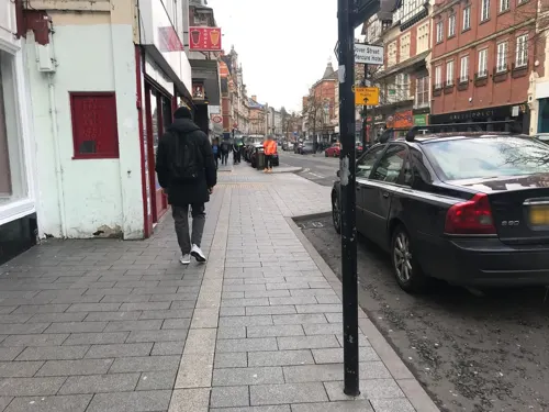
City Gallery
Museum · 2.3 mi
Contemporary art gallery in Leicester, England, UK, closed 2010


Haymarket Memorial Clock Tower
Monument and historic site · 2.3 mi
Clock tower in City of Leicester, Leicestershire, England, UK

Jewry Wall Museum
Museum · 1.9 mi
Museum in Leicester, England, United Kingdom

King Richard III Visitor Centre
Museum · 2.1 mi
Museum in Leicester, England

Leicester Abbey
Monument and historic site · 2.7 mi
Grade I listed building in Leicester, Leicestershire, England, UK

Leicester Castle
Monument and historic site · 1.9 mi
Castle in Leicester, England, UK

Leicester Guildhall
Museum · 2.1 mi
Grade I listed seat of local government, and museum, in Leicester, United Kingdom

Leicester Museum & Art Gallery
Museum · 2.3 mi
Museum in Leicester, England, United Kingdom

Newarke Houses Museum
Museum · 1.9 mi
Public museum in Leicester, England, United Kingdom
4 more on the map.
Parks, trails and playgrounds31

King Power Stadium
Sports field and stadium · 1.5 mi
A football stadium serving as the home ground for Leicester City Football Club.
Filbert Way, Leicester
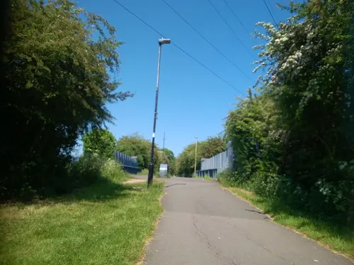


Kirby Frith Nature Reserve
Park · 1.6 mi
Local Nature Reserve in Leicester, United Kingdom



19 more on the map.
Restaurants and cafes140
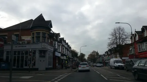
Mithaas
Restaurant · Indian · 1.4 mi
103-105 Narborough Road, Leicester
Mo off; Tu-Su 10:00-22:00; PH 10:00-22:00
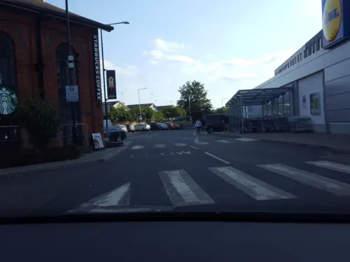
The Western
Bar and pub · 1.5 mi
70 Western Road, Leicester
Mo-Th 12:00-00:00; Fr,Sa 12:00-01:00; Su 12:00-24:00


Asda Café
Cafe · Coffee Shop · 1.3 mi
Narborough Road South, Leicester
Mo-Sa 08:30-18:00; Su 10:00-16:00
Nando's
Restaurant · Chicken, Portuguese · 0.4 mi
Lubbesthorpe Way, Leicester
Su-Th 11:30-22:00, Fr,Sa 11:30-23:00
Bella Italia
Restaurant · Italian · 0.4 mi
Lubbesthorpe Way, Leicester
Mo-Fr 12:00-22:00; Sa 11:30-23:00; Su 11:30-22:00
Chiquito
Restaurant · Tex-Mex · 0.5 mi
Lubbesthorpe Way, Leicester
Mo-Th 12:00-22:00; Fr-Sa 12:00-22:30; Su 12:00-22:00

Frankie & Benny's
Diner · American · 0.5 mi
Lubbesthorpe Way, Leicester
Mo-Th 12:00-22:00; Fr-Sa 12:00-22:30; Su 12:00-22:00
128 more on the map.
History
The earliest dated human find recorded is a Bronze Age axe (about 1000 BC) found in 1893.
Next came the building of the Roman road from Leicester, through the site of the Narborough Road South to the High Cross near Sharnford. It is also evident that the Vikings of the early or later period had settlements in or near Braunstone, hence the nearby names of Viking origin – Lubbesthorpe, Countesthorpe, Enderby, Elmesthorpe, Cosby, Kilby, Kirby etc. Throughout this period Braunstone was covered with forest (as were most county areas surrounding) in what was known as Leicester Forest. Like most forests, these were composed of a series of large woods containing small early settlements or hamlets inter-connected by rough trackways – from which most of our public field paths owe their origin.
Braunstone is mentioned in the Domesday Book (1086) where it is referred to as BRANTESTONE or BRANSTUN.
"Braunstone – six plough lands, all but for oxgangs, in Braunstone which is the reign of The Confessor had been valued at twenty shillings, were worth sixty shillings at the general survey and were then held by the son of Robert Burdet. The land was equal to four ploughs, one was in Demesne, and four Bondmen; and two socmen and five villains, with one border, had two ploughs. There was a wood five furlongs long and three broad, and there were 5 acres (20,000 m2) of meadow.
Read more of the history
Two socmen abiding in Braunstone had five oxgangs of land in Lubbesthorpe; and jointly with ten villains and six borders in that lordship had two ploughs and five ploughing oxen.
The above lands were held by Robert Burdet under Hugh de Grandmesnil, one of William I's most powerful barons.
A ploughland or carucate = about 80 to 120 acres (0.32 to 0.49 km2) of land.
A copy of the Domesday Book is displayed at Braunstone Civic Centre.
The first Lord of the Manor was de Grandmesnil. At this time the village consisted of 8 households and was worth about 60 shillings.
The Harcourt or Horecut family held the over-riding interest in the estate from the 13th to the 16th centuries. A survey taken in 1299 showed a growth to 24 households in the village.
The 14th century saw several outbreaks of the Black Death in the area. Its effect on Braunstone is not recorded, but nearby Glenfield was seriously affected. At this time the Leicester Forest extended into Braunstone as far as Bendbow Spinney.
Several portions of Braunstone were sold off in the late 16th century. 150 acres (0.61 km2) of arable land were sold to the Manners family in 1579 and a further 100 acres (0.40 km2) went to the Bennett family ten years later. 240 acres (0.97 km2) of land were converted to pasture in 1596 by the Hastings family, who owned the estate at that time.
Woodlands were gradually converted to pastures, mainly for sheep – being then the more profitable husbandry. Leicester Forest was fully enclosed in 1628. Villagers of Braunstone were compensated for the loss of Forestry Rights.
The 18th century was a period of prosperity for Braunstone. The largest estate of the time was owned by Abraham Compton and comprised 68 ewes, 25 lambs, 14 cows, 6 heifers, 4 calves and 6 pigs.
In 1750 James Winstanley III tried to sink a pit on the manor. His attempts were thwarted when his bore hole was filled with stones by intruders, thought to be from local mining districts.
In the 1820s Braunstone was known as a place to go fox-hunting. Charles Loraine Smith painted a set of parodies known as the "Smoking Hunt" which pokes fun at the fashionable sport of hunting here.
Braunstone remained a village with various tenanted farmsteads until, in 1925, the Leicester Corporation compulsorily purchased the bulk of the Winstanley Braunstone Hall estate for £116,500.
Braunstone's population rose from 238 in 1921 to 6,997 in 1931.
In 1935 the part of Braunstone on the city side of Braunstone Lane became the North Braunstone Ward of the City of Leicester, and the parish of Braunstone in compensation had part of Lubbesthorpe added to its boundary. It mostly consists of council housing built between 1925 and 1940.
During World War Two Braunstone Park was put to agricultural use. Wheat, barley, and potatoes were grown, and sheep allowed to graze. What is now the Memorial Gardens was used as a military camp, occupied first by the British Army and later by the American 82nd Airborne Division troops. After the war, due to the severe housing shortage, people were allowed to occupy the camp until they found homes of their own.
By the 1990s, however, Braunstone was perhaps the most troubled part of Leicester, with crime rates and unemployment among the highest in the city. In April 1994, The Independent newspaper reported that unemployment on the estate was above 25% and was blighted by youth gangs engaging in anti-social behaviour.
The area is also known for housing the head office of British Shoe Corporation on Sunningdale Road, from 1965 to 1999. A plaque on the corner of Sunningdale Road shows the site's history and connection with British Shoe Corporation (BSC as it was known) and the founder of BSC, Charles Clore.
From the History section of Braunstone Town on Wikipedia, under CC BY-SA 4.0.
Notable people from Braunstone
- Geoffrey BurchEnglish cricketer (born 1937)
Born in Braunstone, according to Wikidata (CC0). Each name links to its Wikipedia article.
Where to stay7
Churches and places of worship45
Church of the Annunciation of Our Lady of the Newarke
Church · 1.9 mi
Shopping22
Gas and EV charging7
Schools, colleges and libraries30
Healthcare9
Map of Braunstone
250 places. The map loads OpenStreetMap tiles when you open it.
Getting there and nearby towns
East Midlands Airport (EMA) is the nearest airport with scheduled flights listed in OpenStreetMap, 16 miles away.
- Leicester 2 mi northeast, about 4 min by car
- Glenfield 2 mi north, about 3 min by car
- Glen Parva 2 mi south, about 4 min by car
- Oadby 4 mi east, about 7 min by car
- Evington 5 mi east, about 8 min by car
- Syston 7 mi northeast, about 10 min by car
- Mountsorrel 7 mi north, about 11 min by car
- Shepshed 11 mi northwest, about 18 min by car
- Market Harborough 15 mi southeast, about 23 min by car
- Melton Mowbray 16 mi northeast, about 26 min by car
Drive times are estimates from straight-line distance, not routes.
Towns near Braunstone


Keep exploring
Local news
Headlines from INDB.
Reviews, tips and questions
Loading what members have shared...
Sources and licences
- GeoNames (CC BY 4.0): population, coordinates, regions and time zone
- Mapillary (see each image): photos
- OpenStreetMap contributors (ODbL 1.0): places, airports, map data
- Wikidata (CC0 1.0): elevation, founding date, time zone, website, landmarks and historic places
- Wikimedia Commons (see each image): photos
- Wikipedia (CC BY-SA 4.0): overview and history text
Photo credits
- Braunstone Hall, Leicester, Leeclarke1981, CC BY-SA 3.0
- Braunstone Gate Bridge, Tim Hallam, CC BY-SA 2.0
- Curve Leicester full panorama, NotFromUtrecht, CC BY-SA 3.0
- De Montfort Hall, NotFromUtrecht, CC BY-SA 3.0
- Leicester Haymarket Theatre entrance, Cordyceps-Zombie, CC BY-SA 4.0
- Teatr Mały w Leicester, Kris1973, CC BY-SA 4.0
- Phoenix Arts Centre Leicester, NotFromUtrecht, CC BY-SA 3.0
- Abbey Pumping station, Jonnic1 at English Wikipedia, Public domain
- War Memorial Leicester, Summer 2009, NotFromUtrecht, CC BY-SA 3.0
- GasMuseumMay2010, Chemical Engineer, Public domain
- Leicester clock tower May2010, NotFromUtrecht, CC BY-SA 3.0
- Jewry Wall ruins panorama 3, NotFromUtrecht, CC BY-SA 3.0
- Dynasty Death and Discovery, Richard III museum entrance, RobinLeicester, CC BY-SA 4.0
- Abbeyruins Leicester, Kev747 at English Wikipedia, CC BY-SA 3.0
- Brama wjazdowa do zamku od strony zewnętrznej, Kris1973, CC BY-SA 4.0
- Leicester Guildhall, NotFromUtrecht, CC BY-SA 3.0
- New Walk Museum main entrance, NotFromUtrecht, CC BY-SA 3.0
- Newarke Houses Museum Leicester, NotFromUtrecht, CC BY-SA 3.0
- Abbey Park Leicester entrance gate, NotFromUtrecht, CC BY-SA 3.0
- Goss Meadows 7, Dudley Miles, CC BY-SA 4.0
- Kirby Frith Nature Reserve 4, Dudley Miles, CC BY-SA 4.0
- Knighton Spinney 4, Dudley Miles, CC BY-SA 4.0
- Nelson Mandela Park, Joshuajohnlee ., CC BY 3.0
- The Orchards Nature Reserve 2, Dudley Miles, CC BY-SA 4.0
- All Saints Church - widok od południowej strony, Kris1973, CC BY-SA 4.0
- Narborough parish church, Narborough, Leicestershire, UK, Kev747 at English Wikipedia, Public domain
- Blaby Parish Church, Chemical Engineer, CC0
- 188565 Leicester St Andrews Church 2, Simon Armstrong, CC BY-SA 3.0
- St Mark's Church, Leicester, south side, Grahamrob, CC BY-SA 3.0
- St Mary de Castro from Castle Yard, NotFromUtrecht, CC BY-SA 3.0
- King Power Stadium wide view, Pottercomuneo, CC BY-SA 4.0
- Winstanley House, Maypm, CC BY-SA 4.0
- Leicester city king power stadium, Arne Müseler, CC BY-SA 3.0 de
- Newarke church arches DMU heritage centre, Leicester, RobinLeicester, CC BY-SA 4.0
- Western park teniss courts, http-www.leicestertravel.co.uk - panoramio, Leicester Holyday, CC BY 3.0
- Street-level photo, shadycraig, CC BY-SA 4.0
- Street-level photo, adam2, CC BY-SA 4.0
- Street-level photo, trigpoint, CC BY-SA 4.0
- Street-level photo, adam2, CC BY-SA 4.0
- Street-level photo, adam2, CC BY-SA 4.0
- Street-level photo, toby, CC BY-SA 4.0
- Street-level photo, adam2, CC BY-SA 4.0
- Street-level photo, shadycraig, CC BY-SA 4.0
- Street-level photo, toby, CC BY-SA 4.0
- Street-level photo, adam2, CC BY-SA 4.0
- Street-level photo, toby, CC BY-SA 4.0
- Street-level photo, toby, CC BY-SA 4.0
- Street-level photo, adam2, CC BY-SA 4.0
- Street-level photo, adam2, CC BY-SA 4.0
- Street-level photo, trigpoint, CC BY-SA 4.0
- Street-level photo, cyclestreets, CC BY-SA 4.0
- Street-level photo, rskedgell, CC BY-SA 4.0


Page built November 10, 2026. Spotted a mistake? Tell us or suggest a place.