


Aylestone, United Kingdom
Aylestone is a town of 11,151 people in England, United Kingdom.
Why visit Aylestone
Townapedia lists 18 museums and landmarks, 37 parks and trails, 172 places to eat, 4 places to stay and 7 attractions in and around town.
Highlights include Odeon, Braunstone Gate Bridge, Raw Dykes and Arch of Remembrance.
Weather in Aylestone
Forecast from MET Norway (CC BY 4.0). Full forecast
About Aylestone
Aylestone is a suburb of Leicester in Leicestershire, England, southwest of the city centre and east of the River Soar.
From the Wikipedia article Aylestone (this version), under CC BY-SA 4.0.
Photos of Aylestone

Things to do7


De Montfort Hall
Cinema and theater · 1.8 mi
Music and performance venue in Leicester, United Kingdom

Leicester Haymarket Theatre
Cinema and theater · 2.4 mi
Theatre in Leicester, England

Little Theatre, Leicester
Cinema and theater · 2.0 mi
Theatre in Leicester, England, originally a Baptist chapel

Sue Townsend Theatre
Cinema and theater · 1.9 mi
Theatre and music venue in Leicester, England
Museums and landmarks18

Raw Dykes
Monument and historic site · 1.0 mi
Archaeological site in City of Leicester, Leicestershire, England, UK

Arch of Remembrance
Monument and historic site · 1.7 mi
War memorial in Leicester, Leicestershire, England, UK
City Gallery
Museum · 2.1 mi
Contemporary art gallery in Leicester, England, UK, closed 2010


Haymarket Memorial Clock Tower
Monument and historic site · 2.3 mi
Clock tower in City of Leicester, Leicestershire, England, UK

Jewry Wall Museum
Museum · 2.1 mi
Museum in Leicester, England, United Kingdom

King Richard III Visitor Centre
Museum · 2.1 mi
Museum in Leicester, England

Leicester Abbey
Monument and historic site · 3.1 mi
Grade I listed building in Leicester, Leicestershire, England, UK

Leicester Castle
Monument and historic site · 2.0 mi
Castle in Leicester, England, UK

Leicester Guildhall
Museum · 2.1 mi
Grade I listed seat of local government, and museum, in Leicester, United Kingdom

Leicester Museum & Art Gallery
Museum · 1.9 mi
Museum in Leicester, England, United Kingdom

Newarke Houses Museum
Museum · 1.9 mi
Public museum in Leicester, England, United Kingdom
6 more on the map.
Parks, trails and playgrounds37

King Power Stadium
Sports field and stadium · 1.1 mi
A football stadium serving as the home ground for Leicester City Football Club.
Filbert Way, Leicester
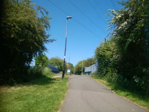


Kirby Frith Nature Reserve
Park · 3.3 mi
Local Nature Reserve in Leicester, United Kingdom



25 more on the map.
Restaurants and cafes172
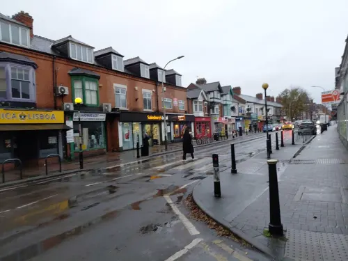
Port and Nata
Restaurant · Portuguese · 1.5 mi
93 Queens Road, Leicester
Mo-We 08:00-17:00; Th-Sa 08:00-23:00; Su 10:00-17:00
Hopology
Bar and pub · 1.5 mi
117 Clarendon Park Road, Leicester
Tu-Th 16:30-21:00; Fr 16:30-22:00; Sa 14:00-22:00; Su 12:00-18:00
Queens Road Tap
Bar and pub · 1.5 mi
Opened in Dec 2017 this modern tap with rustic furniture showcases four real ales, two ciders, and seven keg lines. Dogs, walkers &...
109 Queens Road, Leicester
Sa 12:00-22:30; Tu-Th 16:00-22:00; Fr 15:00-22:30; Su 14:00-20:00

Asda Café
Cafe · Coffee Shop · 1.4 mi
Narborough Road South, Leicester
Mo-Sa 08:30-18:00; Su 10:00-16:00

Bella Italia
Restaurant · Italian · 1.5 mi
297-299 Leicester Road, Wigston
Mo-Fr 06:30-22:00; Sa-Su 07:00-22:00

Munchies cafe
Cafe · Sandwich · 0.4 mi
94 Grace Road, Leicester
Mo-Fr 08:00-15:00; Sa,Su off
160 more on the map.
History
The name 'Aylestone' comes from the Anglo-Saxon 'Aegel's settlement' or 'Egil's settlement'. Aylestone was recorded in the Domesday Book as Ailstone, held in the reign of Edward the Confessor by Alveva, Countess of Mercia. In 1086 it was held by Robert de Beaumont, 1st Earl of Leicester. The manor passed from Robert to his son Robert le Bossu, thence to Bossu's son Robert Blanchemains and finally to Blanchemains' son, Robert FitzPernel. FitzPernel died without issue, and his estates were divided between his two sisters, the manor of Aylestone passing to Margaret, who married Saer de Quincy, 1st Earl of Winchester. The manor passed by marriage into the hands of the Harcourt family, and then the Pembrugge family of Tong, Shropshire. On the death of Fulke de Pembrugge IV in 1409, the manor passed to his wife Isabel. Fulke and Isabel having no issue, the manor eventually passed to the grandson of Fulk's sister Juliana, Richard Vernon III. Aylestone remained in the hands of the Vernon family until the death of Sir George Vernon in 1565. His daughter Dorothy having married John Manners, second son of the 1st Earl of Rutland, Aylestone passed to the Manners family, who later became the Dukes of Rutland.
The estate was sold by the 6th Duke of Rutland, the sale being held at the Temperance Hall in Leicester on 26 June 1869.
Read more of the history
The Leicester Extension Act 1891 (54 & 55 Vict. c. c) incorporated Aylestone into the Borough of Leicester. The village had at this time an area of 1,723 acres. On 26 March 1896 the civil parish was abolished and merged with Leicester.
Aylestone's open fields were enclosed in 1766. about this time Aylestone was the chosen route into Leicester Town for the supply of coal from the areas around Bagworth, Desford and Swannington which was carried in by Packhorse "trains" who crossed, on the Aylestone packhorse bridge, the (sometimes swampy) flood plain area now known as Aylestone Meadows.
During the English Civil War/War of Three Kingdoms King Charles I of England and Prince Rupert used Aylestone Hall as their headquarters during the siege and storming of Parliamentarian Leicester Town by the main Royalist field army on 30 and 31 May 1645. Aylestone Hall was occupied by a ladies' boarding school in 1846. When the estate was sold in 1869 the hall was occupied by a tenant, Nathaniel Stone, who purchased it. From 1871 to 1938 the hall was occupied by the Stretton family. It was requisitioned by the army during World War II. In 1950 Leicester City Council purchased it, and after renovation the hall and the grounds were opened in 1954 as a public park, with a restaurant and a clubhouse for the local bowling club.
Aylestone Hall was renovated again in 2003, and converted into three separate dwellings and a clubhouse. It had been assumed that much of the hall's medieval fabric had been destroyed when alterations were made in 1850. However early timber framing, including parts of an aisled hall, were found during a preliminary investigation. The timbers were dated by dendrochronology to 1339. The hall has a mid-16th-century cross wing of stone in a timber frame, and was re–roofed in the late 17th century, using many of the original 14th-century timbers. Many of the seemingly Tudor architectural features, such as the star–shaped chimneys, were introduced during the rebuilding of 1850. It was the home of Dorothy Vernon and John Manners.
A 15th-century packhorse bridge at the west end of Marsden Lane crosses the River Soar on eleven arches.
Aylestone Park is an area of housing approximately a mile square, which grew between Leicester and Aylestone village and which has housing generally built since 1875.
Aylestone Meadows is a large area of playing fields and water-meadow nearby, and contributes to the semi-rural character of the suburb. In 2003 they were designated a Local Nature Reserve. Plans by Leicester City Council to bulldoze an area within the Aylestone Meadows to make way for an artificial sports pitch, single storey clubhouse and car park, were defeated on 21 March 2011 when the Planning Committee rejected the plans. Many groups including the Aylestone Meadows Appreciation Society, Leicester Friends of the Earth, Leicestershire & Rutland Wildlife Trust, the Leicester Civic Society, and the Campaign for Rural England, all helped rally support against the plans. It was the first time that an E-Petition on Leicester City Council's website had ever been used.
The population of the parish in 1871 was 450, in 1881 it was 2,546 and in 1891 it was 5,381.
The Aylestone Boathouse, a large wooden building, was built c. 1911 by Gordon Biggs on the site of a canal wharf close to Middleton Street. Rollers were installed by the side of King's Lock to allow boats to be transferred to the River Soar from the canal. Later a brick-built ballroom and restaurant, and tennis courts, were added. The building was used as an engineering works during World War II. The boathouse was demolished c.1980. The ballroom became a bingo hall, and was eventually demolished and replaced by housing.
From the History section of Aylestone on Wikipedia, under CC BY-SA 4.0.
More about Aylestone
Geography
Aylestone is the name of two output areas used in the UK Census. One, code 00FNNG, is centred on the Leicester location; the other, code 00GANY, is centred on Aylestone Hill (grid reference SO520407), Herefordshire.
Education
In 1786 the assistant curate of St Andrew's, William Bickerstaffe, and 58 householders petitioned the 4th Duke of Rutland to establish a Charity School at Aylestone for 30 children. In 1844 a National School was opened on land given by the 5th Duke, off Church Road (then called School Road). It had about 40 boys and 50 girls. The school was enlarged in 1881 to accommodate 170 boys, 170 girls and 300 infants, and was run by the Aylestone School Board. It was closed in 1891, when the schools in Aylestone were taken over by the Leicester School Board.
In 1879 the Aylestone School Board applied to open two more schools; these were in Landsdown Road (1881) and Granby Road (1889). The Leicester Education Authority built two schools, at Knighton Fields Road West and Wigston Lane, before 1939.
From the Wikipedia article Aylestone, under CC BY-SA 4.0.
Notable people from Aylestone
- Peter JaquesEnglish cricketer (1919-2013)
- Ralph RobertsonAustralian rules footballer (1882–1917)
- Roy Barrattcricketer (1942-1995)
- Anne LennerEnglish female vocalist, who sang with the British dance bands of the 1930s and 1940s
Born in Aylestone, according to Wikidata (CC0). Each name links to its Wikipedia article.
Where to stay4
Churches and places of worship54
Baitul Ikram Mosque
Place of worship · Ahmadiyya · 1.3 mi
95 Avenue Road Extension, Leicester
Church of the Annunciation of Our Lady of the Newarke
Church · 1.9 mi
Shopping36
Gas and EV charging7
Schools, colleges and libraries44
Healthcare19
Map of Aylestone
250 places. The map loads OpenStreetMap tiles when you open it.
Getting there and nearby towns
East Midlands Airport (EMA) is the nearest airport with scheduled flights listed in OpenStreetMap, 17 miles away.
- Glen Parva 2 mi southwest, about 3 min by car
- Braunstone 2 mi northwest, about 3 min by car
- Leicester 2 mi north, about 4 min by car
- Oadby 3 mi east, about 4 min by car
- Evington 3 mi east, about 5 min by car
- Belgrave 3 mi north, about 5 min by car
- Glenfield 4 mi northwest, about 6 min by car
- Birstall 4 mi north, about 7 min by car
- Syston 6 mi northeast, about 10 min by car
- Mountsorrel 8 mi north, about 13 min by car
Drive times are estimates from straight-line distance, not routes.
Towns near Aylestone


Keep exploring
Local news
Headlines from INDB.
Reviews, tips and questions
Loading what members have shared...
Sources and licences
- GeoNames (CC BY 4.0): population, coordinates, regions and time zone
- Mapillary (see each image): photos
- OpenStreetMap contributors (ODbL 1.0): places, airports, map data
- Wikidata (CC0 1.0): elevation, founding date, time zone, website, landmarks and historic places
- Wikimedia Commons (see each image): photos
- Wikipedia (CC BY-SA 4.0): overview and history text
Photo credits
- Aylestone Meadows canal bridge, NotFromUtrecht, CC BY-SA 3.0
- Braunstone Gate Bridge, Tim Hallam, CC BY-SA 2.0
- Curve Leicester full panorama, NotFromUtrecht, CC BY-SA 3.0
- De Montfort Hall, NotFromUtrecht, CC BY-SA 3.0
- Leicester Haymarket Theatre entrance, Cordyceps-Zombie, CC BY-SA 4.0
- Teatr Mały w Leicester, Kris1973, CC BY-SA 4.0
- Phoenix Arts Centre Leicester, NotFromUtrecht, CC BY-SA 3.0
- War Memorial Leicester, Summer 2009, NotFromUtrecht, CC BY-SA 3.0
- GasMuseumMay2010, Chemical Engineer, Public domain
- Leicester clock tower May2010, NotFromUtrecht, CC BY-SA 3.0
- Jewry Wall ruins panorama 3, NotFromUtrecht, CC BY-SA 3.0
- Dynasty Death and Discovery, Richard III museum entrance, RobinLeicester, CC BY-SA 4.0
- Abbeyruins Leicester, Kev747 at English Wikipedia, CC BY-SA 3.0
- Brama wjazdowa do zamku od strony zewnętrznej, Kris1973, CC BY-SA 4.0
- Leicester Guildhall, NotFromUtrecht, CC BY-SA 3.0
- New Walk Museum main entrance, NotFromUtrecht, CC BY-SA 3.0
- Newarke Houses Museum Leicester, NotFromUtrecht, CC BY-SA 3.0
- Abbey Park Leicester entrance gate, NotFromUtrecht, CC BY-SA 3.0
- Humberstone Park LNR 6, Dudley Miles, CC BY-SA 4.0
- Kirby Frith Nature Reserve 4, Dudley Miles, CC BY-SA 4.0
- Knighton Spinney 4, Dudley Miles, CC BY-SA 4.0
- Lucas Marsh 2, Dudley Miles, CC BY-SA 4.0
- Nelson Mandela Park, Joshuajohnlee ., CC BY 3.0
- The Orchards Nature Reserve 2, Dudley Miles, CC BY-SA 4.0
- All Saints Church - widok od południowej strony, Kris1973, CC BY-SA 4.0
- Narborough parish church, Narborough, Leicestershire, UK, Kev747 at English Wikipedia, Public domain
- Blaby Parish Church, Chemical Engineer, CC0
- 188565 Leicester St Andrews Church 2, Simon Armstrong, CC BY-SA 3.0
- St Mark's Church, Leicester, south side, Grahamrob, CC BY-SA 3.0
- St Mary de Castro from Castle Yard, NotFromUtrecht, CC BY-SA 3.0
- King Power Stadium wide view, Pottercomuneo, CC BY-SA 4.0
- Baitul Ikram Mosque Leicester, HolyArtThou, CC0
- Leicester city king power stadium, Arne Müseler, CC BY-SA 3.0 de
- Raw Dykes north end, NotFromUtrecht, CC BY-SA 3.0
- Newarke church arches DMU heritage centre, Leicester, RobinLeicester, CC BY-SA 4.0
- Street-level photo, adam2, CC BY-SA 4.0
- Street-level photo, trigpoint, CC BY-SA 4.0
- Street-level photo, rskedgell, CC BY-SA 4.0
- Street-level photo, shadycraig, CC BY-SA 4.0
- Street-level photo, shadycraig, CC BY-SA 4.0
- Street-level photo, adam2, CC BY-SA 4.0
- Street-level photo, adam2, CC BY-SA 4.0
- Street-level photo, rskedgell, CC BY-SA 4.0
- Street-level photo, toby, CC BY-SA 4.0
- Street-level photo, cyclestreets, CC BY-SA 4.0
- Street-level photo, adam2, CC BY-SA 4.0
- Street-level photo, adam2, CC BY-SA 4.0
- Street-level photo, adam2, CC BY-SA 4.0
- Street-level photo, adam2, CC BY-SA 4.0
- Street-level photo, adam2, CC BY-SA 4.0
- Street-level photo, rskedgell, CC BY-SA 4.0
- Street-level photo, trigpoint, CC BY-SA 4.0


Page built November 10, 2026. Spotted a mistake? Tell us or suggest a place.