


Belgrave, United Kingdom
Belgrave is a town of 11,558 people in England, United Kingdom.
Why visit Belgrave
Townapedia lists 56 museums and landmarks, 33 parks and trails, 261 places to eat, 19 places to stay and 14 attractions in and around town.
Highlights include Curve, Phoenix, National Space Centre and Abbey Pumping Station.
Weather in Belgrave
Forecast from MET Norway (CC BY 4.0). Full forecast
About Belgrave
Belgrave is an area, suburb, electoral ward and administrative division of the city of Leicester, in the ceremonial county of Leicestershire, England. Belgrave is the location of and known for several notable and famous landmarks such as the National Space Centre, Space Park Leicester, Abbey Pumping Station, the Golden Mile and Belgrave Hall. It is also noted for being the location of businesses such as British United Shoe Machinery and Wolsey.
From the Wikipedia article Belgrave, Leicester (this version), under CC BY-SA 4.0.
Photos of Belgrave


Things to do14


Phoenix
Cinema and theater · 1.0 mi
4 Midland Street, Leicester
Mo-Fr 09:00-23:00, Sa,Su,PH 10:00-23:00


De Montfort Hall
Cinema and theater · 1.7 mi
Music and performance venue in Leicester, United Kingdom

Leicester Haymarket Theatre
Cinema and theater · 1.1 mi
Theatre in Leicester, England

Little Theatre, Leicester
Cinema and theater · 1.4 mi
Theatre in Leicester, England, originally a Baptist chapel

Sue Townsend Theatre
Cinema and theater · 1.5 mi
Theatre and music venue in Leicester, England

Peepul Centre
Cinema and theater · 0.4 mi
Orchardson Avenue, Leicester

2 more on the map.
Museums and landmarks56


Leicester Museum and Art Gallery
Museum · 1.5 mi
53 New Walk, Leicester
Mo-Fr 11:00-16:30; Sa,Su 11:00-17:00

King Richard III Visitor Centre
Museum · 1.4 mi
Museum in Leicester, England
4A St Martins, Leicester
Mo-Fr,Su 10:00-16:00; Sa 10:00-17:00

Jewry Wall Museum
Museum · 1.5 mi
Museum in Leicester, England, United Kingdom

Leicester Abbey
Monument and historic site · 0.9 mi
Grade I listed building in Leicester, Leicestershire, England, UK
Abbey Park Road, Leicester
Abbey Pumping Station Museum
Museum · 0.7 mi
Local Authority Museum in the East Midlands, United Kingdom

Arch of Remembrance
Monument and historic site · 1.8 mi
War memorial in Leicester, Leicestershire, England, UK

Belgrave Hall
Museum · 0.7 mi
Queen Anne-style Grade II* listed building in Belgrave, Leicester, England, UK


City Gallery
Museum · 1.3 mi
Contemporary art gallery in Leicester, England, UK, closed 2010
44 more on the map.
Parks, trails and playgrounds33


Victoria Park
Park · 1.9 mi
Public park in Leicester, Leicestershire, England, UK


21 more on the map.
Restaurants and cafes261
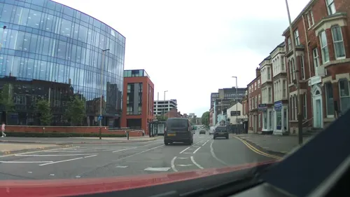
Peter Pizzeria
Restaurant · Sandwich, Pizza · 1.4 mi
9 Welford Place, Leicester
Th-Su 12:00-22:30; Mo-We 12:00-21:30
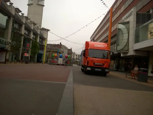
Caffè Nero
Cafe · Coffee Shop · 1.1 mi
28 Humberstone Gate, Leicester
Mo-Sa 07:00-19:00; Su 09:00-18:00

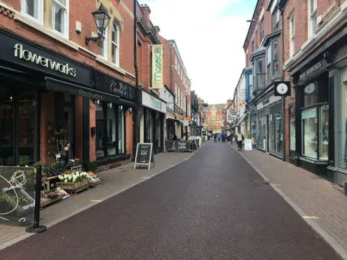
Bodega Cantina
Restaurant · Mexican · 1.3 mi
6-8 St Martin's Square, Leicester
12:00-23:00; Fr,Sa 12:00-00:00
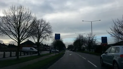
Feast India
Restaurant · Italian,india,chinese · 1.1 mi
411 Melton Road, Leicester
Mo-Fr 18:00-23:00; Sa 17:00-23:00; Su 12:30-15:00,16:00-22:00
Las Iguanas
Restaurant · Latin American · 1.3 mi
13-15 Belvoir Street, Leicester
Mo-Th 11:00-22:00; Fr 11:00-22:30; Sa 11:00-23:00; Su 11:00-22:00
Nando's
Restaurant · Chicken, Portuguese · 1.3 mi
50 Granby Street
Su-Th 11:30-22:30; Fr-Sa 11:30-23:00
Starbucks
Cafe · Coffee Shop · 1.2 mi
93 - 94, Leicester
Mo-Fr 08:00-20:00; Sa 08:00-19:00; Su 10:00-17:00; PH 09:00-18:00

Asda Café
Cafe · Coffee Shop · 0.9 mi
1 Exploration Drive, Leicester
Mo-Sa 08:30-18:00; Su 10:00-16:00
Grays Coffee Shop & Kitchen @ LCB Depot
Cafe · Coffee Shop · 1.2 mi
31 Rutland Street, Leicester
Mo-Fr 08:30-17:30; Sa 10:00-16:00; Su off
KREM
Cafe · Sandwich, Coffee Shop, Ice Cream, Breakfast, Lunch, Cake · 1.2 mi
East Park Road, Leicester
Mo-Su 10:00-16:00
249 more on the map.
History
Belgrave was originally one of Leicestershire’s ancient villages, the first mention of which, under its original Saxon name of Merdegrave (which in old English means Martins grove) appears in Domesday Book of 1086 where it is listed amongst the lands given to Hugh de Grandmesnil. Grandmesnil had fought at the side of William the Conqueror at Hastings and was his chief cavalry commander. As a reward for his services he was granted several manors/lands by the King, of which this was one. The land consisted of a mill, 24 acres (97,000 m2) of meadow and land for six ploughs. For centuries afterwards Belgrave continued as a small agricultural village.
During the Middle Ages Belgrave became one of Leicestershire’s wealthier livings. In the thirteenth century its value rocketed. In 1217 it was valued at 16 marks, at 30 in 1254 and at 60 in 1291.
Back in the 14th Century Thurcaston Road was one of the country's most important roads. On a map of 1675 it is shown as part of the great road from London to Manchester and Carlisle and its importance was further recognised when it became a tumpike (toll road) in 1784. A bridge existed on Thurcaston Road in 1357 although the current medieval one dates from the 15th Century.
Read more of the history
Another important influence on Belgrave was the construction of The Leicester Navigation in 1791. A canal was dug to the south and north of the village to provide a passage for barges where the River Soar was unsuitable for navigation. It helped industry in the town, bringing coal, limestone, state and wool into Leicester and taking hosiery and other finished goods out. The wharf in Belgrave Village, just south of the bridge was the offloading point for Mountsorrel Granite. The medieval bridge had to be widened to allow the barges to pass through.
Belgrave was one of the communities in Leicestershire that experienced the shock of military confrontation because of its situation on the busy London to Derby road which cut right through the heart of the village unlike neighbouring Birstall and Wanlip which it bypassed by some hundreds of yards.
When the English Civil War burst violently into Belgrave, records indicate that there were a number of skirmishes between the opposing forces around the Thurcaston Road Bridge and inside St Peter's Church. There is damage to the Tudor Memorial to Ambrose de Belgrave which suggests that it may have been used for target practice.
With large 19th century terraced developments along the A607 (Belgrave Road and Melton Road), this area now has a large, vibrant Asian community featuring the "Golden Mile". The Asian community based in and around Belgrave and Melton Road have been residents since the early 1970s.
In 1975 the old area of the village was declared a Conservation area and it is this area that represents the nucleus of the ancient village.
Belgrave is home to Belgrave Hall and Gardens. Belgrave Hall, built between 1709 and 1713 in a plain classical style is in the midst of two acres of serene walled gardens. It has changed hands many times but the owners have always played a major role in the economic, social and charitable life of the community. It is very well known for Paranormal Activity.
St Peter's Church is the oldest building in the local conservation area. It has the most magnificent Norman doorway in England. Archaeologists believe that there may be an earlier Saxon church beneath the present structure. Sightings of Apparitions have also been seen.
The Talbot Inn, named after the Talbot Hound, a white hunting Dog dates from the 18th Century and has origins in the 14th century, when it was a popular stop providing bed and board to those who travelled through Leicester along Loughborough Road. Originally a three-storey coaching inn on a major road, the second storey was removed in 1958 after a fire. It is said that The Talbot was the last place a criminal could get a meal or drink on their way to be executed. Their bodies were then returned to the Inn's outbuildings, which also served as a morgue. Paranormal Activity has been reported at The Talbot.
Cross Corners on Thurcaston Road was built by James Vann at the same time that his brother William built Belgrave House. During World War One Belgian refugees were accommodated here and in the 1920s it became a home for “mentally deficient” boys. The building is now owned by Leicester City Council and in 2003 Cross Corners Community Arts Centre opened there.
Tho National School on the corner of Loughborough Road and Thurcaston Road was built in 1861 and stands on the site of the original Bull's Head Pub. Alfred Ellis, who lived opposite in Cross Corners, disliked the “sordid” and “run-down” pub so bought and demolished it, giving the land for a new school. A new Bull's Head was built opposite the school on Bath Street a few years later. By 1877 the school had 350 pupils. It closed in 1974 and is now owned by a firm of solicitors. The Clock was bought to commemorate Queen Victoria's Golden Jubilee of 1887.
As Belgrave grew it became important enough to be linked to Leicester by Horse Tram. The first route of the new Leicester Tramways Company Ltd in 1874 was from the Clock Tower to the Loughborough Road and Thurcaston Road Junction. Electric Trams replaced Horse Trams in 1904.
As can be seen by some of the Houses along Loughborough Road there were some very wealthy residents, including the Chief constable of Leicester at one point.
As the wealth of the area grew so did the population and by the late 19th century many more houses were being built.
As Belgrave grew so did the town of Leicester. In 1891 the parish had a population of 11,405. On 31 October 1891 most of the parish became part of the County Borough of Leicester, on 26 March 1896 the parish was abolished to form Leicester.
From the History section of Belgrave, Leicester on Wikipedia, under CC BY-SA 4.0.
More about Belgrave
Geography
Belgrave is bounded by the wards and areas of the suburb of Rushey Mead and the village of Birstall to the north, Spinney Hills, North Evington and Northfields to the east on the other side of the Midland Main Line, St Matthew's and Leicester City Centre to the south and Beaumont Leys and Stocking Farm to the west. It is located just north of the centre of Leicester, in the eastern part of the city. The old village part of Belgrave is close to the Leicestershire county border and the Borough of Charnwood at the beginning of the Leicester Urban Area in that direction which is located on the other side of Red Hill Circle. Belgrave therefore stretches from and adjoins the city centre and the county.
Education
Rushey Mead Academy, which is the best state-funded secondary school in Leicester and Leicestershire and Soar Valley College.
From the Wikipedia article Belgrave, Leicester, under CC BY-SA 4.0.
Notable people from Belgrave
 Suzanna LeighBritish actress (1945-2017)Photo: Allan warren, CC BY-SA 3.0
- George WaltonEnglish cricketer (1863-1921)
- Tom SidwellEnglish cricketer (1888-1958)
- David WestonBritish industrial artist and author (1935–2011)
Born in Belgrave, according to Wikidata (CC0). Each name links to its Wikipedia article.
Where to stay19
Churches and places of worship89
Shopping66
Gas and EV charging12
Schools, colleges and libraries52
Healthcare14
Leicester Renal Dialysis Centre
Clinic and pharmacy · 1.1 mi
50 Crest Rise, Leicester
Map of Belgrave
250 places. The map loads OpenStreetMap tiles when you open it.
Getting there and nearby towns
East Midlands Airport (EMA) is the nearest airport with scheduled flights listed in OpenStreetMap, 16 miles away.
- Leicester 1 mi southwest, about 2 min by car
- Birstall 1 mi north, about 2 min by car
- Syston 3 mi northeast, about 5 min by car
- Oadby 3 mi southeast, about 5 min by car
- Glenfield 3 mi west, about 5 min by car
- Braunstone 3 mi southwest, about 5 min by car
- Evington 4 mi southeast, about 7 min by car
- Mountsorrel 5 mi north, about 8 min by car
- Glen Parva 5 mi southwest, about 8 min by car
- Shepshed 11 mi northwest, about 17 min by car
Drive times are estimates from straight-line distance, not routes.
Towns near Belgrave


Keep exploring
Local news
Headlines from INDB.
Reviews, tips and questions
Loading what members have shared...
Sources and licences
- GeoNames (CC BY 4.0): population, coordinates, regions and time zone
- Mapillary (see each image): photos
- OpenStreetMap contributors (ODbL 1.0): places, airports, map data
- Wikidata (CC0 1.0): elevation, founding date, time zone, website, landmarks and historic places
- Wikimedia Commons (see each image): photos
- Wikipedia (CC BY-SA 4.0): overview and history text
Photo credits
- Barclays bank Melton Road Belgrave Leicester, Victuallers, CC BY-SA 3.0
- Agar Street, Belgrave, Leicester in 2026, DUDUZ02, CC0
- Curve Leicester full panorama, NotFromUtrecht, CC BY-SA 3.0
- Braunstone Gate Bridge, Tim Hallam, CC BY-SA 2.0
- De Montfort Hall, NotFromUtrecht, CC BY-SA 3.0
- Phoenix Arts Centre Leicester, NotFromUtrecht, CC BY-SA 3.0
- Dynasty Death and Discovery, Richard III museum entrance, RobinLeicester, CC BY-SA 4.0
- Jewry Wall ruins panorama 3, NotFromUtrecht, CC BY-SA 3.0
- Abbeyruins Leicester, Kev747 at English Wikipedia, CC BY-SA 3.0
- War Memorial Leicester, Summer 2009, NotFromUtrecht, CC BY-SA 3.0
- GasMuseumMay2010, Chemical Engineer, Public domain
- Abbey Park Leicester entrance gate, NotFromUtrecht, CC BY-SA 3.0
- Birstall Meadows 5, Dudley Miles, CC BY-SA 4.0
- Goss Meadows 7, Dudley Miles, CC BY-SA 4.0
- Humberstone Park LNR 6, Dudley Miles, CC BY-SA 4.0
- Knighton Spinney 4, Dudley Miles, CC BY-SA 4.0
- Nelson Mandela Park, Joshuajohnlee ., CC BY 3.0
- The Orchards Nature Reserve 2, Dudley Miles, CC BY-SA 4.0
- Victoria Park Leicester from Queens Road, NotFromUtrecht, CC BY-SA 3.0
- River Soar from Wanlip Meadows 2, Dudley Miles, CC BY-SA 4.0
- Birstall Church, Kev747 at English Wikipedia, Public domain
- St Mark's Church, Leicester, south side, Grahamrob, CC BY-SA 3.0
- Leicester Haymarket Theatre entrance, Cordyceps-Zombie, CC BY-SA 4.0
- Teatr Mały w Leicester, Kris1973, CC BY-SA 4.0
- Abbey Pumping station, Jonnic1 at English Wikipedia, Public domain
- All Saints Church - widok od południowej strony, Kris1973, CC BY-SA 4.0
- Leicester Cathedral panorama (small crop), NotFromUtrecht, CC BY-SA 3.0
- Highcross Leicester, NotFromUtrecht, CC BY-SA 3.0
- Leicester - Corn Exchange, Flamenc, CC BY-SA 3.0
- New Walk Museum main entrance, NotFromUtrecht, CC BY-SA 3.0
- Haymarket, Kris1973, CC BY-SA 4.0
- Leicester Baptist Church, Steve Cadman from London, U.K., CC BY-SA 2.0
- Leicester Cathedral south facade, DeFacto, CC BY-SA 4.0
- The Peepul Centre, Belgrave, Leicester, HIDEHIH0DIH0, CC BY-SA 4.0
- Agar Street, HIDEHIH0DIH0, CC BY-SA 4.0
- Phoenix Square Leicester west side, NotFromUtrecht, CC BY-SA 3.0
- National Space Centre (28967294791), Amanda Slater from Coventry, West Midlands, UK, CC BY-SA 2.0
- Belgrave Hall, Leicester, RobinLeicester, CC BY-SA 4.0
- Street-level photo, toby, CC BY-SA 4.0
- Street-level photo, southglos, CC BY-SA 4.0
- Street-level photo, toby, CC BY-SA 4.0
- Street-level photo, sk53, CC BY-SA 4.0
- Street-level photo, sk53, CC BY-SA 4.0
- Street-level photo, toby, CC BY-SA 4.0
- Street-level photo, adam2, CC BY-SA 4.0
- Street-level photo, sk53, CC BY-SA 4.0
- Street-level photo, cyclestreets, CC BY-SA 4.0
- Street-level photo, toby, CC BY-SA 4.0
- Street-level photo, cyclestreets, CC BY-SA 4.0
- Street-level photo, cyclestreets, CC BY-SA 4.0
- Street-level photo, adam2, CC BY-SA 4.0
- Street-level photo, adam2, CC BY-SA 4.0
- Street-level photo, toby, CC BY-SA 4.0
- Street-level photo, sk53_quint, CC BY-SA 4.0
- Street-level photo, adam2, CC BY-SA 4.0
- Street-level photo, sk53_quint, CC BY-SA 4.0
- Street-level photo, sk53, CC BY-SA 4.0
- Street-level photo, toby, CC BY-SA 4.0
- Street-level photo, sk53, CC BY-SA 4.0
- Street-level photo, sk53, CC BY-SA 4.0


Page built November 10, 2026. Spotted a mistake? Tell us or suggest a place.