


Eastleigh, United Kingdom
Eastleigh is a town of 54,225 people in England, United Kingdom.
Why visit Eastleigh
Townapedia lists 8 museums and landmarks, 25 parks and trails, 81 places to eat, 6 places to stay and 4 attractions in and around town.
Highlights include The Point, Cobden Bridge, Eastleigh Museum and Lakeside Country Park.
Weather in Eastleigh
Forecast from MET Norway (CC BY 4.0). Full forecast
About Eastleigh
Eastleigh is a town in Hampshire, England, between Southampton and Winchester. It is the largest town and the administrative seat of the Borough of Eastleigh, with a population of 24,011 at the 2011 census.
From the Wikipedia article Eastleigh (this version), under CC BY-SA 4.0.
Travel tips from other travellers: Eastleigh on Wikivoyage (CC BY-SA 4.0).
Photos of Eastleigh


Things to do4


The Point, Eastleigh
Cinema and theater
Theatre and dance centre in Eastleigh, Hampshire, England, in the former Town Hall

Museums and landmarks8




Parks, trails and playgrounds25

Lakeside Country Park
Park · 0.9 mi
Railway park in the United Kingdom

Riverside Park
Park · 2.5 mi
Public park in Southampton, Hampshire, England



13 more on the map.
Restaurants and cafes81
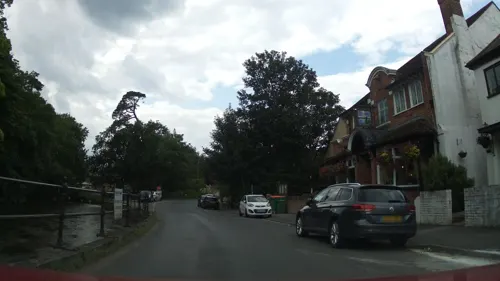
The Anglers Inn
Bar and pub · 0.6 mi
17 Riverside, Eastleigh
Mo-We 14:00-22:00; Th 14:00-23:00; Fr-Su 12:00-23:00



69 more on the map.
History
The modern town of Eastleigh lies on the old Roman road, built in A.D.79 between Winchester (Venta Belgarum) and Bitterne (Clausentum). Roman remains discovered in the Eastleigh area, including a Roman lead coffin excavated in 1908, indicate that a settlement probably existed here in Roman times.
A Saxon village called 'East Leah' has been recorded to have existed since 932 AD. ('Leah' is an ancient Anglo-Saxon word meaning 'a clearing in a forest'). There is additional evidence of this settlement in a survey from the time which details land in North Stoneham being granted by King Æthelstan to his military aid, Alfred in 932 AD. The prefix 'Est' or 'East' is thought to refer to its location relative to the established settlement of Baddesley.
The Domesday Book of 1086 gives a more detailed account of the settlement, which is referred to as 'Estleie'.
Read more of the history
In 1838, the London and South Western Railway Company (L&SWR) built a railway from Southampton to Winchester. It was decided to build a station near the little village of Barton; this railway station was originally named Bishopstoke Junction. In 1868, the villages of Barton and Eastley were combined into one parish. A parish church, the Church of the Resurrection, was built in the same year at a cost of £2,300. A local noted author of many novels, Charlotte Yonge, donated £500 towards the building of the church. She was rewarded by being given the privilege to choose a name for the 'new' parish: either Barton or Eastly. She chose Eastly, but with a new modern spelling: Eastleigh. In 1891, the L&SWR Carriage and Wagon Works from Nine Elms in London were transferred to Eastleigh; this was followed by the Nine Elms Locomotive Works, which were moved there in 1909. These railway works were closed in 2006 but have since reopened, albeit on a smaller scale.
Eastleigh has seen a rapid and controlled expansion in residential, industrial and commercial development over recent years. The borough of Eastleigh was ranked the "9th best place to live in the UK 2006" by a Channel 4 programme.
The United States Navy established a naval air station on 23 July 1918 to assemble and repair Caproni Ca.5 and Airco DH.4 and DH.9 bombers for the Northern Bombing Group of the First World War. The base closed shortly after the First Armistice at Compiègne. Perhaps Eastleigh's best-known resident is the Spitfire aeroplane, which was built in Southampton and first flown from Eastleigh Aerodrome. A replica has recently been placed on the roundabout at the entrance to the airport.
Eastleigh Museum, which is to be found in the High Street, holds information about the town and the surrounding villages, including Bishopstoke which had been the largest residential area.
From the History section of Eastleigh on Wikipedia, under CC BY-SA 4.0.
More about Eastleigh
Economy
The B&Q head office is on Chestnut Avenue in Chandler's Ford. The town was formerly home to a Mr Kipling bakery.
Eastleigh is also home to a manufacturing plant owned by Prysmian Cables & Systems.
The Swan Shopping Centre opened in 1989. It was built in the heart of the town's Victorian 'grid iron' road layout and blocked off Market Street and High Street; through access was possible for pedestrians while the centre was open. It included a French-style café and a new library, which replaced the former library situated in the Park, now used as part of The Point.
Education
Eastleigh has two further education colleges: Barton Peveril Sixth Form College (where Colin Firth was a pupil) and Eastleigh College (both on the same road). Crestwood Community School is the secondary school for the town, and primary schools include Cherbourg Primary School, Norwood Primary School, Nightingale Primary School, the Crescent Primary School and Shakespeare Infant and Junior Schools to the north of the town.
From the Wikipedia article Eastleigh, under CC BY-SA 4.0.
Notable people from Eastleigh
 David NichollsBritish writerPhoto: putnik, CC BY 3.0
 Caroline PidgeonBritish politician (born 1972)Photo: ©House of Lords / photography by Roger Harris, CC BY 3.0
 David SmithBritish Boccia playerPhoto: Richard Gillin from St Albans, UK, CC BY-SA 2.0
 Heather HallettEnglish judge (born 1949)Photo: ©House of Lords / photography by Roger Harris, CC BY 3.0
 Gareth MitchellTechnology broadcasterPhoto: Annika Haas ( EU2017EE ), CC BY 2.0
 John MartinAustralian Paralympic athletePhoto: AdrienneK, CC BY-SA 3.0
- Mary HoffmanBritish writer
- Malcolm GreenBritish chemist (1936-2020)
- Manny AndruszewskiEnglish footballer
- Connor BenzeyEnglish snooker player
- Bill BundyEnglish footballer (1883-1945)
- Chrystabel Leighton-PorterBritish dancer and model (1913-2000)
Born in Eastleigh, according to Wikidata (CC0). Each name links to its Wikipedia article.
Where to stay6
Churches and places of worship27
Emmanuel Baptist Church
Church · Baptist · 0.4 mi
225 Desborough Road, Eastleigh
Shopping12
Gas and EV charging5
Schools, colleges and libraries22
St Swithun Wells Catholic Primary School
School · Roman Catholic · 1.5 mi
Hillcrest Avenue, Eastleigh
Healthcare6
Map of Eastleigh
196 places. The map loads OpenStreetMap tiles when you open it.
Getting there and nearby towns
Southampton Airport (SOU) is the nearest airport with scheduled flights listed in OpenStreetMap, 1 miles away.
- Bishopstoke 1 mi east, about 2 min by car
- Fair Oak 2 mi east, about 4 min by car
- Portswood 3 mi southwest, about 5 min by car
- Hedge End 4 mi southeast, about 7 min by car
- Southampton 5 mi southwest, about 8 min by car
- Winchester 7 mi north, about 11 min by car
- Totton 7 mi southwest, about 11 min by car
- Romsey 7 mi west, about 11 min by car
- Hythe 8 mi south, about 12 min by car
- Fareham 11 mi southeast, about 18 min by car
Drive times are estimates from straight-line distance, not routes.
Towns near Eastleigh


Keep exploring
Local news
Headlines from INDB.
Reviews, tips and questions
Loading what members have shared...
Sources and licences
- GeoNames (CC BY 4.0): population, coordinates, regions and time zone
- Mapillary (see each image): photos
- OpenStreetMap contributors (ODbL 1.0): places, airports, map data
- Wikidata (CC0 1.0): elevation, founding date, time zone, website, landmarks and historic places
- Wikimedia Commons (see each image): photos
- Wikipedia (CC BY-SA 4.0): overview and history text
Photo credits
- High Street Eastleigh, Peter Jordan, CC BY-SA 2.0
- 43065 Eastleigh (9365681495), Train Photos, CC BY-SA 2.0
- Eastleigh Platform 3 Panorama, TheJRB, CC BY-SA 2.0
- 444039+444022 Pass Eastleigh, TheJRB, CC BY-SA 2.0
- 444002 Heads Out of Eastleigh, TheJRB, CC BY-SA 2.0
- 444020 Passes Eastleigh, TheJRB, CC BY-SA 2.0
- 158883 at Eastleigh, TheJRB, CC BY-SA 2.0
- 158883 Departs Eastleigh, TheJRB, CC BY-SA 2.0
- Cobden Bridge, Dave Jacobs, CC BY-SA 2.0
- Beach Lake, Lakeside Country Park, Eastleigh, Peter Facey, CC BY-SA 2.0
- Itchen Valley Country Park visitor centre, Hugh Venables, CC BY-SA 2.0
- Emmanuel Baptist Church, Cherbourg Road, Eastleigh (June 2019) (1), Hassocks5489, CC0
- St James's Church, Church Hill, West End (NHLE Code 1281100) (May 2019) (1), Hassocks5489, CC0
- HighfieldChurch, AlanFord at English Wikipedia, Public domain
- St. Alban's Church, Southampton, Michael Ford, CC BY-SA 2.0
- St Denys Priory, remnants on Priory Avenue, Rob Woodward, Public domain
- St. Michael & All Angels, Bassett, Michael Ford, CC BY-SA 2.0
- The Point, Eastleigh, Paul Spencer, CC BY-SA 3.0
- Eastleigh College, Chestnut Avenue, Eastleigh, Hampshire, Mertbiol, CC0
- St. Nicolas Church 1, Brendan and Ruth McCartney, CC BY-SA 2.0
- All Saints Church, Derby Road, Eastleigh (June 2019) (7), Hassocks5489, CC0
- St Nicolas' Church, Stoneham Lane, North Stoneham (NHLE Code 1204006) (June 2019) (6), Hassocks5489, CC0
- The Point Eastleigh, Marek . 69 talk, CC BY-SA 3.0
- Eastleigh Museum gallery, Geni, CC BY-SA 4.0
- Stoneham war shrine, peter clayton, CC BY-SA 2.0
- Street-level photo, sk53, CC BY-SA 4.0
- Street-level photo, southglos, CC BY-SA 4.0
- Street-level photo, sk53, CC BY-SA 4.0
- Street-level photo, southglos, CC BY-SA 4.0
- Street-level photo, southglos, CC BY-SA 4.0
- Street-level photo, southglos, CC BY-SA 4.0
- Street-level photo, sk53, CC BY-SA 4.0
- Street-level photo, sk53, CC BY-SA 4.0
- Street-level photo, sk53, CC BY-SA 4.0
- Street-level photo, sk53, CC BY-SA 4.0
- Street-level photo, southglos, CC BY-SA 4.0
- Street-level photo, sk53, CC BY-SA 4.0
- Street-level photo, sk53, CC BY-SA 4.0
- Street-level photo, southglos, CC BY-SA 4.0
- Street-level photo, southglos, CC BY-SA 4.0
- Street-level photo, southglos, CC BY-SA 4.0
- Street-level photo, southglos, CC BY-SA 4.0
- Street-level photo, jpennycook, CC BY-SA 4.0
- Street-level photo, southglos, CC BY-SA 4.0
- Street-level photo, southglos, CC BY-SA 4.0
- Street-level photo, iced, CC BY-SA 4.0
- Street-level photo, sk53, CC BY-SA 4.0
- Street-level photo, southglos, CC BY-SA 4.0
- Street-level photo, sk53, CC BY-SA 4.0


Page built November 10, 2026. Spotted a mistake? Tell us or suggest a place.