


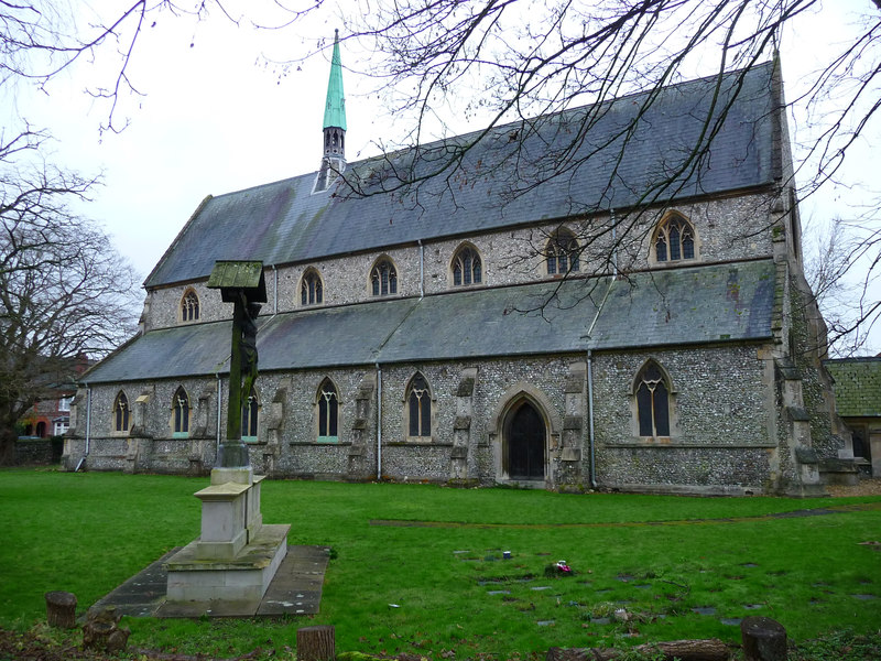


Winchester, United Kingdom
Winchester is a town of 46,074 people in England, United Kingdom.
Why visit Winchester
Townapedia lists 56 museums and landmarks, 27 parks and trails, 144 places to eat, 7 places to stay and 16 attractions in and around town.
Highlights include St. Catherine's Hill, Blue Apple Theatre, Great Hall and The Westgate.
Weather in Winchester
Forecast from MET Norway (CC BY 4.0). Full forecast
About Winchester
Winchester (, ) is a cathedral city in Hampshire, England. The city lies at the heart of the wider City of Winchester, a local government district, at the western end of the South Downs National Park, on the River Itchen. It is 60 miles (97 km) south-west of London and 14 miles (23 km) from Southampton, its nearest major city. At the 2021 census, the built-up area of Winchester had a population of 48,478.
From the Wikipedia article Winchester (this version), under CC BY-SA 4.0.
Travel tips from other travellers: Winchester on Wikivoyage (CC BY-SA 4.0).
Photos of Winchester


Things to do16


Blue Apple Theatre
Cinema and theater · 1.3 mi
British charitable organization

4 more on the map.
Museums and landmarks56


Royal Hampshire Regiment Museum
Museum
Military museum in Winchester, Hampshire, England, UK

Adjutant General's Corps Museum
Museum
Military museum in Winchester, Hampshire, England, United Kingdom
HorsePower: The Museum of the King's Royal Hussars
Museum
Military museum in Winchester, Hampshire, United Kingdom
Royal Green Jackets (Rifles) Museum
Museum
Regimental museum in Peninsula Barracks, Winchester, United Kingdom
Royal Logistic Corps Museum
Museum · 3.2 mi
Military museum in near Winchester, Hampshire, United Kingdom

44 more on the map.
Parks, trails and playgrounds27




15 more on the map.
Restaurants and cafes144
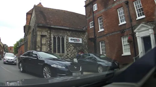
The Chesil Rectory
Restaurant · 0.6 mi
1 Chesil Street, Winchester
We,Th 12:00-14:30,18:00-21:00; Fr,Sa 12:00-14:30,18:00-21:30; Su...
The William Walker
Bar and pub
34 The Square, Winchester
Mo-We 11:00-23:00; Th-Sa 11:00-24:00; Su 11:00-22:30


The Old Gaolhouse
Bar and pub
11a Jewry Street, Winchester
Mo-Th 08:00-24:00; Fr-Sa 08:00-01:00; Su 08:00-24:00

The Winchester Orangery
Restaurant
11 The Square, Winchester
Mo-Th 09:00-17:00, Fr-Sa 09:00-22:00, Su 09:00-17:00
Tanoshii Fusion
Restaurant · Asian
Free delivery within 3 miles on orders over £20, evenings only.
12 Upper High Street, Winchester
Tu-Th 12:00-14:00,18:00-21:30; Fr-Sa 12:00-14:00,18:00-22:00; Su...

Cafe Monde
Cafe
22 The Square, Winchester
Mo-Th 08:30-15:30, Fr-Sa 08:30-17:00, Su 09:30-17:00
Gurkha's Inn
Restaurant · Indian
17 City Road, Winchester
Mo-Th 12:00-14:30,17:30-23:00; Fr-Sa 12:00-14:30,17:30-23:30; Su...
132 more on the map.
History
The area around Winchester has been inhabited since prehistoric times, with three Iron Age hillforts, Oram's Arbour, St. Catherine's Hill, and Worthy Down all nearby. In the Late Iron Age, a more urban settlement type developed, known as an oppidum, although the archaeology of this phase remains obscure.
The settlement became an important centre for the British Belgae tribe; however, it remains unclear how the Belgae came to control the initial settlement. Caesar recorded the tribe had crossed the channel as raiders (probably in the 1st century BCE), only to later establish themselves. The Roman account of continental invaders has been challenged in recent years with scientific studies favouring a gradual change through increased trade links rather than migration.
To the Celtic Britons, the settlement was probably known as Wentā or Venta (from a common Celtic word meaning "tribal town" or "meeting place"). An etymology connected with the Celtic word for "white" (Modern Welsh gwyn) has been suggested, due to Winchester's situation upon chalk. It was the Latinised versions of this name, together with that of the tribe, that gave the town its Roman name of Venta Belgarum.
Read more of the history
After the Roman conquest of Britain, the settlement served as the capital (Latin: civitas) of the Belgae and was distinguished as Venta Belgarum, "Venta of the Belgae". Although in the early years of the Roman province it was of subsidiary importance to Silchester and Chichester, Venta eclipsed them both by the latter half of the second century. At the beginning of the third century, Winchester was given protective stone walls. At around this time the city covered an area of 144 acres (58 ha), making it among the largest towns in Roman Britain by surface area. There was a limited suburban area outside the walls. Like many other Roman towns, however, Winchester began to decline in the later fourth century.
Despite the Roman withdrawal from Britain, urban life continued much as it had done into the mid fifth century. The settlement was reduced in size, but work was carried out to improve the city's defences. The city may have functioned as a centre for a religious community or a royal palace, as they continued to use the Christian cemeteries established in the Roman period.
Winchester appears in early Welsh literature and is commonly identified as the city of Cair Guinntguic listed among the 28 cities of Britain in the History of the Britons (commonly attributed to Nennius). The city is known as Caerwynt in Modern Welsh.
Between 476 and 517 AD, the town and surrounding areas seem to have been fortified by several Jutish settlements and to have operated as part of a larger polity.
The city became known as Wintanceaster ("Fort Venta") in Old English. In 648, King Cenwalh of Wessex erected the Church of St Peter and St Paul, later known as the Old Minster. This became a cathedral in the 660s when the West Saxon bishop's see was transferred from Dorchester on Thames. The present form of the city dates from reconstruction in the late 9th century, when King Alfred the Great obliterated the Roman street plan in favour of a new grid in order to provide better defence against the Vikings. The city's first mint appears to date from this period.
In the early 10th century there were two new ecclesiastical establishments: the convent of Nunnaminster, founded by Alfred's widow Ealhswith, and the New Minster. Bishop Æthelwold of Winchester was a leading figure in the monastic reform movement of the later 10th century. He expelled the secular canons of both minsters and replaced them with monks. He created the drainage system, the "Lockburn", which served as the town drain until 1875, and still survives. Also in the late 10th century, the Old Minster was enlarged as a centre of the cult of the 9th century Bishop of Winchester, Saint Swithun. The three minsters were the home of what architectural historian John Crook describes as "the supreme artistic achievements" of the Winchester School.
The consensus among historians of Anglo-Saxon England is that the court was mobile in this period and there was no fixed capital. Martin Biddle has suggested that Winchester was a centre for royal administration in the 7th and 8th centuries, but this is questioned by Barbara Yorke, who sees it as significant that the shire was named after Hamtun, the forerunner of Southampton. However, Winchester is described by the historian Catherine Cubitt as "the premier city of the West Saxon kingdom" and Janet Nelson describes London and Winchester as Alfred the Great's "proto-capitals".
There was a fire in the city in 1141 during the Rout of Winchester. In the 14th century, William of Wykeham played a role in the city's restoration. As Bishop of Winchester he was responsible for much of the current structure of the cathedral, and he founded the extant public school Winchester College. During the Middle Ages, the city was an important centre of the wool trade, before going into a slow decline. The curfew bell in the bell tower (near the clock in the picture), still sounds at 8:00 pm each evening.
Jews lived in Winchester from at least 1148, and in the 13th century the Jewish community in the city was one of the most important in England. There was an archa in the city, and the Jewish quarter was located in the city's heart (present day Jewry street). There were a series of blood libel claims against the Jewish community in the 1220s and 1230s, which was probably the cause of the hanging of the community's leader, Abraham Pinch, in front of the synagogue of which he was the head. Simon de Montfort ransacked the Jewish quarter in 1264, and in 1290 all Jews were expelled from England. A statue of Licoricia of Winchester, described as "the most important Jewish woman in medieval England", located in Jewry Street, was unveiled by the then Prince of Wales on 10 February 2022.
From the History section of Winchester on Wikipedia, under CC BY-SA 4.0.
More about Winchester
Geography
Winchester is situated on a bed of Cretaceous lower chalk with small areas of clay and loam soil, inset with combined clay and rich sources of fuller's earth.
As with the rest of the UK, Winchester experiences an oceanic climate (Köppen Cfb). The nearest Met Office station is in Martyr Worthy, just outside the city.
Education
Winchester has a variety of Church of England primary schools, including both state and private provision schools. St Peters Catholic Primary School had the highest SATS results, after achieving a perfect score of 300 in 2011.
There are three state comprehensive secondary schools in Winchester; the Henry Beaufort School, King's School, and The Westgate School.
Shepherds Down Special School is a state funded special school for pupils aged 4 to 11, located just outside of the city in Compton.
Osborne School is a maintained special school for pupils with learning disabilities aged 11-19.
Independent junior/preparatory schools are The Pilgrims' School Winchester, the Prince's Mead School and Twyford School, which is just outside the city and claims to be the oldest preparatory school in the United Kingdom. There are two major independent senior schools in Winchester, St Swithun's (a day and boarding school for girls from nursery to sixth form) and Winchester College, a public school. Both schools often top the examination result tables for the city and county.
From the Wikipedia article Winchester, under CC BY-SA 4.0.
Notable people from Winchester
 Henry III of EnglandKing of England from 1216 to 1272Photo: Anonymous Unknown author, Public domain
 Danny IngsEnglish association football playerPhoto: Egghead06, CC BY 4.0
 Matt TargettEnglish association football player (born 1995)Photo: Solent Creatives from Southampton,..., CC BY 2.0
 Christopher CazenoveBritish actor (1945–2010)Photo: Ian Brown LRPS ., Public domain
 Mary Russell MitfordEnglish author and dramatist (1787–1855)Photo: Benjamin Haydon, Public domain
- Empress MatildaHoly Roman Empress (1114–1125); claimant to the English throne
- Arthur, Prince of WalesPrince of Wales, Earl of Chester and Duke of Cornwall
- Richard of CornwallKing of the Romans, Earl of Cornwall, English royalty
- William AdelinDuke of Normandy
- Lucy PinderBritish actress and model
- Mary Warnock, Baroness WarnockPhilosopher of morality, education and mind, and writer on existentialism (1924-2019)
- Hugh MitchellBritish actor
Born in Winchester, according to Wikidata (CC0). Each name links to its Wikipedia article.
Where to stay7
Churches and places of worship53
Shopping28
Gas and EV charging9
Schools, colleges and libraries26
All Saints Church of England Primary School
School · Anglican · 0.9 mi
St Catherine's Road, Winchester
St Peter's Catholic Primary School
School · Roman Catholic · 1.5 mi
Oliver's Battery Road North, Winchester
Healthcare6
Map of Winchester
250 places. The map loads OpenStreetMap tiles when you open it.
Getting there and nearby towns
Southampton Airport (SOU) is the nearest airport with scheduled flights listed in OpenStreetMap, 8 miles away.
- Bishopstoke 7 mi south, about 11 min by car
- Fair Oak 7 mi south, about 11 min by car
- Romsey 9 mi southwest, about 15 min by car
- Portswood 10 mi south, about 16 min by car
- Hedge End 11 mi south, about 17 min by car
- Southampton 12 mi south, about 19 min by car
- Hythe 15 mi south, about 24 min by car
- Alton 16 mi east, about 26 min by car
- Basingstoke 17 mi northeast, about 27 min by car
- Petersfield 17 mi east, about 28 min by car
Drive times are estimates from straight-line distance, not routes.
Towns near Winchester


Keep exploring
Local news
Headlines from INDB.
Reviews, tips and questions
Loading what members have shared...
Sources and licences
- GeoNames (CC BY 4.0): population, coordinates, regions and time zone
- Mapillary (see each image): photos
- OpenStreetMap contributors (ODbL 1.0): places, airports, map data
- Wikidata (CC0 1.0): elevation, founding date, time zone, website, landmarks and historic places
- Wikimedia Commons (see each image): photos
- Wikipedia (CC BY-SA 4.0): overview and history text
Photo credits
- View of Winchester, Hampshire, England, ITookSomePhotos, CC BY-SA 4.0
- Winchester United Church, Jewry Street, Winchester (NHLE Code 1387465) (May 2021) (5), Hassocks5489, CC0
- Holy Trinity Church, Winchester, Chris Talbot, CC BY-SA 2.0
- WinCath30Je6-4836wiki, http://www.wyrdlight.com Author: Antony McCallum, CC BY 3.0
- Royal Hants County Hospital2, Pterre, Public domain
- St. Catherine's Hill, Dave Moore, CC BY-SA 4.0
- Pilgrims school xmas, SuzanneKn at en.wikipedia, Public domain
- 1350695-The Westgate, Johan Bakker, CC BY-SA 3.0
- 1095347-Winchester city mill, Johan Bakker, CC BY-SA 3.0
- God Begot House, Jhsteel, CC BY-SA 3.0
- Friends Meeting House, 16 Colebrook Street, Winchester (NHLE Code 1350680) (June 2019) (4), Hassocks5489, CC0
- 1351065-Great Hall, Winchester Castle (2), Johan Bakker, CC BY-SA 3.0
- St Faith's Church, Hospital of St Cross, St Cross Road, Winchester (NHLE Code 1095374) (June 2019) (11), Hassocks5489, CC0
- Peter Symonds College, GaryReggae, CC BY-SA 2.0
- Winchester city mill march 2024, Geni, CC BY-SA 4.0
- Hospital of St Cross, Peter Facey, CC BY-SA 2.0
- Osborne School, Winchester, Mx. Granger, CC0
- Hockley Meadows nature reserve, Twyford, Hampshire, AndyScott, CC BY-SA 4.0
- Tudor fireplace in Westgate Museum 2026-07-12, Andy Li, CC0
- Royal Hampshire Regiment Museum - Winchester - panoramio, HackBitz, CC BY-SA 3.0
- Street-level photo, jpennycook, CC BY-SA 4.0
- Street-level photo, jpennycook, CC BY-SA 4.0
- Street-level photo, jpennycook, CC BY-SA 4.0
- Street-level photo, southglos, CC BY-SA 4.0
- Street-level photo, jpennycook, CC BY-SA 4.0
- Street-level photo, swinetown, CC BY-SA 4.0
- Street-level photo, jpennycook, CC BY-SA 4.0
- Street-level photo, jpennycook, CC BY-SA 4.0
- Street-level photo, jpennycook, CC BY-SA 4.0
- Street-level photo, jpennycook, CC BY-SA 4.0
- Street-level photo, southglos, CC BY-SA 4.0
- Street-level photo, jpennycook, CC BY-SA 4.0
- Street-level photo, southglos, CC BY-SA 4.0
- Street-level photo, southglos, CC BY-SA 4.0
- Street-level photo, jpennycook, CC BY-SA 4.0
- Street-level photo, southglos, CC BY-SA 4.0
- Street-level photo, jpennycook, CC BY-SA 4.0
- Street-level photo, jpennycook, CC BY-SA 4.0
- Street-level photo, jpennycook, CC BY-SA 4.0
- Street-level photo, southglos, CC BY-SA 4.0
- Street-level photo, jpennycook, CC BY-SA 4.0
- Street-level photo, swinetown, CC BY-SA 4.0
- Street-level photo, swinetown, CC BY-SA 4.0
- Street-level photo, jpennycook, CC BY-SA 4.0


Page built November 10, 2026. Spotted a mistake? Tell us or suggest a place.