


Wood Green, United Kingdom
Wood Green is a town of 28,453 people in England, United Kingdom.
Why visit Wood Green
Townapedia lists 37 museums and landmarks, 104 parks and trails, 194 places to eat, 17 places to stay and 12 attractions in and around town.
Highlights include Everyman Cinema, ArtHouse Crouch End, Alexandra Palace and Arsenal Football Club Museum.
Weather in Wood Green
Forecast from MET Norway (CC BY 4.0). Full forecast
About Wood Green
Wood Green is a suburban district of the London Borough of Haringey, London, England. Its postal district is N22, with parts in N8 and N15. The London Plan identifies it as one of the metropolitan centres in Greater London, and today it forms a major commercial district of north London.
From the Wikipedia article Wood Green (this version), under CC BY-SA 4.0.
Photos of Wood Green

Things to do12

Everyman Cinema
Cinema and theater · 1.5 mi
Art deco cinema
Fortis Green Road, London
Mo-Su 12:00-23:00


Hornsey Town Hall
Cinema and theater · 1.5 mi
A public building and former town hall in Crouch End area of Hornsey, London

Middle Lane Market
Farm and orchard · 0.9 mi
226 Middle Lane, London
Mo-Tu 09:00-16:00; We-Th, Sa 09:00-19:00; Fr 09:00-20:00; Su 09:00-17:00

Bernie Grant Arts Centre
Cinema and theater · 2.1 mi
Arts centre in Tottenham, London



Crouch End Hippodrome
Cinema and theater · 1.3 mi
Former theatre in Tottenham Lane, Crouch End, Haringey, London
Millfield Theatre
Cinema and theater · 2.0 mi
Theatre in Enfield, London
Museums and landmarks37

Alexandra Palace
Monument and historic site · 0.7 mi
Entertainment venue in Alexandra Park, London
Alexandra Palace Way, London


Francis Skaryna Belarusian Library and Museum
Museum · 3.1 mi
Library

Kenwood House
Museum · 2.9 mi
Art museum and historic house in Hampstead, London


Monument to Samuel Rogers and Family
Monument and historic site · 0.9 mi
Chest tomb of the nonconformist Roger’s family of Stoke Newington. Samuel Roger’s was a celebrated Victorian poet who died in 1855 aged...


Jealous Gallery and Print Studio
Museum · 1.4 mi
27 Park Road, London
Mo off; Tu off; We-Sa 10:00-18:00; Su 11:00-17:00
25 more on the map.
Parks, trails and playgrounds104


Barfield Allotments Nature Park
Park · 2.6 mi
Parkland in London, England



Stationers Park
Park · 1.4 mi
A 1.5-hectare park in the London Borough of Haringey
Mayfield Road, London
24/7

Little Dinosaurs
Playground · 1.1 mi
Alexandra Palace Way, London
Mo-Th 09:30-17:30; Fr 09:30-18:30; Sa-Su 10:00-18:00

Alexandra Palace Pitch & Putt
Golf course · 0.6 mi
10 hole Pitch & Putt course, par 3 course
Alexandra Palace Way, London
92 more on the map.
Restaurants and cafes194

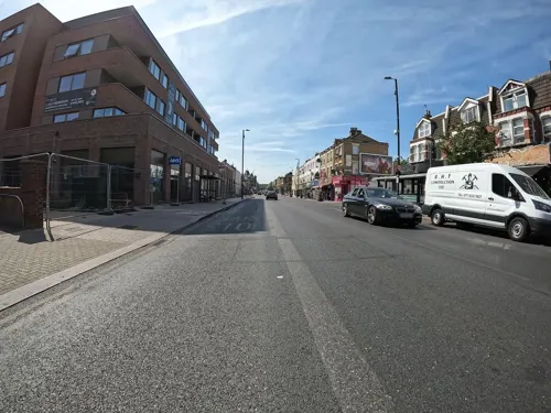
Langham Working Mens Club
Bar and pub · 1.3 mi
600 Green Lanes, London
Mo-Th 16:30-32:00; Fr 13:00-24:00; Sa 12:00-24:00; Su 12:00-23:00

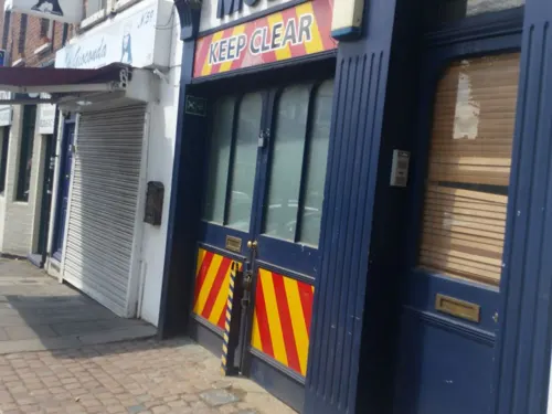
The Great Northern Railway Tavern
Bar and pub · 0.8 mi
67 High Street, London
Mo-Th 12:00-23:00; Fr-Sa 12:00-00:00; Su 12:00-22:30

The Mossy Well
Bar and pub · Usual Wetherspoons Selection · 1.3 mi
258-260 Muswell Hill Broadway, London
Mo 08:00-23:30; Tu-We 08:00-24:00; Th-Su 08:00-01:00

The Queens
Bar and pub · British, Pub, Roast · 1.3 mi
26 Tottenham Lane, London
Mo-Th 12:00-23:00; Fr-Sa 12:00-24:00; Su 12:00-23:00

The Starting Gate
Bar and pub
Station Road, London
Mo-Th 12:00-23:00; Fr 12:00-24:00; Sa 11:00-24:00; Su 11:00-22:30;...
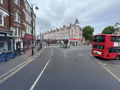
Akatuki
Restaurant · Japanese · 1.3 mi
224 Muswell Hill Broadway, London
Mo-Su 12:00-15:00,17:00-23:00
Bar Esteban
Restaurant · Spanish, Tapas · 1.4 mi
29 Park Road, London
Tu-Th 18:00-22:00; Fr-Sa 17:00-23:00
Barbers Bazaar
Restaurant · Indian · 1.0 mi
37 Tottenham Lane, London
Mo off; Tu-Fr 17:00-22:30; Sa-Su 12:00-22:30
Bolland and Crust
Cafe · Breakfast, Coffee Shop, Local · 1.1 mi
38 Crawley Road, London
We-Th 10:00-15:00; Fr-Sa 09:00-16:00; Su 10:00-16:00
182 more on the map.
History
Records suggest that settlement around Wood Green did not start till after the Norman Conquest. There is some limited evidence of Roman presence in the Wood Green area but none of any Saxon settlement. However, from the latter part of the 14th century, a number of estates developed around Wood Green. This included the Manor of Ducketts and a handful of smaller estates.
In the early Seventeenth Century, the lord of Tottenham Manor, the Earl of Dorset, conducted a major survey of his land. It showed that Wood Green, at the time roughly the Western half of Tottenham, had only sixteen houses and 50 inhabitants.
Read more of the history
At around the same time as the Dorset Survey, the New River was constructed through Wood Green. Winding through the area, the river looped across Chitts Hill and then passed along the northern side of Wood Green Common before turning south. The proximity of Wood Green to the new watercourse enhanced the area's reputation and between the 17th and early 19th Century, several large properties were constructed in the area, initially as country retreats for wealthy Londoners. Such dwellings included Cherson House, Wood Green Cottage, Moat Cottage and the Grange, all of which were situated on the fringes of Wood Green Common and dated from the 17th Century. Later, Wood Green House (c. 1780), Chitts Hill House (c. 1805) and Bounds Green House were constructed at the perimeter of the common. Despite the development of these dwellings, by 1798 the population of Wood Green stood at just 100 inhabitants and remained scattered. It was centred at this period on Wood Green Common.
At the same time as the population was growing so was the traffic along Green Lanes. As a result, Wood Green's first inn and recognisable business appeared. In 1770 George Chesser established a blacksmith's shop on the corner of Green Lanes and Lordship Lane (later known as Spouter's Corner). In 1781, the Three Jolly Butchers coaching inn was opened on the west side of Green Lanes between Lordship Lane and Bounds Green Road.
During the early decades of the 19th Century, the number of inhabitants in the area began to increase significantly. By the middle of the nineteenth century the population had increased to 400 and the centre of Wood Green's gravity had moved north and east with most development taking place in a triangle directly north of St Michael's Church. By the time of the publication of the 1869 Ordnance Survey map, Clarence Road, Truro Road, Nightingale Road, Finsbury Road and Commerce Road were all laid out and were becoming increasingly built up.
The opening of the Great Northern Railway Line station at Wood Green in 1859 encouraged further development. By the end of the nineteenth century, much of Wood Green had been built up. What remained was built over during the first part of the twentieth century.
The Victorian development was both residential and commercial in nature. Wood Green's industrial development was centred on the area bounded by Wood Green Common, the Great Northern Railway, Turnpike Lane and the High Street. Amongst the first companies to arrive in the early 1860s was E Welch & Co Tobacco Manufacturer. Then in short order came the Hornsey Steam Laundry, Henry A. Ivory & Co Piano Manufacturers and Davis and Timmins Screw Factory. In 1880, Barratts arrived and grew to be one of the biggest confectionery manufacturers of the twentieth century.
As Wood Green's population grew, so did its high street. The earliest retail developments had been in Commercial Road and Finsbury Road during the 1860s. However, by the early 1880s retail activity was clearly shifting to the High Road. At first, it focussed on the area between White Hart Lane and Truro Road. As the population grew, retail growth south of Lordship Lane began to exceed that north of it and by the end of the first decade of the twentieth Wood Green, High Street had become a popular shopping centre for North London. By 1976 Wood Green was the largest shopping centre in north London with a turnover of more than £20m.
With the reorganisation of local government in the 1960s, Haringey Council was formed from the former boroughs of Wood Green, Hornsey and Tottenham. The new unified administration wanted to reinvent Wood Green as a ‘Heart for Haringey’. It was one of a number of new suburban centres intended to counteract the pull of Central London. The Shopping City was constructed between 1976 and 1981.
Up to the nineteenth century, Wood Green came under the governance of the Manor and Parish of Tottenham. Tottenham developed from a parish in Middlesex into an Urban sanitary district in 1875, after a local board of health had been established in 1850.
In 1888, the Municipal Borough of Wood Green was created as an urban district, and later a municipal borough, of Middlesex. In 1965, under the London Government Act 1963, the Municipal Borough of Wood Green was abolished and its area merged with that of the Municipal Borough of Tottenham and the Municipal Borough of Hornsey to form the present-day London Borough of Haringey.
The constituency of Wood Green was created in 1918 and existed until 1983 when it was split. Some of the constituency was transferred to the neighbouring seat of Tottenham, but most was merged with the Hornsey parliamentary constituency to form the Hornsey and Wood Green parliamentary constituency. Since 2015, the seat has been represented in the House of Commons by the Labour Party Member of Parliament (MP) Catherine West.
In mid century, Wood Green was known locally as the "Golden Mile of North London". Some shops and buildings were demolished in the 1960s and buildings were cleared to construct Shopping City, now known as The Mall Wood Green, which is one of London's major shopping centres.
The Alexandra Palace, which is within Wood Green parish, played a leading role in the development of public service television. It is now an events and entertainment venue hosting exhibitions, concerts and sporting events.
From the History section of Wood Green on Wikipedia, under CC BY-SA 4.0.
More about Wood Green
Geography
Wood Green stretches from Turnpike Lane in the south to the borough boundary in the north. Its eastern and western boundaries have changed over time and today people have varying senses of what exactly is included in Wood Green. One definition sees the western boundary as formed by the Great Northern Railway Line. Others argue that Alexandra Park is still within Wood Green's boundaries. Less contentious is the eastern boundary. A common definition would roughly describe it by a line running from the southwestern corner of Tottenhall Park, to the junction of The Roundway and Lordship Lane, then along Downhills Way as far as Belmont Avenue. This part of the boundary is completed by a line running in a northwesterly direction as far as Westbury Avenue.
The area rises from 66 ft (20 m) to 98 ft (30 m) above sea level.
Economy
Wood Green is a busy urban activity centre with a sizeable shopping area with two cinemas, bars, nightclubs, numerous restaurants and cafes and a shopping area, The Mall, close to the tube station. The High Road, the main shopping spine, stretches from the Wood Green tube station to the next stop on the Piccadilly line, Turnpike Lane, and is lined with shops along its route. It joins with Green Lanes at both its northern and southern ends.
As of 2012, Wood Green has 120,757 square metres (1,299,820 sq ft) of total town centre floorspace.
The Chocolate Factory was set up by Haringey Arts Council in 1996 to develop artists' studios and now has a second building. The project houses 200 local artists, music, film and multimedia studios, photographic studios, and several performing arts organisations.
From the Wikipedia article Wood Green, under CC BY-SA 4.0.
Notable people from Wood Green
 Jack HawkinsBritish film and stage actor (1910-1973)Photo: Allan warren, CC BY-SA 3.0
 Nile RangerEnglish footballer (born 1991)Photo: Timmy96, CC0
 Sir Trevor PhillipsBritish television producer (born 1953)Photo: Heinrich Böll Stiftung from Berlin,..., CC BY-SA 2.0
 Roger T. ForsterBritish theologianPhoto: Unknown author, Public domain
- Paul FurlongEnglish footballer (born 1968)
- Les BennettEnglish footballer (1918-1999)
- Will DixonEnglish footballer
- Pat AshtonBritish actress (1931-2013)
- Michael FishBritish fashion designer
- Ken Bennettfootballer (1921-1994)
- Linda LusardiEnglish model, television presenter and actress
- Matilda ThorpeBritish actress
Born in Wood Green, according to Wikidata (CC0). Each name links to its Wikipedia article.
Where to stay17
Churches and places of worship81
Braemar Avenue Baptist Church
Church · Baptist
Braemar Avenue, London
Shopping95
Gas and EV charging16
Schools, colleges and libraries51
Our Lady of Lourdes Catholic Primary School
School · Roman Catholic · 1.4 mi
The Limes Avenue, London
St Mary's Church of England Primary School (nursery to year 2)
School · Anglican · 0.9 mi
Church Lane, London
St Mary's Church of England Primary School (Years 3-6)
School · Anglican · 0.9 mi
Rectory Gardens, London
Healthcare35
Map of Wood Green
250 places. The map loads OpenStreetMap tiles when you open it.
Getting there and nearby towns
London City Airport (LCY) is the nearest airport with scheduled flights listed in OpenStreetMap, 10 miles away.
- Tottenham 2 mi east, about 3 min by car
- Archway 2 mi south, about 4 min by car
- Enfield Town 4 mi north, about 6 min by car
- Walthamstow 4 mi east, about 7 min by car
- Islington 4 mi south, about 7 min by car
- London 6 mi south, about 10 min by car
- City of Westminster 7 mi south, about 11 min by car
- Ilford 9 mi east, about 14 min by car
- Harrow 9 mi west, about 15 min by car
- Barking 10 mi southeast, about 16 min by car
Drive times are estimates from straight-line distance, not routes.
Towns near Wood Green


Keep exploring
Local news
Headlines from INDB.
Reviews, tips and questions
Loading what members have shared...
Sources and licences
- GeoNames (CC BY 4.0): population, coordinates, regions and time zone
- Mapillary (see each image): photos
- OpenStreetMap contributors (ODbL 1.0): places, airports, map data
- Wikidata (CC0 1.0): elevation, founding date, time zone, website, landmarks and historic places
- Wikimedia Commons (see each image): photos
- Wikipedia (CC BY-SA 4.0): overview and history text
Photo credits
- Bernie Grant Arts Centre JL 001, Berniegrantcentre, CC BY 3.0
- APalace 1, Jack Rose, CC BY-SA 4.0
- Museum Arsenal Football Club Museum, Gael13011, CC BY-SA 3.0
- Bruce Castle front 2024-02-24 (2), The wub, CC BY-SA 4.0
- Belarusian library London, Aleksandrs Čaičics, Public domain
- The Noble Sage, East Finchley art gallery (354235321), Mark Hillary from São Paulo, Brazil, CC BY 2.0
- Priory Park 2006, Pterre, CC BY-SA 3.0
- Downhills Park, Sheriff Of Nothing, CC BY 2.0
- Ducketts Common, Mx. Granger, CC0
- Barfield Allotments Nature Park, Dudley Miles, CC0
- Bethune Park nature area 2, Dudley Miles, CC BY-SA 3.0
- Muswell Hill Baptist Church 04, Philafrenzy, CC BY-SA 4.0
- United Reformed Church, Muswell Hill 02, Philafrenzy, CC BY-SA 4.0
- Braemar Avenue Baptist Church, Wood Green 02, Philafrenzy, CC BY-SA 4.0
- Flickr - Duncan~ - The Queens, Duncan Harris from Nottingham, UK, CC BY 2.0
- SPNS interior, Angelic Doc, CC BY-SA 4.0
- New Testament Church of God 01, Philafrenzy, CC BY-SA 4.0
- Parish Church of St. Michael Wood Green 10, Philafrenzy, CC BY-SA 4.0
- GOC Ally Pally 077 The Starting Gate pub, Wood Green (28935949052), Peter O'Connor aka anemoneprojectors, CC BY-SA 2.0
- St Mark's, N22, Iridescent, CC BY-SA 3.0
- Monument to the Rogers Family outside Saint Mary's Tower, Hornsey (Northwest View - 01), Doyle of London, CC BY-SA 4.0
- Muswell Hill Library 02, Philafrenzy, CC BY-SA 4.0
- W. Martyn grocers shop 01, Philafrenzy, CC BY-SA 4.0
- Arthouse Cinema, Tottenham Lane - panoramio, N19±, CC BY-SA 3.0
- The Mossy Well pub, Muswell Hill - 2022-09-02, The wub, CC BY-SA 4.0
- St Michael-at-Bowes, Richard Nevell, CC BY-SA 3.0
- Abney Park 3, Mx. Granger, CC0
- Greig City Academy, Mx. Granger, CC0
- The Salisbury, Barney Laurance, CC BY-SA 4.0
- Campbell Works, Mx. Granger, CC0
- Cherry tree woods finchley, G ri m 2 3 ★, CC BY-SA 3.0
- St James' Church, Muswell Hill, Philafrenzy, CC BY-SA 4.0
- The Queens, Broadway Parade, Crouch End, Philafrenzy, CC BY-SA 4.0
- O'Neill's pub, Muswell Hill 07, Philafrenzy, CC BY-SA 4.0
- Everyman Cinema, Muswell Hill, Matt Brown, CC BY 2.0
- Hornsey Town Hall 2026-03-26, Tom Page, CC BY-SA 4.0
- Middle Lane Market 2026-03-19, Keith Page, CC BY-SA 4.0
- A Christmas Carol at Alexandra Palace Theatre, December 2021, Richard Nevell, CC BY-SA 4.0
- Kenwood House King Charles I by unknown Artist, Ricardalovesmonuments, CC BY-SA 4.0
- The Markfield Beam Engine and Museum, Markfield Park, Loz Pycock, CC BY-SA 2.0
- London from Alexandra Park in the early morning (2012) - panoramio, Alexander Kachkaev, CC BY 3.0
- Street-level photo, matth81, CC BY-SA 4.0
- Street-level photo, erias, CC BY-SA 4.0
- Street-level photo, erias, CC BY-SA 4.0
- Street-level photo, matth81, CC BY-SA 4.0
- Street-level photo, matth81, CC BY-SA 4.0
- Street-level photo, asturksever, CC BY-SA 4.0
- Street-level photo, matth81, CC BY-SA 4.0
- Street-level photo, matth81, CC BY-SA 4.0
- Street-level photo, matth81, CC BY-SA 4.0
- Street-level photo, asturksever, CC BY-SA 4.0
- Street-level photo, asturksever, CC BY-SA 4.0
- Street-level photo, matth81, CC BY-SA 4.0
- Street-level photo, matth81, CC BY-SA 4.0
- Street-level photo, matth81, CC BY-SA 4.0
- Street-level photo, matth81, CC BY-SA 4.0
- Street-level photo, asturksever, CC BY-SA 4.0
- Street-level photo, gness, CC BY-SA 4.0
- Street-level photo, gness, CC BY-SA 4.0
- Street-level photo, gness, CC BY-SA 4.0
- Street-level photo, gness, CC BY-SA 4.0
- Street-level photo, gness, CC BY-SA 4.0
- Street-level photo, matth81, CC BY-SA 4.0
- Street-level photo, erias, CC BY-SA 4.0
- Street-level photo, erias, CC BY-SA 4.0
- Street-level photo, matth81, CC BY-SA 4.0
- Street-level photo, matth81, CC BY-SA 4.0
- Street-level photo, matth81, CC BY-SA 4.0
- Street-level photo, gness, CC BY-SA 4.0


Page built November 10, 2026. Spotted a mistake? Tell us or suggest a place.