


Southgate, United Kingdom
Southgate is a town of 14,454 people in England, United Kingdom.
Why visit Southgate
Townapedia lists 22 museums and landmarks, 65 parks and trails, 246 places to eat, 13 places to stay and 7 attractions in and around town.
Highlights include Intimate Theatre, Alexandra Palace, Bruce Castle and East Barnet War Memorial.
Weather in Southgate
Forecast from MET Norway (CC BY 4.0). Full forecast
About Southgate
Southgate is a suburban area of north London, England, in the London Borough of Enfield, 8 miles (13 km) north of Charing Cross.
From the Wikipedia article Southgate, London (this version), under CC BY-SA 4.0.
Things to do7

Alexandra Palace
Cinema and theater · 2.0 mi
Entertainment venue in Alexandra Park, London

Bernie Grant Arts Centre
Cinema and theater · 2.3 mi
Arts centre in Tottenham, London

Hornsey Town Hall
Cinema and theater · 2.8 mi
A public building and former town hall in Crouch End area of Hornsey, London

Crouch End Hippodrome
Cinema and theater · 2.7 mi
Former theatre in Tottenham Lane, Crouch End, Haringey, London
Museums and landmarks22


East Barnet War Memorial
Monument and historic site · 3.2 mi
War memorial in London

Finchley War Memorial
Monument and historic site · 3.4 mi
War memorial in London

Friern Barnet Parishioners War Memorial
Monument and historic site · 2.8 mi
War memorial in London

Hornsey War Memorial
Monument and historic site · 2.6 mi
War memorial in London


Wood Green War Memorial
Monument and historic site · 1.3 mi
War memorial in London



10 more on the map.
Parks, trails and playgrounds65


Grovelands Park
Park · 1.3 mi
Park in the London Borough of Enfield, UK
Mo-Sa 08:00-sunset; Su 08:30-sunset;PH 08:30-sunset


Barfield Allotments Nature Park
Park · 2.6 mi
Parkland in London, England

Belmont Open Space
Park · 3.2 mi
Public park in Cockfosters in the London Borough of Barnet


53 more on the map.
Restaurants and cafes246

Browns
Restaurant · British · 1.2 mi
The Green, London
Mo-Th 10:00-23:00; Fr 10:00-00:00; Sa 09:00-00:00; Su 09:00-23:00

The Starting Gate
Bar and pub · 1.5 mi
Station Road, London
Mo-Th 12:00-23:00; Fr 12:00-24:00; Sa 11:00-24:00; Su 11:00-22:30;...


The Alfred Herring
Bar and pub
Reopened as a sports bar in Dec 2024 after the Wetherspoons closed
316-322 Green Lanes, London
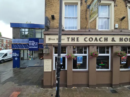
White Rose
Restaurant · Turkish · 1.5 mi
864 High Road, London
Mo-Th 08:30-23:30; Fr-Sa 08:30-00:00; Su 11:30-00:00
Oita
Restaurant · Japanese · 1.4 mi
13-27 Station Road, London
Mo-Th 12:00-15:30,17:00-23:00; Fr,Sa 12:00-23:00; Su 12:00-22:30
The Antwerp Arms
Bar and pub · 1.5 mi
168-170 Church Road, London
Tu-Th 16:00-23:00; Fr 14:00-00:00; Sa 12:00-00:00; Su 12:00-22:30


Holtwhites Bakery & Deli
Bakery · 0.6 mi
66 Alderman's Hill, London
Mo-Fr 07:30-17:00; Sa 08:00-17:00; Su 08:00-16:00
234 more on the map.
History
Southgate was originally the south gate of Enfield Chase, the King's hunting grounds. This is reflected in the street names Chase Road (which leads due north from the station to Oakwood, and was formerly the avenue into the Chase) and Chase Side. There is a blue plaque on a building on the site of the south gate. A little further to the south was another small medieval settlement called South Street which had grown up around a village green; by 1829 the two settlements had merged and the village green became today's Southgate Green.
Southgate was predominantly developed in the 1930s: largish semi-detached houses were built on the hilly former estates (Walker, Osidge, Monkfrith, etc.) following increased transport development. In 1933, the North Circular Road was completed through Edmonton and Southgate, and also in 1933, the London Underground Piccadilly line was extended from Arnos Grove (where it had reached the previous year), through Southgate tube station, on to Enfield West (now known as Oakwood). This unleashed a building boom, and by 1939 the area had become almost fully developed.
Read more of the history
In 1894 an urban district of Middlesex, called Southgate, was created by the Local Government Act 1894. In 1933 the Municipal Borough of Southgate was created. The borough, which had its headquarters at Southgate Town Hall, was abolished in 1965 by the London Government Act 1963. Its area then came within the newly created London Borough of Enfield, which also included the areas that had been within the Municipal Borough of Enfield and the Municipal Borough of Edmonton.
The parliamentary constituency covering the part of Southgate in the London Borough of Enfield is Southgate and Wood Green. Until his death in the Brighton bombing in 1984, the constituency was represented by Sir Anthony Berry. In 1997, Michael Portillo, who succeeded Berry, lost the seat to Stephen Twigg, who after two terms lost in his turn to David Burrowes in May 2005. In the 2017 general election, Bambos Charalambous defeated Burrowes and became the new representative of the constituency.
From the History section of Southgate, London on Wikipedia, under CC BY-SA 4.0.
Notable people from Southgate
 Amy WinehouseEnglish singer-songwriter (1983–2011)Photo: Rama, CC BY-SA 2.0 fr
 Leigh HuntBritish critic, essayist, poet and writer (1784-1859)Photo: Benjamin Robert Haydon (died 1846), Public domain
 David PuttnamBritish film producer (born 1941)Photo: Roger Harris, CC BY 3.0
 Neville BrodyBritish graphic designer (born 1957)Photo: FontShop, Amber Gregory, CC BY 2.0
 Andrew RayBritish actor (1939-2003)Photo: Bill Doll and Company, New..., Public domain
 Frederick William HasluckAntiquarian, Historian, Archaeologist (1878-1920)Photo: Frederick William Hasluck, Public domain
 V. E. WalkerEnglish cricketer (1837-1906)Photo: "A.R.", Public domain
- Paul ScottBritish writer (1920–1978)
- Francis WalkerEnglish entomologist (1809–1874)
- Elpis MelenaAnglo-German writer (1818-1899)
- Martin StephensBritish actor
- Timothy Bell, Baron BellBritish advertising and public relations executive (1941-2019)
Born in Southgate, according to Wikidata (CC0). Each name links to its Wikipedia article.
Where to stay13
Churches and places of worship79
Palmers Green United Reformed Church
Church · United Reformed · 0.6 mi
Fox Lane, London
Shopping34
Gas and EV charging10
Schools, colleges and libraries49
Our Lady of Lourdes Catholic Primary School
School · Roman Catholic · 1.5 mi
The Limes Avenue, London
Healthcare30
Map of Southgate
250 places. The map loads OpenStreetMap tiles when you open it.
Getting there and nearby towns
London City Airport (LCY) is the nearest airport with scheduled flights listed in OpenStreetMap, 10 miles away.
- Wood Green 1 mi southwest, about 2 min by car
- Tottenham 2 mi southeast, about 3 min by car
- Enfield Town 2 mi north, about 4 min by car
- Archway 4 mi southwest, about 6 min by car
- Walthamstow 4 mi southeast, about 6 min by car
- Totteridge 4 mi west, about 7 min by car
- Woodford Green 5 mi east, about 9 min by car
- Islington 6 mi south, about 9 min by car
- Waltham Cross 6 mi northeast, about 9 min by car
- London 8 mi south, about 12 min by car
Drive times are estimates from straight-line distance, not routes.
Towns near Southgate


Keep exploring
Local news
Headlines from INDB.
Reviews, tips and questions
Loading what members have shared...
Sources and licences
- GeoNames (CC BY 4.0): population, coordinates, regions and time zone
- Mapillary (see each image): photos
- OpenStreetMap contributors (ODbL 1.0): places, airports, map data
- Wikidata (CC0 1.0): elevation, founding date, time zone, website, landmarks and historic places
- Wikimedia Commons (see each image): photos
- Wikipedia (CC BY-SA 4.0): overview and history text
Photo credits
- Chase Side, Londoneye at English Wikipedia, CC BY-SA 3.0
- APalace 1, Jack Rose, CC BY-SA 4.0
- Bernie Grant Arts Centre JL 001, Berniegrantcentre, CC BY 3.0
- Bruce Castle front 2024-02-24 (2), The wub, CC BY-SA 4.0
- East Barnet war memorial 7, Philafrenzy, CC BY-SA 4.0
- Finchley War Memorial 5 April 2016 01, Philafrenzy, CC BY-SA 4.0
- Friern Barnet Parishioners War Memorial 02, Philafrenzy, CC BY-SA 4.0
- Hornsey War Memorial 10, Philafrenzy, CC BY-SA 4.0
- The Noble Sage, East Finchley art gallery (354235321), Mark Hillary from São Paulo, Brazil, CC BY 2.0
- Wood Green War Memorial 20170706 131924 (49368979152), Irid Escent, CC BY-SA 2.0
- Broomfield Park garden, Dudley Miles, CC BY-SA 3.0
- Grovelands House, The Bourne, Southgate, N14, Stu's Images, CC BY-SA 3.0
- Pymmes Park1, Northmetpit, Public domain
- Barfield Allotments Nature Park, Dudley Miles, CC0
- Belmont Open Space Cockfosters, Dudley Miles, Public domain
- Bethune Park nature area 2, Dudley Miles, CC BY-SA 3.0
- Downhills Park, Sheriff Of Nothing, CC BY 2.0
- Ducketts Common, Mx. Granger, CC0
- New River at Enfield Town Park, Smerus, CC BY-SA 3.0
- Palmers Green United Reformed Church 11, Philafrenzy, CC BY-SA 4.0
- St Mary's Greek Orthodox Church, Wood Green 13, Philafrenzy, CC BY-SA 4.0
- All Hallows, Tottenham, Alan Stanton, CC BY-SA 2.0
- Bowes Road School 01, Philafrenzy, CC BY-SA 4.0
- Millfield House, Christine Matthews, CC BY-SA 2.0
- Main Entrance - 4850786721, Alan Stanton, CC BY-SA 2.0
- St Benet Fink 2008-10-22 09-04-10, Arbus Driver, CC BY-SA 2.0 uk
- Mammogram, National Cancer Institute, Public domain
- New Testament Church of God 01, Philafrenzy, CC BY-SA 4.0
- Ye Olde Cherry Tree, Southgate, Philafrenzy, CC BY-SA 4.0
- Parish Church of St. Michael Wood Green 10, Philafrenzy, CC BY-SA 4.0
- GOC Ally Pally 077 The Starting Gate pub, Wood Green (28935949052), Peter O'Connor aka anemoneprojectors, CC BY-SA 2.0
- St Mark's, N22, Iridescent, CC BY-SA 3.0
- The Alfred Herring, Palmers Green, Philafrenzy, CC BY-SA 4.0
- Spouter's Corner pub, Wood Green, Philafrenzy, CC BY-SA 4.0
- St Michael-at-Bowes, Richard Nevell, CC BY-SA 3.0
- Cherry tree woods finchley, G ri m 2 3 ★, CC BY-SA 3.0
- Hornsey Town Hall 2026-03-26, Tom Page, CC BY-SA 4.0
- The Markfield Beam Engine and Museum, Markfield Park, Loz Pycock, CC BY-SA 2.0
- London from Alexandra Park in the early morning (2012) - panoramio, Alexander Kachkaev, CC BY 3.0
- Chestnuts Park Entrance With Plaque, Paul Carpenter, CC BY-SA 4.0
- Street-level photo, zymurgic, CC BY-SA 4.0
- Street-level photo, erias, CC BY-SA 4.0
- Street-level photo, matth81, CC BY-SA 4.0
- Street-level photo, erias, CC BY-SA 4.0
- Street-level photo, erias, CC BY-SA 4.0
- Street-level photo, zymurgic, CC BY-SA 4.0
- Street-level photo, rskedgell, CC BY-SA 4.0
- Street-level photo, pbb, CC BY-SA 4.0
- Street-level photo, matth81, CC BY-SA 4.0
- Street-level photo, erias, CC BY-SA 4.0
- Street-level photo, IpswichEdits, CC BY-SA 4.0
- Street-level photo, matth81, CC BY-SA 4.0
- Street-level photo, erias, CC BY-SA 4.0
- Street-level photo, matth81, CC BY-SA 4.0
- Street-level photo, rskedgell, CC BY-SA 4.0
- Street-level photo, pbb, CC BY-SA 4.0
- Street-level photo, pbb, CC BY-SA 4.0
- Street-level photo, pbb, CC BY-SA 4.0
- Street-level photo, southglos, CC BY-SA 4.0
- Street-level photo, smsm1, CC BY-SA 4.0
- Street-level photo, rskedgell, CC BY-SA 4.0


Page built November 10, 2026. Spotted a mistake? Tell us or suggest a place.