


Palmers Green, United Kingdom
Palmers Green is a town of 15,162 people in England, United Kingdom.
Why visit Palmers Green
Townapedia lists 25 museums and landmarks, 74 parks and trails, 287 places to eat, 15 places to stay and 7 attractions in and around town.
Highlights include Alexandra Palace, Alexandra Palace Theatre, Bruce Castle and Cockfosters War Memorial.
Weather in Palmers Green
Forecast from MET Norway (CC BY 4.0). Full forecast
About Palmers Green
Palmers Green is a suburban area in north London, England, within the London Borough of Enfield. It is located within the N13 postcode district, around 8 miles (13 km) north of Charing Cross. It is home to the largest population of Greek Cypriots outside Cyprus and is often nicknamed "Little Cyprus" or "Palmers Greek".
From the Wikipedia article Palmers Green (this version), under CC BY-SA 4.0.
Photos of Palmers Green

Things to do7

Alexandra Palace
Cinema and theater · 1.9 mi
Entertainment venue in Alexandra Park, London

Alexandra Palace Theatre
Cinema and theater · 1.8 mi
Venue in Haringey, North London

Bernie Grant Arts Centre
Cinema and theater · 2.6 mi
Arts centre in Tottenham, London

Hornsey Town Hall
Cinema and theater · 2.8 mi
A public building and former town hall in Crouch End area of Hornsey, London

Crouch End Hippodrome
Cinema and theater · 2.6 mi
Former theatre in Tottenham Lane, Crouch End, Haringey, London
Museums and landmarks25


Cockfosters War Memorial
Monument and historic site · 3.1 mi
War memorial in London

East Barnet War Memorial
Monument and historic site · 2.8 mi
War memorial in London

Finchley War Memorial
Monument and historic site · 2.9 mi
War memorial in London

Francis Skaryna Belarusian Library and Museum
Museum · 3.2 mi
Library

Friern Barnet Parishioners War Memorial
Monument and historic site · 2.3 mi
War memorial in London

Hornsey War Memorial
Monument and historic site · 2.5 mi
War memorial in London


Wood Green War Memorial
Monument and historic site · 1.3 mi
War memorial in London


13 more on the map.
Parks, trails and playgrounds74


Grovelands Park
Park · 1.1 mi
Park in the London Borough of Enfield, UK
Mo-Sa 08:00-sunset; Su 08:30-sunset;PH 08:30-sunset


Barfield Allotments Nature Park
Park · 2.1 mi
Parkland in London, England

Belmont Open Space
Park · 2.8 mi
Public park in Cockfosters in the London Borough of Barnet


Finsbury Park
Park · 3.3 mi
Public park in the London Borough of Haringey, England
62 more on the map.
Restaurants and cafes287

Browns
Restaurant · British · 0.7 mi
The Green, London
Mo-Th 10:00-23:00; Fr 10:00-00:00; Sa 09:00-00:00; Su 09:00-23:00

The Starting Gate
Bar and pub · 1.4 mi
Station Road, London
Mo-Th 12:00-23:00; Fr 12:00-24:00; Sa 11:00-24:00; Su 11:00-22:30;...
Caffè Nero
Cafe · Coffee Shop · 1.3 mi
10 Chase Side, London
Mo-Fr 06:30-18:30; Sa 07:00-18:30; Su 07:30-18:00
Coffee Island
Cafe · Coffee Shop · 1.2 mi
4 Ashfield Parade, London
Mo-Fr 07:30-18:00; Sa-Su 07:30-17:00
Meat et-Doner
Restaurant · Turkish · 1.4 mi
95 Chase Side, London
Su-Th 11:30-23:30; Fr-Sa 11:30-00:00

275 more on the map.
History
Palmers Green was once a tiny hamlet in the parish of Edmonton, situated at the junction of Green Lanes and Fox Lane. Its population was very small, and there were no more than a few isolated houses in the mid-17th century. Local records mention a Palmers Field in 1204 and a Palmers Grove in 1340. Palmers Green is mentioned as a highway in 1324 (in Westminster Abbey Muniments).
By 1801, the area had grown to a village of 54 buildings, including two inns (according to the Middlesex Record Office). In 1871 the railway line from Wood Green to Enfield was opened and a station was built in Aldermans Hill to serve Palmers Green (half a mile away from the nearest houses).
Read more of the history
The area remained largely undeveloped for thirty more years, as local landowners refused to sell their large estates for building. In 1902, however, large tracts of land were sold for building and the area began to develop rapidly. The first large-scale developments were on the Old Park estate between Fox Lane and Aldermans Hill, and the Hazelwood Park Estate between Hazelwood Lane and Hedge Lane, within the latter development the building that now serves as Hazelwood Infant School and Hazelwood Junior School was built in Hazelwood Lane in 1908.Notable local buildings include Broomfield House and Truro House. The former Southgate Town Hall has now been converted into flats. The former Pilgrims Rest (reflecting the name Palmers – "medieval pilgrim who carried a palm branch as a token of having visited the Holy Land") has already been demolished for housing. The Fox public house, which has been in its present guise since 1904, was once the site of the Electric Mouse comedy venue.
The Intimate Theatre was opened in a building that had been built in 1931 as St Monica's Church Hall. Among the actors who performed there were Richard Attenborough, Vivien Leigh, Roger Moore and (in a mime production) David Bowie. It is no longer a repertory theatre and the building is no longer used exclusively for theatrical performances, but it is still often referred to as the Intimate Theatre. In 1992 the building housed a Radio Cracker studio.
In 1988, Palmers Green's only hospital, Greentrees Hospital, was closed and demolished.
From the History section of Palmers Green on Wikipedia, under CC BY-SA 4.0.
Notable people from Palmers Green
- Megan PrescottEnglish actress
- Patsy RowlandsActress, singer (1931-2005)
- Rodney Joseph BurnBritish artist (1899-1984)
- Kenneth PlummerBritish sociologist
- Jack HargreavesBritish television presenter
- John WalkerMiddlesex cricketer (1826-1885)
- Margaret LoudenBritish surgeon
Born in Palmers Green, according to Wikidata (CC0). Each name links to its Wikipedia article.
Where to stay15
Churches and places of worship77
Shopping43
Gas and EV charging14
Schools, colleges and libraries47
Our Lady of Lourdes Catholic Primary School
School · Roman Catholic · 1.1 mi
The Limes Avenue, London
Healthcare26
Map of Palmers Green
250 places. The map loads OpenStreetMap tiles when you open it.
Getting there and nearby towns
London City Airport (LCY) is the nearest airport with scheduled flights listed in OpenStreetMap, 11 miles away.
- Southgate 0 mi east, about 1 min by car
- Wood Green 1 mi south, about 2 min by car
- Tottenham 2 mi southeast, about 3 min by car
- Enfield Town 3 mi northeast, about 4 min by car
- Ponders End 3 mi northeast, about 5 min by car
- Archway 4 mi south, about 6 min by car
- Walthamstow 4 mi southeast, about 7 min by car
- Totteridge 4 mi west, about 6 min by car
- Islington 6 mi south, about 9 min by car
- London 8 mi south, about 12 min by car
Drive times are estimates from straight-line distance, not routes.
Towns near Palmers Green


Keep exploring
Local news
Headlines from INDB.
Reviews, tips and questions
Loading what members have shared...
Sources and licences
- GeoNames (CC BY 4.0): population, coordinates, regions and time zone
- Mapillary (see each image): photos
- OpenStreetMap contributors (ODbL 1.0): places, airports, map data
- Wikidata (CC0 1.0): elevation, founding date, time zone, website, landmarks and historic places
- Wikimedia Commons (see each image): photos
- Wikipedia (CC BY-SA 4.0): overview and history text
Photo credits
- 9 Aldermans Hill Wishing Well, Palmers Green, N13, Ewan Munro, CC BY-SA 2.0
- Chestnut Tree, Palmers Green, N13, Ewan-M, CC BY-SA 4.0
- Money lender Palmers Green, Philafrenzy, CC BY-SA 4.0
- Palmers Green station, Ewan Munro, CC BY-SA 2.0
- The Yard Cafe, Palmers Green 2025-05-30, Matt Brown, CC BY 2.0
- Suffragette plaque in Palmers Green, Matt Brown, CC BY 2.0
- Fingerpost in Palmers Green 2025-05-30, Matt Brown, CC BY 2.0
- Palmers Green, Green Lanes looking north, Philafrenzy, CC BY-SA 4.0
- APalace 1, Jack Rose, CC BY-SA 4.0
- Bernie Grant Arts Centre JL 001, Berniegrantcentre, CC BY 3.0
- Bruce Castle front 2024-02-24 (2), The wub, CC BY-SA 4.0
- Cockfosters war memorial May 2019, Philafrenzy, CC BY-SA 4.0
- East Barnet war memorial 7, Philafrenzy, CC BY-SA 4.0
- Finchley War Memorial 5 April 2016 01, Philafrenzy, CC BY-SA 4.0
- Belarusian library London, Aleksandrs Čaičics, Public domain
- Friern Barnet Parishioners War Memorial 02, Philafrenzy, CC BY-SA 4.0
- Hornsey War Memorial 10, Philafrenzy, CC BY-SA 4.0
- The Noble Sage, East Finchley art gallery (354235321), Mark Hillary from São Paulo, Brazil, CC BY 2.0
- Wood Green War Memorial 20170706 131924 (49368979152), Irid Escent, CC BY-SA 2.0
- Broomfield Park garden, Dudley Miles, CC BY-SA 3.0
- Grovelands House, The Bourne, Southgate, N14, Stu's Images, CC BY-SA 3.0
- Barfield Allotments Nature Park, Dudley Miles, CC0
- Belmont Open Space Cockfosters, Dudley Miles, Public domain
- Bethune Park nature area 2, Dudley Miles, CC BY-SA 3.0
- Downhills Park, Sheriff Of Nothing, CC BY 2.0
- Ducketts Common, Mx. Granger, CC0
- New River at Enfield Town Park, Smerus, CC BY-SA 3.0
- Walking in Finsbury Park, Hjuk at en.wikipedia, CC BY-SA 3.0
- St Mary's Greek Orthodox Church, Wood Green 13, Philafrenzy, CC BY-SA 4.0
- All Hallows, Tottenham, Alan Stanton, CC BY-SA 2.0
- All Saints' Church, East Finchley 05, Philafrenzy, CC BY-SA 4.0
- Bowes Road School 01, Philafrenzy, CC BY-SA 4.0
- Millfield House, Christine Matthews, CC BY-SA 2.0
- Main Entrance - 4850786721, Alan Stanton, CC BY-SA 2.0
- Mammogram, National Cancer Institute, Public domain
- St Andrew's church, Southgate 8 April 2016 01, Philafrenzy, CC BY-SA 4.0
- SPNS interior, Angelic Doc, CC BY-SA 4.0
- New Testament Church of God 01, Philafrenzy, CC BY-SA 4.0
- Ye Olde Cherry Tree, Southgate, Philafrenzy, CC BY-SA 4.0
- Parish Church of St. Michael Wood Green 10, Philafrenzy, CC BY-SA 4.0
- GOC Ally Pally 077 The Starting Gate pub, Wood Green (28935949052), Peter O'Connor aka anemoneprojectors, CC BY-SA 2.0
- St Michael-at-Bowes, Richard Nevell, CC BY-SA 3.0
- Cherry tree woods finchley, G ri m 2 3 ★, CC BY-SA 3.0
- Stage Machinery at Alexandra Palace Theatre, CuriosityScribe, CC BY-SA 4.0
- Hornsey Town Hall 2026-03-26, Tom Page, CC BY-SA 4.0
- The Markfield Beam Engine and Museum, Markfield Park, Loz Pycock, CC BY-SA 2.0
- London from Alexandra Park in the early morning (2012) - panoramio, Alexander Kachkaev, CC BY 3.0
- Chestnuts Park Entrance With Plaque, Paul Carpenter, CC BY-SA 4.0
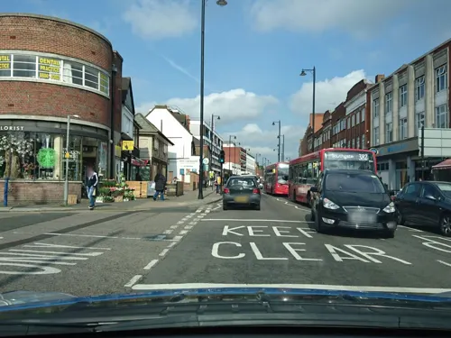
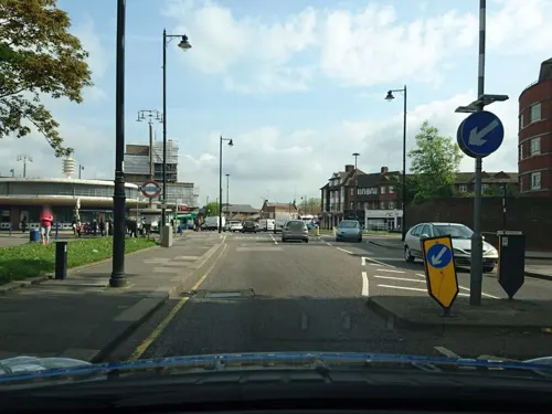
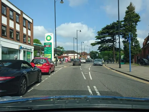
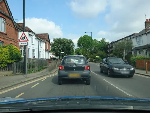
- Street-level photo, zymurgic, CC BY-SA 4.0
- Street-level photo, erias, CC BY-SA 4.0
- Street-level photo, erias, CC BY-SA 4.0
- Street-level photo, matth81, CC BY-SA 4.0
- Street-level photo, zymurgic, CC BY-SA 4.0
- Street-level photo, zymurgic, CC BY-SA 4.0
- Street-level photo, zymurgic, CC BY-SA 4.0
- Street-level photo, zymurgic, CC BY-SA 4.0
- Street-level photo, zymurgic, CC BY-SA 4.0
- Street-level photo, zymurgic, CC BY-SA 4.0
- Street-level photo, zymurgic, CC BY-SA 4.0
- Street-level photo, zymurgic, CC BY-SA 4.0
- Street-level photo, zymurgic, CC BY-SA 4.0
- Street-level photo, zymurgic, CC BY-SA 4.0
- Street-level photo, zymurgic, CC BY-SA 4.0
- Street-level photo, erias, CC BY-SA 4.0
- Street-level photo, erias, CC BY-SA 4.0
- Street-level photo, zymurgic, CC BY-SA 4.0
- Street-level photo, matth81, CC BY-SA 4.0
- Street-level photo, erias, CC BY-SA 4.0
- Street-level photo, matth81, CC BY-SA 4.0
- Street-level photo, zymurgic, CC BY-SA 4.0
- Street-level photo, zymurgic, CC BY-SA 4.0
- Street-level photo, zymurgic, CC BY-SA 4.0
- Street-level photo, zymurgic, CC BY-SA 4.0
- Street-level photo, erias, CC BY-SA 4.0
- Street-level photo, zymurgic, CC BY-SA 4.0


Page built November 10, 2026. Spotted a mistake? Tell us or suggest a place.