


Harringay, United Kingdom
Harringay is a town of 16,500 people in England, United Kingdom.
Why visit Harringay
Townapedia lists 50 museums and landmarks, 108 parks and trails, 180 places to eat, 22 places to stay and 16 attractions in and around town.
Highlights include ArtHouse Crouch End, Bernie Grant Arts Centre, Arsenal Football Club Museum and Bruce Castle.
Weather in Harringay
Forecast from MET Norway (CC BY 4.0). Full forecast
About Harringay
Harringay (pronounced HARR-ing-gay) is a district of north London, England, within the London Borough of Haringey. It is centred on the section of Green Lanes running between the New River, where it crosses Green Lanes by Finsbury Park, and Duckett's Common, near Turnpike Lane.
From the Wikipedia article Harringay (this version), under CC BY-SA 4.0.
Photos of Harringay


Things to do16


Bernie Grant Arts Centre
Cinema and theater · 1.2 mi
Arts centre in Tottenham, London

Middle Lane Market
Farm and orchard · 1.0 mi
226 Middle Lane, London
Mo-Tu 09:00-16:00; We-Th, Sa 09:00-19:00; Fr 09:00-20:00; Su 09:00-17:00

Almeida Theatre
Cinema and theater · 3.0 mi
Theatre in Islington, London

Collins' Music Hall
Cinema and theater · 3.2 mi
Former theatre in London, England, now shops, only façade remaining


O2 Academy Islington
Cinema and theater · 3.3 mi
Music venue in London, England

Pleasance Islington
Cinema and theater · 2.5 mi
Theatre and comedy venue in Islington, London

Park Theatre
Cinema and theater · 1.2 mi
Theatre in Finsbury Park, London, England
Clifton Terrace, London

Arcola Theatre
Cinema and theater · 2.4 mi
Theatre in Hackney, London, England
Young Actors Theatre, Islington
Cinema and theater · 3.2 mi
Drama school and community theatre in Islington, London, England
4 more on the map.
Museums and landmarks50


Estorick Collection of Modern Italian Art
Museum · 2.7 mi
Art museum in London, United Kingdom

Islington Green War Memorial
Monument and historic site · 3.2 mi
War memorial in London

Kenwood House
Museum · 3.0 mi
Art museum and historic house in Hampstead, London



Banner Repeater
Museum · 2.9 mi
Artist-run reading room and project space in London

Jealous Gallery and Print Studio
Museum · 1.1 mi
27 Park Road, London
Mo off; Tu off; We-Sa 10:00-18:00; Su 11:00-17:00
38 more on the map.
Parks, trails and playgrounds108

The Castle Climbing Centre
Sports field and stadium · 1.2 mi
Engine House of Metropolitan Water Board
Green Lanes, London
Mo-Fr 08:00-22:00, Sa-Su 09:00-20:00


Bingfield Park
Park · 3.1 mi
Park in the London Borough of Islington, England


Gillespie Park
Park · 1.6 mi
Nature reserve in the London Borough of Islington

Stationers Park
Park · 0.6 mi
A 1.5-hectare park in the London Borough of Haringey
Mayfield Road, London
24/7

Alexandra Palace Pitch & Putt
Golf course · 1.4 mi
10 hole Pitch & Putt course, par 3 course
Alexandra Palace Way, London
96 more on the map.
Restaurants and cafes180
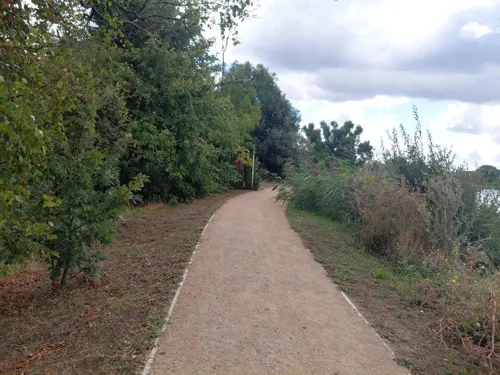
Coal House Cafe
Cafe · Sandwich, Coffee Shop · 1.0 mi
Gas house to West of reservoir
226 Lordship Road, London
Mo-Su 09:00-17:00

The Beehive
Bar and pub · Burger, Chicken · 1.5 mi
Stoneleigh Road, London
Mo-Th 15:00-23:00; Fr-Sa 12:00-01:00; Su 12:00-22:30

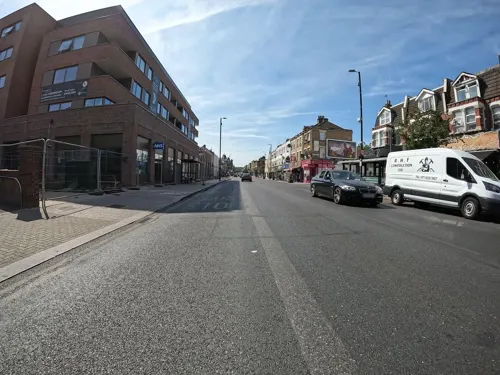
Langham Working Mens Club
Bar and pub
600 Green Lanes, London
Mo-Th 16:30-32:00; Fr 13:00-24:00; Sa 12:00-24:00; Su 12:00-23:00
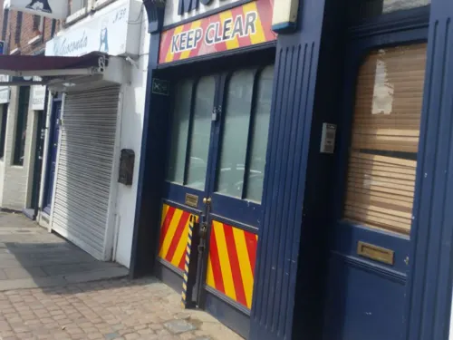
The Great Northern Railway Tavern
Bar and pub · 0.8 mi
67 High Street, London
Mo-Th 12:00-23:00; Fr-Sa 12:00-00:00; Su 12:00-22:30

The Queens
Bar and pub · British, Pub, Roast · 1.0 mi
26 Tottenham Lane, London
Mo-Th 12:00-23:00; Fr-Sa 12:00-24:00; Su 12:00-23:00

The Starting Gate
Bar and pub · 1.4 mi
Station Road, London
Mo-Th 12:00-23:00; Fr 12:00-24:00; Sa 11:00-24:00; Su 11:00-22:30;...
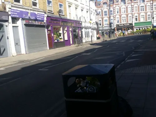
Bar Esteban
Restaurant · Spanish, Tapas · 1.1 mi
29 Park Road, London
Tu-Th 18:00-22:00; Fr-Sa 17:00-23:00
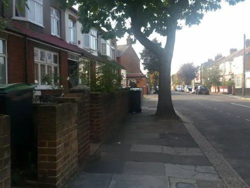
Bolland and Crust
Cafe · Breakfast, Coffee Shop, Local · 0.9 mi
38 Crawley Road, London
We-Th 10:00-15:00; Fr-Sa 09:00-16:00; Su 10:00-16:00

Barbers Bazaar
Restaurant · Indian · 0.7 mi
37 Tottenham Lane, London
Mo off; Tu-Fr 17:00-22:30; Sa-Su 12:00-22:30
Bruce Burgers
Restaurant · Chicken, Burger · 1.5 mi
93 Bruce Grove, London
Mo-Th 17:00-00:00; Fr-Sa 17:00-01:00; Su 17:00-00:00
168 more on the map.
History
In the Ice Age Harringay was on the edge of a huge glacial mass that reached as far south as Muswell Hill. The area was then largely covered with forest until the Middle Ages when it was developed as agricultural land. From 1750 to 1880 Harringay experienced the pressures of the burgeoning population in London. Gradually inroads into the pastoral landscape were made, first for the leisure and then for the settlement of Londoners. By 1900 Harringay had become a respectable London-adjacent suburb with all the land built over and only Finsbury Park remaining as a hint of its former character. It remained part of Middlesex and was not within the jurisdiction of the County of London until 1965. Identified as a single unified urban area from 1900, Harringay was originally split between the old boroughs of Hornsey and Tottenham with the boundary between the two running slightly to the west of Green Lanes The unification of the two boroughs in 1965, as the London Borough of Haringey, brought all Harringay under the control of a single unit of local governance for the first time in more than a thousand years. On many of the roads in West Harringay, it is still possible to see the old Tottenham - Hornsey boundary where the paving stones give way to tarmacked pavement. The old parish / borough boundary markers are also still in place on some roads (see picture, right).
Read more of the history
The name Harringay has its origin in the Saxon period and is derived from the name of a Saxon chieftain called Haering. Haering's Hege meant Haering's enclosure. The earliest written form of the name was recorded as Harenhg’ in about 1195. Its development thereafter gave rise to the modern-day names of Harringay (the district of London), the London Borough of Haringey and Hornsey (another nearby district of London).
From 1750 until the second half of the 20th century, Harringay became a destination for Londoners seeking to relax. Hornsey Wood House, Finsbury Park, Harringay Stadium and Harringay Arena were all popular leisure destinations in their day. The stadium and arena site is now occupied by Sainsbury's and the Arena Shopping Park. In the 21st century, Harringay continues to attract visitors from across London and beyond to visit the ever-growing number of popular restaurants, bars, festivals and live music venues. In the years since 2010, the festivals, bar and music studios of the creative hub in the Harringay Warehouse District are also attracting people to Harringay as an entertainment centre.
There is little doubt that the history of transport communications through Harringay had a significant effect on its shape today. In Roman times, a great roadway through the area to the north was established. This roadway endured as a great communication passage to the north and brought much activity through the heart of the area. It also acted as the rough dividing line for land ownership, identifying Harringay's position on the edge of manorial and subsequently borough boundaries.
In the mid-19th century, the arrival of the Great Northern Railway (GNR) cleaved western Harringay from the rest of the Borough of Hornsey and set it fair for its subsequent union with the southwesternmost slice of the Borough of Tottenham. The subsequent construction of the Tottenham & Hampstead Junction Railway (THJR) almost defined Harringay's present-day southern boundary.
From the History section of Harringay on Wikipedia, under CC BY-SA 4.0.
More about Harringay
Geography
Harringay is just under 5+1⁄2 miles (9 km) from the centre of London sitting on a chalk bed covered by a thick layer of London Clay. The western part of the district is hilly, rising to 138 feet (42 m) at its highest. Further to the west, beyond Harringay, the ground rises steadily to one of the highest points in London at Hampstead Heath, about 3+1⁄2 miles (6 km) away. The eastern part of Harringay is low-lying, at between 60 and 90 feet, as the land descends towards the Lea Valley, 2 miles (3 km) to the east.
Harringay covers an area of approximately 3⁄4 square mile (2 km2). The land use for the area is shown in the table below.
Education
There are four generally well regarded schools located within Harringay. These are shown below together with the number of places available in 2018:
Inspection reports on Harringay's four schools are available at the Ofsted website.
From the Wikipedia article Harringay, under CC BY-SA 4.0.
Notable people from Harringay
- Stanley Greenhuman billboard, active in Oxford St. (London) in the period 1968-1993
- Alan R. KatritzkyAmerican chemist
- Peter Bullockcricketer (1925-1997)
- Francis William MarkallCatholic archbishop
- Steve CoxAustralian artist (born 1958)
- Maurice CranstonEnglish philosopher, professor, and author (1920-1993)
Born in Harringay, according to Wikidata (CC0). Each name links to its Wikipedia article.
Where to stay22
No.8 Hostel Seven Sisters
Motel and hotel · 0.8 mi
618 Seven Sisters Road, London
Pembury Hotel
Motel and hotel · Portuguese · 1.1 mi
326-328 Seven Sisters Road, London
Churches and places of worship82
Shopping89
Gas and EV charging14
Schools, colleges and libraries47
St Mary's Church of England Primary School (nursery to year 2)
School · Anglican · 0.7 mi
Church Lane, London
St Mary's Church of England Primary School (Years 3-6)
School · Anglican · 1.0 mi
Rectory Gardens, London
Healthcare39
Map of Harringay
250 places. The map loads OpenStreetMap tiles when you open it.
Getting there and nearby towns
London City Airport (LCY) is the nearest airport with scheduled flights listed in OpenStreetMap, 9 miles away.
- Hornsey 1 mi west, about 2 min by car
- Wood Green 1 mi northwest, about 2 min by car
- Archway 2 mi southwest, about 3 min by car
- Tottenham 2 mi northeast, about 3 min by car
- Muswell Hill 2 mi west, about 3 min by car
- Highbury 2 mi south, about 4 min by car
- Southgate 2 mi north, about 4 min by car
- Palmers Green 2 mi north, about 4 min by car
- Islington 3 mi south, about 5 min by car
- Highgate 3 mi southwest, about 5 min by car
Drive times are estimates from straight-line distance, not routes.
Towns near Harringay


Keep exploring
Local news
Headlines from INDB.
Reviews, tips and questions
Loading what members have shared...
Sources and licences
- GeoNames (CC BY 4.0): population, coordinates, regions and time zone
- Mapillary (see each image): photos
- OpenStreetMap contributors (ODbL 1.0): places, airports, map data
- Wikidata (CC0 1.0): elevation, founding date, time zone, website, landmarks and historic places
- Wikimedia Commons (see each image): photos
- Wikipedia (CC BY-SA 4.0): overview and history text
Photo credits
- Conscientious Objectors memorial at Harringay, Matt Brown, CC BY 2.0
- Salisbury, Harringay, N4 (6892344432), Ewan Munro from London, UK, CC BY-SA 2.0
- The Salisbury - Harringay - N4, Ewan Munro from London, UK, CC BY-SA 2.0
- Salisbury, Harringay, N4, Ewan-M, CC BY-SA 4.0
- Aerial view of the Salisbury PUB, Harringay Green Lanes. London DJI 0877MODy, Basilvanderpump, CC BY-SA 4.0
- The Salisbury, Harringay 2026-07-08, Matt Brown, CC BY 4.0
- The Salisbury Hotel, Harringay Green Lanes - panoramio, N19±, CC BY-SA 3.0
- Bernie Grant Arts Centre JL 001, Berniegrantcentre, CC BY 3.0
- Almeida Theatre 05 (2023), GilPe, CC BY-SA 4.0
- Collins Music Hall - 10-11 Islington Green Islington London N1 2XH, Spudgun67, CC BY-SA 4.0
- Lea Bridge Station re-opening after 31 years (26432053793), Sludge G, CC BY-SA 2.0
- O2 Academy Islington, Magnus Manske, CC BY-SA 3.0
- Woodstore Bar and Grill, Holloway, N7 (5679401240), Ewan Munro from London, UK, CC BY-SA 2.0
- Museum Arsenal Football Club Museum, Gael13011, CC BY-SA 3.0
- Bruce Castle front 2024-02-24 (2), The wub, CC BY-SA 4.0
- Estorick Collection, Luke McKernan, CC BY-SA 2.0
- Islington Green War Memorial (3133010321), sara~, CC BY-SA 2.0
- Queer Britain, proposed UK national LGBTQ+ museum, Queer Britain, Public domain
- Sutton House 1, Julian Mason from London, UK, CC BY 2.0
- Priory Park 2006, Pterre, CC BY-SA 3.0
- Walking in Finsbury Park, Hjuk at en.wikipedia, CC BY-SA 3.0
- Bingfieldpark, Stetay ( talk ) ( Uploads ), Public domain
- Gillespie Park pond, Dudley Miles, CC BY-SA 3.0
- St Benet Fink 2008-10-22 09-04-10, Arbus Driver, CC BY-SA 2.0 uk
- Flickr - Duncan~ - The Queens, Duncan Harris from Nottingham, UK, CC BY 2.0
- St Philip the Apostle, Tottenham, Brian Collins, CC BY-SA 4.0
- Aerial photo of the The Castle Climbing Centre in Stoke Newington, Hackney, London (2), Jonty Wareing, CC BY-SA 4.0
- Stoke Newington East Reservoir, N Chadwick, CC BY-SA 2.0
- Parish Church of St. Michael Wood Green 10, Philafrenzy, CC BY-SA 4.0
- GOC Ally Pally 077 The Starting Gate pub, Wood Green (28935949052), Peter O'Connor aka anemoneprojectors, CC BY-SA 2.0
- St Mark's, N22, Iridescent, CC BY-SA 3.0
- Church Of St Mark With St Anne, Aurelio Ogliari, CC BY-SA 4.0
- St Olave, Stoke Newington, London, stair-turret, Grahamrob, CC BY-SA 3.0
- Arthouse Cinema, Tottenham Lane - panoramio, N19±, CC BY-SA 3.0
- Abney Park 3, Mx. Granger, CC0
- Greig City Academy, Mx. Granger, CC0
- Our Lady's Catholic High School, Stamford Hill 2, Mx. Granger, CC0
- The Salisbury, Barney Laurance, CC BY-SA 4.0
- Cherry tree woods finchley, G ri m 2 3 ★, CC BY-SA 3.0
- The Queens, Broadway Parade, Crouch End, Philafrenzy, CC BY-SA 4.0
- Barnsbury Wood 6, Dudley Miles, CC BY-SA 3.0
- Middle Lane Market 2026-03-19, Keith Page, CC BY-SA 4.0
- Bruce Castle Museum - J.A.P. bike, Alan Stanton, CC BY-SA 2.0
- Kenwood House King Charles I by unknown Artist, Ricardalovesmonuments, CC BY-SA 4.0
- Flickr - Duncan~ - Clissold Park Lions, Duncan Harris from Nottingham, UK, CC BY 2.0
- Raining Again - Stoneleigh Road N17 near the Beehive pub, Alan Stanton, CC BY-SA 2.0
- Street-level photo, rskedgell, CC BY-SA 4.0
- Street-level photo, erias, CC BY-SA 4.0
- Street-level photo, matth81, CC BY-SA 4.0
- Street-level photo, matth81, CC BY-SA 4.0
- Street-level photo, erias, CC BY-SA 4.0
- Street-level photo, erias, CC BY-SA 4.0
- Street-level photo, erias, CC BY-SA 4.0
- Street-level photo, matth81, CC BY-SA 4.0
- Street-level photo, zymurgic, CC BY-SA 4.0
- Street-level photo, matth81, CC BY-SA 4.0
- Street-level photo, asturksever, CC BY-SA 4.0
- Street-level photo, matth81, CC BY-SA 4.0
- Street-level photo, matth81, CC BY-SA 4.0
- Street-level photo, asturksever, CC BY-SA 4.0
- Street-level photo, pbb, CC BY-SA 4.0
- Street-level photo, asturksever, CC BY-SA 4.0
- Street-level photo, matth81, CC BY-SA 4.0
- Street-level photo, matth81, CC BY-SA 4.0
- Street-level photo, matth81, CC BY-SA 4.0
- Street-level photo, matth81, CC BY-SA 4.0
- Street-level photo, matth81, CC BY-SA 4.0
- Street-level photo, matth81, CC BY-SA 4.0
- Street-level photo, matth81, CC BY-SA 4.0
- Street-level photo, matth81, CC BY-SA 4.0
- Street-level photo, asturksever, CC BY-SA 4.0


Page built November 10, 2026. Spotted a mistake? Tell us or suggest a place.