


Why visit Fairford
Townapedia lists 9 museums and landmarks, 4 parks and trails, 19 places to eat, 2 places to stay and 5 attractions in and around town.
Highlights include Castle Eaton Bridge, Halfpenny Bridge and Votive Column Monument.
Weather in Fairford
Forecast from MET Norway (CC BY 4.0). Full forecast
About Fairford
Fairford is a market town in Gloucestershire, England. The town lies in the Cotswold hills on the River Coln, 6 miles (10 km) east of Cirencester, 4 miles (6 km) west of Lechlade and 9 miles (14 km) north of Swindon. Nearby are RAF Fairford and the Cotswold Water Park.
From the Wikipedia article Fairford (this version), under CC BY-SA 4.0.
Travel tips from other travellers: Fairford on Wikivoyage (CC BY-SA 4.0).
Photos of Fairford


Things to do5
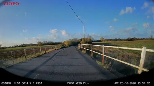
Castle Eaton Bridge
Bridge · 3.3 mi
Road bridge in Castle Eaton, Wiltshire, England, UK

Halfpenny Bridge
Bridge · 3.9 mi
Bridge across the River Thames, England

Hannington Bridge
Bridge · 3.4 mi
Bridge in Gloucestershire/Wiltshire, UK

Museums and landmarks9



Parks, trails and playgrounds4


Restaurants and cafes19
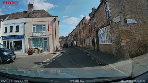
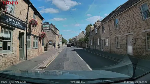
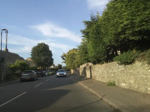



7 more on the map.
History
There was a major roundhouse settlement in Horcott (on the south side of the town), and the Welsh Way, which passed through Fairford, was used during this period as a trade route.
Evidence of settlement in Fairford dates back to the 9th century, and it received a royal market grant in the 12th century. An estate in Fairford, which seemingly belonged to Gloucester Abbey, was bequeathed to Burgred of Mercia in the mid 9th century. At the time of the Norman Conquest in 1066, Brictric, a large landowner in the West Country, held a manor in Fairford. Matilda of Flanders came to own the land, which became the property of the Crown. In 1100, Robert Fitzhamon, the first Norman feudal baron of Gloucester, is recorded as owning the land, which would be passed down to subsequent barons of Gloucester for the next 200 years, along with the manor of Tewkesbury.
In 1066 there were three mills in the town, one of which was still used in the wool trade in the 13th century. The mill that survives today was built in the 17th century.
Edward I and Henry VIII visited the town in 1276 and 1520 respectively.
Fairford is recorded as having a prison in 1248. Hundred courts were held by the lord of the manor and borough.
Read more of the history
By the 15th century the land of Fairford was managed by wool merchants John Twynyho and John Tame, after George Plantagenet, Duke of Clarence was forced to give up his lands after being tried for treason.
In 1608, the inhabitants of Fairford were mostly agricultural labourers or artisans.
Fairford Park, to the north of the town, was built by Andrew Barker in the 1660s and became part of the manor house grounds. It was later turned into a deer park by James Lambe, with an obelisk built to mark the edge of the grounds. The park remained in the Barker family until it was sold to Ernest Cook in 1945.
The first record of an inn appears in 1419, and more inns appeared over the centuries owing to Fairford's location on routes between larger towns; in 1755, seven innkeepers were licensed in Fairford. Stagecoaches often called at Fairford on their way to Gloucester, Cirencester, Bristol, Oxford or London.
The first outbreak of the 1830–31 Swing Riots in Gloucestershire was in Fairford on 26 November 1830. Farming machinery which was being manufactured in the town was destroyed by protestors, who then joined forces with those from the surrounding villages of Quenington, Hatherop, Coln and Southrop.
By this time there were pounds, in the town as well as a village lock-up that had been around since at least 1809.
RAF Fairford was constructed in 1944 as a joint British and American base.
From 1947 to 1959, Fairford housed 1,200 Poles in The Displaced Persons Camp who had been displaced due to the Second World War. The site had originally been an American Air Force hospital that had been built during the war. The buildings were then repurposed for the camp, before being demolished in 1977.
In March 2003 'Flowers to Fairford' was held as a protest against the use of RAF Fairford as the base for the 14 B-52 bombers aircraft which were used to bomb Iraq as part of Operation Iraqi Freedom. Several thousand people attended and there was a large police presence, but the event passed off peacefully. A coach load of people intending to protest was stopped in Lechlade under Section 44 of the Terrorism Act 2000 and searched by police and sent back to London. Ninety of the detained demonstrators formed Fairford Coach Action and sought legal recourse against Gloucestershire constabulary. The group stated that:"On 22 March 2003, the police used surprisingly extreme tactics to prevent more than 120 activists from reaching [the] legally sanctioned anti-war demonstration in Fairford, (Gloucestershire, UK). The demonstration outside a US Airforce Base in Fairford was well attended with estimates of up to 5,000 activists attending. Among the scheduled speakers on the day were writer George Monbiot and Caroline Lucas (MEP). The people who police prevented from attending were a diverse group with a broad range of affiliations. The main thing that they had in common was the desire to travel from London by coach and the intention of joining the legal protest in Fairford. Two of the four main scheduled speakers for the Fairford demonstration were travelling on these coaches from London. After the coaches had travelled two and a half hours from London, the coaches were stopped by police just miles from the demonstration. Using section 60 powers (of the Public Order and Criminal Justice Act 1994) police searched the coaches for weapons for one and a half hours. The passengers cooperated with this search, and they were invited to reboard the coaches when the search concluded. No arrests were made and no items found. After all the passengers boarded, the coaches were escorted immediately back to London under a continuous 9–12 vehicle police escort."In 2013, after appeal, Gloucestershire police's actions were found to be unlawful, and included breaching "protesters' rights to freedom of expression and freedom of peaceful assembly." Some of the demonstrators involved were awarded upwards of £4,000 in compensation by a judge after taking their claim to court.
In July 2007 Fairford suffered unseasonably high rainfall which led to major flooding of 64 homes on Milton Street and London Street as well as in some other surrounding areas. This meant that many of the annual events had to be cancelled.
In 2013, a female skeleton was found in the River Coln and was later discovered to be of Sub-Saharan origin. The remains were estimated to be around 1000 years old (between 896 and 1025 CE) and it is thought that the woman was around 18-24 when she died. Until this discovery, the earliest known Africans in Britain were from the 12th century.
From the History section of Fairford on Wikipedia, under CC BY-SA 4.0.
More about Fairford
Arts and culture
For three days every year RAF Fairford hosts one of the world's largest military air shows – the Royal International Air Tattoo. The event usually takes place in July and brings a boost to the economy of the town and surrounding areas. The 2003 show was recognised as the largest military airshow ever, with an attendance of 535 aircraft.
The Fairford, Faringdon, Filkins and Burford Championship and Country Show held every year since 1948.
The Ernest Cook Trust used to host the annual Fairford Steam Rally and Show. The Show closed in 2015 after running for 46 years.
Education
The town has a primary and secondary school, Fairford Primary and Farmor's School, respectively. Farmor's School is an 11-18 co-educational academy.
Coln House School was a 9-16, residential/day state special school. After being put into special measures following a 2016 Ofsted report, the school closed in March 2017. The building was originally built in 1822 by Alexander Iles as a private asylum called 'The Retreat', which closed in 1944 before becoming a school in 1949.
From the Wikipedia article Fairford, under CC BY-SA 4.0.
Notable people from Fairford
 John KebleBritish churchman and poet (1792–1866)Photo: Donkin (Miss), Public domain
 Wills Hill, 1st Marquess of DownshireBritish Marquess and politicianPhoto: Pompeo Batoni, Public domain
 Alfred CowleyAustralian politician (1848-1926)Photo: Unknown author Unknown author, Public domain
- George BissillBritish painter, furniture designer (1896-1973)
- Thomas KebleChurch of England clergyman, contributor to the Tracts for the Times (1793–1875)
- Arthur PapeEnglish cricketer (1890-1945)
Born in Fairford, according to Wikidata (CC0). Each name links to its Wikipedia article.
Where to stay2
Churches and places of worship15
Gas and EV charging1
Schools, colleges and libraries4
Healthcare1
Map of Fairford
60 places. The map loads OpenStreetMap tiles when you open it.
Getting there and nearby towns
RAF Fairford (FFD) is the nearest airport with scheduled flights listed in OpenStreetMap, 2 miles away.
- Lechlade 4 mi east, about 6 min by car
- Broad Blunsdon 7 mi south, about 11 min by car
- South Cerney 7 mi west, about 11 min by car
- Cirencester 8 mi west, about 13 min by car
- Ashton Keynes 8 mi southwest, about 13 min by car
- Carterton 9 mi northeast, about 14 min by car
- Northleach 9 mi north, about 14 min by car
- Purton 9 mi southwest, about 15 min by car
- Burford 9 mi northeast, about 15 min by car
- Swindon 10 mi south, about 17 min by car
Drive times are estimates from straight-line distance, not routes.
Towns near Fairford


Keep exploring
Local news
Headlines from INDB.
Reviews, tips and questions
Loading what members have shared...
Sources and licences
- GeoNames (CC BY 4.0): population, coordinates, regions and time zone
- Mapillary (see each image): photos
- OpenStreetMap contributors (ODbL 1.0): places, airports, map data
- Wikidata (CC0 1.0): elevation, founding date, time zone, website, landmarks and historic places
- Wikimedia Commons (see each image): photos
- Wikipedia (CC BY-SA 4.0): overview and history text
Photo credits
- Stained glass window, St Mary's church, Fairford, Glos. (16262783047), Jules & Jenny from Lincoln, UK, CC BY 2.0
- Stained glass window, n.X St Mary's church, Fairford, Glos. (16447722042), Jules & Jenny from Lincoln, UK, CC BY 2.0
- Fairford, St Mary's church, East window detail, Jules & Jenny, CC BY 2.0
- Fairford, St Mary's church, Misericord S04, Jules & Jenny, CC BY 2.0
- Fairford, St Mary's church - From the South East, Jules & Jenny, CC BY 2.0
- Fairford, St Mary's church, Window s.IX, Jules & Jenny, CC BY 2.0
- Stained glass window, St Mary's church, Fairford, Glos. (16260997098), Jules & Jenny from Lincoln, UK, CC BY 2.0
- Stained glass window, St Mary's church, Fairford, Glos. (16422685956), Jules & Jenny from Lincoln, UK, CC BY 2.0
- Fairford, St Mary's church, window s.VI, Jules & Jenny, CC BY 2.0
- Fairford, St Mary's church, Window n.IX, Jules & Jenny, CC BY 2.0
- Fairford, St Mary's church, Misericord N01, Jules & Jenny, CC BY 2.0
- Stained glass window, N.III, St Mary's church, Fairford, Glos. (15828614163), Jules & Jenny from Lincoln, UK, CC BY 2.0
- Fairford, St Mary's church, window s.IV, Jules & Jenny, CC BY 2.0
- Fairford, St Mary's church, Misericord N04, Jules & Jenny, CC BY 2.0
- Fairford, St Mary's church, Interior - east view, Jules & Jenny, CC BY 2.0
- Fairford, St Mary's church, Window s.VIII, Jules & Jenny, CC BY 2.0
- Fairford, St Mary's church, Misericord N02, Jules & Jenny, CC BY 2.0
- Fairford, St Mary's church, Misericord S06 - 52581521365, Jules & Jenny, CC BY 2.0
- Stained glass window, St Mary's church, Fairford, Glos. (16446932931), Jules & Jenny from Lincoln, UK, CC BY 2.0
- Fairford, St Mary's church, Misericord, Jules & Jenny, CC BY 2.0
- Stained glass window, n.III St Mary's church, Fairford (16262896977), Jules & Jenny from Lincoln, UK, CC BY 2.0
- Fairford, St Mary's church, Window n.VII, Jules & Jenny, CC BY 2.0
- Fairford, St Mary's church, Window n.VI, Jules & Jenny, CC BY 2.0
- Fairford, St Mary's church - Lady Chapel, Jules & Jenny, CC BY 2.0
- Fairford, St Mary's church - detail of west window, Jules & Jenny, CC BY 2.0
- Fairford, St Mary's church, Misericord S06, Jules & Jenny, CC BY 2.0
- Fairford, St Mary's church - n.IV window detail, Jules & Jenny, CC BY 2.0
- East window, St Mary's church, Fairford (15828730653), Jules & Jenny from Lincoln, UK, CC BY 2.0
- Fairford, St Mary's church, window n.V (Reprocess), Jules & Jenny, CC BY 2.0
- Stained glass window, St Mary's church, Fairford, Glos. (16262421509), Jules & Jenny from Lincoln, UK, CC BY 2.0
- Halfpenny Bridge, Lechlade, Martin Clark, CC BY-SA 2.0
- Hannington Bridge, Brian Robert Marshall, CC BY-SA 2.0
- Lechlade Church (Saint Lawrence) (44505020612), Hugh Llewelyn from Keynsham, UK, CC BY-SA 2.0
- Meysey Hampton Church, Roger Cornfoot, CC BY-SA 2.0
- St John the Baptist Inglesham, Jonathan Billinger, CC BY-SA 2.0
- Peace of Christ Eastleach Martin, Saffron Blaze, CC BY-SA 3.0
- October plenty, Mymuk, CC BY-SA 3.0
- Votive Column Monument, Fairford, OrangeStarling1997, CC BY-SA 4.0
- The Old Rectory, Quenington, Dave.Dunford, CC BY-SA 4.0
- Street-level photo, RyanBush, CC BY-SA 4.0
- Street-level photo, RyanBush, CC BY-SA 4.0
- Street-level photo, RyanBush, CC BY-SA 4.0
- Street-level photo, jacobgriff6, CC BY-SA 4.0
- Street-level photo, RyanBush, CC BY-SA 4.0
- Street-level photo, southglos, CC BY-SA 4.0
- Street-level photo, RyanBush, CC BY-SA 4.0
- Street-level photo, southglos, CC BY-SA 4.0
- Street-level photo, southglos, CC BY-SA 4.0
- Street-level photo, RyanBush, CC BY-SA 4.0
- Street-level photo, RyanBush, CC BY-SA 4.0
- Street-level photo, southglos, CC BY-SA 4.0
- Street-level photo, southglos, CC BY-SA 4.0


Page built November 10, 2026. Spotted a mistake? Tell us or suggest a place.