


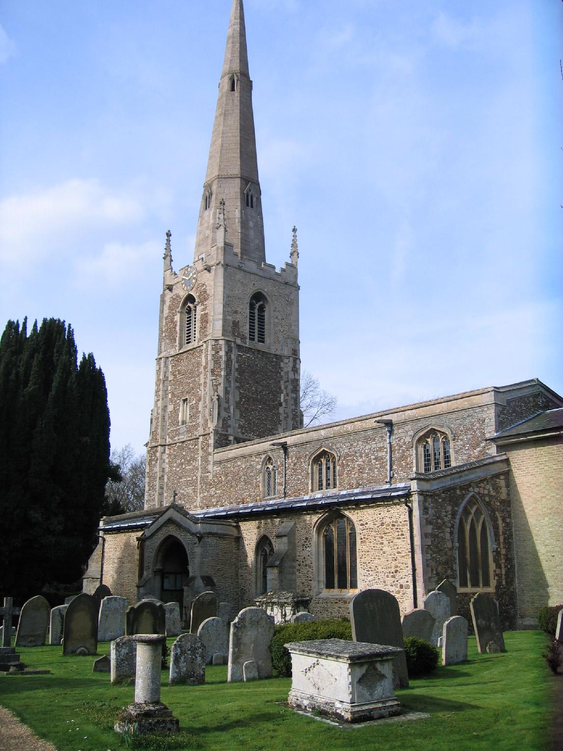


Fenstanton, United Kingdom
Fenstanton is a town of 2,639 people in England, United Kingdom.
Why visit Fenstanton
Townapedia lists 8 museums and landmarks, 6 parks and trails, 9 places to eat, 3 places to stay and 1 attraction in and around town.
Highlights include The Manor, War Memorial, Fen Drayton Lakes and Hemingford Grey Meadow.
Weather in Fenstanton
Forecast from MET Norway (CC BY 4.0). Full forecast
About Fenstanton
Fenstanton is a village and civil parish in Cambridgeshire, England, 2 miles (3 km) south of St Ives in Huntingdonshire, a non-metropolitan district of Cambridgeshire and historic county. Fenstanton lies on the south side of the River Ouse.
From the Wikipedia article Fenstanton (this version), under CC BY-SA 4.0.
Things to do1
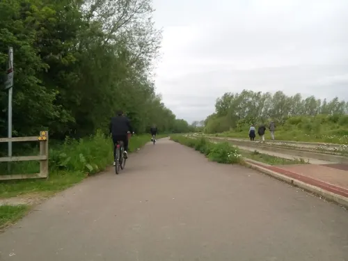
Museums and landmarks8


Swavesey Priory
Monument and historic site · 2.7 mi
Priory in Swavesey, South Cambridgeshire, England, UK
Low Hill bowl barrow
Monument and historic site · 1.1 mi
The mound of Low Hill barrow, preserved as a prominent earthwork, stands 1m high and covers an area approximately 30m in diameter. Its...
Parks, trails and playgrounds6
Fen Drayton Lakes
Park · 1.4 mi
RSPB nature reserve in the United Kingdom

Hemingford Grey Meadow
Park · 1.7 mi
Nature reserve in Hemingford Grey, Huntingdonshire, Cambridgeshire, England, UK


Jones Boatyard
Marina and boat launch · 1.2 mi
Facilities available: Approximately 160 fixed and floating moorings, mostly serviced with electricity, Shower block, Chemical waste...
Low Road, St Ives

Restaurants and cafes9





History
Lying on the Via Devana, the Roman road that linked the army camps at Godmanchester and Cambridge, Fenstanton was the site of a Roman villa, possibly designed to keep order after an attack on the forces of the IX Legion Hispana as they retreated from an ambush at Cambridge by Boudicca's tribesmen. The first evidence of a Roman crucifixion in the UK was discovered in a burial in Fenstanton in 2017, when a skeleton of a man was found with a nail through his heel. In 2021 the bones were unearthed.
The inhabitants of Fenstanton rose in support of Hereward the Wake after the Norman Conquest in 1066. From his stronghold on the Isle of Ely Hereward led resistance against the Normans, causing King William I to assemble a force in Cambridge to deal with the problem. Men were summoned from Huntingdon but they did not pass Fenstanton and escaped with their lives only by swimming across the river.
Fenstanton was listed in Domesday Book of 1086 in the Hundred of Toseland in Huntingdonshire; the name of the settlement was written as Stantone in Domesday Book. In 1086 there was just one manor at Fenstanton; the annual rent paid to the lord of the manor in 1066 had been £17 but had fallen to £16 in 1086, and the parish contained 33 households. By 1086 there was already a church and a priest at Fenstanton.
From the History section of Fenstanton on Wikipedia, under CC BY-SA 4.0.
More about Fenstanton
Geography
The original Fenstanton bypass opened in early February 1965 as a single carriageway three-lane road built by Cementation Company. It was the first part of the busy A604 to be improved. It was further improved when the Godmanchester to Bar Hill section of the A604 was built by Sir Alfred McAlpine (Southern), opening in April 1981. The Bar Hill to Swavesey section had opened first, in early December 1980. It was the A14 from 1994 until 2022. The archaeological works undertaken as a result of the large road improvement scheme found Early Bronze Age burials and cremations at Fenstanton Gravels and give an insight into Bronze Age funerary practices.
Arts and culture
The village supports two public houses: The Pipes and the Duchess. In 1851 eight pubs were recorded: The Bell, the Crown, the George, the King William IV, the Rose & Crown, the Royal Oak, the White Horse, the Woolpack and the Duchess.
There is a post office as well as a primary school with an attached pre-school, shared with neighbouring Hilton.
There is a convenience store called Ash's Shop, which won the Small Convenience Store of the Year award at the 2021 Convenience Awards
Fenstanton is the current operating base of Stagecoach in Huntingdonshire.
From the Wikipedia article Fenstanton, under CC BY-SA 4.0.
Notable people from Fenstanton
 John HowlandPassenger on the MayflowerPhoto: William Halsall, Public domain
- Colin CooteBritish politician (1893-1979)
Born in Fenstanton, according to Wikidata (CC0). Each name links to its Wikipedia article.
Where to stay3
Churches and places of worship6
St Mary (Conington Parish Church)
Church · Anglican · 1.5 mi
School Lane, Conington
Gas and EV charging3
Schools, colleges and libraries2
Healthcare1
Map of Fenstanton
39 places. The map loads OpenStreetMap tiles when you open it.
Getting there and nearby towns
Cambridge City Airport (CBG) is the nearest airport with scheduled flights listed in OpenStreetMap, 12 miles away.
- Hemingford Grey 2 mi northwest, about 3 min by car
- Saint Ives 2 mi north, about 4 min by car
- Swavesey 3 mi east, about 4 min by car
- Needingworth 3 mi northeast, about 4 min by car
- Houghton 3 mi northwest, about 5 min by car
- Over 4 mi east, about 6 min by car
- Papworth Everard 4 mi southwest, about 7 min by car
- Huntingdon 5 mi northwest, about 9 min by car
- Longstanton 5 mi east, about 8 min by car
- Earith 6 mi northeast, about 9 min by car
Drive times are estimates from straight-line distance, not routes.
Towns near Fenstanton


Keep exploring
Local news
Headlines from INDB.
Reviews, tips and questions
Loading what members have shared...
Sources and licences
- GeoNames (CC BY 4.0): population, coordinates, regions and time zone
- Mapillary (see each image): photos
- OpenStreetMap contributors (ODbL 1.0): places, airports, map data
- Wikidata (CC0 1.0): elevation, founding date, time zone, website, landmarks and historic places
- Wikimedia Commons (see each image): photos
- Wikipedia (CC BY-SA 4.0): overview and history text
Photo credits
- Hemingford Grey Meadow 4, Dudley Miles, CC BY-SA 4.0
- Cmglee St Ives Market Hill, Cmglee, CC BY-SA 3.0
- Hemingford Abbots church, Smb1001, CC BY-SA 3.0
- Godmanchester to St Ives 090 The Manor House gardens, Hemingford Grey (22164131578), Peter O'Connor aka anemoneprojectors, CC BY-SA 2.0
- Godmanchester to St Ives 198 Houghton Meadows (22653366042), Peter O'Connor aka anemoneprojectors, CC BY-SA 2.0
- Dahlias at Carriages of Cambridge, kitmasterbloke, CC BY 2.0
- Street-level photo, adam2, CC BY-SA 4.0
- Street-level photo, adam2, CC BY-SA 4.0
- Street-level photo, cyclestreets, CC BY-SA 4.0
- Street-level photo, adam2, CC BY-SA 4.0
- Street-level photo, adam2, CC BY-SA 4.0
- Street-level photo, adam2, CC BY-SA 4.0
- Street-level photo, adam2, CC BY-SA 4.0
- Street-level photo, adam2, CC BY-SA 4.0
- Street-level photo, adam2, CC BY-SA 4.0
Page built November 10, 2026. Spotted a mistake? Tell us or suggest a place.