


Why visit Fishguard
Townapedia lists 8 museums and landmarks, 3 parks and trails, 24 places to eat, 11 places to stay and 1 attraction in and around town.
Highlights include Theatr Gwaun.
Weather in Fishguard
Forecast from MET Norway (CC BY 4.0). Full forecast
About Fishguard
Fishguard (Welsh: Abergwaun, meaning 'Mouth of the River Gwaun') is a coastal town in Pembrokeshire, Wales, with a population of 3,400 (rounded to the nearest 100) as of the 2021 census. Modern Fishguard consists of two parts, Lower Fishguard and the "Main Town". Fishguard and Goodwick are twin towns with a joint Town Council.
From the Wikipedia article Fishguard (this version), under CC BY-SA 4.0.
Travel tips from other travellers: Fishguard on Wikivoyage (CC BY-SA 4.0).
Things to do1
Museums and landmarks8



Parks, trails and playgrounds3


Restaurants and cafes24

The Ship Inn
Bar and pub · 0.4 mi
3 Newport Road
Mo-Tu off; We-Fr 17:00-23:00; Sa 12:00-23:00; Su 12:00-21:00
Cove Corner
Cafe · Coffee Shop
Market Square, Fishguard
Mo-Th 08:00-17:00; Su 09:00-15:00; Fr-Sa 08:00-22:00

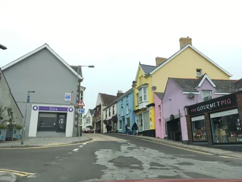
Mannings
Cafe · Breakfast, Cake, Coffee Shop
18 West Street, Fishguard

12 more on the map.
History
Fishguard is within the historic Welsh cantref of Cemais, and part of the Welsh province of Dyfed, within the historic Principality of Deheubarth. The coasts of Wales were subject to Norse raids during the Viking Age, and in the latter part of the 10th century Norse trading posts and settlements emerged within Dyfed, with Fishguard established sometime between 950 and 1000 AD.
In 1078 Goodwick Moor was the scene of a bloody battle in which Rhys, son of Owain ap Edwyn, was defeated and slain by Trahaearn ap Caradog (Brut y Tywysogion) in the Battle of Pwllgwdig.
The English place name indicates that there may have been a Scandinavian trading post, although no evidence has been found. However, the V-shaped stone structures of ancient fish traps can still be seen at low tide on both sides of the bay, and it is believed these were the foundations for wooden fences that would trap the fish as the tide went out. Other examples can be found around the country, and they probably date from Saxon times, though similar devices have been in use since Neolithic times.
Read more of the history
Called Fiscard until the turn of the 19th century when the name was Anglicised, Fishguard was a marcher borough and in 1603 was described as one of five Pembrokeshire boroughs overseen by a portreeve. The Norman settlement lay along what is now High Street between the church at its north end and the remains of a Norman motte at its south end.
In 1912, Denys Corbett Wilson made the first flight between Britain and Ireland. Starting his journey from Hendon aerodrome on 17 April 1912, he eventually landed in Goodwick on 21 April having made a few unscheduled stops along the way. He then set off from a field near Harbour Village at 5:47 on 22 April and crash-landed 100 minutes later in Crane near Enniscorthy in County Wexford.
Lower Fishguard developed as a herring fishery and port, trading with Ireland, Bristol and Liverpool. In the late 18th century it had 50 coasting vessels, and exported oats and salt herring. In 1779, the port was raided by the privateer Black Prince, which bombarded the town when the payment of a £1,000 ransom was refused. As a result, Fishguard Fort was completed in 1781, overlooking Lower Fishguard. The port declined in the latter half of the 19th century.
Fishguard's ancient Royal Oak public house was the site of the signing of surrender after the Battle of Fishguard. This brief campaign, on 22–24 February 1797, is the most recent landing on British soil by a hostile foreign force, and thus is often referred to as the "last invasion of mainland Britain". A force of 1,400 French soldiers landed near Fishguard but surrendered two days later.
A 19th-century vicar of Fishguard, the Rev. Samuel Fenton MA, wrote the book The History of Pembrokeshire.
The ancient Parliamentary Borough of Fishguard was contributory to the Borough of Haverfordwest. During the Second World War, the Fishguard Bay Hotel was Station IXc of Special Operations Executive where submersibles were tested in Fishguard Bay.
Fishguard & Goodwick Golf Club was founded in 1921 and closed in the 1960s.
From the History section of Fishguard on Wikipedia, under CC BY-SA 4.0.
More about Fishguard
Geography
The town is situated at the back of a north facing bay known as Fishguard Bay (Welsh: Bae Abergwaun) which offers protection from waves generated by prevailing westerly winds. It has a relatively mild climate due to its coastal position. The winds coming from the west or south-west have a determining influence on temperature and precipitation. There is an islet in Fishguard Bay, Needle Rock which reaches 131 feet (40 metres).
Wildlife around Fishguard is rich with a wide variety of colourful wild flowers and sea mammals including the grey seal, porpoises and dolphins. The local birdlife include Eurasian curlew, common redshank and sanderling regularly foraging in the lower Fishguard Harbour and European stonechat, great cormorant and northern fulmar can be seen from the coastal path.
From the Wikipedia article Fishguard, under CC BY-SA 4.0.
Notable people from Fishguard
 Willie ThomasWelsh rugby union playerPhoto: Walter Alfred Pearce, Public domain
 Paula CraigUK Wheelchair Detective - MBEPhoto: john coxon, Public domain
- Arthur Wade-EvansWelsh historian (1875–1964)
- Saunders DaviesAnglican bishop (1937–2018)
- Glenys CourBritish artist (born 1924)
- John BowenAnglican missionary and bishop
- John WilliamsWelsh Anglican clergyman, died 1802
- Sir Evan Davies Jones, 1st BaronetBritish politician (1859-1949)
Born in Fishguard, according to Wikidata (CC0). Each name links to its Wikipedia article.
Where to stay11
Churches and places of worship5
Shopping13
Gas and EV charging1
Schools, colleges and libraries4
Healthcare2
Map of Fishguard
72 places. The map loads OpenStreetMap tiles when you open it.
Getting there and nearby towns
Haverfordwest Airport (HAW) is the nearest airport with scheduled flights listed in OpenStreetMap, 11 miles away.
- Goodwick 1 mi northwest, about 2 min by car
- Haverfordwest 13 mi south, about 21 min by car
- Saint Davids 15 mi southwest, about 23 min by car
- Johnston 16 mi south, about 27 min by car
- Narberth 17 mi southeast, about 27 min by car
- Milford Haven 20 mi south, about 31 min by car
- Neyland 20 mi south, about 32 min by car
- Whitland 20 mi southeast, about 31 min by car
- Pembroke Dock 21 mi south, about 34 min by car
- Pembroke 22 mi south, about 36 min by car
Drive times are estimates from straight-line distance, not routes.
Towns near Fishguard


Keep exploring
Local news
Headlines from INDB.
Reviews, tips and questions
Loading what members have shared...
Sources and licences
- GeoNames (CC BY 4.0): population, coordinates, regions and time zone
- Mapillary (see each image): photos
- OpenStreetMap contributors (ODbL 1.0): places, airports, map data
- Wikidata (CC0 1.0): elevation, founding date, time zone, website
- Wikimedia Commons (see each image): photos
- Wikipedia (CC BY-SA 4.0): overview and history text
Photo credits
- Fishguard West Street, Humphrey Bolton, CC BY-SA 2.0
- Bennetts Navy Tavern DSC 8645 -1, Talsarnau Times, CC BY-SA 3.0
- Fishguard Fort DSC 8631 -1, Talsarnau Times, CC BY-SA 3.0
- The Ship Inn DSC 8449 -1, Talsarnau Times, CC BY-SA 3.0
- Street-level photo, southglos, CC BY-SA 4.0
- Street-level photo, trigpoint, CC BY-SA 4.0
- Street-level photo, trigpoint, CC BY-SA 4.0
- Street-level photo, southglos, CC BY-SA 4.0
- Street-level photo, trigpoint, CC BY-SA 4.0
- Street-level photo, trigpoint, CC BY-SA 4.0
- Street-level photo, southglos, CC BY-SA 4.0
- Street-level photo, trigpoint, CC BY-SA 4.0
- Street-level photo, trigpoint, CC BY-SA 4.0
- Street-level photo, trigpoint, CC BY-SA 4.0
- Street-level photo, trigpoint, CC BY-SA 4.0
- Street-level photo, southglos, CC BY-SA 4.0
- Street-level photo, trigpoint, CC BY-SA 4.0
- Street-level photo, trigpoint, CC BY-SA 4.0
- Street-level photo, southglos, CC BY-SA 4.0
- Street-level photo, southglos, CC BY-SA 4.0
- Street-level photo, trigpoint, CC BY-SA 4.0
- Street-level photo, trigpoint, CC BY-SA 4.0
- Street-level photo, southglos, CC BY-SA 4.0
- Street-level photo, trigpoint, CC BY-SA 4.0
- Street-level photo, southglos, CC BY-SA 4.0
- Street-level photo, trigpoint, CC BY-SA 4.0
- Street-level photo, southglos, CC BY-SA 4.0
- Street-level photo, southglos, CC BY-SA 4.0
- Street-level photo, southglos, CC BY-SA 4.0
- Street-level photo, trigpoint, CC BY-SA 4.0
- Street-level photo, southglos, CC BY-SA 4.0
- Street-level photo, southglos, CC BY-SA 4.0
- Street-level photo, trigpoint, CC BY-SA 4.0
- Street-level photo, trigpoint, CC BY-SA 4.0
- Street-level photo, trigpoint, CC BY-SA 4.0
- Street-level photo, trigpoint, CC BY-SA 4.0
Page built November 10, 2026. Spotted a mistake? Tell us or suggest a place.