


Pembroke Dock, United Kingdom
Pembroke Dock is a town of 9,657 people in Wales, United Kingdom.
Why visit Pembroke Dock
Townapedia lists 11 museums and landmarks, 4 parks and trails, 24 places to eat, 5 places to stay and 1 attraction in and around town.
Highlights include Cleddau Bridge, Pembroke Castle, Pembroke Museum and Neyland Yacht Haven - Lower Basin.
Weather in Pembroke Dock
Forecast from MET Norway (CC BY 4.0). Full forecast
About Pembroke Dock
Pembroke Dock (Welsh: Doc Penfro) is a port town and a community in Pembrokeshire, South West Wales, 3 miles (5 km) northwest of Pembroke on the banks of the River Cleddau.
From the Wikipedia article Pembroke Dock (this version), under CC BY-SA 4.0.
Things to do1
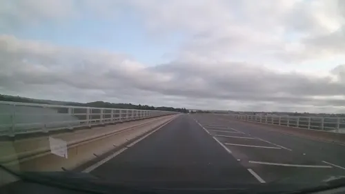
Museums and landmarks11

Pembroke Castle
Monument and historic site · 1.3 mi
Medieval castle in Wales
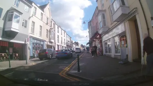

South West Dock Martello Gun Tower
Monument and historic site · 0.9 mi
Fort Road, Pembroke Dock



Northern Martello Gun Tower
Monument and historic site · 0.4 mi
Front Street, Pembroke Dock
Parks, trails and playgrounds4



Restaurants and cafes24


Café Rose
Cafe · Mediterranean · 1.5 mi
28 Main Street, Pembroke
Tu-Th 09:30-15:00; Fr-Sa 09:30-15:00, 18:00-21:00

Rowlies Fish & Chips
Restaurant · Fish And Chips · 1.4 mi
2 Main Street
Mo-Th 11:00-19:00; Fr,Sa 11:00-19:30

Watermans Arms
Bar and pub · 1.4 mi
2 The Green, Pembroke
Mo-Th 12:00-23:00; Fr-Sa 12:00-00:00; Su 12:00-23:00

Cwtch Coffee
Cafe · Breakfast, Regional
23 Dimond Street, Pembroke Dock
Mo-Fr 09:00-17:00

12 more on the map.
History
The natural harbour (now the Milford Haven Waterway) offering shelter from the prevailing south-westerly winds, has probably been used for many thousands of years. From maps, the first evidence of settlement is the name of the Carr Rocks at the entrance, derived from the Norse-language skare for rock.
From 790 until the Norman Invasion (1066) the estuary was used by the Vikings. During one visit, either in 854 or in 878, maybe on his way to the Battle of Cynuit, the Viking chieftain Hubba wintered in the haven with 23 ships.
In 1172, King Henry II's fleet and army were prepared in the mouth of the Pembroke River and sailed to Ireland during the Norman Invasion of Ireland.
Until 1814, the area was mostly farmland and known as Paterchurch. The first recorded mention of Paterchurch was in 1289. A medieval tower was built and like nearby 18th century and 19th century fortifications, it may have served as a lookout post. By the 17th century, additional domestic and farm buildings stood close to the tower and the isolated settlement had its own cemetery, whose last recorded burial is that of a Roger Adams, in 1731. The ruin of the tower now lies within the walls of the dockyard.
Read more of the history
Paterchurch Tower was the centre of an estate said to stretch from Pennar Point to Cosheston. This changed hands in 1422 when Ellen de Paterchurch married a John Adams. Prior to the building of the town and before the dockyard was thought of, various sales and exchanges took place between the principal local landowners – the Adams, Owen and Meyrick families. These exchanges left the Meyricks in control of most of the land on which the dockyard and new town were to develop. By 1802 the Paterchurch buildings were mostly ruins.
During the Second World War Pembroke Dock was targeted by the German Luftwaffe. On Monday 19 August 1940 a Luftwaffe Junkers Ju 88 bomber flew up the haven waterway and bombed a series of oil tanks sited at Pennar. The oil-fuelled fire that followed raged for 18 days and was recorded as the largest UK conflagration since the Great Fire of London. Bombing on the night of 11 and 12 May 1941 resulted in 30 people killed and many injured in the town. Nearly 2,000 houses were damaged.
The origins of naval shipbuilding on Milford Haven were on the north side of the waterway. In November 1757, the Admiralty sent a surveying delegation to the haven, which prepared a report for Parliament recommending, "the construction of a Milford dock yard". Originally privately owned, the Navy took over the shipyard lease in 1796. In 1809, the Admiralty sought to purchase the facility outright and formally establish it as a Royal Navy dockyard, but failed to agree a purchase price.
Instead, the Admiralty agreed purchase of land across the haven, near the town of Pembroke in a district called Pater (village) or Paterchurch, and in 1814 Pembroke Dockyard was established, initially called Pater Dockyard. The site was one of the few in the haven suitable for a dock for constructing decent sized ships, as its shoreline was flat but led quickly into deep harbour. Construction started immediately, with a former frigate driven ashore as a temporary accommodation hulk. Orders were placed for the construction of a 74 gun battleship and four frigates. After the Battle of Waterloo in June 1815, the scheme still seemed ill placed in what would be a smaller Royal Navy, but the final plans were given the go ahead on 31 October 1815.
On 10 February 1816, the first two ships were launched from the dockyard – HMS Valorous and Ariadne, both 20-gun post-ships, subsequently converted at Plymouth Dockyard into 26-gun ships. Over the span of 112 years, five royal yachts were built, along with 263 other Royal Navy vessels. The last ship launched from the dockyard was the Royal Fleet Auxiliary tanker Oleander on 26 April 1922.
After the First World War, the dockyard was closed by the cash-strapped Admiralty as redundant in 1926. A petition was sent to Prime Minister Stanley Baldwin, stressing the lack of alternative employment and the economic consequences of closure, but the decision was not overturned.
The Royal Maritime Auxiliary Service (RMAS) maintained a base in Pembroke Dock until disestablishment in 2008, including the MOD Salvage & Marine Team. The Ministry of Defence sold the freehold of the site to the Milford Haven Port Authority (MHPA) in 2007.
The dockyard wall is substantially complete and the dry dock also remains, along with two out of ten building slips. Among several surviving Georgian and Victorian buildings on the site is the Terrace, a row of houses for the dockyard officers. Garrison Chapel at the end of the Terrace has been rebuilt using Objective One funding from the European Union and now serves as the Pembroke Dock Heritage Centre run by Pembroke Dock Heritage Trust.
As the dockyard and its importance grew, the need to defend it was addressed and Pembroke Dock became a military town. Work began in 1844 to build defensible barracks. In 1845 the first occupiers were the Royal Marines of the Portsmouth Division, followed through the years by many famous regiments. Between 1849 and 1857, two Martello towers of dressed Portland stone were constructed at the south-western and north-western corner of the dockyard; both were garrisoned by sergeants of artillery and their families.
In the 1850s a hutted encampment was established nearby on Llanion Hill. In 1904 this was replaced by four brick-built barrack blocks, designed to house a thousand troops. The new Llanion Barracks was 'the first barracks to be constructed with a separate area for cooking and ablutions and was one of the most modern in the country'.
From the History section of Pembroke Dock on Wikipedia, under CC BY-SA 4.0.
More about Pembroke Dock
Economy
The Pembrokeshire Technium was built and opened in 2006 and succeeded by Technium Science. Although the initial interest was slow the first major uptake on this facility began in 2009 when Infinergy built a wind farm in the local area and based its local office in the centre. Following its removal from the Welsh Government’s Technium network it was rebranded as the Bridge Innovation Centre in 2013. There has been approval given by Pembrokeshire County Council for a new yacht marina to be built alongside Front Street but work has yet to begin.
In 2021 permission was granted for 'ambitious plans to transform Pembroke Dock's historic dockyard' as part of a '£60 million marine energy project', despite protests from heritage groups. Some buildings within the conservation area will be demolished, the grade II* graving dock and the grade II timber pond infilled and built over, the remaining grade II listed building slips partially demolished and the setting of the adjacent grade II Carr Jetty damaged. These will be replaced by two five-storey warehouses (to house future shipbuilding operations) and 'a giant concrete slipway, stretching out into the water alongside the grade II listed Hobbs point causeway'.
From the Wikipedia article Pembroke Dock, under CC BY-SA 4.0.
Notable people from Pembroke Dock
 Christine GwytherBritish politician (born 1959)Photo: Senedd Cymru / Welsh Parliament from Wales, CC BY 2.0
 Henry Stanhope SlomanBritish generalPhoto: Hsq7278, CC BY-SA 4.0
- Andy GoddardBritish director and screenwriter (born 1968)
- Bert HodgkinsonWelsh footballer (1884-1939)
- Scott GammerBritish boxer
- Guy GriffithsRoyal Marines officer (1915–1999)
- Tal SelleyWelsh rugby union player
- Ernie FinchWelsh rugby union player (1899-1983)
Born in Pembroke Dock, according to Wikidata (CC0). Each name links to its Wikipedia article.
Where to stay5
Churches and places of worship12
Wesley Methodist Church
Church · Methodist · 1.2 mi
49a High Street, Milford Haven
Shopping7
Gas and EV charging1
Schools, colleges and libraries7
Healthcare1
Map of Pembroke Dock
73 places. The map loads OpenStreetMap tiles when you open it.
Getting there and nearby towns
Haverfordwest Airport (HAW) is the nearest airport with scheduled flights listed in OpenStreetMap, 10 miles away.
- Milford Haven 4 mi west, about 7 min by car
- Haverfordwest 8 mi north, about 12 min by car
- Tenby 10 mi east, about 16 min by car
- Saundersfoot 10 mi east, about 17 min by car
- Whitland 16 mi northeast, about 26 min by car
- Saint Davids 19 mi northwest, about 31 min by car
- Saint Clears 21 mi northeast, about 34 min by car
- Carmarthen 29 mi northeast, about 47 min by car
- Llanelli 33 mi east, about 54 min by car
- Swansea 43 mi east, about 1 h 15 min by car
Drive times are estimates from straight-line distance, not routes.
Towns near Pembroke Dock


Keep exploring
Local news
Headlines from INDB.
Reviews, tips and questions
Loading what members have shared...
Sources and licences
- GeoNames (CC BY 4.0): population, coordinates, regions and time zone
- Mapillary (see each image): photos
- OpenStreetMap contributors (ODbL 1.0): places, airports, map data
- Wikidata (CC0 1.0): elevation, founding date, time zone, website, landmarks and historic places
- Wikimedia Commons (see each image): photos
- Wikipedia (CC BY-SA 4.0): overview and history text
Photo credits
- Pembroke Dock, Dimond Street, Colin Bell, CC BY-SA 2.0
- PembrokeCastle 2007, Monkeyrustler at English Wikipedia, Public domain
- Neyland Library, Agathoclea, CC BY-SA 3.0
- Prince of Wales Tower - 2017 (35781219381), Dennis G. Jarvis, CC BY-SA 2.0
- Statue Of William Marshal, Poupipouw, CC0
- Street-level photo, trigpoint, CC BY-SA 4.0
- Street-level photo, brianh, CC BY-SA 4.0
- Street-level photo, trigpoint, CC BY-SA 4.0
- Street-level photo, trigpoint, CC BY-SA 4.0
- Street-level photo, trigpoint, CC BY-SA 4.0
- Street-level photo, trigpoint, CC BY-SA 4.0
- Street-level photo, trigpoint, CC BY-SA 4.0
- Street-level photo, trigpoint, CC BY-SA 4.0
- Street-level photo, trigpoint, CC BY-SA 4.0
- Street-level photo, wibbit, CC BY-SA 4.0
- Street-level photo, wibbit, CC BY-SA 4.0
- Street-level photo, trigpoint, CC BY-SA 4.0
- Street-level photo, trigpoint, CC BY-SA 4.0
- Street-level photo, trigpoint, CC BY-SA 4.0
- Street-level photo, wibbit, CC BY-SA 4.0
Page built November 10, 2026. Spotted a mistake? Tell us or suggest a place.