


Saint Davids, United Kingdom
Saint Davids is a town of 1,751 people in Wales, United Kingdom.
Why visit Saint Davids
Townapedia lists 23 museums and landmarks, 13 parks and trails, 32 places to eat, 34 places to stay and 15 attractions in and around town.
Highlights include Whitesands Bay, Carn Llidi, Bishop's Palace and Coetan Arthur.
Weather in Saint Davids
Forecast from MET Norway (CC BY 4.0). Full forecast
About Saint Davids
St Davids or St David's (Welsh: Tyddewi, [tiː ˈðɛwi], lit. "David's house") is a cathedral city in Pembrokeshire, Wales. It lies on the River Alun and is part of the community of St Davids and the Cathedral Close. It is the resting place of Saint David, Wales's patron saint, and named after him.
From the Wikipedia article St Davids (this version), under CC BY-SA 4.0.
Travel tips from other travellers: Saint Davids on Wikivoyage (CC BY-SA 4.0).
Photos of Saint Davids


Things to do15

Whitesands Bay
Beach · 1.6 mi
Bay and beach in Pembrokeshire, Wales, UK



3 more on the map.
Museums and landmarks23

Bishop's Palace
Monument and historic site
Mar-Jun Mo-Su 09:30-17:00; Jul-Aug Mo-Su 09:30-18:00; Sep-Oct...

Coetan Arthur
Monument and historic site · 2.4 mi
Neolithic burial chamber near St David's Head, Pembrokeshire, Wales



Clegyr Boia
Monument and historic site · 1.0 mi
Hillfort in Pembrokeshire
11 more on the map.
Parks, trails and playgrounds13





1 more on the map.
Restaurants and cafes32
The Harbour Inn
Bar and pub · 3.3 mi
31-33 Main Street
Mo-Su 10:00-22:00
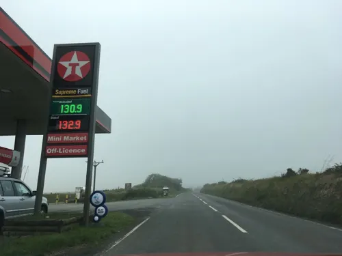
Ocean Haze Sri Lankan Restaurant (& Takeaway)
Restaurant · 0.7 mi
Sri Lankan restaurant & takeaway. Meat & vegetarian dishes. Attached to Hotel & adjacent to the fuel station.
A487
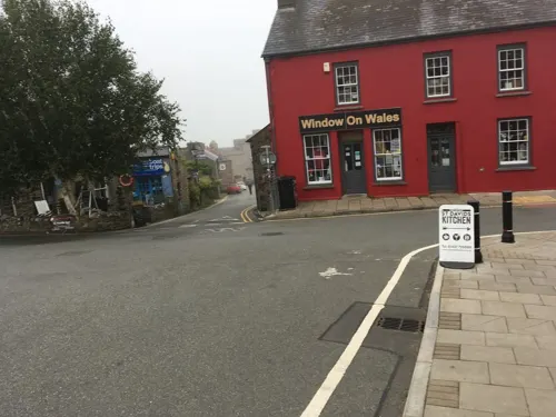
St David's Gin & Kitchen
Restaurant
16 Heol Non, St David's
Mo,Tu off; Su 12:00-15:00,18:00-22:00; We-Sa 18:00-22:00,12:00-14:00



20 more on the map.
History
Although the surrounding landscape is home to a number of Palaeolithic, Bronze Age and Iron Age sites, documentary and archaeological evidence suggests that Pembrokeshire was not heavily occupied by the Romans. Following the Roman withdrawal from Britain, the area that would become St Davids was known in Ecclesiastical Latin as Meneva or Menevia and in Welsh as Mynyw. Some medieval texts state that the area was home to a cell, church or monastery founded by Saint Patrick around the year 470 AD, years before the birth of Saint David.
David is said to have been born to Saint Non around 500 AD, at the place where the Chapel of St Non now stands. He was baptised by Saint Elvis at Porthclais, and was brought up by his mother at Llanon. He may also have been educated at the "Ty Gwyn", Whitesands by Saint Paulinus. David is thought to have founded an earlier community somewhere to the west of modern St Davids, before establishing a new church and monastery at a place then known as "Glyn Rhosyn" on the banks of the Afon Alun (where the current Cathedral now stands).
Read more of the history
During his life, David gained great fame throughout the Celtic church and was a key figure in the fight against the Pelagian Heresy. At the Synod of Brefi in 545 AD, Saint Dubricius (who held two Bishoprics, Caerleon and Llandaff) is said to have freely given David the ancient Metropolitan See of Caerleon. It is also implied that in transferring the See from Caerleon, David also transferred an important royal court. The Welsh Triads name "Mynyw" as the seat of "one of the three Tribal Thrones of the island of Britain" (the other courts being Celliwig and Pen Rhionydd). The entry states that the court had Arthur as Chief Prince, "Dewi" as the Chief Bishop, and "Maelgwn Gwynedd" as Chief Elder. Indeed, Geoffrey of Monmouth would describe David as "The pious archbishop of Legions, at the city of Menevia" (Caerleon's name in both Welsh and Latin means "The city of Legions").
The monastery would become known as Tyddewi (House of David) and was a famous centre of pilgrimage early in its history, attracting both foreign pilgrims of status and numerous Viking attacks by the ninth century. Its scholastic community was also famous throughout the Celtic world and in Anglo-Saxon England. When Alfred the Great wanted to establish a centre of learning at his court, he requested Asserius Menevensis, (Asser of St Davids) to join them. At that time, Asser had lived all his life at St Davids, being raised, tonsured, trained and ordained there. Yet Alfred's desire to secure his service was such that he acquiesced to a number of delays and requests before finally agreeing that Asser could split his time between Alfred's court and St David's.
The cult of Saint David was actively encouraged by the cathedral's pre-Norman Bishops, especially Sulien and Rhigyfarch, who would write Vita sancti Davidis episcopi, the standard Vita of the saint.
As the Normans advanced into Pembrokeshire, the city became a marcher borough, and the new hundred was named "Dewisland". The cathedral was rebuilt during the Norman era and much of the earliest sections that are still extant, date back to the twelfth century. However, it is thought that this cathedral would have followed the layout of medieval structure and it continued to host its many ancient relics, including the remains of David.
At its height, the city was visited by many pilgrims, including noblemen and kings such as William the Conqueror in 1081, Henry II in 1171, and Edward I and Queen Eleanor in 1284. Pope Calixtus II decreed that two pilgrimages to St Davids were equivalent to one to Rome ("Roma semel quantum dat bis Menevia tantum"). The monastery became a Cathedral in the twelfth Century. This allowed a vast income to be raised from visiting pilgrims in the Middle Ages.
The Reformation saw both the income and importance of St Davids begin to fade as pilgrimages fell out of favour; this was exacerbated by the appointment of a number of English Bishops who were seemingly less concerned with the welfare of the cathedral or the city. Perhaps most infamously, Bishop William Barlow sold the lead from the roof of the Bishop's Palace in 1536, beginning a long period of neglect for St Davids.
Barlow had the Bishop's chief residence moved to Abergwili, Carmarthenshire in 1542 and St Davids continued to decline. In 1603, the antiquarian George Owen described the city as one of five Pembrokeshire boroughs overseen by a portreeve. The seventeenth century, saw two separate bishops apply for licences to demolish some of the city's ancient buildings, and the Bishop's palace was now considered "beyond repair".
By the 19th century, only the Cathedral itself seemed to retain the city's former glory, as described in the Penny Cyclopaedia:
At present its appearance is that of a poor village, the houses, excepting those of the clergy, being in a ruinous state. The locality is lonely, and the neighbouring district wild and unimproved; but it is still an interesting place as the seat of a large episcopal see, with a fine cathedral and the remains of other magnificent religious edifices.
The unique nature of the cathedral and the city was evident as late as the twentieth century. Following the disestablishment of the Church in Wales in 1920, the Cathedral Close was allowed to operate as its own civil parish, separate from that of the adjacent city for the next 50 years.
With better transport links and the advent of tourism, the city prospered once more in the later twentieth century, with the city's 210 listed buildings making it a destination for walkers, tourists and modern pilgrims. Many of the ancient buildings, including the Bishop's Palace, are today maintained by Cadw and open to the public.
From the History section of St Davids on Wikipedia, under CC BY-SA 4.0.
More about Saint Davids
Geography
The community council area sits at the southern end of the Irish Sea on a peninsula, between Cardigan Bay, St George's Channel and St Brides Bay. It covers not just the mainland area, but also several islands off the coast, of which Ramsey Island is the largest and the only one inhabited, separated by the Ramsey Sound. The most westerly mainland point of Wales is at Pen Dal-aderyn. To the north lie Whitesands Bay and St Davids Head, which are locally notable landscape features. The community includes the former chapelries at St Justinian and Gwrhyd. The mainland contains much area used for farming, but contains very small scattered residences and several campsites.
St Davids Lifeboat Station, at St Justinian, has saved an estimated 360 people since the first lifeboat was located there in 1869; four lifeboatmen have died while saving others. The Irish Sea includes a large number of offshore rocks and islands and is notorious for strong tides. The entire coastline around St Davids forms part of the Pembrokeshire Coast National Park. Saint Non's Well overlooks the Pembrokeshire Coast Path and St Brides Bay. St David's Airfield, although named after the city when opened in 1943, is in the neighbouring community of Solva. The highest point is Carn Llidi at 181 metres (594 ft).
Arts and culture
The city hosted the National Eisteddfod in 2002. The Archbishop-designate of Canterbury, Dr Rowan Williams, was inducted into the Gorsedd of Bards, a historic order of Druids.
The St Davids Penknife Club is a group of people dedicated to voluntary fund raising for local groups and charities.
St Davids has a rugby union club, St. Davids RFC, which competes in the Welsh Rugby Union League West.
In addition to the cathedral and 210 other listed ancient buildings and structures, notable features of the city and community include the 14th-century Tower Gate, the Celtic Old Cross and a number of art galleries. St Davids is also a base for walking and water sports. In 2019 Consumers' Association members placed St Davids in the top three best value beach destinations in Britain. Whitesands Bay, about two miles (three kilometres) west of St Davids, is a popular water sports resort. It has been described as the best surfing beach in Pembrokeshire and among the best tourist beaches in the world.
Television signals are received from the Preseli TV transmitter and the local relay transmitter situated west of the city.
Education
Ysgol Dewi Sant (St David's School) is the local secondary school covering years 7–13 (aged 11–18). Ysgol Bro Dewi (Dewisland School) is a Voluntary Controlled Primary School, with pupils from Reception to Year 6.
From the Wikipedia article St Davids, under CC BY-SA 4.0.
Notable people from Saint Davids
 Richard FentonTopographer and poet; (1746-1821)Photo: Samuel Woodforde, Public domain
 Jo PriceWelsh footballer and rugby union playerPhoto: Ailura, CC BY-SA 3.0 at
- AsserWelsh monk who became Bishop of Sherborne in the 890s
- Thomas TomkinsWelsh composer
- Jasmine JoyceWelsh rugby player
- Henry HicksBritish geologist and paleontologist (1837–1899)
- Ian WalshWelsh footballer (born 1958)
- RhygyfarchWelsh writer and bishop
- Kieran EvansWelsh director
- Rowland PhillipsWelsh rugby union footballer and coach, and rugby league footballer
- Mary KeirBritish supercentenarian
- Wilfrith GreenBritish military officer, Brigadier-General
Born in Saint Davids, according to Wikidata (CC0). Each name links to its Wikipedia article.
Where to stay34
Churches and places of worship10
Shopping28
Gas and EV charging1
Schools, colleges and libraries3
Healthcare1
Map of Saint Davids
160 places. The map loads OpenStreetMap tiles when you open it.
Getting there and nearby towns
Haverfordwest Airport (HAW) is the nearest airport with scheduled flights listed in OpenStreetMap, 14 miles away.
- Solva 3 mi east, about 5 min by car
- Haverfordwest 14 mi southeast, about 22 min by car
- Milford Haven 15 mi southeast, about 25 min by car
- Saundersfoot 27 mi southeast, about 43 min by car
- Tenby 28 mi southeast, about 45 min by car
- Whitland 28 mi east, about 45 min by car
- Saint Clears 33 mi east, about 53 min by car
- Carmarthen 41 mi east, about 1 h by car
- Llanelli 49 mi east, about 1 h 15 min by car
- Gorseinon 54 mi east, about 1 h 30 min by car
Drive times are estimates from straight-line distance, not routes.
Towns near Saint Davids


Keep exploring
Local news
Headlines from INDB.
Reviews, tips and questions
Loading what members have shared...
Sources and licences
- GeoNames (CC BY 4.0): population, coordinates, regions and time zone
- Mapillary (see each image): photos
- OpenStreetMap contributors (ODbL 1.0): places, airports, map data
- Wikidata (CC0 1.0): elevation, founding date, time zone, website, landmarks and historic places
- Wikimedia Commons (see each image): photos
- Wikipedia (CC BY-SA 4.0): overview and history text
Photo credits
- St Davids village and Cathedral South Wales, Manfred Heyde, CC BY-SA 3.0
- Porth Mawr (Whitesands Bay) near Tyddewi (St David's), Sir Benfro, Cymru, Wales 15, Llywelyn2000, CC BY-SA 4.0
- CoetanArthurDolmen, Daeve, CC BY-SA 3.0
- Capel y Santes Non, Tyddewi, Sir Benfro - St Non's Chapel, St Davids, Wales 27, Llywelyn2000, CC BY-SA 4.0
- St David's Head-by-Cered, Cered, CC BY-SA 2.0
- Carn Llidi (8397), Nilfanion, CC BY-SA 4.0
- Ebeneser Welsh Independent Chapel (10), GeraintTudur2, CC BY-SA 3.0
- 20140825 S28 Solva (15167264702), Sjaak Kempe from Groningen, The Netherlands, CC BY 2.0
- Porth Clais harbour, Thruxton, CC BY 3.0
- St Non's Chapel, Thruxton, CC BY 3.0
- 20140826 56 St. Davids (14981449327), Sjaak Kempe from Groningen, The Netherlands, CC BY 2.0
- St Davids Bishops Palace 001, Hamburg103a, CC BY-SA 4.0
- Red Kite at Treheinif coast near Castell Heinif Celtic Fort - 2km West of Tyddewi, Sir Benfro, Wales 10, Llywelyn2000, CC BY-SA 4.0
- Street-level photo, southglos, CC BY-SA 4.0
- Street-level photo, southglos, CC BY-SA 4.0
- Street-level photo, southglos, CC BY-SA 4.0
- Street-level photo, southglos, CC BY-SA 4.0
- Street-level photo, southglos, CC BY-SA 4.0
- Street-level photo, southglos, CC BY-SA 4.0
- Street-level photo, trigpoint, CC BY-SA 4.0
- Street-level photo, southglos, CC BY-SA 4.0
- Street-level photo, southglos, CC BY-SA 4.0
- Street-level photo, southglos, CC BY-SA 4.0
- Street-level photo, southglos, CC BY-SA 4.0
- Street-level photo, southglos, CC BY-SA 4.0
- Street-level photo, coljay72, CC BY-SA 4.0
- Street-level photo, southglos, CC BY-SA 4.0
- Street-level photo, trigpoint, CC BY-SA 4.0
- Street-level photo, trigpoint, CC BY-SA 4.0
- Street-level photo, trigpoint, CC BY-SA 4.0
- Street-level photo, southglos, CC BY-SA 4.0
- Street-level photo, southglos, CC BY-SA 4.0
- Street-level photo, southglos, CC BY-SA 4.0
- Street-level photo, LandandLens, CC BY-SA 4.0
- Street-level photo, southglos, CC BY-SA 4.0
- Street-level photo, southglos, CC BY-SA 4.0
- Street-level photo, southglos, CC BY-SA 4.0
- Street-level photo, southglos, CC BY-SA 4.0


Page built November 10, 2026. Spotted a mistake? Tell us or suggest a place.