


Why visit Flimwell
Townapedia lists 5 museums and landmarks, 6 parks and trails, 4 places to eat and 2 places to stay in and around town.
Highlights include Scotney Castle, Collingwood Nature Reserve and Bedgebury National Pinetum.
Weather in Flimwell
Forecast from MET Norway (CC BY 4.0). Full forecast
About Flimwell
Flimwell is a village in the civil parish of Ticehurst, in the Rother district of East Sussex, England. It is located close to the border with Kent at the junction of the A21 road with the A268 and the B2087. The village is situated in an Area of Outstanding Natural Beauty near Bewl Water and Bedgebury Pinetum, and neighbouring villages include Ticehurst, Hurst Green and Hawkhurst.
From the Wikipedia article Flimwell (this version), under CC BY-SA 4.0.
Museums and landmarks5

Scotney Castle
Museum · 3.1 mi
Country house in Lamberhurst, Kent, England, UK

Parks, trails and playgrounds6



Dale Hill Golf Club
Golf course · 0.7 mi
18 hole Par 71 Ian Woosnam Course + 18 hole Par 69 Dale Hill Course


Restaurants and cafes4


Where to stay2

Churches and places of worship4
Gas and EV charging1
Schools, colleges and libraries1
Ticehurst and Flimwell Church of England Primary School
School · Anglican · 1.3 mi
Steellands Rise, Wadhurst
Map of Flimwell
23 places. The map loads OpenStreetMap tiles when you open it.
Getting there and nearby towns
Rochester Airport (RCS) is the nearest airport with scheduled flights listed in OpenStreetMap, 21 miles away.
- Ticehurst 2 mi west, about 3 min by car
- Lamberhurst 4 mi northwest, about 6 min by car
- Goudhurst 4 mi north, about 7 min by car
- Burwash 5 mi southwest, about 8 min by car
- Horsmonden 6 mi north, about 9 min by car
- Sissinghurst 6 mi northeast, about 10 min by car
- Brenchley 7 mi north, about 11 min by car
- Northiam 8 mi southeast, about 13 min by car
- Biddenden 9 mi northeast, about 15 min by car
- Royal Tunbridge Wells 10 mi northwest, about 15 min by car
Drive times are estimates from straight-line distance, not routes.
Towns near Flimwell


Keep exploring
Local news
Headlines from INDB.
Reviews, tips and questions
Loading what members have shared...
Sources and licences
- GeoNames (CC BY 4.0): population, coordinates, regions and time zone
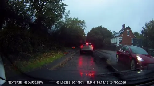
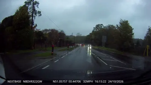
- Mapillary (see each image): photos
- OpenStreetMap contributors (ODbL 1.0): places, airports, map data
- Wikidata (CC0 1.0): elevation, founding date, time zone, website, landmarks and historic places
- Wikimedia Commons (see each image): photos
- Wikipedia (CC BY-SA 4.0): overview and history text
Photo credits
- Scotney Castle, National Trust (5662078576), Berit from Redhill/Surrey, UK, CC BY 2.0
- Collingwood Nature Reserve 6, Dudley Miles, CC BY-SA 4.0
- St Augustine of Canterbury's Church, Flimwell (NHLE Code 1222404), The Voice of Hassocks, CC0
- Bedgebury Lake, Colin Smith, CC BY-SA 2.0
- Bedgebury Pinetum 5, Poliphilo, CC0
- Street-level photo, tallguy, CC BY-SA 4.0
- Street-level photo, tallguy, CC BY-SA 4.0
- Street-level photo, tallguy, CC BY-SA 4.0
Page built November 10, 2026. Spotted a mistake? Tell us or suggest a place.