


Lamberhurst, United Kingdom
Lamberhurst is a town of 1,147 people in England, United Kingdom.
Why visit Lamberhurst
Townapedia lists 6 museums and landmarks, 3 parks and trails, 7 places to eat and 1 attraction in and around town.
Highlights include Scotney Castle and Bayham Old Abbey.
Weather in Lamberhurst
Forecast from MET Norway (CC BY 4.0). Full forecast
About Lamberhurst
Lamberhurst () is a village and civil parish in the borough of Tunbridge Wells in Kent, England. The parish contains the hamlets of The Down and Hook Green. At the 2001 Census it had a population of 1,491, increasing to 1,706 at the 2011 Census.
From the Wikipedia article Lamberhurst (this version), under CC BY-SA 4.0.
Things to do1

Museums and landmarks6

Scotney Castle
Monument and historic site · 1.0 mi
Country house in Lamberhurst, Kent, England, UK
10 Old Road

Bayham Old Abbey
Monument and historic site · 1.5 mi
Abbey in Frant, East Sussex, England, UK
Apr-Oct Mo-Sa 10:00-17:00; Nov-Mar closed
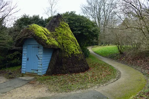


Parks, trails and playgrounds3


Restaurants and cafes7


History
The place-name 'Lamberhurst' is first attested in the Textus Roffensis of circa 1100 AD, where it appears as Lamburherste. The name means 'lambs' hill or wood'.
Prior to the Industrial Revolution, Lamberhurst was a centre for the Wealden iron industry, which was established in Roman times. Since then it has had some importance for hop-growing; been a weekend home to Margaret Thatcher; been controversially by-passed; and played a major role in English wine production.
Lamberhurst civil parish on formation, when such parishes first became possible in the 19th century, was in both Kent and East Sussex. The line of the county boundary was adjusted following the Local Government Act 1894, which required that parish boundaries be aligned with counties. The redrawing of the county boundary included transferring part of Bayham Lake so its entirety was in Kent.
From the History section of Lamberhurst on Wikipedia, under CC BY-SA 4.0.
More about Lamberhurst
Geography
The village lies in the valley of the River Teise, one of the main tributaries of the River Medway. The valley of one of its tributaries, the River Bewl, was dammed and flooded between 1973 and 1975 creating the Bewl Water reservoir. The village itself has a large conservation area with many 17th- and 18th-century buildings, and the Strict Baptist Church, established in the village since the 18th century.
From the Wikipedia article Lamberhurst, under CC BY-SA 4.0.
Notable people from Lamberhurst
- Thomas John HusseyBritish astronomer (1792–1854)
Born in Lamberhurst, according to Wikidata (CC0). Each name links to its Wikipedia article.
Churches and places of worship8
Shopping1
Map of Lamberhurst
26 places. The map loads OpenStreetMap tiles when you open it.
Getting there and nearby towns
Rochester Airport (RCS) is the nearest airport with scheduled flights listed in OpenStreetMap, 18 miles away.
- Ticehurst 4 mi south, about 6 min by car
- Royal Tunbridge Wells 6 mi west, about 10 min by car
- Sissinghurst 7 mi east, about 12 min by car
- Tonbridge 8 mi northwest, about 13 min by car
- Speldhurst 8 mi northwest, about 13 min by car
- Yalding 9 mi north, about 14 min by car
- Crowborough 10 mi west, about 16 min by car
- Heathfield 11 mi southwest, about 18 min by car
- Northiam 12 mi southeast, about 19 min by car
- Maidstone 13 mi northeast, about 20 min by car
Drive times are estimates from straight-line distance, not routes.
Towns near Lamberhurst


Keep exploring
Local news
Headlines from INDB.
Reviews, tips and questions
Loading what members have shared...
Sources and licences
- GeoNames (CC BY 4.0): population, coordinates, regions and time zone
- Mapillary (see each image): photos
- OpenStreetMap contributors (ODbL 1.0): places, airports, map data
- Wikidata (CC0 1.0): elevation, founding date, time zone, website, landmarks and historic places
- Wikimedia Commons (see each image): photos
- Wikipedia (CC BY-SA 4.0): overview and history text
Photo credits
- Scotney Castle, National Trust (5662078576), Berit from Redhill/Surrey, UK, CC BY 2.0
- Bayham Old Abbey, Mstanyauk, CC BY-SA 3.0
- Former Rehoboth Chapel, Pell Green, Wadhurst, The Voice of Hassocks, CC0
- St Mary, Goudhurst, west front, Poliphilo, CC0
- Lamberhurst, St Mary, Poliphilo, CC0
- The Dower House front door Bayham Old Abbey, Countrymaid, CC BY-SA 4.0
- Street-level photo, tallguy, CC BY-SA 4.0
- Street-level photo, tallguy, CC BY-SA 4.0
- Street-level photo, tallguy, CC BY-SA 4.0
- Street-level photo, pvaj, CC BY-SA 4.0
- Street-level photo, tallguy, CC BY-SA 4.0
Page built November 10, 2026. Spotted a mistake? Tell us or suggest a place.