


Goudhurst, United Kingdom
Goudhurst is a town of 1,142 people in England, United Kingdom.
Why visit Goudhurst
Townapedia lists 3 museums and landmarks, 1 park or trail, 4 places to eat, 1 place to stay and 1 attraction in and around town.
Highlights include Scotney Castle, Finchcocks Music Museum and The Gill.
Weather in Goudhurst
Forecast from MET Norway (CC BY 4.0). Full forecast
About Goudhurst
Goudhurst is a village and civil parish in the borough of Tunbridge Wells in Kent, England. It lies in the Weald, around 12 miles (19 km) south of Maidstone, on the crossroads of the A262 and B2079.
From the Wikipedia article Goudhurst (this version), under CC BY-SA 4.0.
Things to do1
Museums and landmarks3

Scotney Castle
Museum · 2.5 mi
Country house in Lamberhurst, Kent, England, UK

Parks, trails and playgrounds1

Restaurants and cafes4
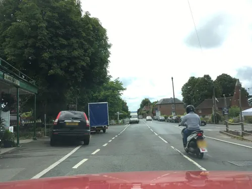
History
The village was one of those involved in the Wealden iron industry; it was a centre for the growing of hops and for weaving. A group of weavers' cottages stands opposite the church.
The Battle of Goudhurst in 1747 led to the end of the Hawkhurst Gang of smugglers and the execution of local gang leader Thomas Kingsmill whose body was hung in chains in the village.
The village's recent history is documented in the Goudhurst Jubilee Book (1935), Goudhurst Coronation Book (1937) and Goudhurst and Kilndown Millennium Book (2001, ISBN 0-9527822-1-9) which contain reminiscences, directories, historical notes, matters of local intelligence and records of celebrations starting from the 1800s or before. The books were printed as limited editions with the authors recording the written and the oral history of the village.
In 2023 Peter A Harding published "After the War was Over" (2023) ISBN 978-1-3999-5260-6 which captures his memories of an idyllic childhood at Goudhurst during the late 1940s and early 1950s.
The church stands on a hill and its tower commands views of the surrounding countryside.
Read more of the history
For this reason it was a major surveying point in the Anglo-French Survey (1784–1790) to measure the precise distance and relationship between the Paris Observatory and the Royal Greenwich Observatory, supervised by General William Roy. Sightings were made to Frant to the west, Tenterden to the east, Wrotham Hill to the north and Fairlight Down to the south.
St Mary's church was founded in 1170 by Robert de Crevecour. The church has been altered and restored many times over the centuries. Until 1637 it had a tall spire which was destroyed by lightning in that year. In 1638 three London masons rebuilt the west tower. During the Victorian era the church was restored by the architects William Slater and Richard Carpenter. The church contains a remarkable painted wood and gesso effigy to Sir Alexander Culpeper (d.1599) and his wife Constance.
Bedgebury is one of the oldest estates in Kent: having given its name to the de Bedgebury family, it passed into the hands of the Culpeper family in 1450. When the estate was sold in 1680, a new house was built which itself became a girls' school in the 1920s (closed in the summer of 2006). In 2007 the school was purchased by the Bell
Educational Trust, an educational charity. In the summer of 2007 the school reopened as the Bell Bedgebury International School, and the grounds also played host to the Bell Bedgebury Language Centre. In November 2010, the owners decided to close and sell the school. – the riding school and 125 acres were sold separately and are now independent. Bedgebury National Pinetum is nearby. It was acquired by the Forestry Commission in 1924.
A former Glebe Field at the East end of St Mary's Church was registered as a village green by Kent County Council in June 2016. It is 2.47 acres in extent and is surrounded by trees and hedges. It is owned by the Diocese of Canterbury and is maintained by Goudhurst Parish Council which has a long lease for this purpose. A volunteer group called The Friends of Goudhurst Village Green has been established with the aim to protect and preserve Goudhurst Village Green for the use of the residents of Goudhurst Parish by right, for lawful sports and pastimes, in perpetuity. St Mary's Church is permitted to use the village green for parking for occasional events such as large weddings and funerals.
In the past, the branch railway line from Paddock Wood had a station for the village. It was opened on 1 October 1892 and was originally named 'Hope Mill for Goudhurst and Lamberhurst' before being renamed to 'Goudhurst' on 4 September 1893, the day the final part of the line came into service – the extension to Hawkhurst via Cranbrook; physically, the station was about half a mile from the centre of Goudhurst, and somewhat further from Lamberhurst. The station was closed on 12 June 1961 because of lack of use, passenger numbers having dropped to fewer than 200 per day. The track was lifted in 1964, and in 1967 the station sites were offered for sale.
At present, the only public transport for Goudhurst are three bus routes– the 23 via Yalding and 27 via Linton l, both of which run to Maidstone and are run by Nu-venture of Aylesford. Additionally the 297 'wealden link' runs to Tunbridge Wells and Pembury in the west and Cranbrook, and Tenterden in the east, this is run by Hams Travel of Flimwell. There are also various other school time only routes.
From the History section of Goudhurst on Wikipedia, under CC BY-SA 4.0.
Notable people from Goudhurst
 Hugh Welch DiamondBritish photographer and psychiatrist (1808–1886)Photo: Francis Bedford, Public domain
 Jacqueline WinspearEnglish writerPhoto: Slowking4, CC BY-SA 2.5
 Harry ChristophersEnglish conductorPhoto: Jebulon, CC BY-SA 3.0
 George JohnsonEnglish physician, born 1818Photo: G. Jerrard, CC BY 4.0
 Daniel HorsmandenAmerican judge (1691–1778)Photo: Matthew Pratt, Public domain
 Thomas KingsmillsmugglerPhoto: E. Keble Chatterton, Public domain
- Hopper Levettcricketer (1908-1995)
- Alfred Mynncricketer (1807-1861)
- Ted Witherdencricketer (1922-2019)
- Bernard Bannoncricketer (1874-1938)
- Frank KendonBritish poet
- Andrew LargeBritish banker
Born in Goudhurst, according to Wikidata (CC0). Each name links to its Wikipedia article.
Where to stay1
Churches and places of worship7
Shopping1
Gas and EV charging1
Schools, colleges and libraries2
Goudhurst and Kilndown Church of England Primary School
School · Anglican · 0.5 mi
Beaman Close, Goudhurst
Map of Goudhurst
21 places. The map loads OpenStreetMap tiles when you open it.
Getting there and nearby towns
Rochester Airport (RCS) is the nearest airport with scheduled flights listed in OpenStreetMap, 17 miles away.
- Horsmonden 2 mi northwest, about 3 min by car
- Lamberhurst 3 mi west, about 5 min by car
- Sissinghurst 5 mi east, about 7 min by car
- Ticehurst 5 mi southwest, about 8 min by car
- Yalding 8 mi north, about 12 min by car
- Royal Tunbridge Wells 9 mi west, about 14 min by car
- Tonbridge 10 mi northwest, about 16 min by car
- Northiam 10 mi southeast, about 17 min by car
- Maidstone 11 mi north, about 18 min by car
- Speldhurst 11 mi west, about 17 min by car
Drive times are estimates from straight-line distance, not routes.
Towns near Goudhurst


Keep exploring
Local news
Headlines from INDB.
Reviews, tips and questions
Loading what members have shared...
Sources and licences
- GeoNames (CC BY 4.0): population, coordinates, regions and time zone
- Mapillary (see each image): photos
- OpenStreetMap contributors (ODbL 1.0): places, airports, map data
- Wikidata (CC0 1.0): elevation, founding date, time zone, website, landmarks and historic places
- Wikimedia Commons (see each image): photos
- Wikipedia (CC BY-SA 4.0): overview and history text
Photo credits
- St Mary's church Goudhurst Kent ( 4 Views ) (8700860807), Loco Steve from Bromley , UK, CC BY-SA 2.0
- Scotney Castle, National Trust (5662078576), Berit from Redhill/Surrey, UK, CC BY 2.0
- The Gill 5, Dudley Miles, CC BY-SA 4.0
- Lamberhurst, St Mary, Poliphilo, CC0
- St Mary, Goudhurst, west front, Poliphilo, CC0
- Kent - Church of St Margaret - 2026-10-06 12-06-15 001, KentSnapper, CC BY-SA 4.0
- Street-level photo, southglos, CC BY-SA 4.0
- Street-level photo, tallguy, CC BY-SA 4.0
- Street-level photo, southglos, CC BY-SA 4.0
- Street-level photo, southglos, CC BY-SA 4.0
- Street-level photo, southglos, CC BY-SA 4.0
- Street-level photo, southglos, CC BY-SA 4.0
- Street-level photo, southglos, CC BY-SA 4.0
Page built November 10, 2026. Spotted a mistake? Tell us or suggest a place.