


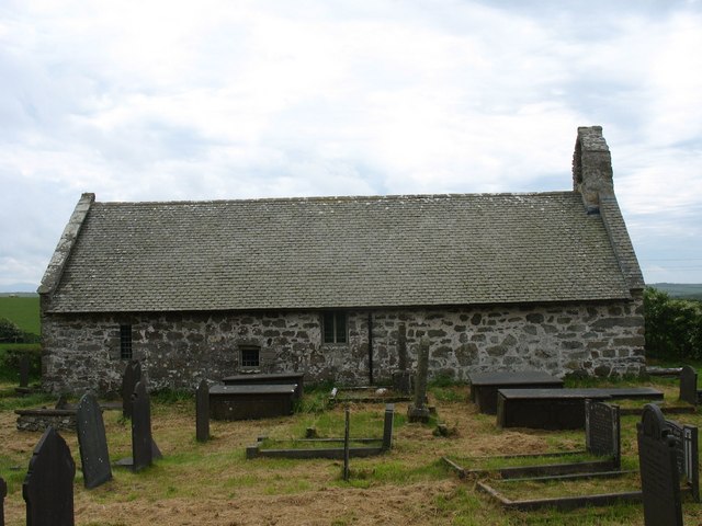


Llanerchymedd, United Kingdom
Llanerchymedd is a town of 1,133 people in Wales, United Kingdom.
Why visit Llanerchymedd
Townapedia lists 5 museums and landmarks, 1 park or trail, 3 places to eat, 1 place to stay and 1 attraction in and around town.
Highlights include Bryn Carmel, Presaddfed Chambered Tomb and Tre'r Ddôl.
Weather in Llanerchymedd
Forecast from MET Norway (CC BY 4.0). Full forecast
About Llanerchymedd
Llannerch-y-medd, sometimes spelt Llanerchymedd, is a small village and community on the Isle of Anglesey in North West Wales. In 2011, it had a population of 1,360, of whom more than 70% were Welsh speaking. It is historically a market town.
From the Wikipedia article Llannerch-y-medd (this version), under CC BY-SA 4.0.
Things to do1

Museums and landmarks5

Presaddfed Chambered Tomb
Monument and historic site · 4.8 mi
Neolithic burial chamber in Anglesey, Wales

Parks, trails and playgrounds1

Restaurants and cafes3


History
Llannerch means "a woodland clearing". The word medd in the name is Welsh for mead, which is made from honey, and the name may be related to the production of honey for mead.
Evidence of human activity in the area dates back to approximately 3500 BCE. 1,500 years later, Cors-y-Bol, a large plot of mires that stretch from Llyn Alaw to Llandyfrydog and Clorach, was used as a burial site. Also around this time, a large number of standing stones were placed in and around the village. Clorach, a nearby plot of land, has been suggested as a settlement centre; however, as the area and property is largely agricultural, much evidence of prehistoric items or remains is lost.
Despite the record of a church and fairs throughout the 12th century, there is no mention of an official township until 1440. Neolithic and Bronze Age artefacts are still being found.
Agricultural markets began to be held in the village in the 1600s; this market was the only one to be run on Anglesey other than the market at Beaumaris. In 1831 the first wool fair was held in Anglesey, with the location alternating between Llannerch-y-medd and Llangefni.
Other industries in the village in the 1800s included the manufacturing of snuff and rock. It was also home to 250 shoemakers, who made the shoes for the miners in Parys Mountain.
Read more of the history
Just to the northeast of the village is the hill called Pen y Foel, which is 123 m above sea level. Between 1951 and 1956 this was the site of a VHF Fixer station, part of the RAF Western Sector, and it was one of a number of similar sites managed by RAF Longley Lane near Preston in Lancashire. The site contained an octagonal wooden hut with a hand-steerable radio mast with two radio receivers of type R1392D, transmitter and telephone line. This hut was protected by a close surrounding octagonal brick wall to provide some bomb blast protection. The wall still exists. The station was used to allow each sector to locate RAF or allied aircraft and to help pilots find airfields in low cloud conditions. Also on the hill was a rectangular brick hut (now unroofed) also built by the RAF; this was a simple two-room hut with a rainwater collection tank. The site had three RAF wireless personnel (two were normally on duty) who were billeted with a landlady in Llannerch-y-Medd and attached to nearby RAF Valley. The site closed around 1956 as the technology was replaced by improved systems.
To the north of the village, along the B5111 to Amlwch, is an abandoned Victorian workhouse. It was erected in 1868 for 70 inmates, at a cost of £2,200. Several single-storey outbuildings surrounded the workhouse, including a vagrants' ward and an isolation block. It was abandoned in 1924, and despite several attempts to renovate it, it remains abandoned today.
A claim that Mary, the mother of Jesus, is buried in the village forms the subject of Graham Phillips's The Marian Conspiracy. Mary's traditional burial place is near Ephesus, in present-day Turkey.
From the History section of Llannerch-y-medd on Wikipedia, under CC BY-SA 4.0.
More about Llanerchymedd
Geography
The village stands at an average of 73 metres above sea level. Llannerch-y-medd is surrounded almost entirely by farmland.
The village is situated near the centre of Anglesey, close to the large water supply reservoir, Llyn Alaw, and is believed to have an ancient foundation. The River Alaw flows beneath the settlement's infrastructure and comes out on the other side.
A much smaller village known as Carmel, located slightly south on Holyhead Road (B1152), is governmentally part of Llanerch-y-medd; as also are Bachau and Coedana, much smaller hamlets to the east of Llanerch-y-medd. Coedana was classed as a community until 1984, when it became part of the Llanerch-y-medd council area.
Arts and culture
The hill Pen y Foel is the basis for the name of the local male voice choir, Cor Meibion Y Foel, which is a member of the National Association of Choirs. It has 43 members and rehearses in the village at Capel Ifan. Over the past decade the choir has supported local eisteddfodau, competed in the Anglesey Eisteddfod, has raised money for numerous charities and has entertained audiences and congregations in concerts, weddings and other functions throughout North Wales.
Ysgol Gymuned Llanerch-y-medd is a primary school in the village, teaching children ages 5–11.
Llannerch-y-medd has its own association football club, Llanerchymedd F.C.
From the Wikipedia article Llannerch-y-medd, under CC BY-SA 4.0.
Where to stay1
Churches and places of worship19
Capel Ifan Congregational Chapel
Church · Congregational
Bridge Street, Llanerchymedd
Old Church of St Afran, St Ieuan and St Sannan, Llantrisant
Church · 4.2 mi
Schools, colleges and libraries2
Map of Llanerchymedd
32 places. The map loads OpenStreetMap tiles when you open it.
Getting there and nearby towns
RAF Valley - Anglesey Airport (VLY) is the nearest airport with scheduled flights listed in OpenStreetMap, 9 miles away.
- Llangefni 6 mi southeast, about 9 min by car
- Valley 8 mi west, about 14 min by car
- Rhosneigr 9 mi southwest, about 14 min by car
- Llanfairpwllgwyngyll 10 mi southeast, about 17 min by car
- Holyhead 11 mi west, about 17 min by car
- Menai Bridge 11 mi southeast, about 18 min by car
- Bangor 12 mi southeast, about 20 min by car
- Tregarth 15 mi southeast, about 25 min by car
- Llanfairfechan 17 mi east, about 28 min by car
- Penmaenmawr 19 mi east, about 30 min by car
Drive times are estimates from straight-line distance, not routes.
Towns near Llanerchymedd


Keep exploring
Local news
Headlines from INDB.
Reviews, tips and questions
Loading what members have shared...
Sources and licences
- GeoNames (CC BY 4.0): population, coordinates, regions and time zone
- OpenStreetMap contributors (ODbL 1.0): places, airports, map data
- Wikidata (CC0 1.0): elevation, founding date, time zone, website, landmarks and historic places
- Wikimedia Commons (see each image): photos
- Wikipedia (CC BY-SA 4.0): overview and history text
Photo credits
- Both Presaddfed chambers, Beep boop beep, CC BY-SA 4.0
- Eglwys Cynfarwy Sant, Llechcynfarwy, Eric Jones, CC BY-SA 2.0
- Eglwys Pabo Sant from the north, Eric Jones, CC BY-SA 2.0
- St Caian's Church, Tregaian, Stephen Elwyn RODDICK, CC BY-SA 2.0
- Capel Ifan, GeraintTudur2, CC BY-SA 3.0
- St Mary, Llannerch-y-Medd, Eric Jones, CC BY-SA 2.0
Page built November 10, 2026. Spotted a mistake? Tell us or suggest a place.